
Widespread life-threatening flash and urban flooding will continue to pose a significant threat to life and property in south-central Texas. Catastrophic fiver flooding, with rapid rises on small streams, arroyos, and typically dry washes, is expected. Monsoonal showers persist across the Great Basin and Southwest with greatest flash flooding in southern Arizona. Read More >
The first week of July in west-central Texas was marked by unsettled weather, with several thunderstorm complexes producing locally heavy rainfall and gusty winds. The more noteworthy occurrences were on the 1st, and on the 4th through 6th.
A band of thunderstorms with strong, gusty winds moved south-southeast across much of west-central Texas during the early morning of July 1. The Abilene Regional Airport recorded a peak wind gust of 60 mph, and San Angelo recorded a peak gust of 42 mph. A Mesonet site 2 miles east-northeast of Weinert (Haskell County) recorded a 64 mph wind gust from a separate thunderstorm preceding the band of storms. Figure 1 shows a loop of animated radar imagery, with the band of thunderstorms.
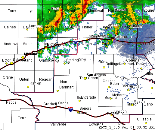
Figure 1: Animated Loop of Radar Imagery on the early morning of July 1 (between 330 AM and 730 AM).
Scattered showers and thunderstorms developed on the afternoon of the 4th across the western Big Country and northwestern Concho Valley. These showers and storms became more numerous and moved south-southeast across the Concho Valley and Northern Edwards Plateau during the evening and early nighttime hours. The strongest storms affected the San Angelo area, where several tree limbs were blown down and a peak wind gust of 55 mph was recorded at the San Angelo Airport. The threatening weather necessitated rescheduling of the San Angelo Independence Day fireworks celebration until July 5.
Figure 2 shows an animated radar loop of the thunderstorms on the late afternoon and evening of July 4.
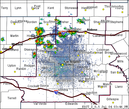
Figure 2: Animated Loop of Radar Imagery on the late afternoon and evening of July 4 (between 345 PM and 745 PM).
On the 5th, scattered to numerous showers and thunderstorms occurred across much of the area south of Interstate 20. Showers and scattered thunderstorms persisted through the overnight hours and into the morning of the 6th, across parts of the eastern Concho Valley and Northern Edwards Plateau. The heaviest rainfall (3-6 inches) occurred near and southwest of Eden, and in parts of Schleicher and Sutton Counties.
Figure 3 shows rainfall amounts for the first week of July.
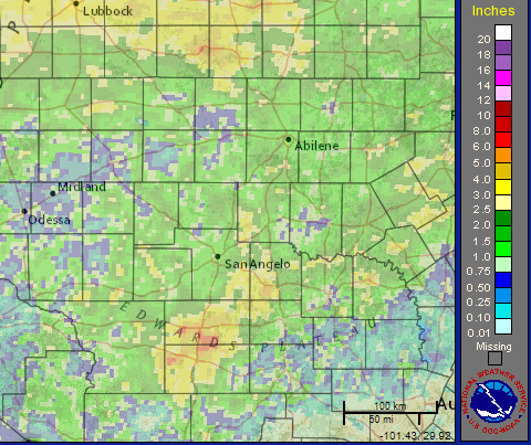
Figure 3: Rainfall Amounts for the 10-day Period Ending at 7 AM July 9.
The vast majority of the 10-day rainfall in Figure 3 occurred during the first week of July. The July 1-7 rainfall was beneficial in the short term for vegetation, crops and soil moisture across nearly all of west-central Texas.

