Implementing Improved Fire Weather Zone Coverage for Puerto Rico and the U.S. Virgin Islands
Effective Thursday August 6, 2015 at 800 AM Atlantic Standard Time (AST) or 1200 Coordinated Universal Time (UTC), the National Weather Service Forecast Office (WFO) in San Juan, Puerto Rico will adjust its current fire weather zones for Puerto Rico and the U.S. Virgin Islands. This adjustment will provide improved fire weather warning and forecast services for PR and the USVI. The NWS Weather Forecast Office in San Juan, Puerto Rico, will reconfigure the fire weather forecast zones for Puerto Rico and the U.S. Virgin Islands to align with the boundaries of the National Fire Danger Rating Areas.
Specifically, fire weather zone PRZ014 was split into two zones, PRZ014 Southeast Coastal Plains and PRZ027 Southwest Coastal Plains and Mona Island.
Table 1: WFO San Juan products affected by the fire weather zone changes effective August 6, 2015.
|
PRODUCT NAME
|
WMO HEADING
|
AWIPS ID
|
|
FIRE WEATHER PLANNING FORECAST
|
FNCA52 TJSJ
|
FWFSJU
|
|
FIRE WEATHER WATCH/RED FLAG WARNING
|
WWCA82 TJSJ
|
RFWSJU
|
|
RANGELAND/GRASSLAND FIRE
DANGER STATEMENT
|
FNCA52 TJSJ
|
RFDSJU
|
Customers must reprogram hardware and software to continue processing products in Table 1.
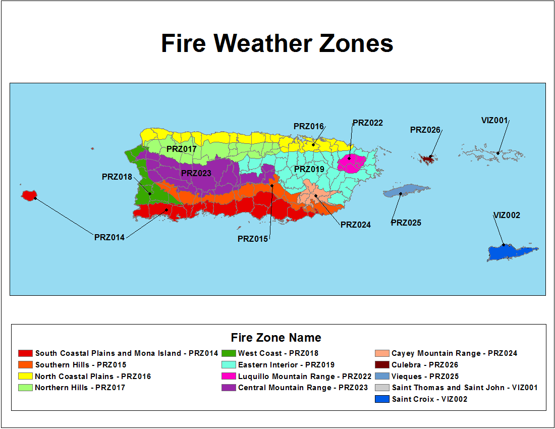
WFO San Juan Fire Weather Zones prior to August 6, 2015 (Current)
WFO San Juan Fire Weather Zones effective August 6, 2015
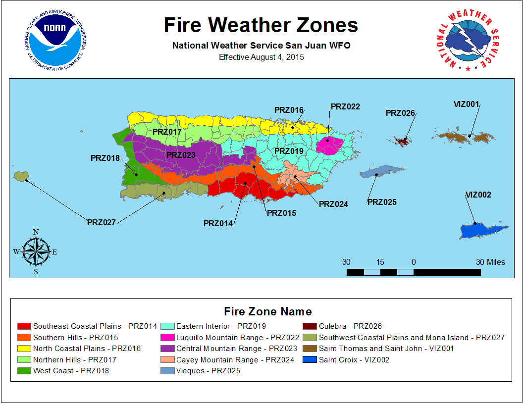
An updated zone map shapefile containing the new boundaries for these and other fire weather zones is available for download at:
Fire Weather Forecast_Zones
For questions about these changes, please contact:
Gary Votaw Paul Witsaman
Fire Weather Program Leader Regional Fire Weather Program Manager
NWS San Juan NWS SRH
(787) 253-4586 X 242 (817) 978-1100 X 116
Email: Email:


 7-Day Graphical Hazardous Weather Outlook
 Tropical Analysis
 Tropical Weather
 Regional Satellite
 Puerto Rico and US Virgin Islands
 Local Radar