|
Synoptic Overview
|
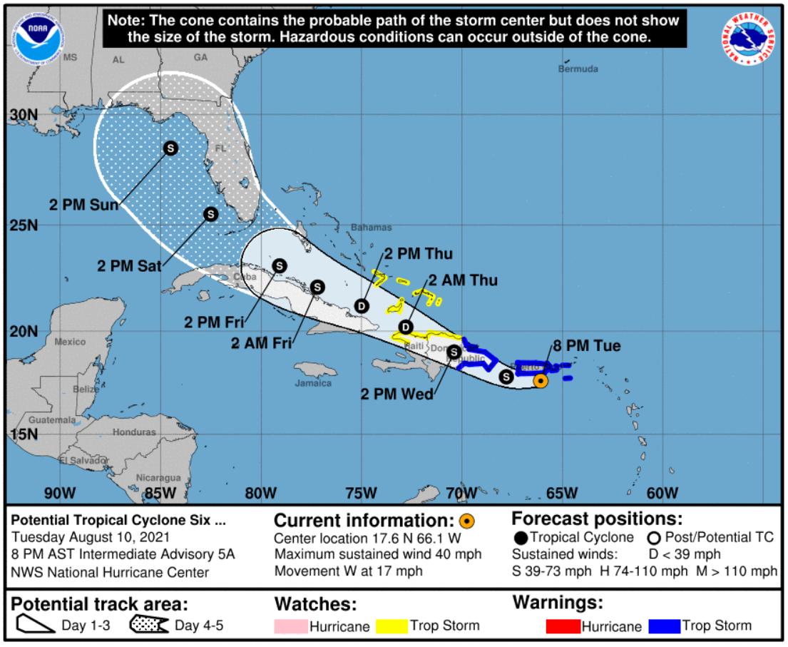
On Thursday August 5th, a vigorous tropical wave moved out of the west coast of Africa. The National Hurricane Center (NHC) increased the 5-day probability of tropical cyclone formation to high the next day as the monsoon trough remained very active while the disturbance moved westward across the tropical Atlantic . By Monday August 9th, NHC started identifying the disturbance as a Potential Tropical Cyclone (PTC) Six with a 90% probability of formation while it was approaching the Lesser Antilles. The PTC crossed the Leeward Islands as it moved towards the west-northwest over the northeast Caribbean on Tuesday. The disturbance then became a tropical storm late Tuesday evening just south of Puerto Rico. The closest point of approach of Tropical Storm Fred was about 40 miles south of Ponce and about 30 miles southwest of Cabo Rojo.
Figure 1: National Hurricane Center forecast on Potential Tropical Cyclone Six on August 10 at 8 PM AST. |
|
Satellite & Radar Imagery
|
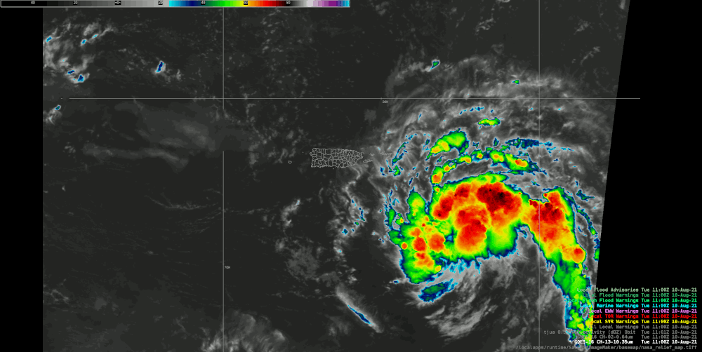
Figure 2: Animated image of GOES-East on August 10, 2021. Image credit NOAA.
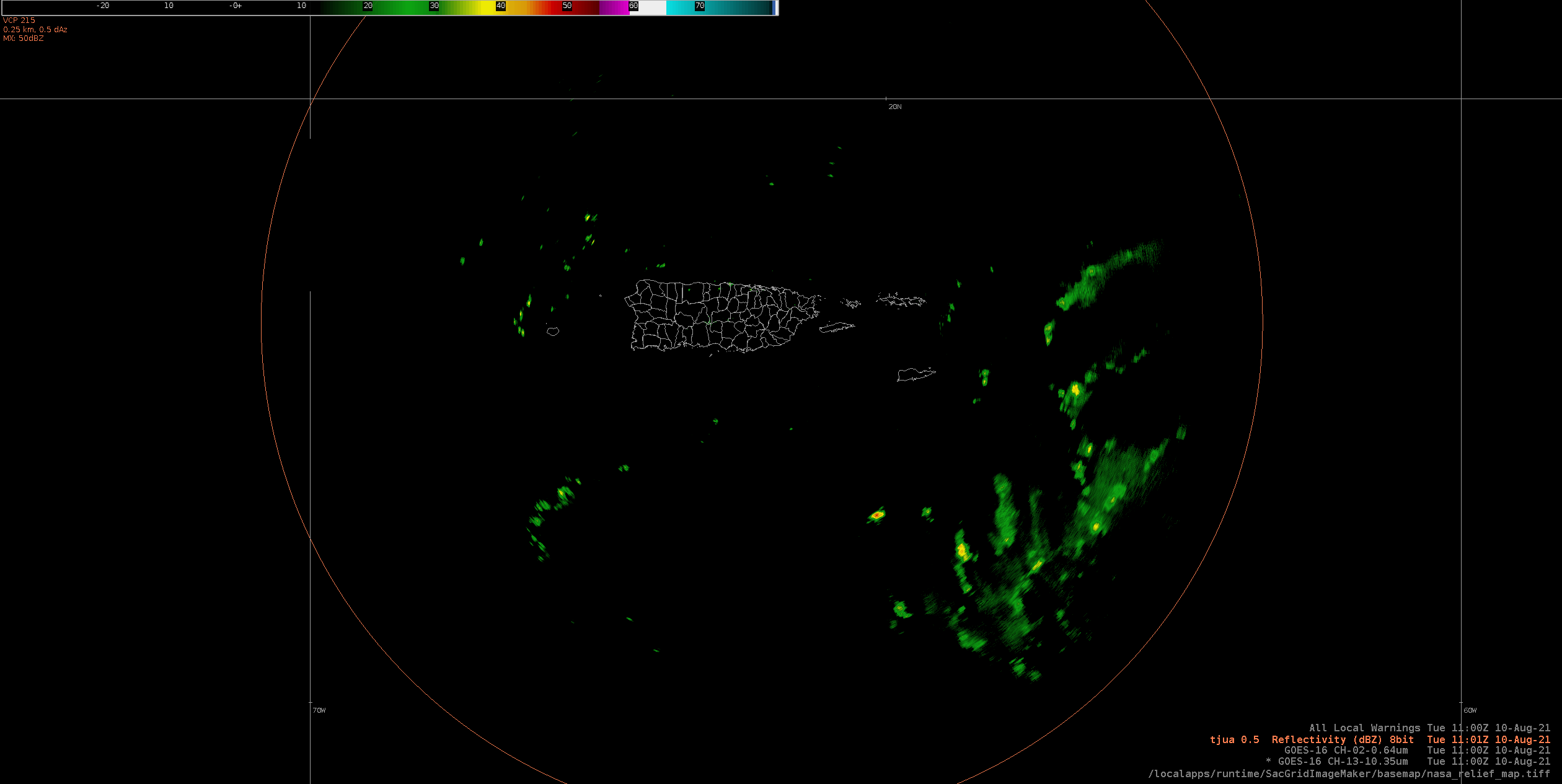
Figure 3: Radar loop of Tropical Storm Fred as it moved just south of Puerto Rico and the U.S. Virgin Islands. Image credit NOAA.
|
Total Rainfall Accumulation
|
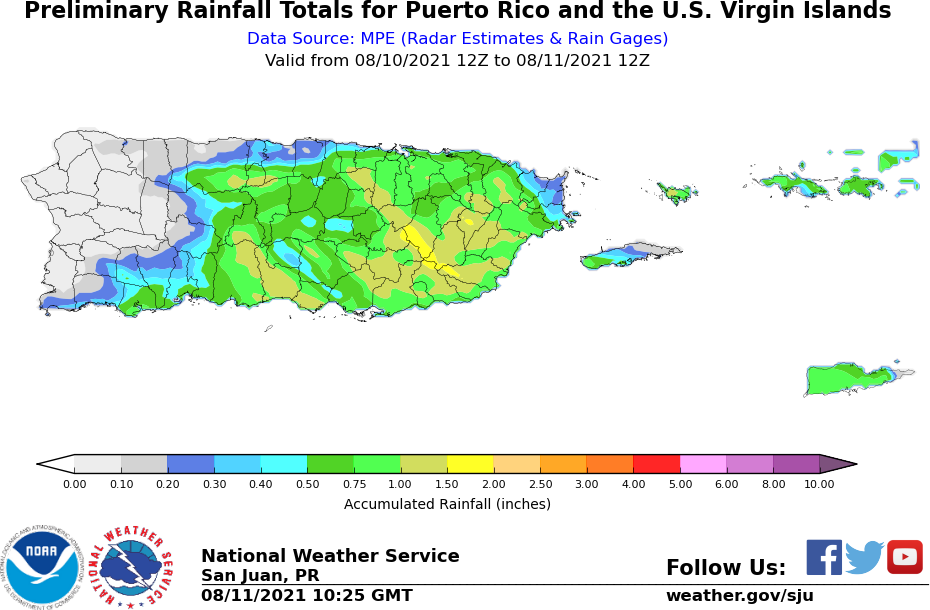
Figure 4: 24-hours rainfall accumulation associated with Tropical Storm Fred.
|
Maximum Wind Gust Reports
|
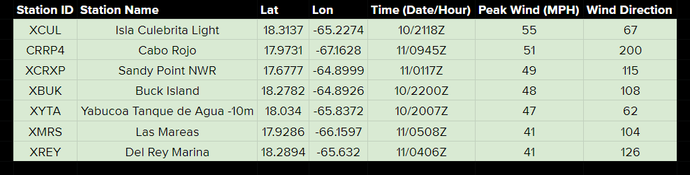
Table 1: Maximum Wind Gusts (MPH) measured during the passage of Tropical Storm Fred.
|
Damages
|
|
Impacts associated with Tropical Storm Fred were minor in Puerto Rico and the U.S. Virgin Islands. Rainfall accumulations ranged between 1-3 inches across portions of the local islands. Tropical storm force gusts were also observed across the U.S. Virgin Islands, Culebra, eastern and southwest Puerto Rico. |


 7-Day Graphical Hazardous Weather Outlook
 Tropical Analysis
 Tropical Weather
 Regional Satellite
 Puerto Rico and US Virgin Islands
 Local Radar