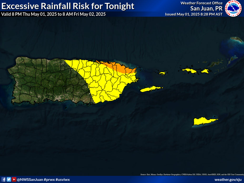
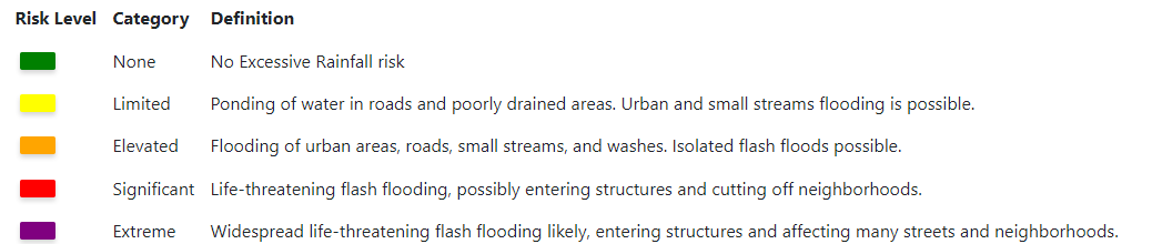
Forecaster Discussion : Weather Summary
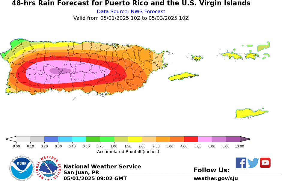
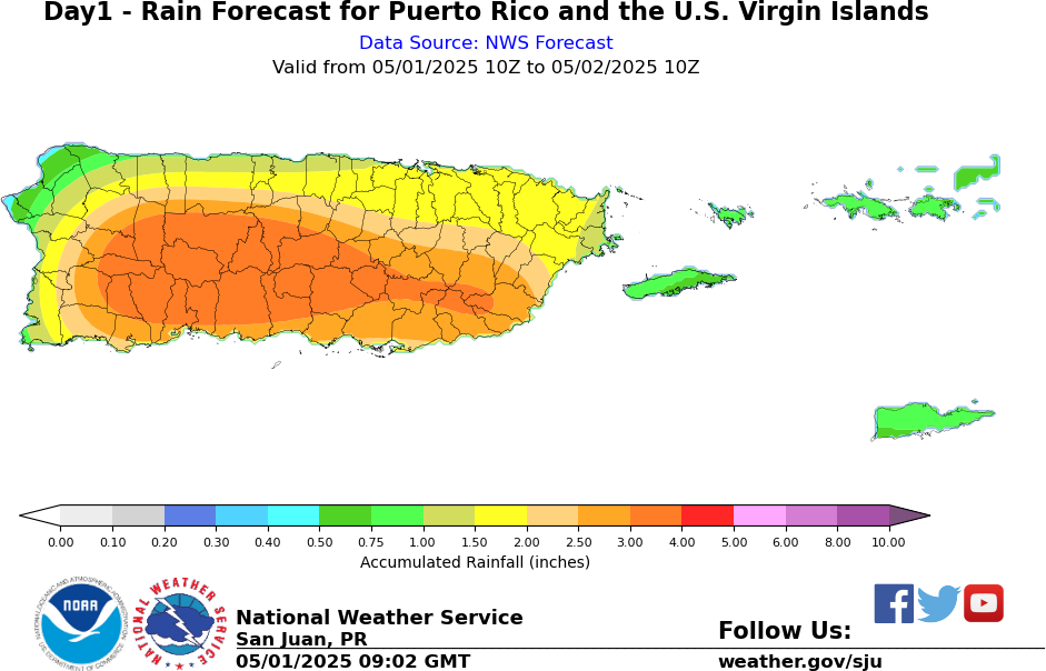
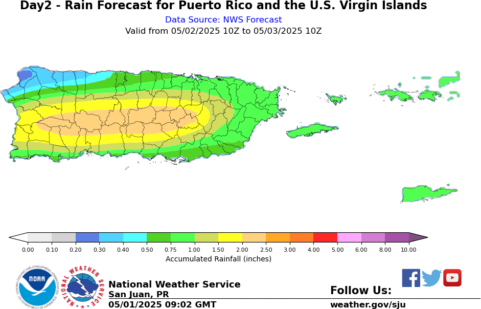
| 24 hr Rainfall Forecast Total | 48 hr Rainfall Forecast Total |
 |
 |
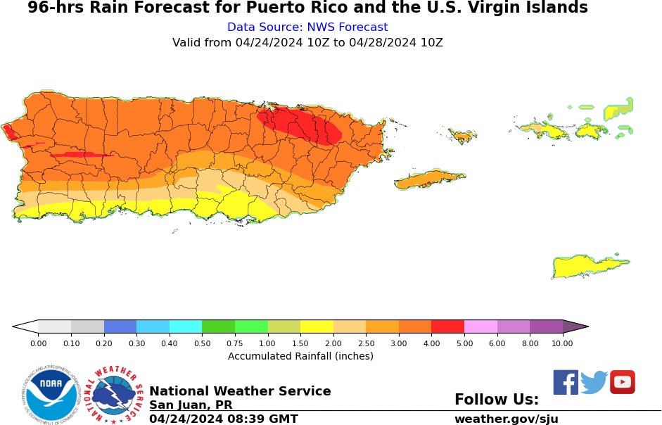
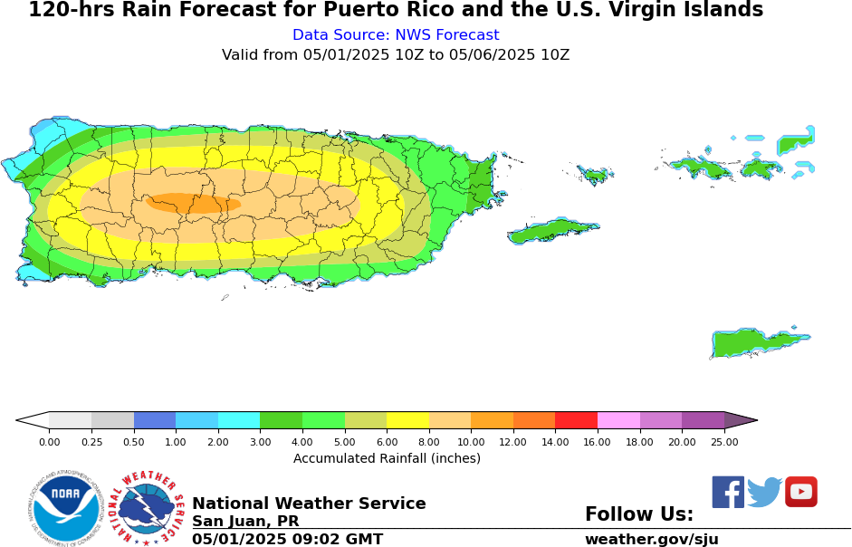
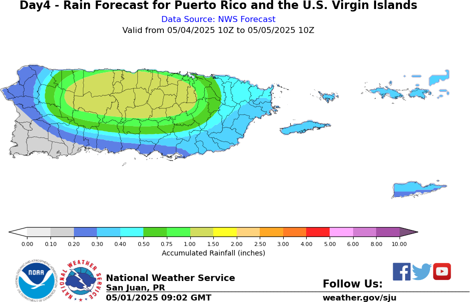
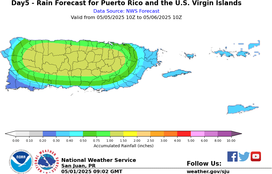
| 72 hr Rainfall Forecast Total | 96 hr Rainfall Forecast Total | 120 hr Rainfall Forecast Total |
 |
 |
 |
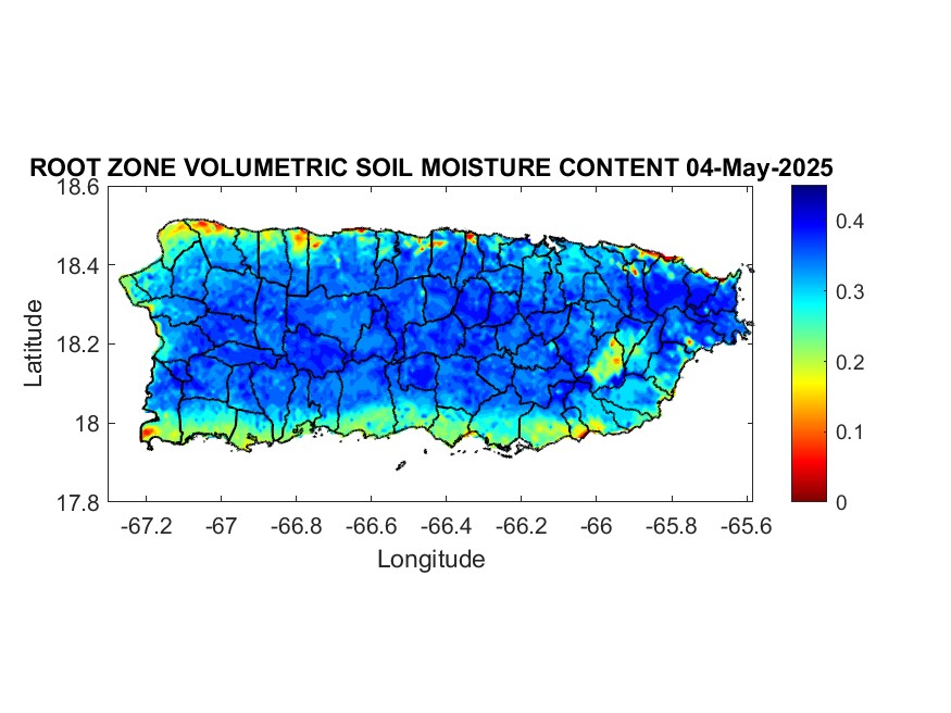
| Latest Volumetric Soil Moisture Image |
 |
| Latest Soil Saturation |
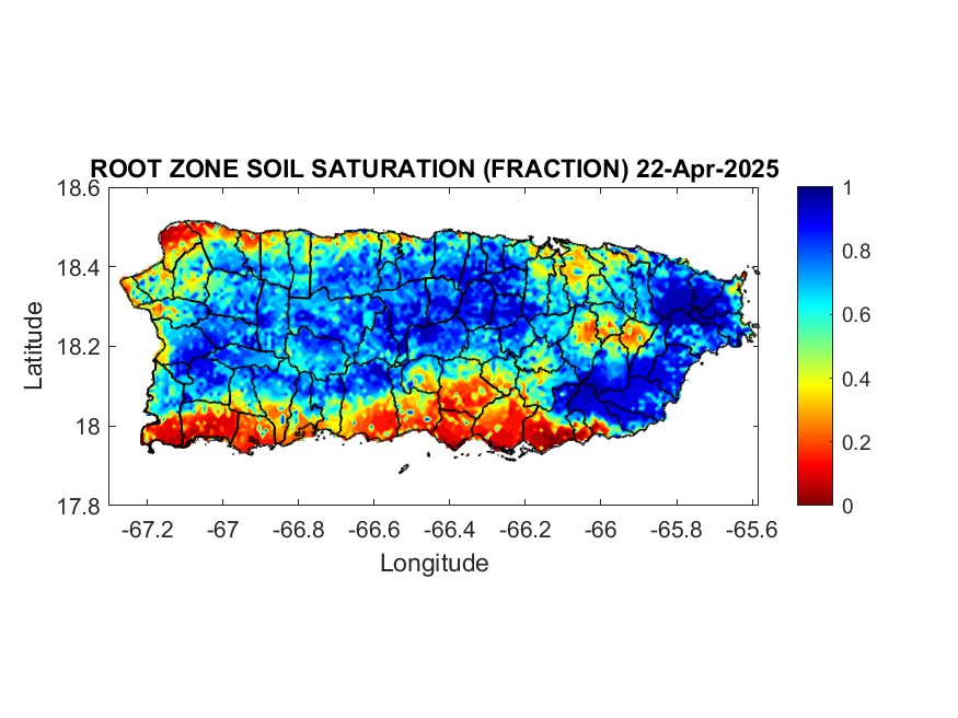 |
Soil saturation: 1=Saturated.
Water Data by Puerto Rico River Basin Grouping
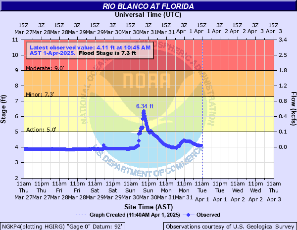
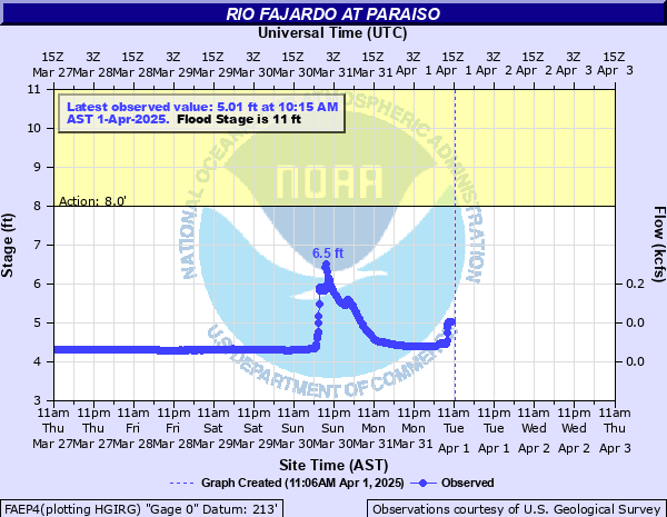
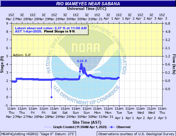
| Rio Blanco | Rio Fajardo at Paraiso | Rio Mameyes |
 |
 |
 |
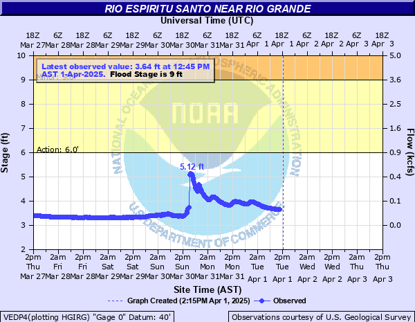
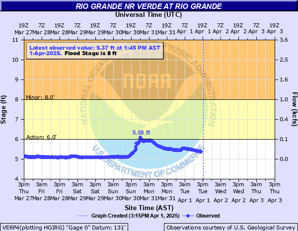
| Rio Espiritu Santo | Rio Grande near El Verde |
 |
 |
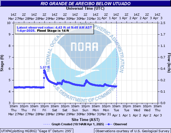
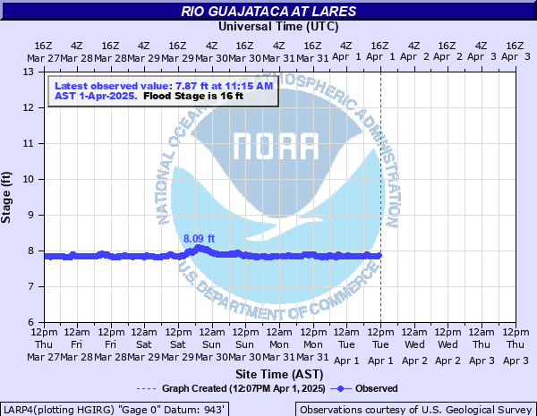
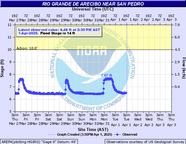
| Rio Grande Arecibo blw Utuado | Rio Guajataca | Rio Grande Arecibo abv Arecibo |
 |
 |
 |
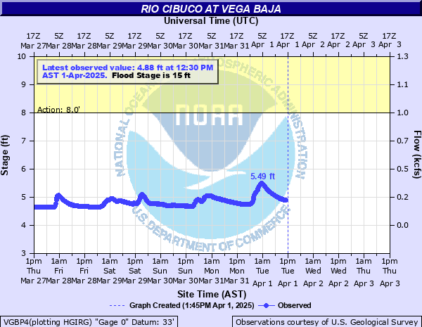
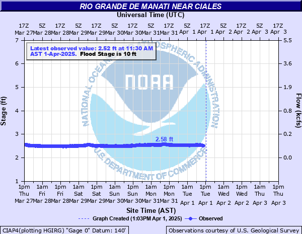
| Rio Cibuco | Rio Manati near Ciales |
 |
 |
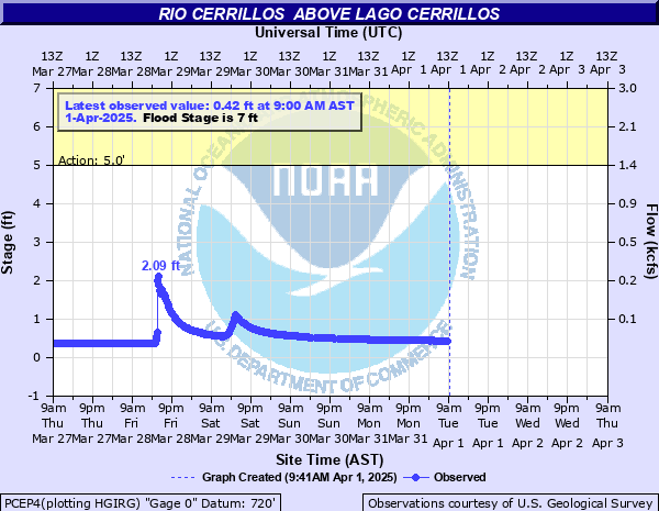
| Rio Cerrillos | Rio Portugues |
 |
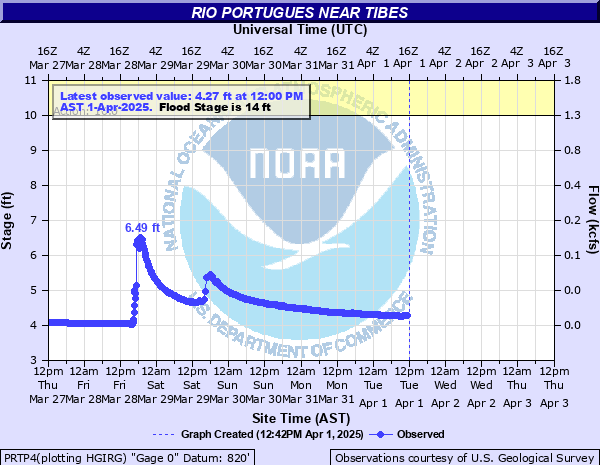 |
| Rio Grande de Añasco | Rio Culebrinas near Moca | Rio Culebrinas at Margarita Damsite |
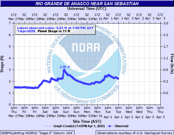 |
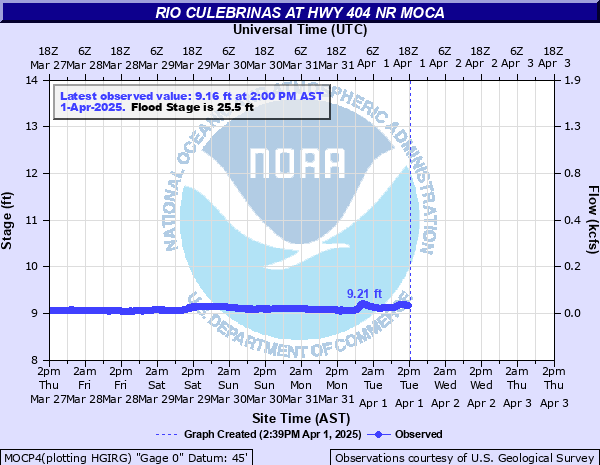 |
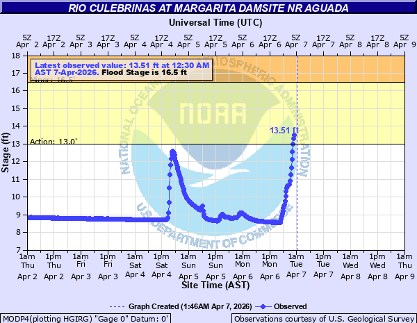 |
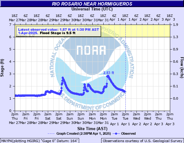
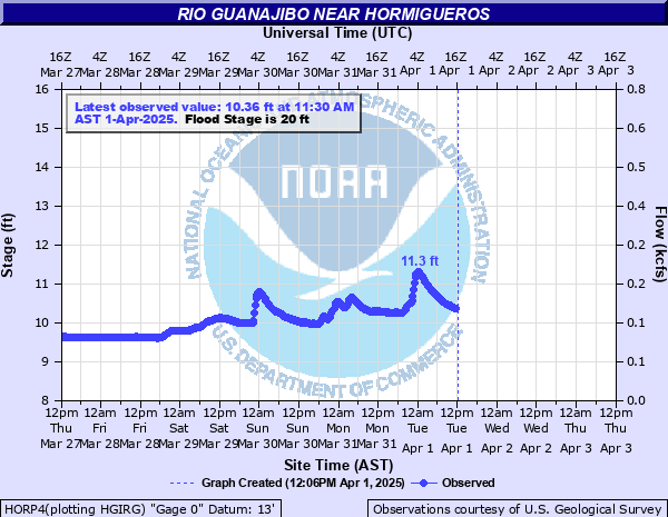
| Rio Rosario | Rio Guanajibo |
 |
 |
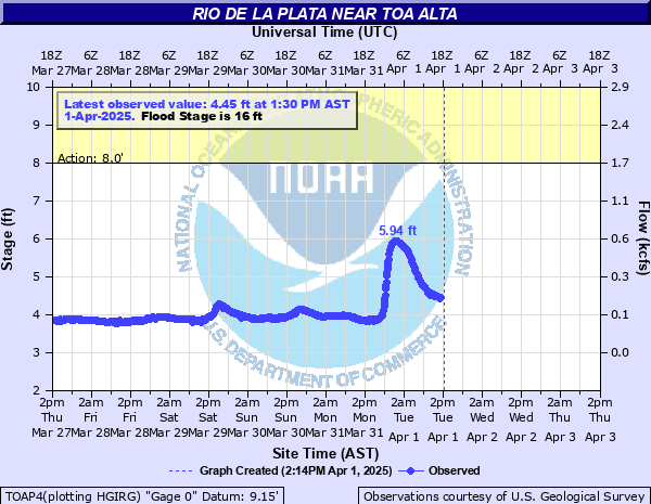
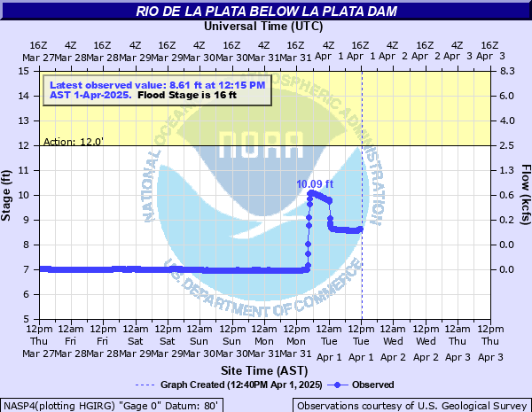
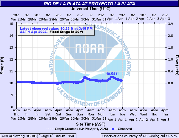
| Rio de La Plata nr Toa Alta | Rio de la Plata blw La Plata Dam | Rio de La Plata at Proyecto La Plata |
 |
 |
 |
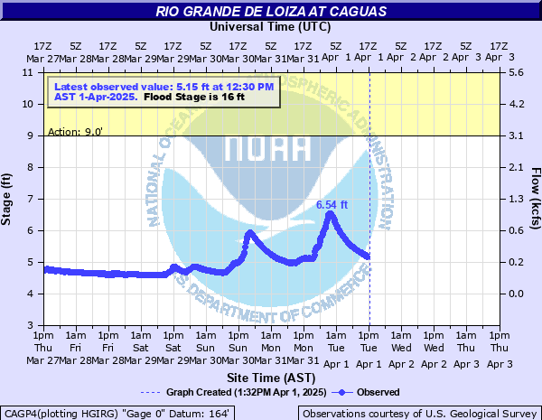
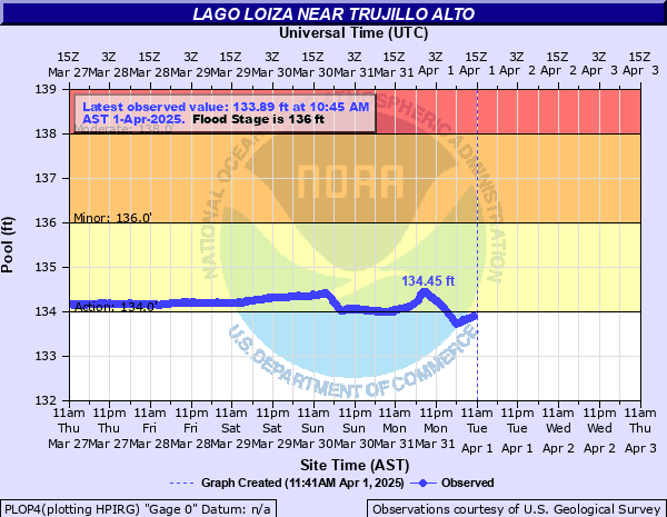
| Rio Grande de Loiza at San Lorenzo | Rio Grande de Loiza at Caguas | Lago Loiza nr Trujillo Alto |
 |
 |
 |
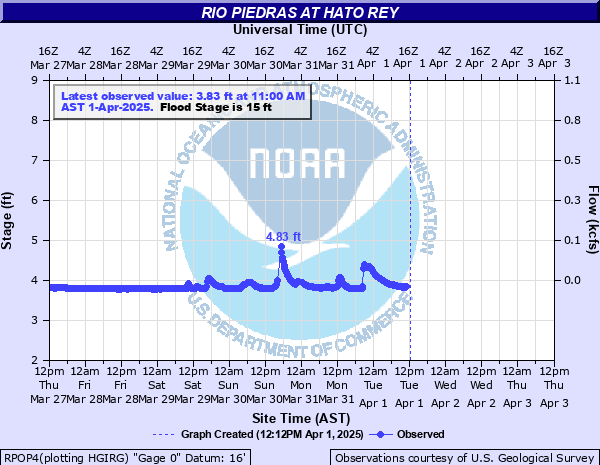
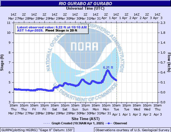
| Rio Piedras at Hato Rey | Rio Gurabo |
 |
 |


 7-Day Graphical Hazardous Weather Outlook
 Tropical Analysis
 Tropical Weather
 Regional Satellite
 Puerto Rico and US Virgin Islands
 Local Radar