|
Hurricane Irma began showing its convective appearance on satellite imagery the 26-27th of August 2017 as it moved into the Eastern Atlantic waters. During the morning of August 30th, Irma was classified as a Tropical Storm with maximum sustained winds of 50 mph moving westward at 13 mph about 400 miles to the east of the Cabo Verde Islands. Within the next 30 hours, Irma went through a rapid intensification period primarily due to the moist environment and very warm sea surface temperatures during that time frame. On August 31st, the National Hurricane Center (NHC) classified Irma as a major hurricane, category 3 on the Saffir–Simpson hurricane scale (SSHS). During the next couple of days, there was little change in intensity as the hurricane moved west-northwestward into a drier environment and cooler sea surface temperatures; it had also completed several eyewall replacement cycles.
.png) 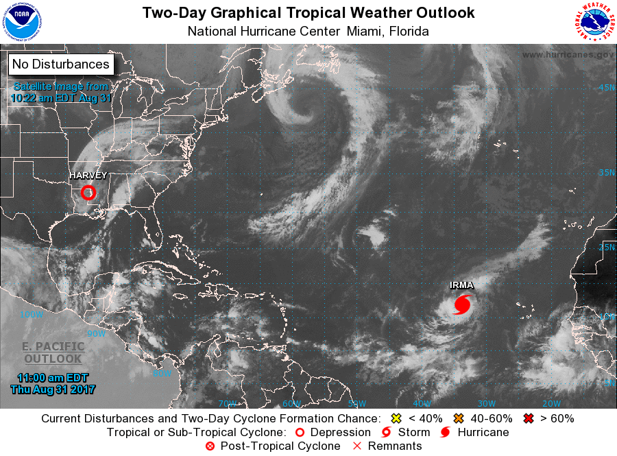
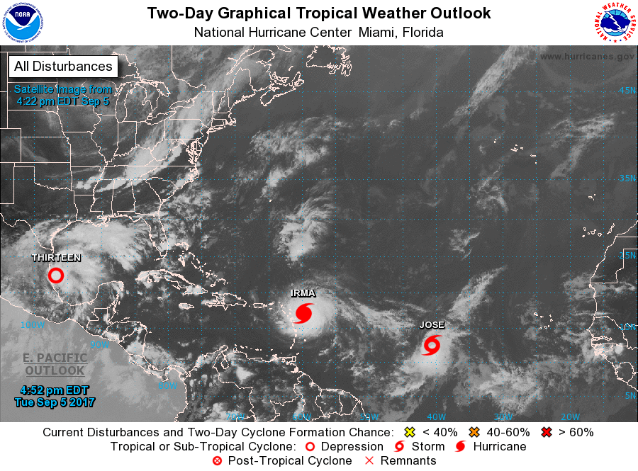
On September 2nd, a strong area of high pressure over the central Atlantic began to steer Irma towards the west southwest. Most of the model guidance showed that Irma would be on this west-southwest track for the next 36-48 hours followed by a westward track as it approached the northern Leeward Islands. The model guidance then showed a west to northwest track once it passed near the northern Leeward Islands. Thereafter, the NHC’s forecast trajectory indicated Irma’s center moving near Puerto Rico and the U.S. Virgin Islands; a Hurricane Watch was issued on September 4th at 11 AM AST and upgraded to a Hurricane Warning by 11 PM AST.
Moreover, the hurricane was embedded within a very favorable environment with very warm sea surface temperatures of greater than 28 degrees Celsius and low wind shear supporting additional strengthening. As a result, the hurricane intensified into a very dangerous Category 5 hurricane with of up to 185 mph winds, as measured by the NOAA Hurricane Hunters aircraft, on the morning of September 5th, classifying it as the strongest hurricane ever recorded in the Atlantic Basin outside of the Gulf of America and Caribbean regions.
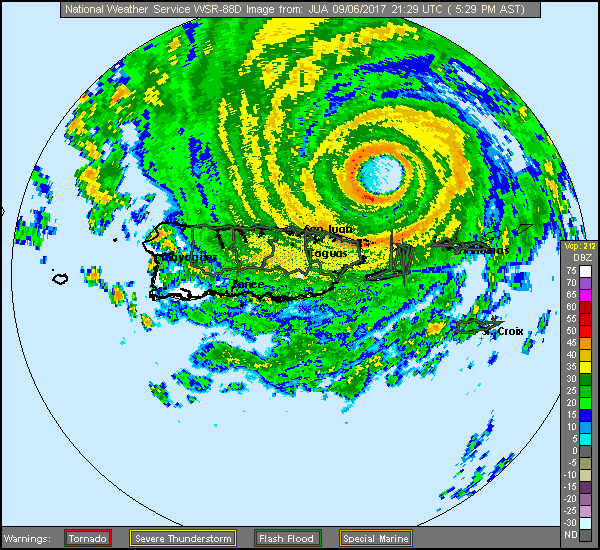
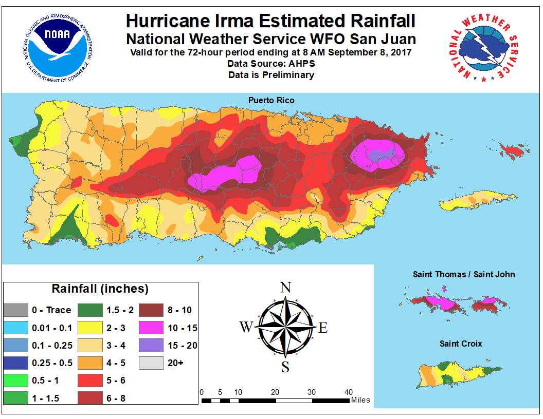
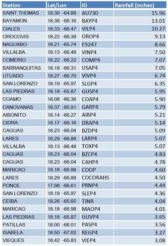
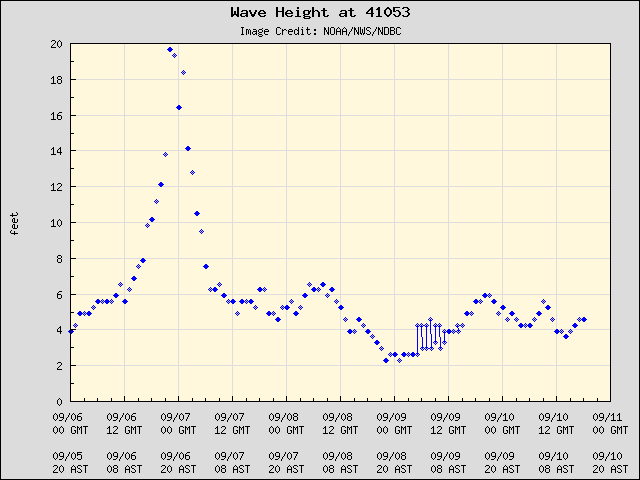
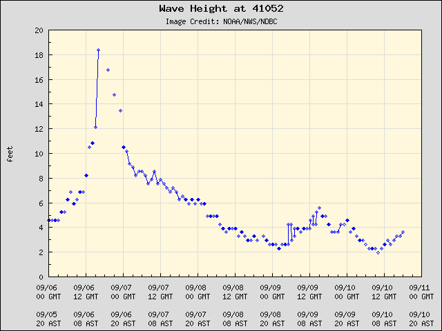
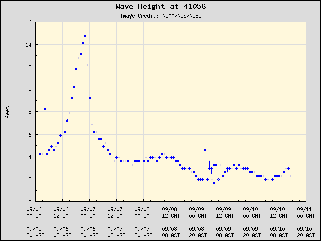
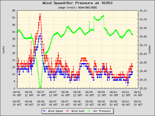
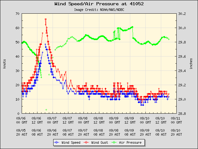
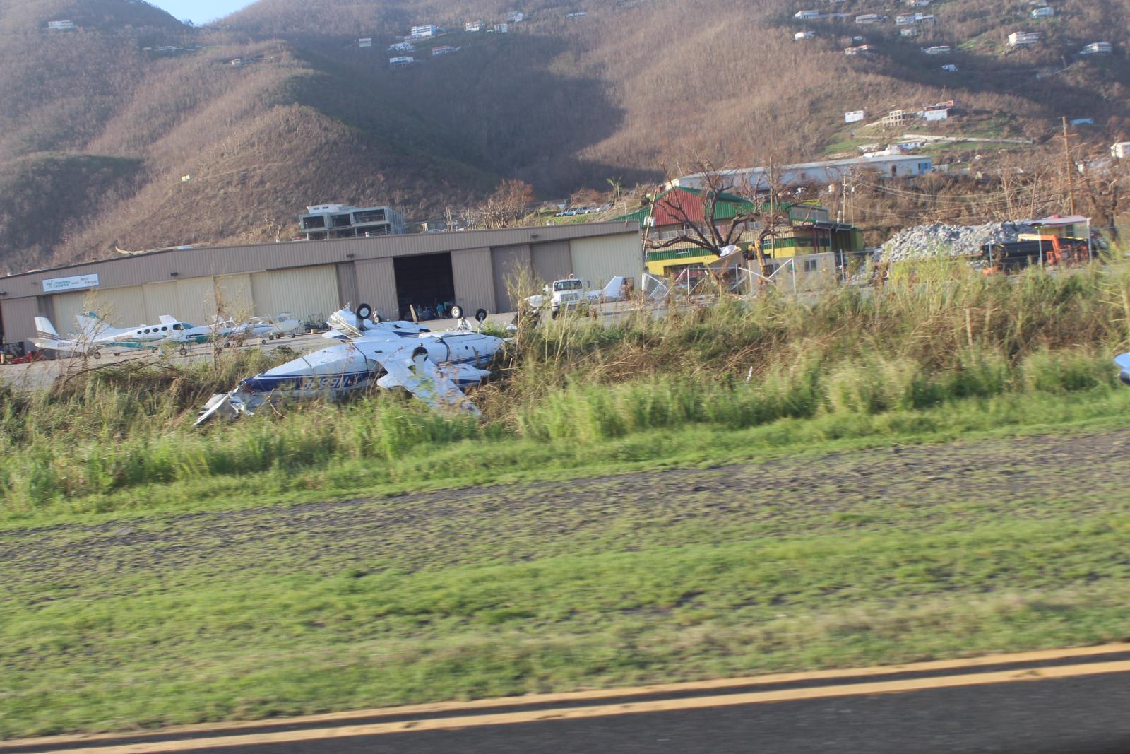
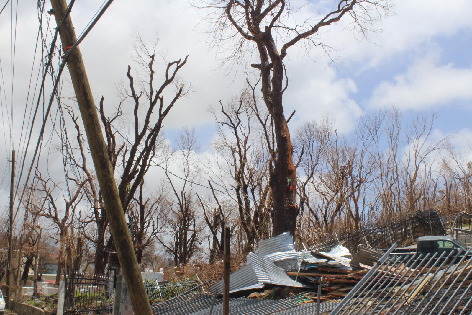
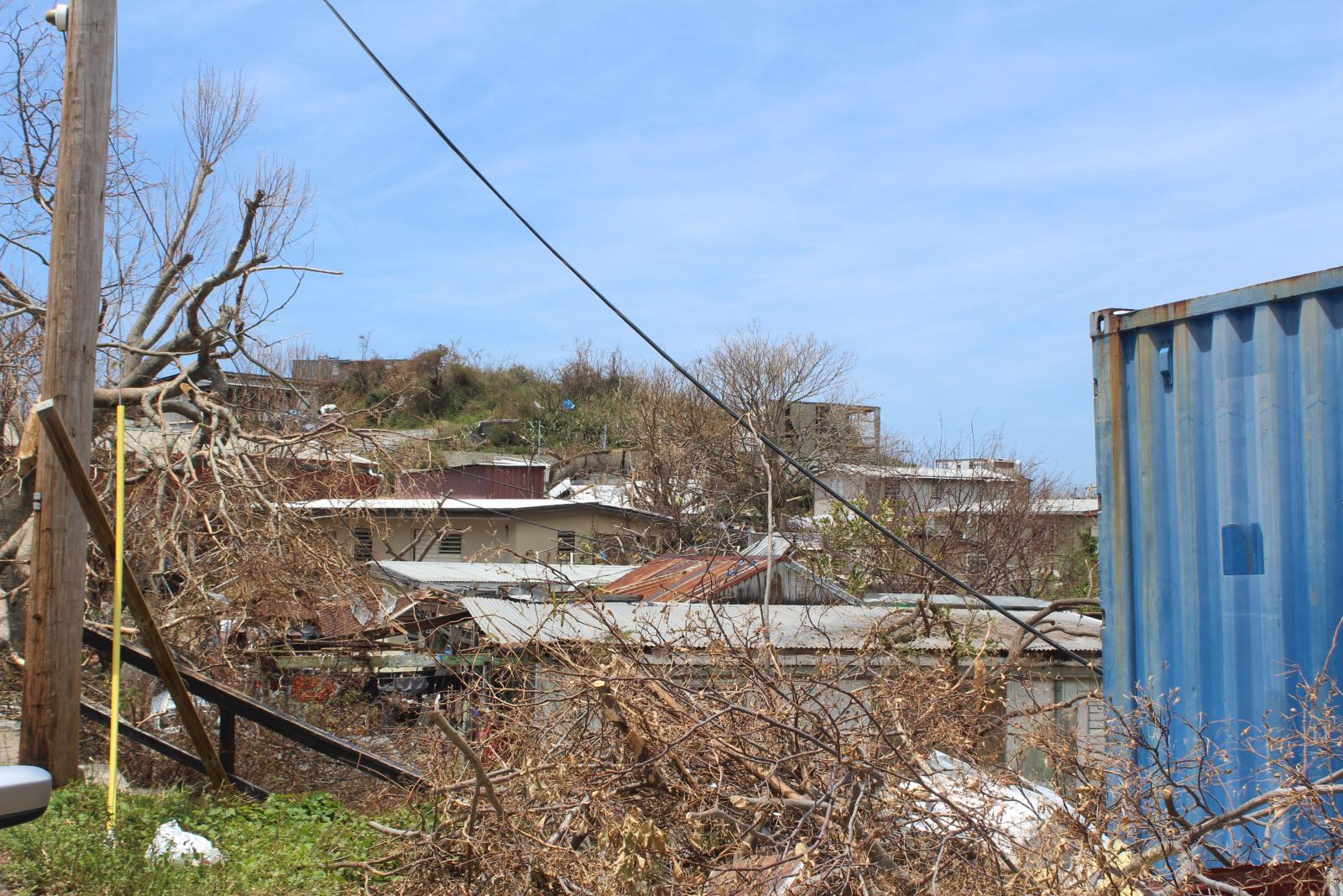
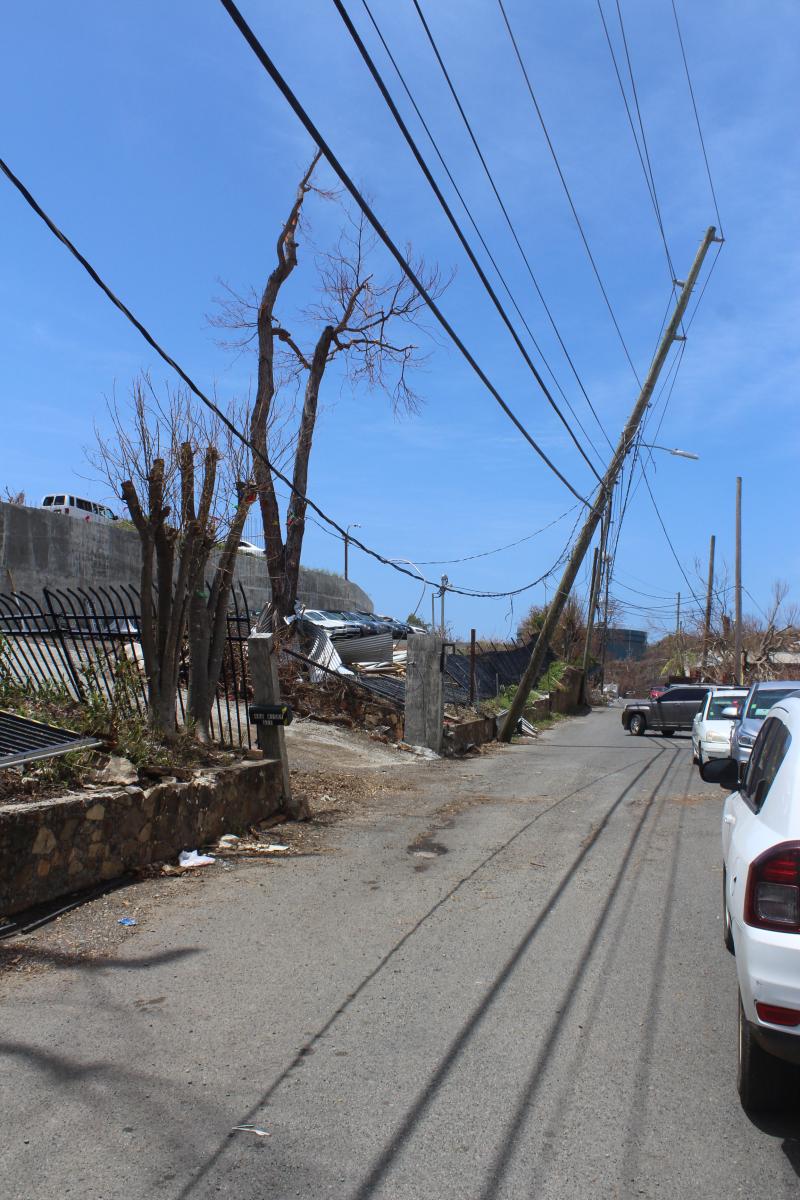
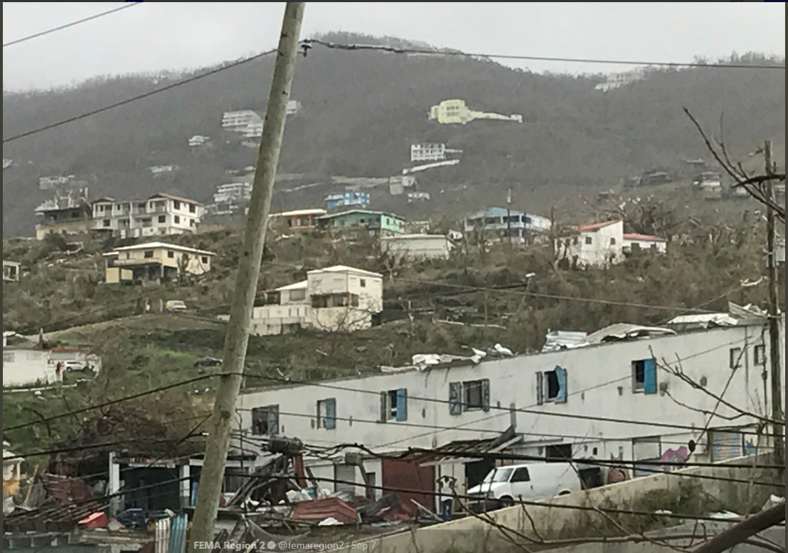
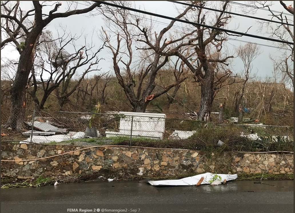
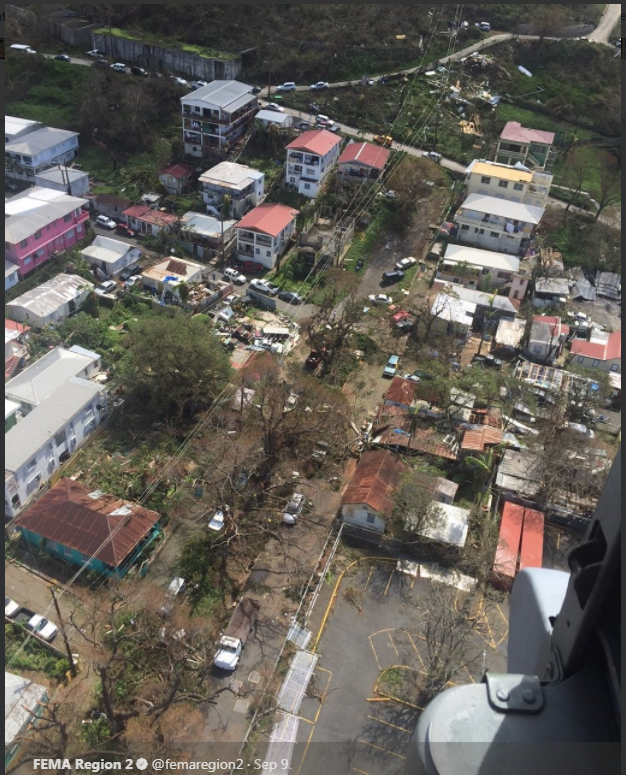
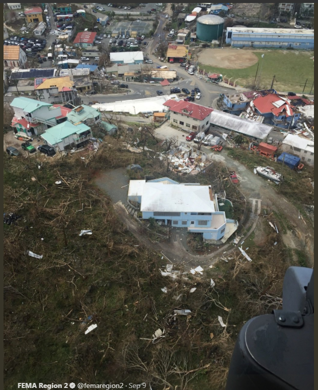
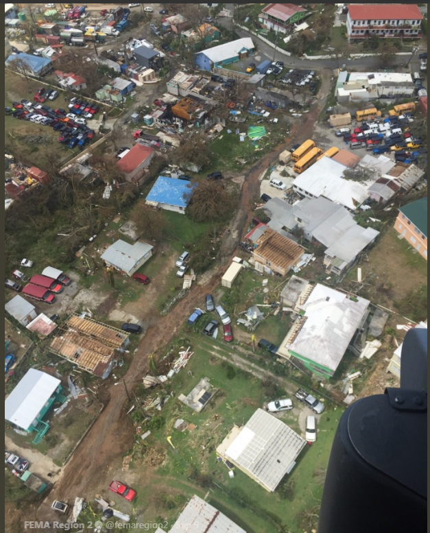
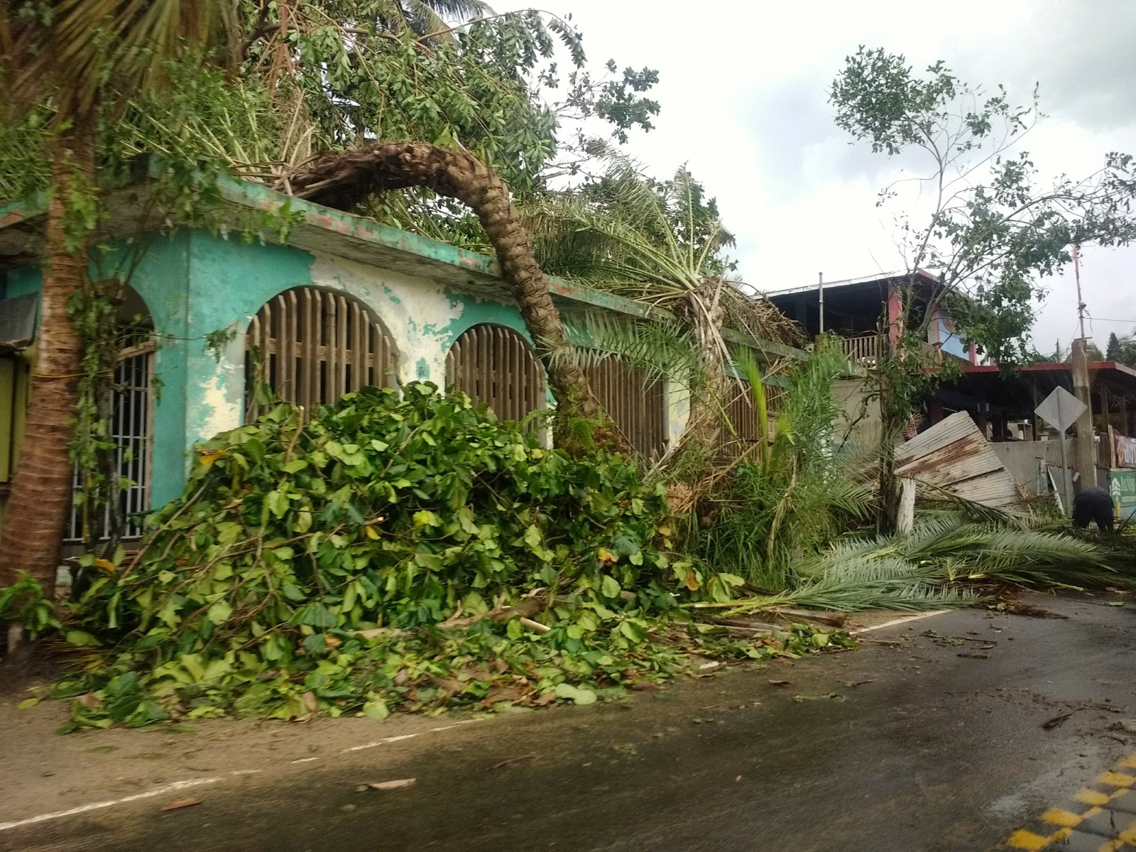
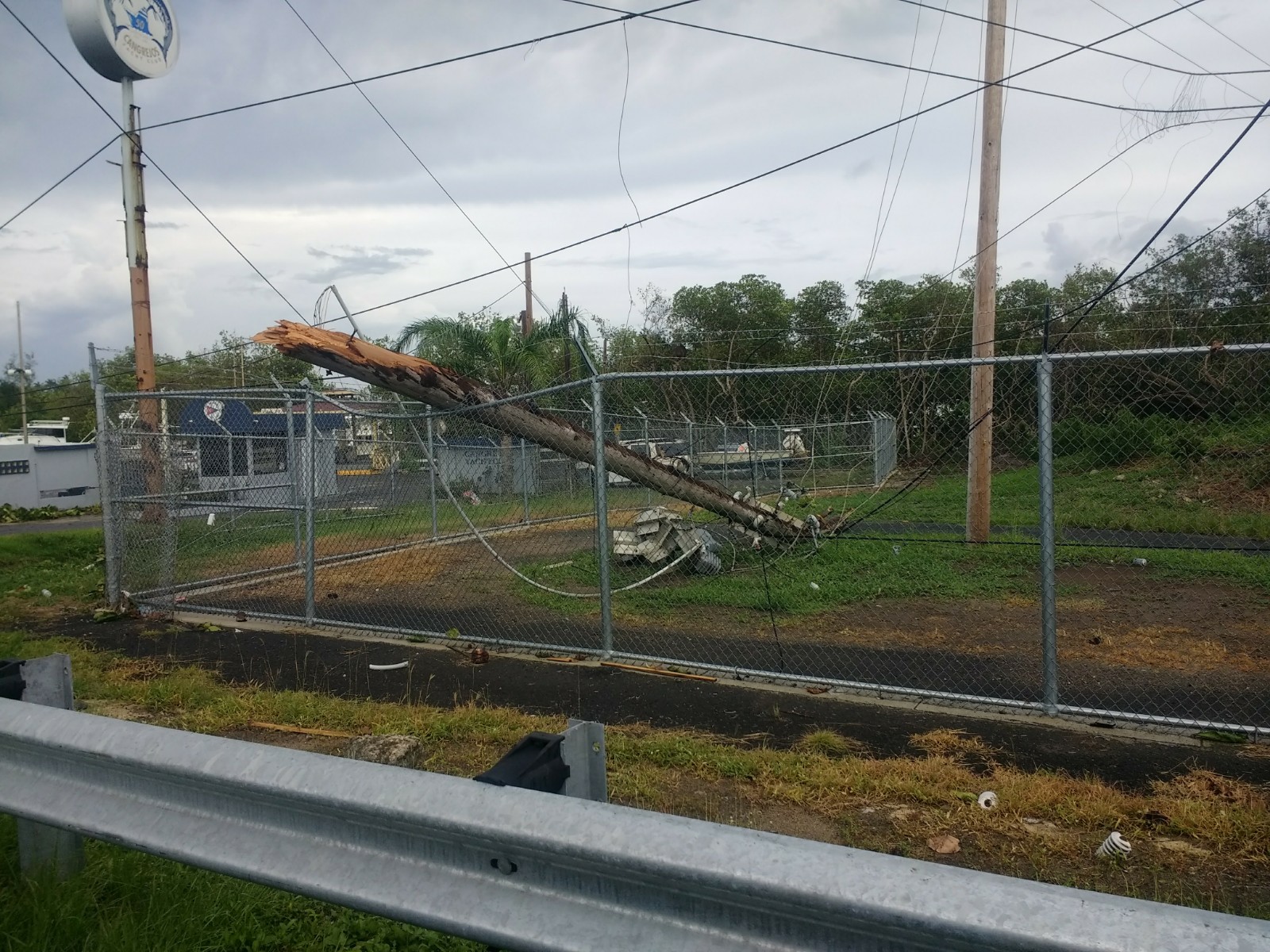
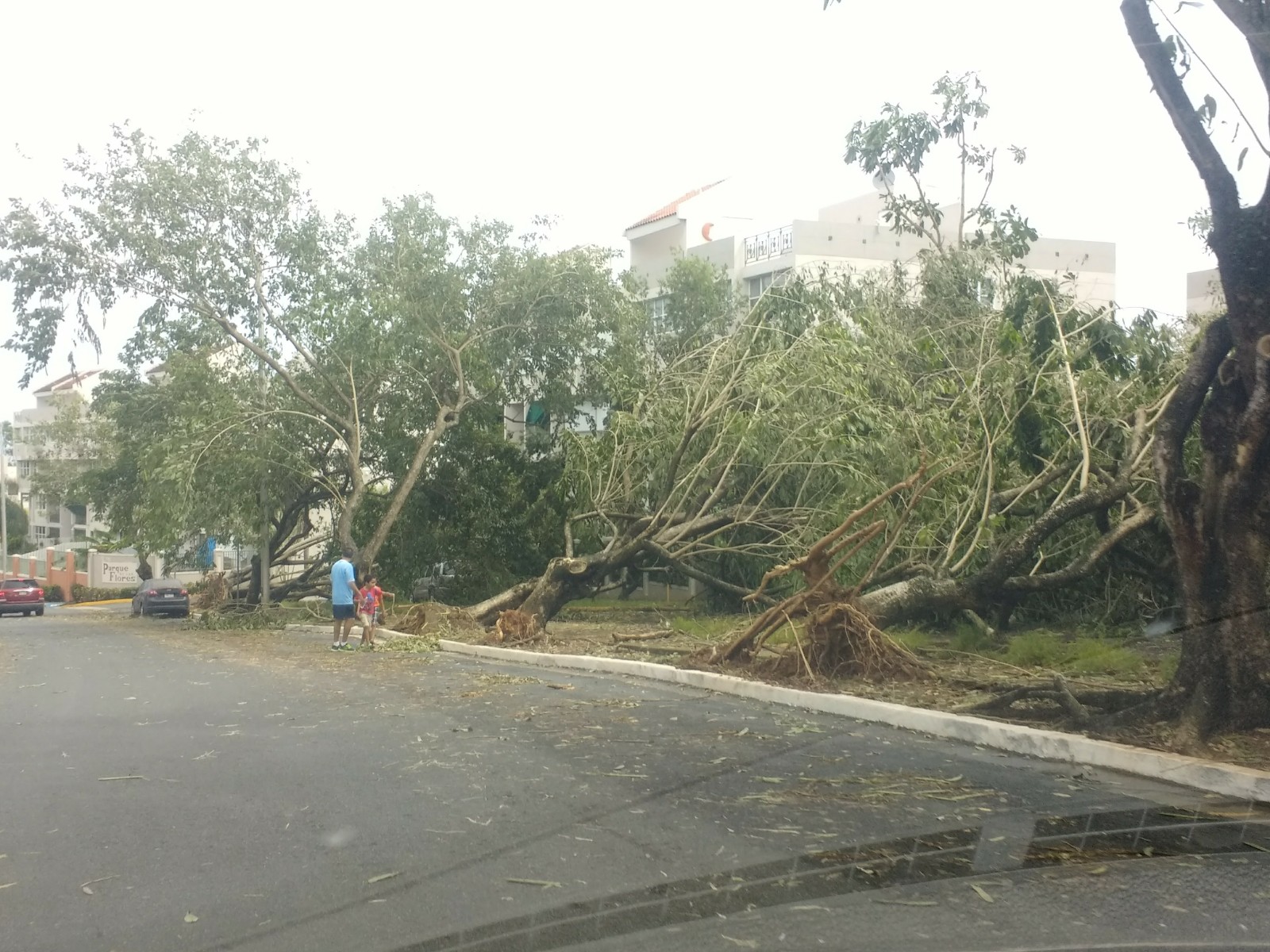
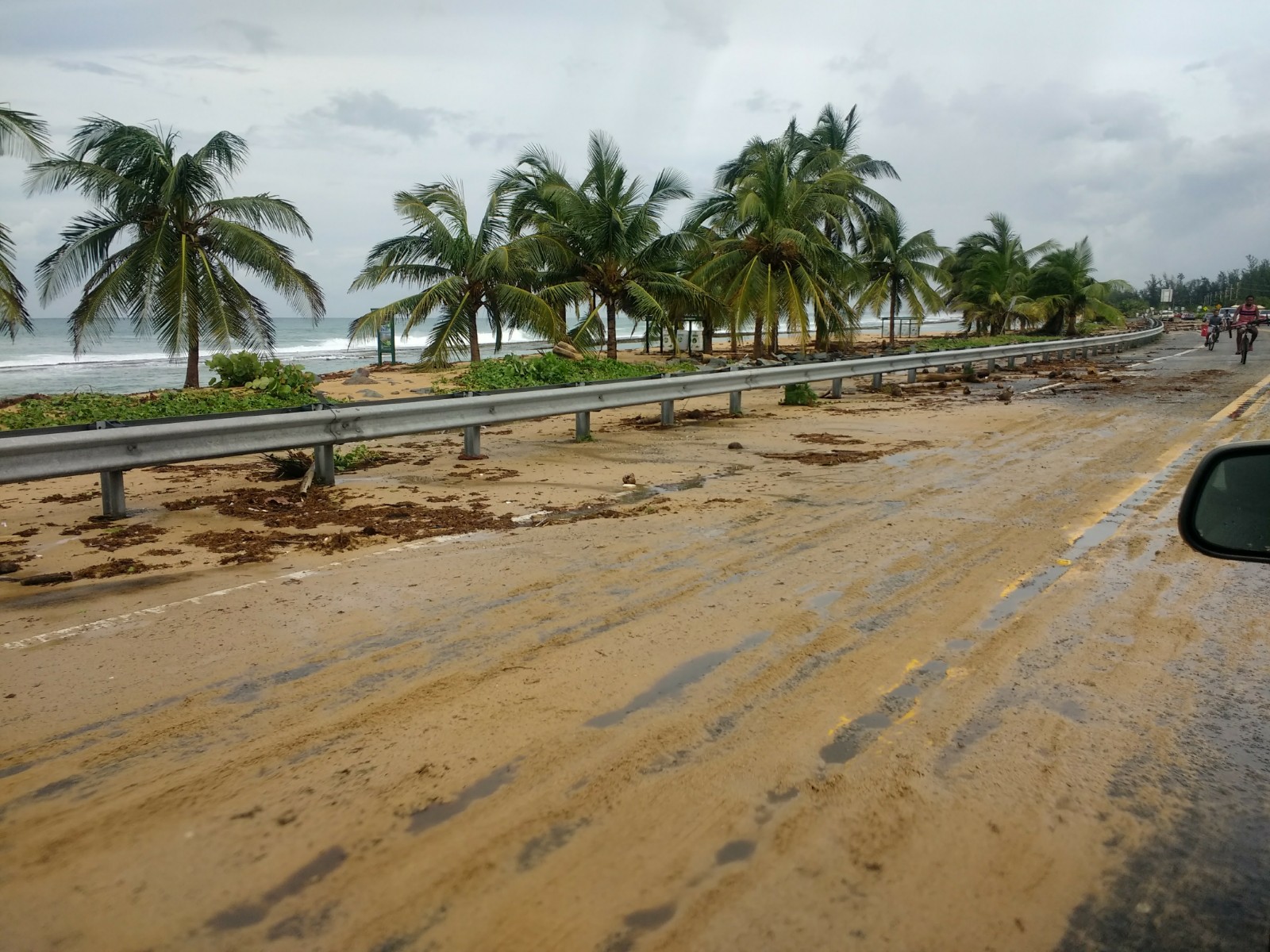
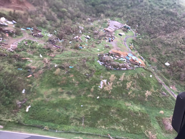
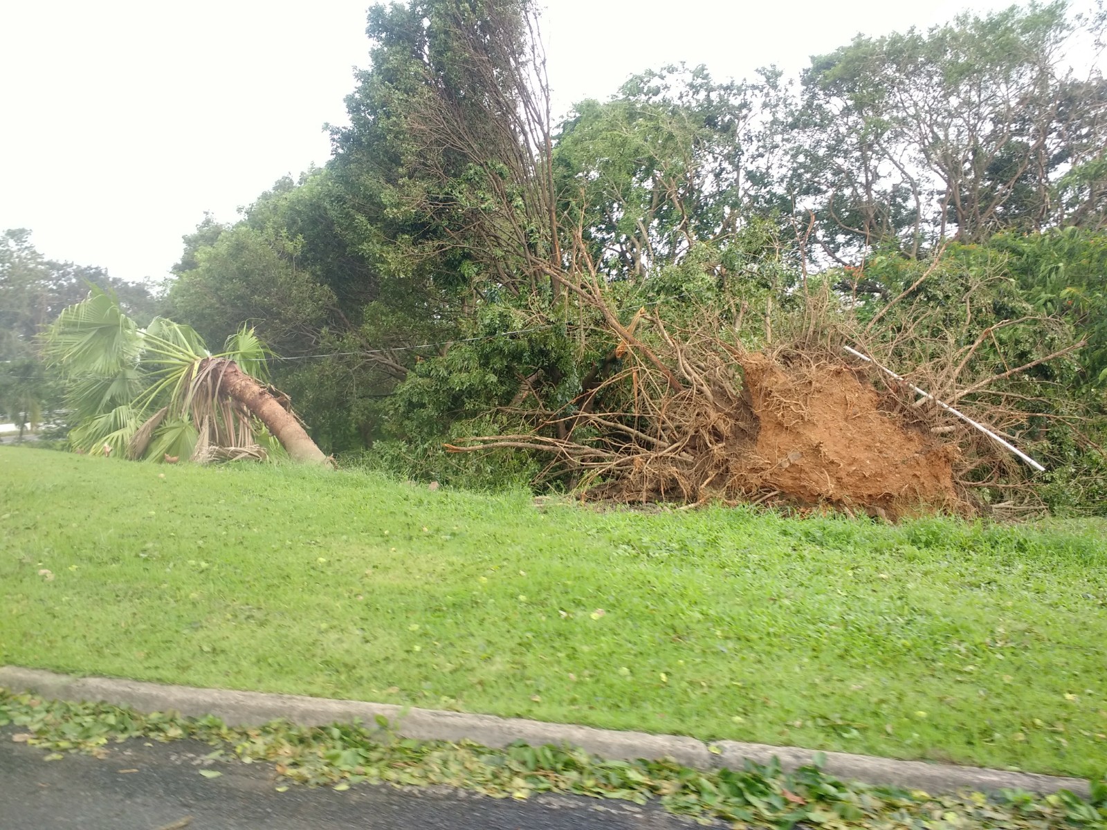
Throughout the overnight and early morning hours of September 6th, Irma severely impacted the northern Leeward Islands, especially the islands of Barbuda and Saint Martin. As the hurricane continued along a west-northwestward trajectory, it began to impact the British and U.S. Virgin Islands during the late morning and early afternoon hours with the southern eyewall passing directly over these islands. Culebra, Vieques, and mainland Puerto Rico began to experience sustained tropical storm forced winds as the center of Irma approached during that afternoon. Although the majority of the rainbands of the hurricane affected Puerto Rico and the US Virgin Islands, the eyewall remained just north of mainland Puerto Rico. In general, most of mainland Puerto Rico only observed sustained tropical storm forced winds but the island of Culebra however, experienced sustained hurricane force winds. By September 7th, the conditions began to improve across the forecast area as Irma began to pull away towards the northwest.
|

.gif)


.JPG)
.jpg)
.jpg)
.jpg)


 7-Day Graphical Hazardous Weather Outlook
 Tropical Analysis
 Tropical Weather
 Regional Satellite
 Puerto Rico and US Virgin Islands
 Local Radar