|
Synoptic Overview
|
|
Tropical Storm Karen formed about 100 miles east of Barbados at 5 AM AST on Sunday, September 22, 2019. Later that morning, a Tropical Storm Watch was issued for the U.S. Virgin Islands and Puerto Rico, including Vieques and Culebra. Karen was a poorly organized storm when it crossed the Windward Islands during the afternoon hours on Sunday. The storm continued very disorganized over the southeast Caribbean waters as it was interacting with 20-25 knots of northeasterly vertical shear. These conditions helped to maintain Karen as a weak tropical storm with an intensity of 35 knots (40 MPH) for more than 24 hours. By 5 AM AST on Monday, a Tropical Storm Watch was upgraded to a Tropical Storm Warning for Puerto Rico, Vieques, Culebra, and the U.S. Virgin Islands. Then, conditions became more hostile with dry air intrusion during the next 12 hours, and Tropical Storm Karen was downgraded to a Tropical Depression with an intensity of 30 knots (35 MPH) on Monday afternoon.
Figure 1: Loop of the NHC forecast from September 22, 2019 at 11 AM AST to September 24, 2019 at 11 PM AST.
Karen became better organized during the overnight hours and re-strengthened into a Tropical Storm about 100 miles south of Puerto Rico. The center of Karen reformed to the west and became slightly stronger with sustained winds of 40 knots (45 MPH) on Tuesday afternoon. Puerto Rico, Culebra and Vieques took a direct hit of Tropical Storm Karen when the center of the storm passed between the islands. Heavy rains associated with Karen led to the issuance of 12 Flash Flood Warnings between September 24-25, 2019.
|
Presione aquí para retornar a la página principal del Servicio Nacional de Meteorología
|
Satellite & Radar Imagery
|
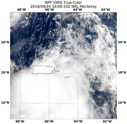
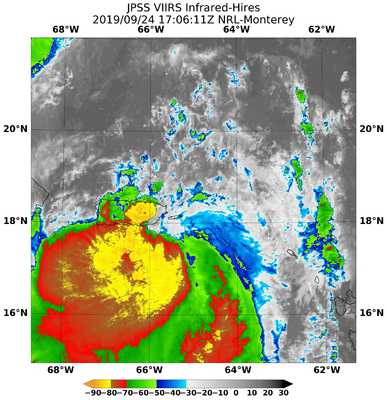
Figure 2: NPP/JPSS VIIRS images of Tropical Storm Karen south of Puerto Rico around 18 UTC September 24, 2019. Image courtesy of NRL-Monterrey.
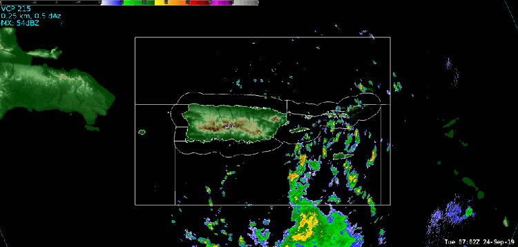
Figure 3: Loop of the TJUA NEXRAD on Septemeber 24-25, 2019 as Tropical Storm Karen moves across the local area.
Presione aquí para retornar a la página principal del Servicio Nacional de Meteorología
|
Storm Total Accumulations
|
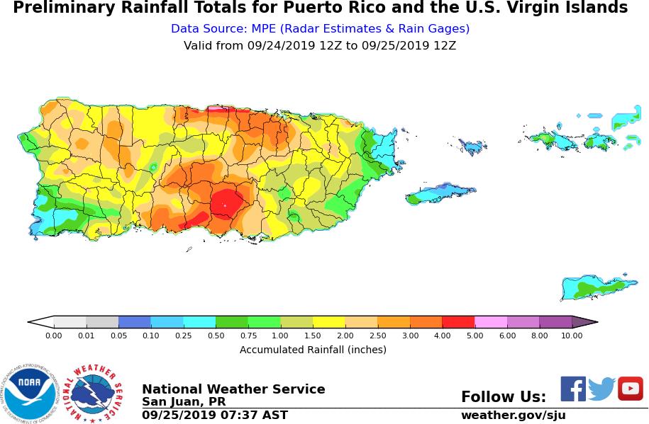
Figure 4: 24-hour rainfall accumulation from 12 UTC September 24 to 12 UTC September 25.
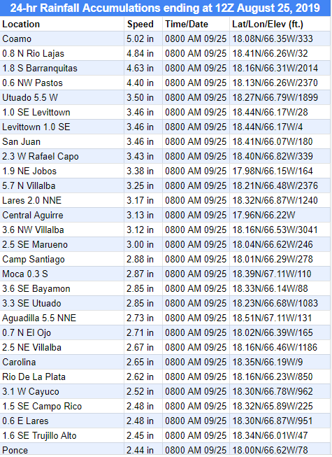
Table of 24-hour rainfall accumulation from 12Z September 24, 2019 to 12Z September 25, 2019.
|
Maximum Wind Gust
|

Maximum Wind Gust measured during the passage of Tropical Storm Karen.
|
Tropical Storm Watches and Warnings
|
![tc_warning]](/images/sju/Huracanes/karen/TCwarnings_KAREN.PNG)
Table that shows the issuance and expiration times of the Tropical Storm Watches and Warnings.

Municipalities where Flash Flood Warnings were issued between September 24-25, 2019.
|
Damages
|
|
In Puerto Rico, The most significant impact from Tropical Storm Karen was due to heavy rainfall. An overall estimate of 2 to 4 inches with isolated higher amounts were reported. Several roads were reported as flooded and/or impassable due to excessive runoff and mudslides, particularly across Barranquitas, Cayey and Guayama municipalities. Flash flooding was also reported Tuesday night into Wednesday early morning at Toa Baja and Dorado, where emergency managers rescued two people that were trapped in their house at Barrio Campanillas in Dorado. Hazardous marine conditions generated high seas, resulting in coastal damage that affected mainly the southern coast of Puerto Rico. Also, two local piers were washed-out due to the heavy storm surge in Vieques island. |


 7-Day Graphical Hazardous Weather Outlook
 Tropical Analysis
 Tropical Weather
 Regional Satellite
 Puerto Rico and US Virgin Islands
 Local Radar