
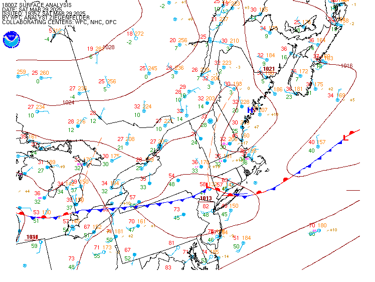
The second storm will track across central and eastern portion of the country this weekend. Heavy wintry precipitation will affect the northern Plains to the upper peninsula of Michigan. Severe thunderstorms are expected along and ahead of the cold front, where very large hail, damaging winds and a few tornadoes are possible from the mid-Mississippi and Ohio Valleys to southern Plains. Read More >
|


 >
>
