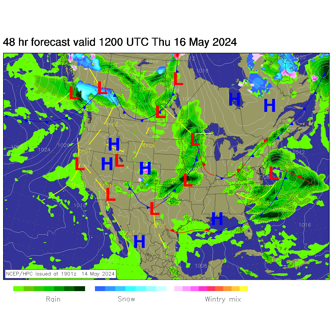
National Weather Service United States Department of Commerce

Back-to-Back Storms for the Center of the Nation

These storm systems will bring late season snow, sleet and ice for portions of the northern Plains, upper Midwest and Great Lakes region. Meanwhile, where temperatures are warmer, severe thunderstorms are expected for areas of the Mississippi Valley into the southern Plains. Furthermore, combination of windy and dry conditions will raise fire weather concerns for the southern High Plains. Read More >


ZBW Aviation Weather SA--Quick Brief
Navigation Menu
Current Conditions

Advance Planning


Current Conditions
Northeast Observations
Northeast Radar


Northeast Fronts
Fog Channel
IR Satellite
Current Icing
Current Turbulence


Turbulence PIREPS
Icing PIREPS
WX PIREPS


Core TAFs
KBOS
KPVD
KMHT
KBDL


All Hazards
CCFP 2 Hour Forecast
CCFP 4 Hour Forecast
CCFP 6 Hour Forecast
CCFP 8 Hour Forecast


SPC Day 1
SPC Day 1 Tornado
SPC Day 1 Hail
SPC Day 1 Wind


Watches/Warnings/Advisories
Mid SIG WX
High SIG WX
SIGMETS


SFC Progs
12 Hour Forecast
24 Hour Forecast
36 Hour Forecast
48 Hour Forecast


Winds Aloft Forecast
18,000 ft MSL/500 mb Winds
0 Hour
6 Hour
12 Hour
24 Hour


30,000 ft MSL/300 mb Winds
0 Hour
6 Hour
12 Hour
24 Hour