National Weather Service United States Department of Commerce

Prolonged Atmospheric River in the Pacific Northwest; Snow and High Winds from the Upper Midwest into the Northeast

A prolonged atmospheric river will continue to impact the Pacific Northwest into the Northern Rockies with heavy rainfall, areas of urban and river flooding, landslides, heavy mountain snow, and gusty winds into Thursday. A strong clipper system will bring the threat of heavy snow and high winds across the Upper Midwest/Great Lakes as well as portions of the interior Northeast and Appalachians. Read More >

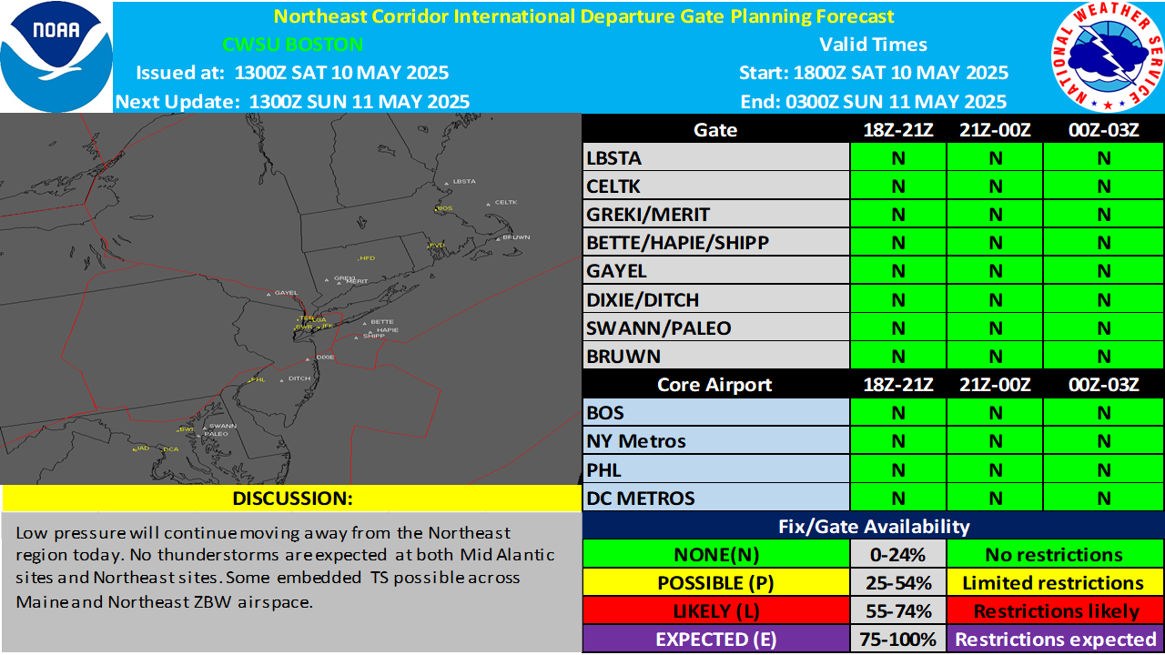
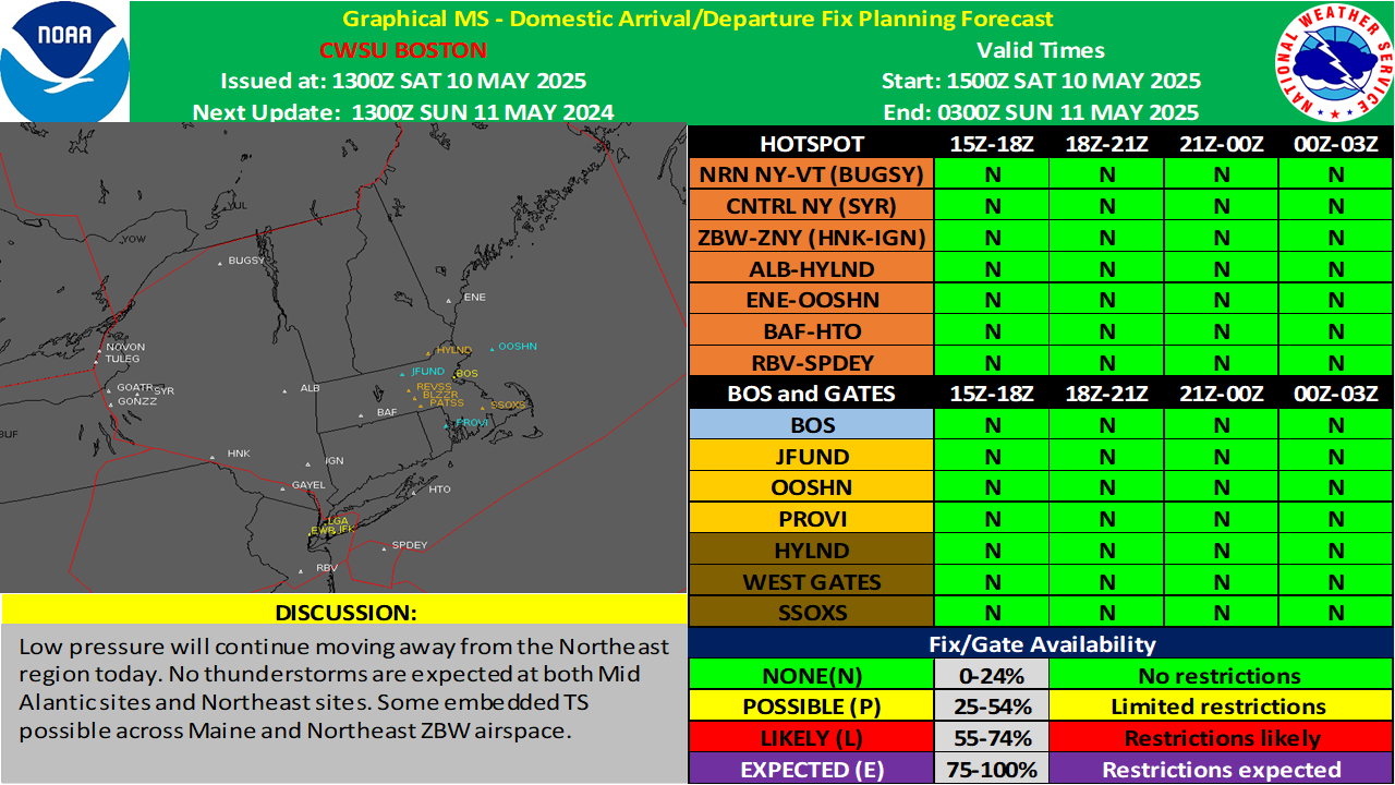
International Gate Forecasts

The International Departure Gate and Arrival Fix Forecasts are collaborative forecasts issued at

around 1330Z and 2300z daily. The CWSU's at Boston, New York and Washington ARTCCs collaborate to produce this forecast.

The 0000z issuance is a "next day" planning forecast.  The 1315z issuance is a

"same day update" forecast.  


Please take a minute to provide us with some feedback so that we can evaluate the usefulness of the
International Departure Gate and Arrival Fix Products.


https://www.weather.gov/images/zbw/IDGF.png


https://www.weather.gov/images/zbw/IAF.png