
Excessive rainfall may produce locally considerable flash flooding over parts of the northwestern Gulf Coast, lower Mississippi River Valley, and Deep South through Thursday. Potential Tropical Cyclone One is forecast to become a tropical storm (Arthur) as it moves along or just off the northwestern Gulf coast through Wednesday. An outbreak of severe weather is forecast in the Midwest Wednesday. Read More >
Washington CWSU
Center Weather Service Unit
Mouse over links below to view images. Click on the links to open the webpage. If you need to adjust the viewable resolution, press Ctrl (+) or Ctrl (-) to expand or contract the page content.
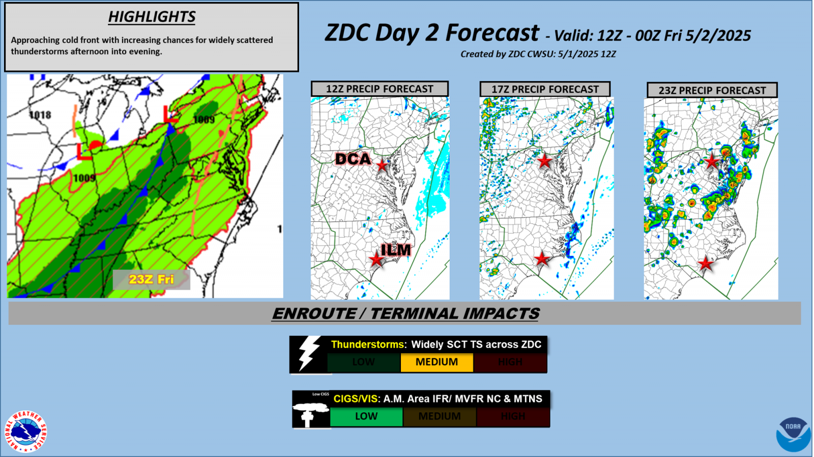
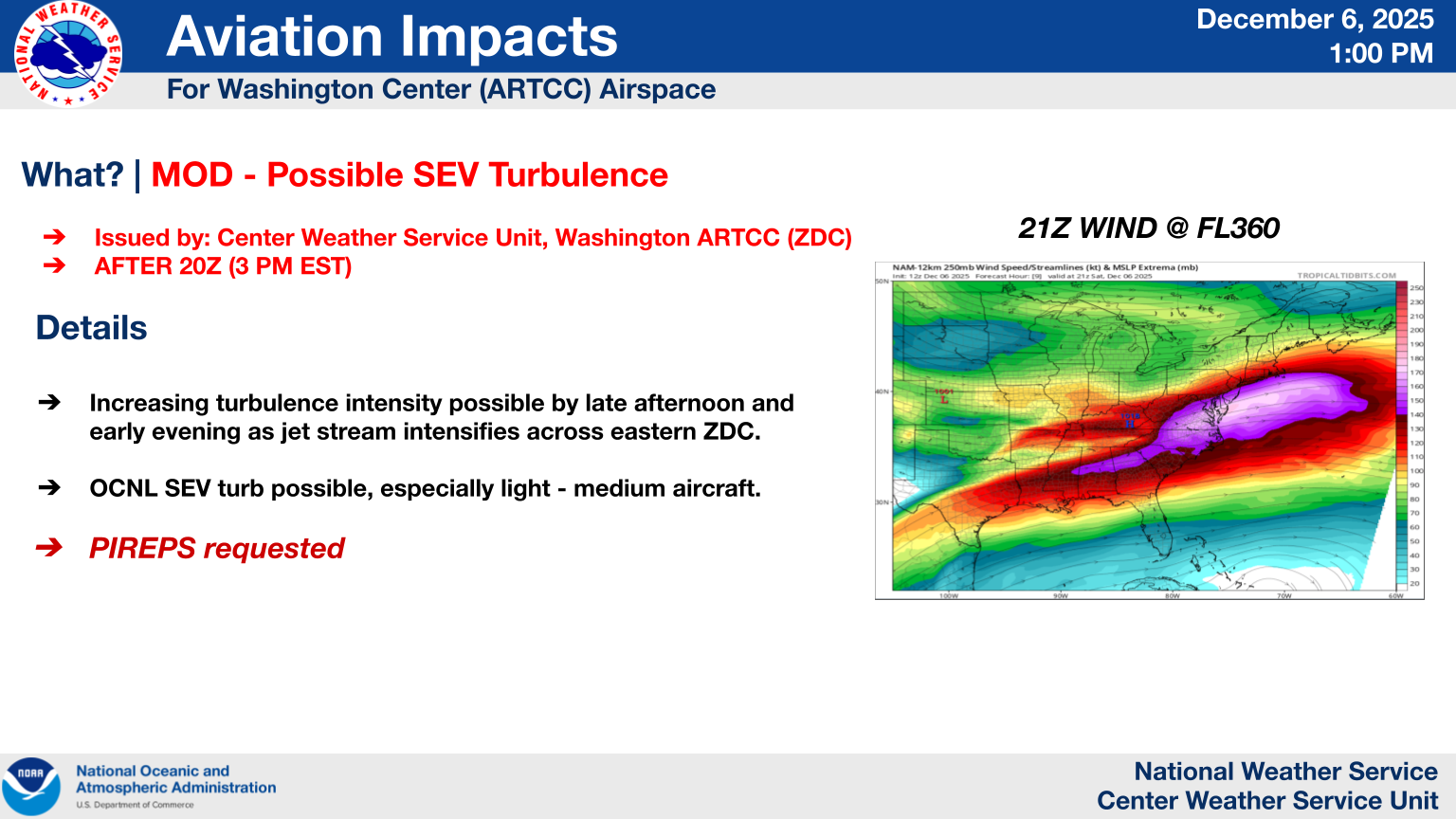
| Tactical Decision Aids: Day 1 Impacts | Day 2 Forecast | | |
| Radar: Morehead City/MHX | Blacksburg/FCX | Charleson/RLX | Mt. Holly/DIX | Sterling/LWX | Wakefield/AKQ | Wilmington/LTX | Pittsburgh/PBZ | | |
|
Please take a minute to provide us with some feedback so that we can evaluate the usefulness of the Weather Dashboard.
US Dept of Commerce
National Oceanic and Atmospheric Administration
National Weather Service
Washington CWSU
Washington ARTCC Center Weather Service Unit
825 East Market Street
Leesburg, VA 20176-4496
703-771-3480
Comments? Questions? Please Contact Us.


