
Tropical system in the Gulf expected to gradually strengthen the next couple of days off the Florida Panhandle and Alabama coasts. Instances of flash flooding will be possible through Thursday along the eastern and central Gulf Coast. Severe thunderstorms will develop and move along a cold front crossing the Upper Midwest, and through the Ohio Valley/Mid-Atlantic on Tuesday. Read More >
 |
Potomac TRACON Weather |
 |
| For ATC Planning Purposes Only - See AviationWeather.gov if data is not current |
For More information on PIREPs and Observations visit aviationweather.gov
Forecast Products
|
TCF 4 Hour
|
TCF 6 Hour
|
|
TCF 8 Hour
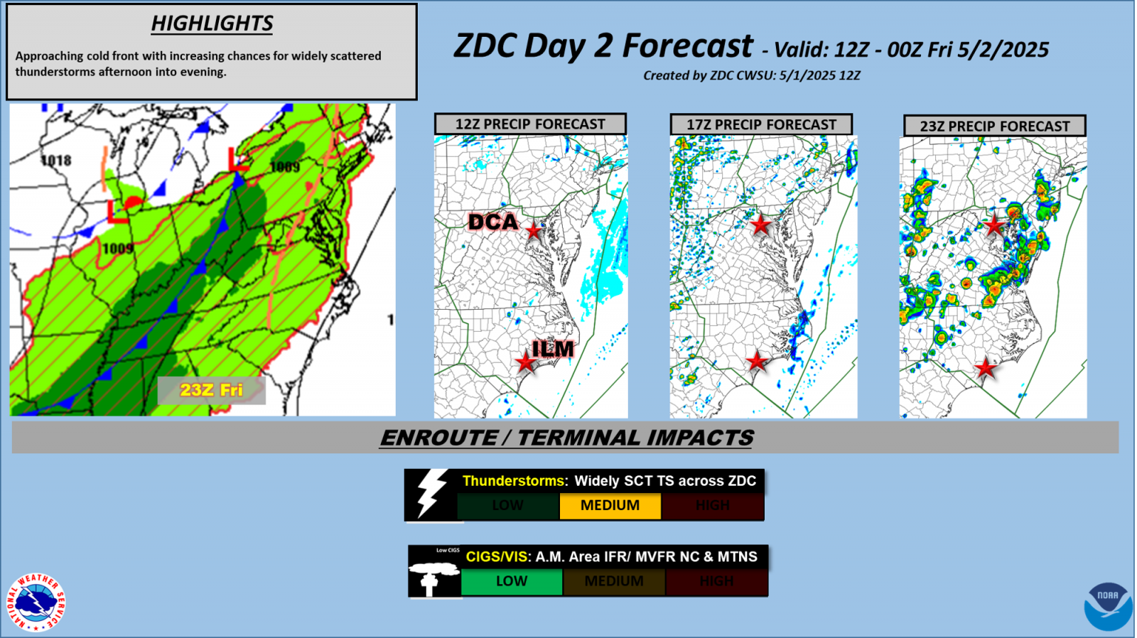
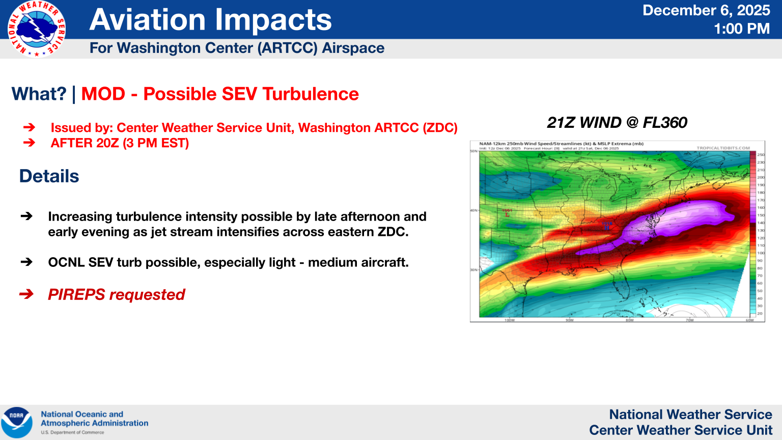
Day 2 Impacts for ZDC
Daily Briefing Sheet
|
DCA TDA DC Metro Gate Forecast here. Today's Severe Weather Threat (Tomorrow's Threat)
International Departure Forecast
International Arrival Forecast
|
DCA |
IAD |
BWI |
RIC |
|
|


