April 4, 2011 Tensas Parish into Claiborne County Tornado
Click on Map Below to Zoom In/Out and Damage Notation

|
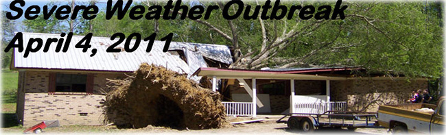
Event Summary This tornado first touched down along Highway 573 just south of Cooter Point. It tracked northeast across Highway 892 and Highway 128 and then crossed Highway 65 a few miles northwest of St. Joseph. The tornado then crossed Lake Bruin and traveled north of that lake before crossing the southern end of Lake St. Joseph. The tornado moved across the Mississippi River where trees were observed down on Middle Ground Island. The tornado ended as it touched the eastern bank of the river in Claiborne county. Numerous homes...farms and outbuildings were significantly damaged by the tornado. Much of the damage to the homes was to the roofs with many being blown off. A water treatment plant received major damage and an antebellum home received significant damage. A grain silo received a huge dent from the tornado and an 18 wheeler was flipped over. Hundreds of trees were snapped and uprooted along the path and numerous power poles were snapped. |
|


 Follow us on YouTube