East Carroll Parish Tornado

Click on map above to see entire damage point notation and damage pictures at select points.
|
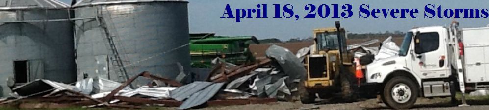
Event Summary The tornado appears to have started in an open field just west of U.S. Highway 65, about 2 miles northwest of the Sondheimer community. As it crossed Highway 65 near the intersection of Henderson Loop Road, it destroyed a large farm outbuilding, downed a couple of power poles, and caused some minor damage to some nearby structures. The tornado continued east northeast along the north side of Henderson Loop Road, and snapped a large tree and caused shingle damage to two homes near the intersection with Sand Field Road. The tornado then turned a bit more toward the north along that road, causing some minor tree damage before dissipating. |
|


 Follow us on YouTube