|
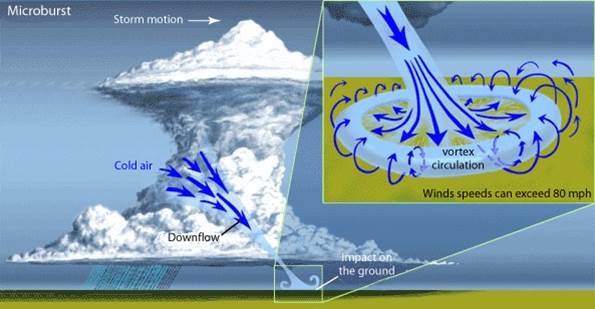
What is a Microburst?
A microburst is a localized column of sinking air (downdraft) within a thunderstorm and is usually less than or equal to 2.5 miles in diameter. Microbursts can cause extensive damage at the surface, and in some instances, can be life-threatening. There are two primary types of microbursts: 1) wet microbursts and 2) dry microbursts. Wet microbursts are accompanied by significant precipitation and are common in the Southeast during the summer months.
|
 |
 |
What causes a Microburst?
It all starts with the development of a thunderstorm and the water droplets/hailstones being suspended within the updraft. Sometimes an updraft is so strong it suspends large amounts of these droplets and hailstones in the upper portions of the thunderstorm. There are many factors that can lead to evaporational cooling (sinking air) and therefore weakening of the updraft. Once this occurs, it is no longer capable of holding the large core of rain/hail up in the thunderstorm. As a result, the core plummets to the ground. As it hits the ground it spreads out in all directions. The location in which the microburst first hits the ground experiences the highest winds and greatest damage.
|
|
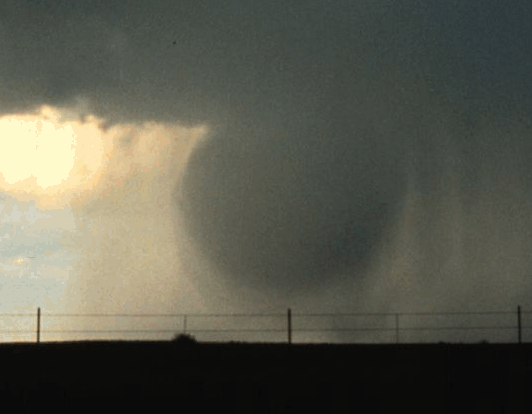
Microburst Damage
Wind speeds in microbursts can reach up to 100 mph, or even higher, which is equivalent to an EF-1 tornado! Winds this high can cause major damage to homes and other structures and level hundreds of trees. It is very important that you take Severe Thunderstorm Warnings just as seriously as Tornado Warnings!
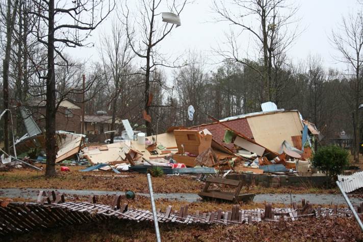
The image to the right shows just how much damage can be caused by microburst winds. As you can see, this manufactured home was completely destroyed.
|
 |
|
|
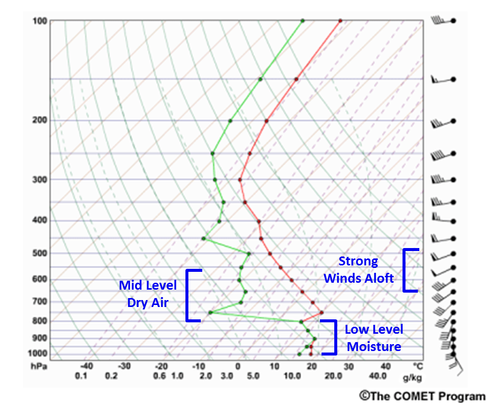
Forecasting Microburst Potential
Forecasting for microbursts is typically done on a near-term basis, generally within 6-12 hours before convection is expected to develop. There are several atmospheric parameters that forecasters use to help determine the microburst potential on any given day, primarily during the summer months. Instability, high precipitable water (PW), dry air in the mid levels, and strong winds in the dry layer are just a few of the parameters necessary for the development of microbursts. The ideal conditions typically come together during hot and humid summertime afternoons in the Southeast.
|
|
Warning for Microbursts
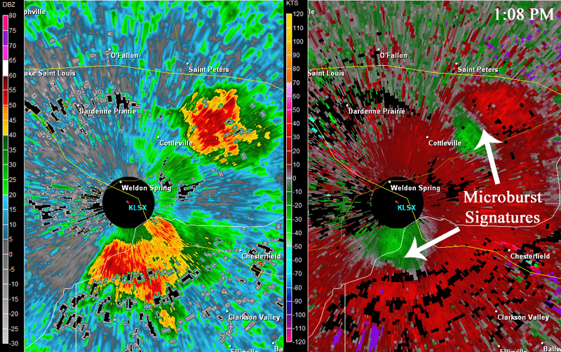
When interpreting radar data, forecasters look for converging air within the mid levels of the thunderstorm, also known as a mid-altitude radial covergence (MARC) signature. These can be very hard to detect since microbursts are so short-lived and can sometimes occur between radar scans. Therefore, unfortunately, Severe Thunderstorm Warning lead times for microbursts can be very short, or there may be no warning at all. Our understanding of microburst formation and detection continues to increase and will hopefully lead to better lead times in the future.
When a microburst reaches the ground, a divergence signature can be seen on radar. In the image to the right, you can see the divergent wind pattern in velocity near ground level from two different storms. The bright red indicates winds blowing away from the radar, and the bright green indicates winds blowing toward the radar.
|
 |
|


 Follow us on YouTube