Heavy Snow and Ice Event of January 9-10, 2011
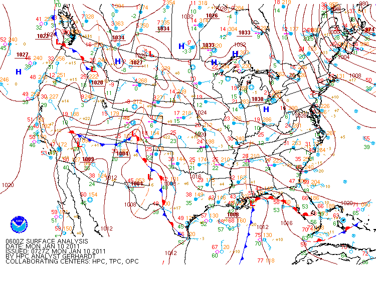
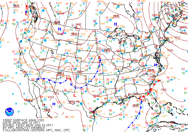
On the morning of Sunday, January 9th, a low pressure system formed in the Gulf of Mexico just off the Texas coast. This low pressure system traveled parallel to the Gulf Coast throughout the day on Sunday and into the day on Monday before moving over the Florida Panhandle and off the Atlantic Seaboard Monday night. Even though the system weakened as it moved eastward, it brought moisture across Central Alabama, where cold temperatures were already in place from a cold front that had moved through Friday and Saturday, the 7th and 8th of January.
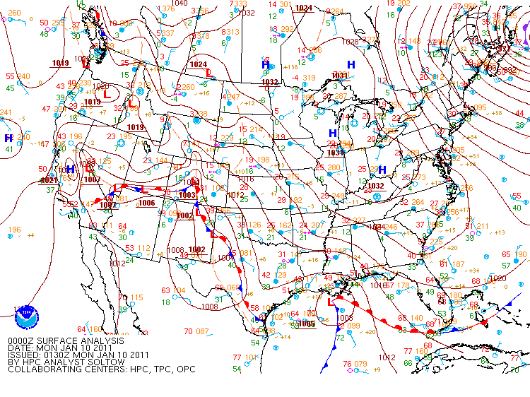
Surface Analysis from 6 PM Sunday Surface Analysis from 12 AM Monday
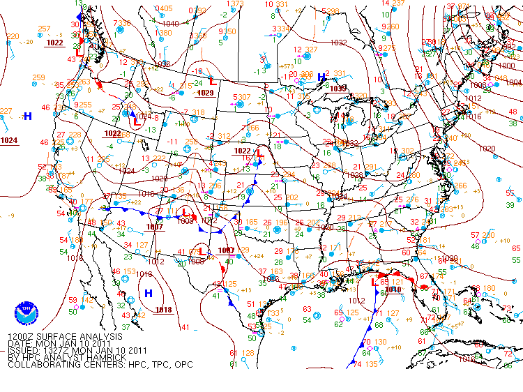
Surface Analysis from 6 AM Monday Surface Analysis from 12 PM Monday
By noon on Sunday, weak reflectivities were already on the radar, though, it wasn't until about 2 PM that afternoon when Tuscaloosa began reporting unknown precipitation. The bulk of the activity started later that evening, but because of an elevated warm layer of air that moved inland as the low pressure system passed to the south of Alabama, the southern half of the county warning area didn't receive any snow -- just ice and sleet. By daybreak Monday morning, areas north of Interstate 20 were reporting anywhere from 1 to 14 inches of snow with the heaviest totals near the Alabama-Tennessee state line. Ice reports were as high as 0.50 inches in multiple counties south of Interstate 20.
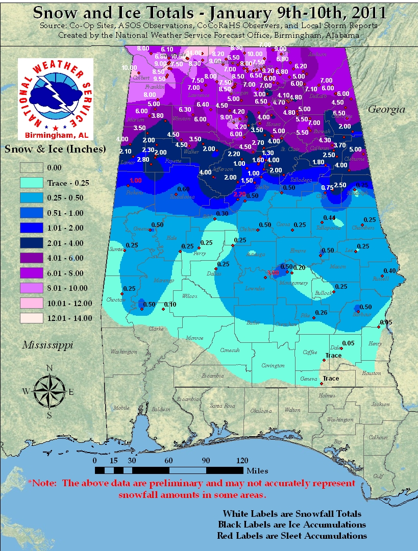
The ice and snow from Sunday night and Monday morning created havoc across most of the state. By Sunday evening, businesses and schools had already declared they would be closed on Monday and for good reason. Road conditions around central Alabama caused many counties to declare that roads would be closed overnight Sunday night. Unfortunately, this winter weather event caused the loss of at least 2 lives on area roadways because of slick conditions.
Though the majority of the activity was over by Monday night, the effects of the system were felt for the next couple of days. Areas that saw excessive amounts of snow were plagued with melting and refreezing on area roadways for the next couple of days, creating slick conditions through Wednesday, January 12th.
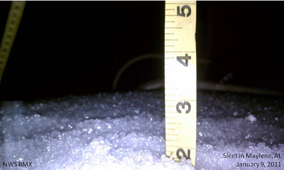
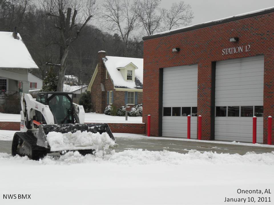
Sleet in Maylene, AL. Storm Totals of 2.5 inches. Snow in Oneonta, AL.
Submitted by Kristina Sumrall. Submitted by Blount County EMA.
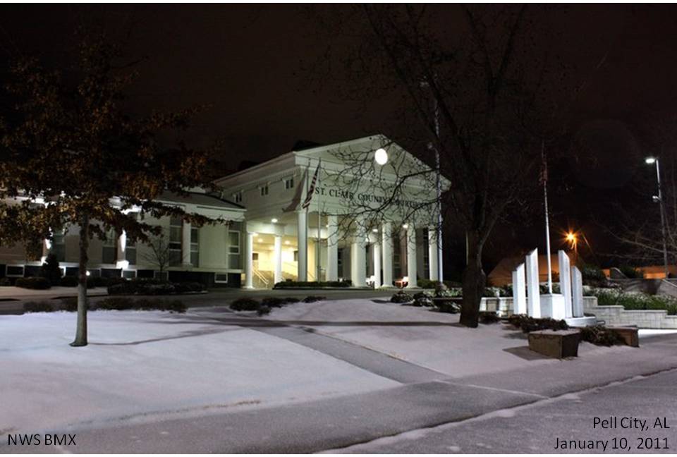
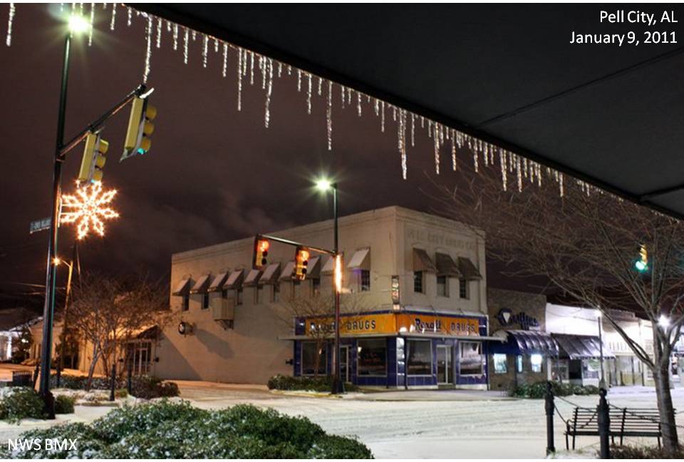
Snow at the courthouse in St. Clair County. Snow in downtown Pell City.
Submitted by Patrice Payne. Submitted by Patrice Payne.
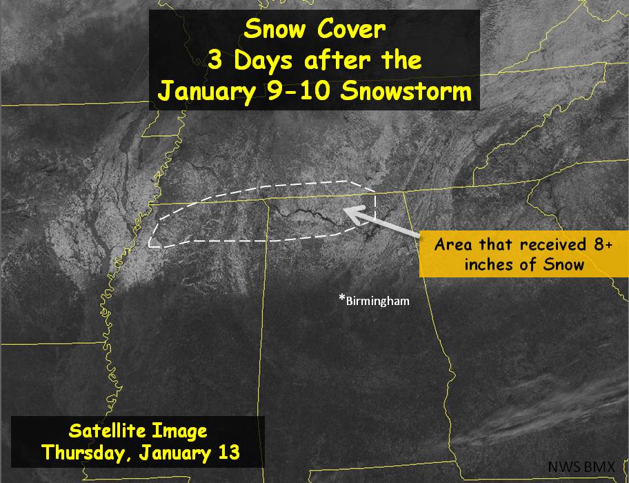
Visible Satellite Image of Snow 3 Days Later
If you have any pictures from this event you would like to share with us, please email them to sr-bmx.pix@noaa.gov. Images can be submitted in any format, but please try to keep the file sizes below 500 Kb. Please include a date and location the image was taken, and a brief description. Although not every detail is needed, be as specific as you can. For proper credit for the image, also include your name and location.


 Follow us on YouTube