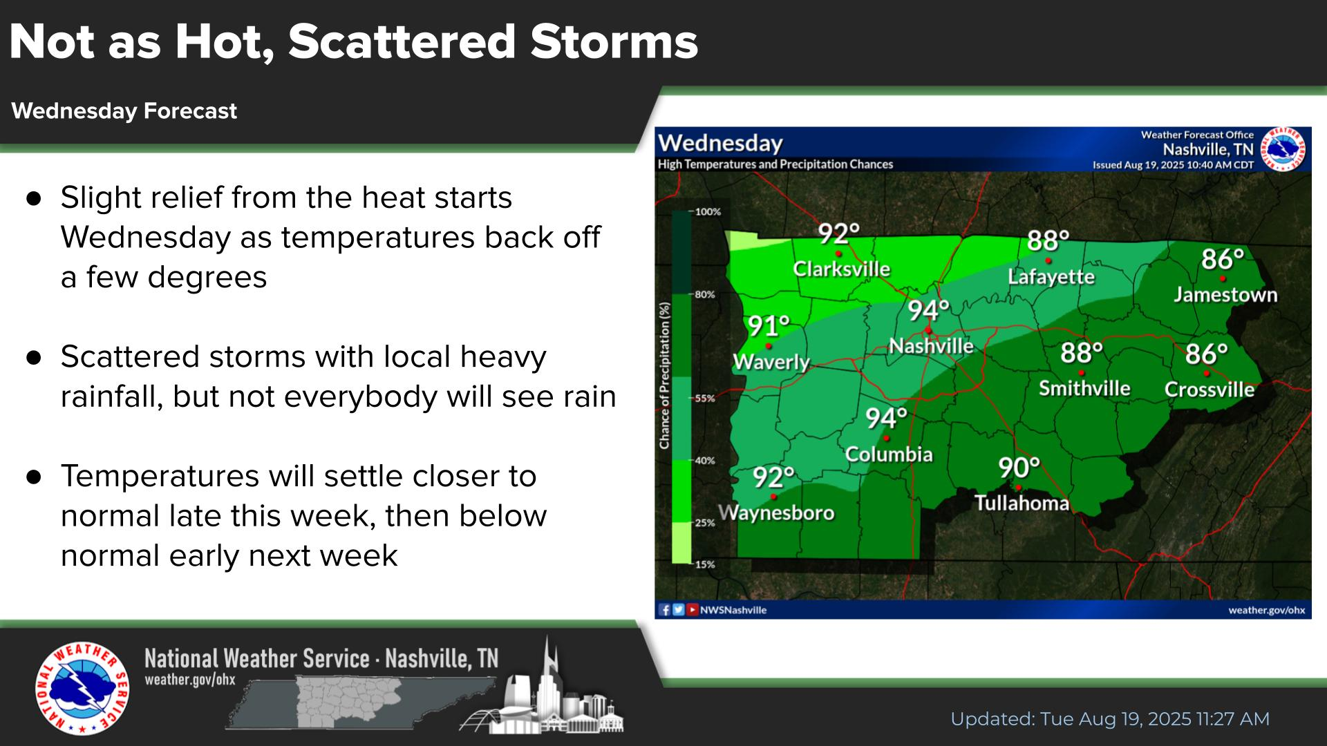
Last Map Update: Tue, Jul 21, 2026 at 12:28:38 am CDT


|
Middle Tennessee Weather History For July 20th...
|
|
On July 20, 2000...Severe thunderstorm winds down numerous trees and
power lines down across Lincoln County, especially between Fayetteville and Coldwater. Some trees fall on cars. One man is killed flying a gyrocopter in the southern Vanntown area, just off Holster Creek Road. |
|
Text Product Selector (Selected product opens in current window)
|
|
| Decision Support | Hydrology | Past Weather Events | GHWO | Observations | Gridded Forecast |
| IDSS Point Forecasts | Daily Climate | Local Climate | Tornado Database | Tropical | Weather Radio |
 |
|||||
| Being Prepared | Probabilistic | Climate Records | Outreach |


 NWS Nashville (KOHX) Radar Loop
 Situation Report
 Regional Satellite
 National Weather Map
 Drought Monitor
 Graphical Forecast