|
Event Summary
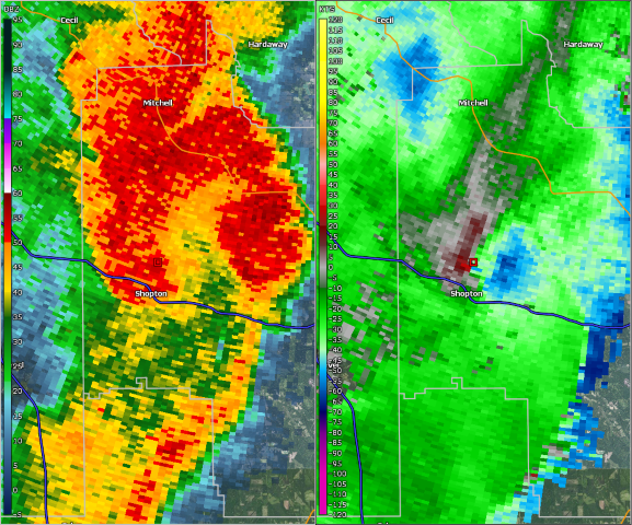
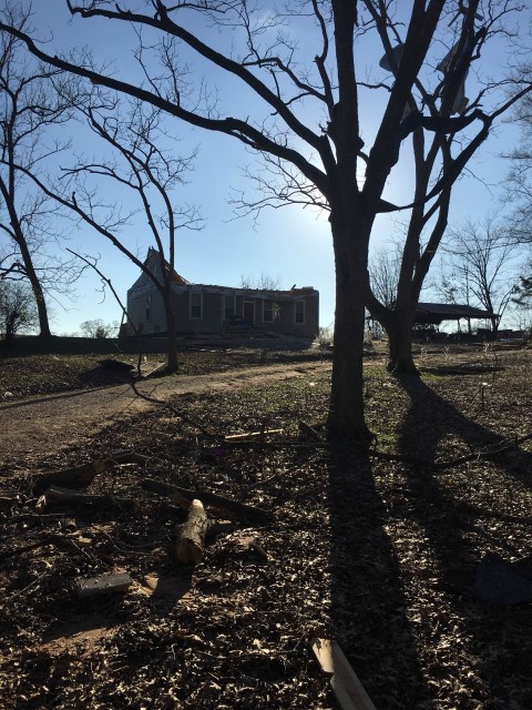
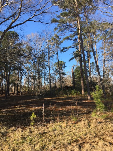
National Weather Service meteorologists surveyed damage in northwest Bullock County and determined that the damage was consistent with an EF-1 tornado.
The tornado touched down northwest of Shopton along U.S. Highway 82. At least one home suffered damage near U.S. Highway 82. The tornado tracked northeast and mainly produced tree damage. The tornado lifted northeast of Shopton east of County Road 37. The tornado was 1.98 miles long and was 320 yards wide at its widest point. The tornado was rated an EF-1 with maximum winds around 90 mph.
Thanks to Bullock County EMA for their assistance with this survey.
|