|
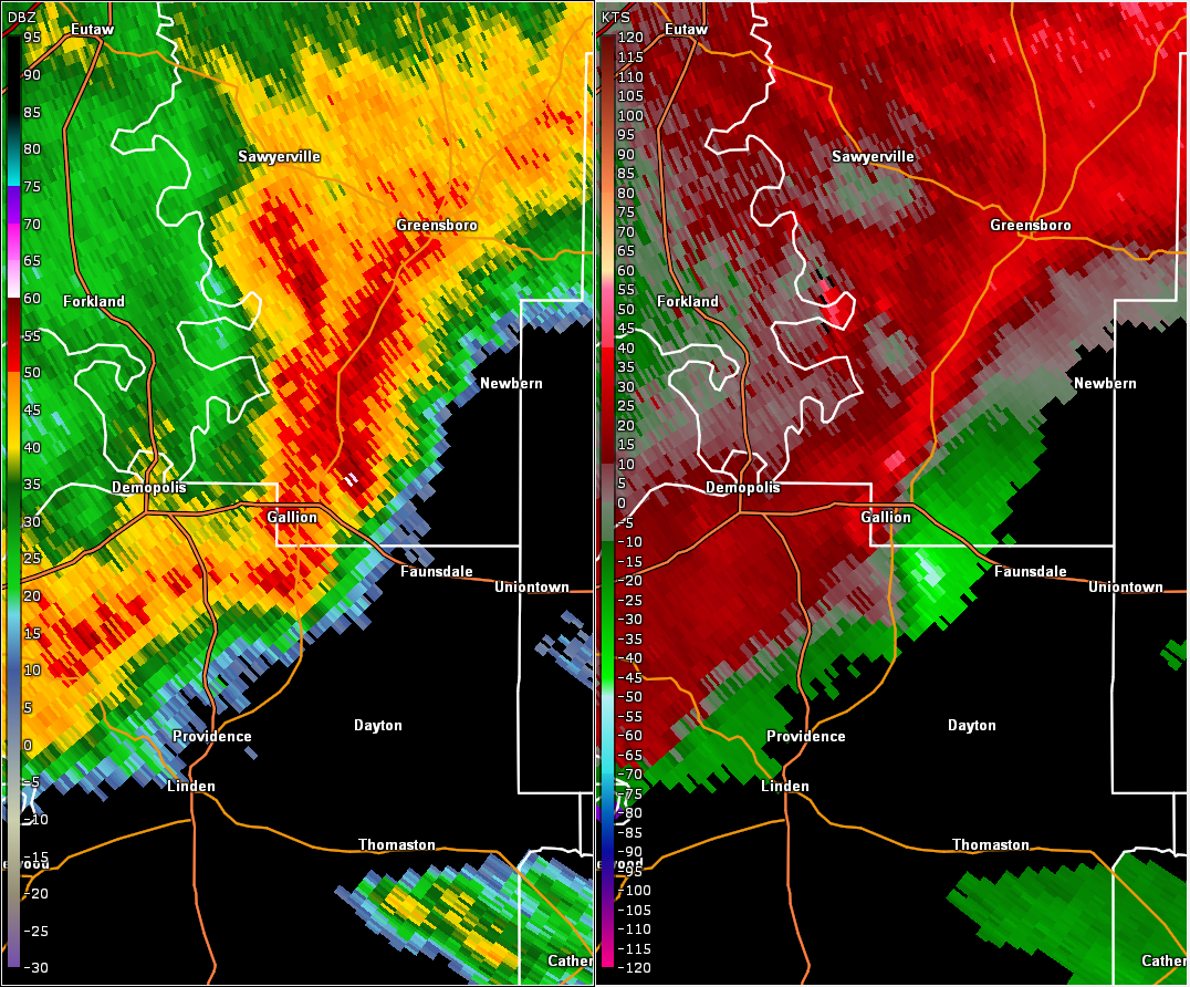
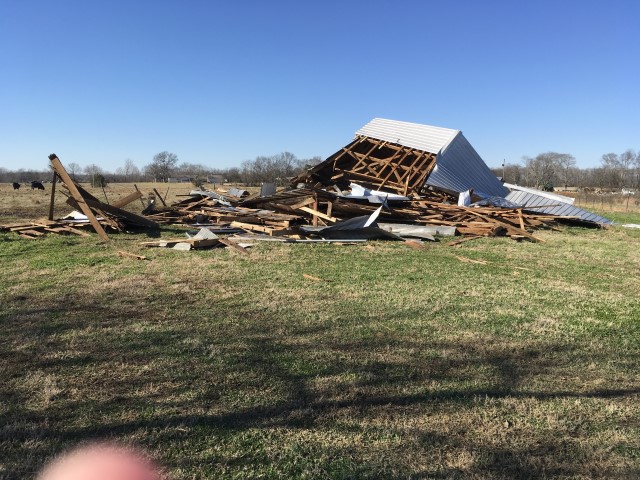
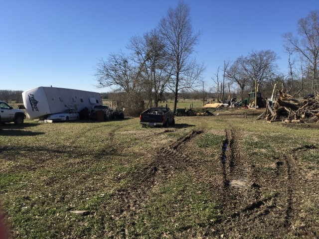
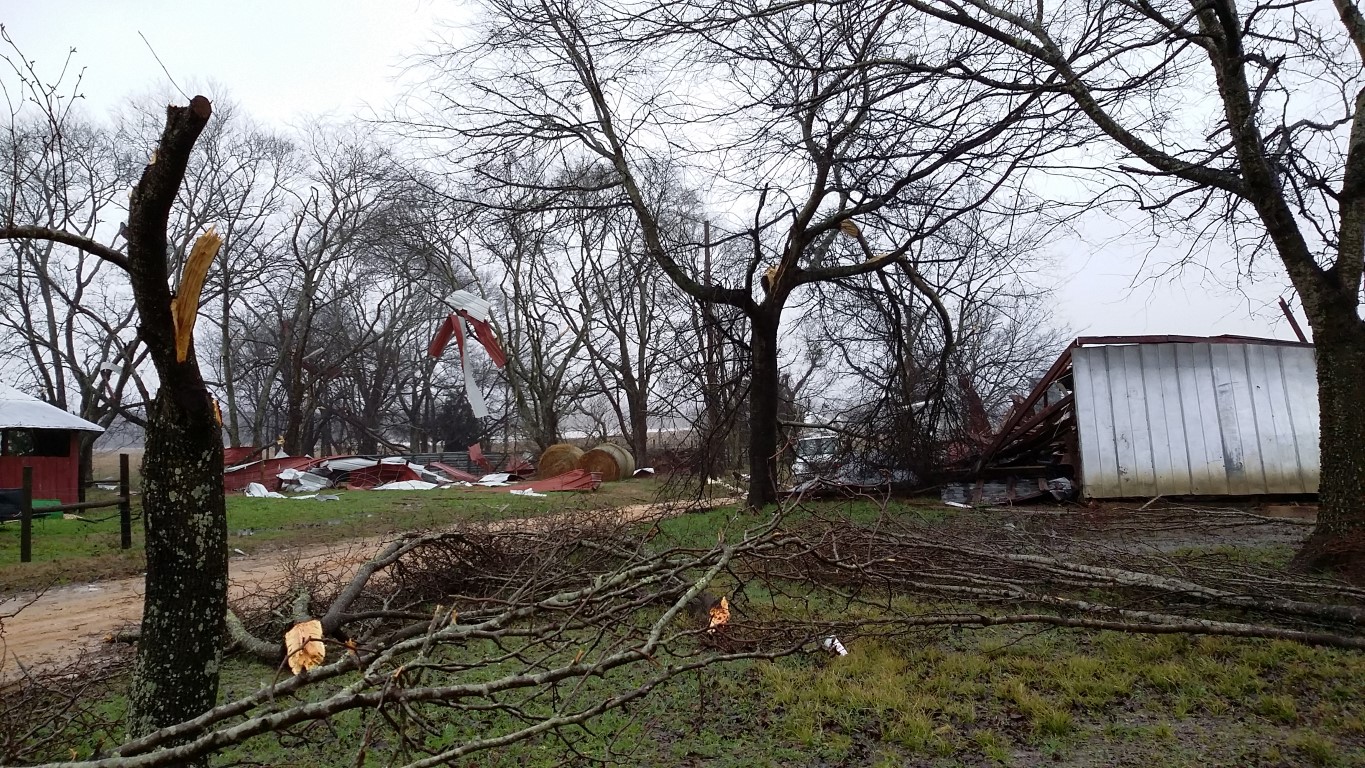
The National Weather Service surveyed damage near Gallion in northern Marengo County and determined the damage was the result of a tornado. The tornado began near the intersection of U.S. Highway 43 and County Road 54 where damage to cedar trees was observed. The tornado continued east through a heavily forested area and crossed French Creek. Tree damage was observed along County Road 1. The tornado moved further east crossing Alabama Highway 69 where, on the north side, a large tree crushed the south side of a single wide mobile home. Further south, on the south side of the path, near Windsor Drive and Alabama Highway 69, a large farm equipment building lost its roof and walls while wooden supports remained in tact. Two mobile homes nearby sustained minor damage to their roofs and siding on the south side. A 5th wheel RV camper was blown over and crushed a vehicle. Trees were uprooted and split in the vicinity. The tornado pushed east, paralleling Windsor Drive, and caused additional damage to trees that were either uprooted or split. The damage peaked where a single wide mobile home was lofted and blown to the northeast about 30 feet from its original position. The mobile home was less than a year old but appeared to lack any substantial anchoring system. The walls and roof were completely torn away from the floor base and nearly all of the contents were deposited downwind. This appears to be the climax of the tornado's intensity, and winds were estimated to be near 100 mph. To the south of the mobile home's original position was a metal barn that collapsed and destroyed. The tornado continued to the east where it caused damage to an agricultural crop sprinkler system and snapped a power pole along Allenville Road. It then crossed U.S. Highway 80 and damaged two road signs and caused timber damage. The tornado tracked even further east and dissipated just across the Hale County line along Alabama Highway 25 where the timber damage became more sporadic and less defined.
|