National Weather Service United States Department of Commerce

Hackleburg EF-0 Tornado
February 24, 2011


EF-0
Estimated Maximum Wind:
75-80 mph
Injuries/Fatalities:
None
Damage Path Length:
0.57 miles
Maximum Path Width:
100 yards
Approximate Start Point/Time:
0.8 ENE Wiginton
34.2858/-87.8578 at 1018 pm
Approximate End Point/Time:

1.4 ENE Wiginton
34.2878
/-87.8482 at 1018 pm

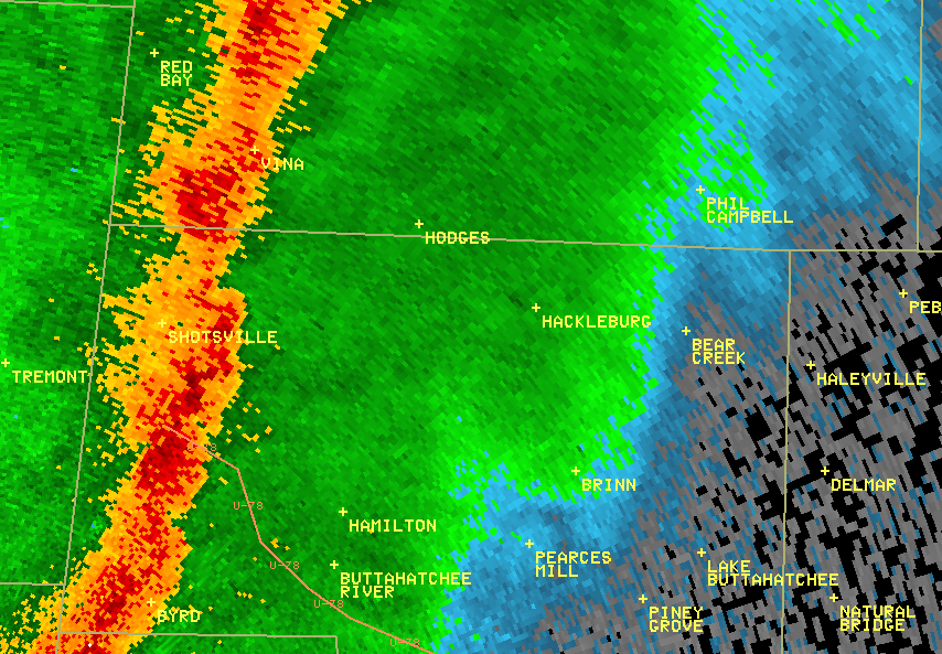
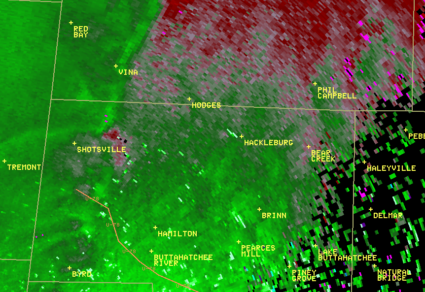
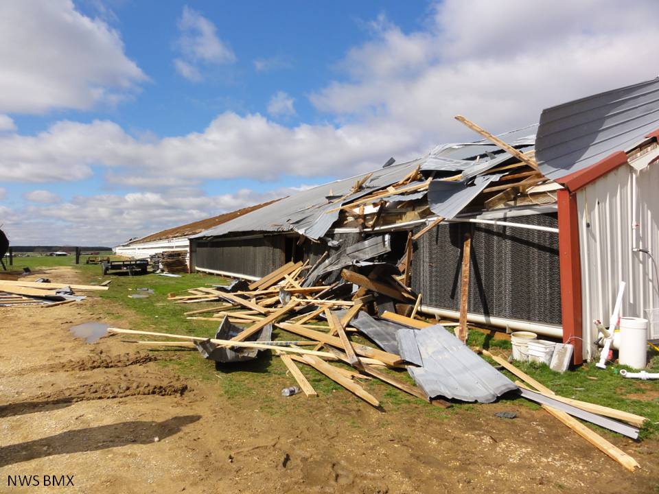
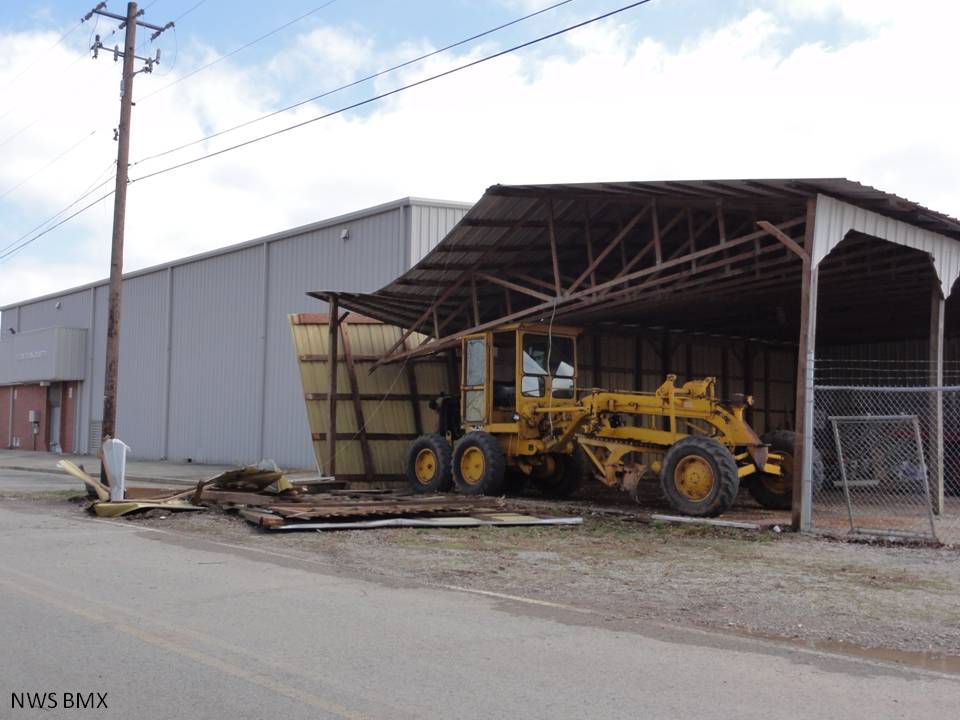
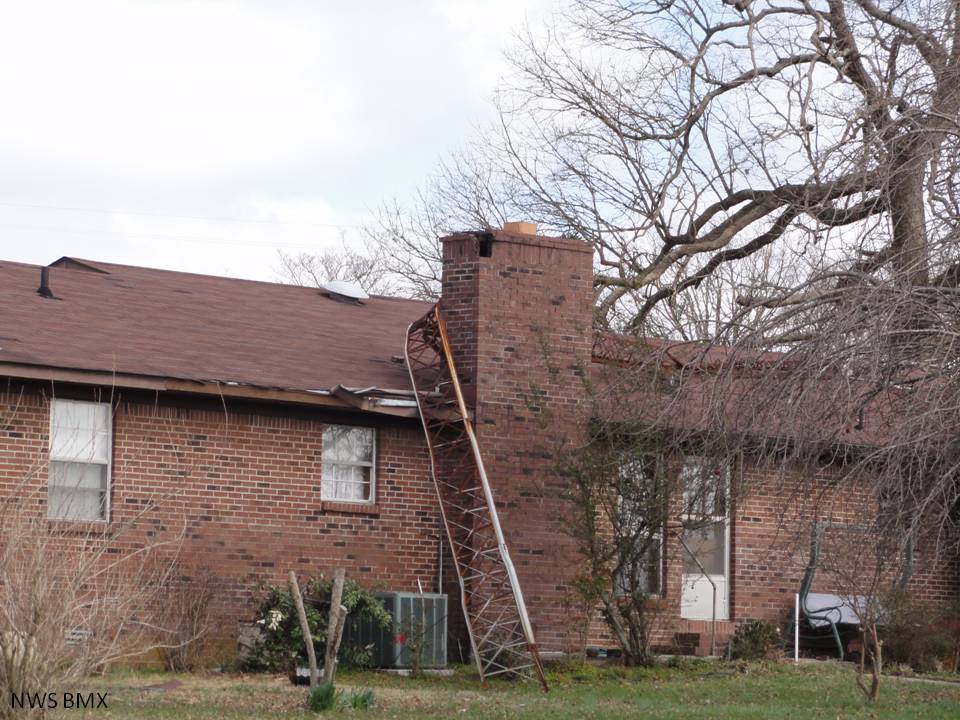
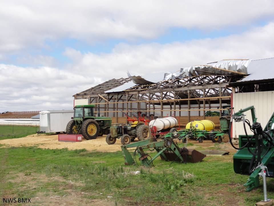
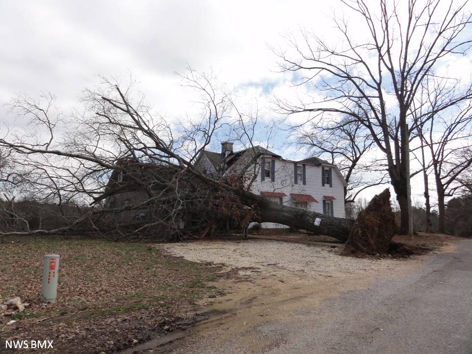
A National Weather Service Damage Assessment Team has surveyed the storm damage in Marion County and has determined that the damage was caused by a weak tornado.

A EF-0 tornado briefly touched down just to the northwest of the town of Hackleburg, with winds that were approximated at 75-80 mph.  Traveling on the ground for only 1/2 mile, the tornado did considerable damage to a number of chicken barns and outbuildings in the area, extensively lifting tin roofs and overhangs.


Reflectivity

Reflectivity 


Storm Relative Velocity

Storm Relative Velocity

The animated loops above are from the Columbus, MS radar (KGWX) at the time of the tornado in Hackleburg.  The loop on the left is the 0.5 degree scan of reflectivity and the loop on the right is the 0.5 degree scan of the Storm Relative Velocity.  Notice the notch in the reflectivity as the squall line passes over Hackleburg.  Weak rotation can be discerned in the velocity loop on the right.  Pay attention to the inbound and outbound velocities (colored green and red, respectively) that are adjacent to one another as the line passes over Hackleburg.  This signifies rotation in the atmosphere.  


Damage and Debris

Damage & Debris 


Damage and Debris

Damage


Damage and Debris

Roof antennae wrapped around a chimney


Damage and Debris

Notice how the barn pole was concreted into the ground


Damage and Debris

Tin roof damage. A carport-style covering used to
shelter the farm equipment in this picure


Damage and Debris

Uprooted Tree