National Weather Service United States Department of Commerce


Ashville-Southside EF-2 Tornado (St. Clair/Etowah/Calhoun Counties)
  March 19, 2018


EF-2
Estimated Maximum Wind:
120 mph
Injuries/Fatalities:
1 Injury
Damage Path Length:
15.73 miles
Maximum Path Width:
1760 yards
Approximate Start Point/Time:
2 NE Ashville
33.8552/-86.2398
at 8:02 pm CDT
Approximate End Point/Time:
3 W Silver Lakes Golf Course
33.8806/-85.9688
at 8:21 pm CDT

Event Summary

National Weather Service meteorologists surveyed damage in northern St. Clair County and extreme southern Etowah County and determined that the damage was consistent with an EF-2  tornado. The tornado touched down just northeast of Ashville along Highway 411. The tornado continued east northeast and caused tree damage. The tornado appeared to intensify as it approached the Coosa River where structural damage became evident. One house was moved off its foundation with a complete loss of roofing materials. Stands of trees were snapped off near their bases, including both hardwoods and softwoods. The tornado then crossed Neely Henry Lake where the tornado was at its widest point and moved into Etowah County. The tornado crossed Highway 77 near Leota Road where numerous trees were either snapped off or uprooted and several structures were damaged by falling trees. The tornado continued east where it narrowed and further intensified toward Green Valley Road. The most intense damage was observed here where several structures suffered complete loss of roofing material and exterior walls. As the tornado entered Calhoun County, it narrowed and weakened and lifted shortly thereafter. 


View Larger Map


 Radar Data & Damage Pictures
Radar Image  

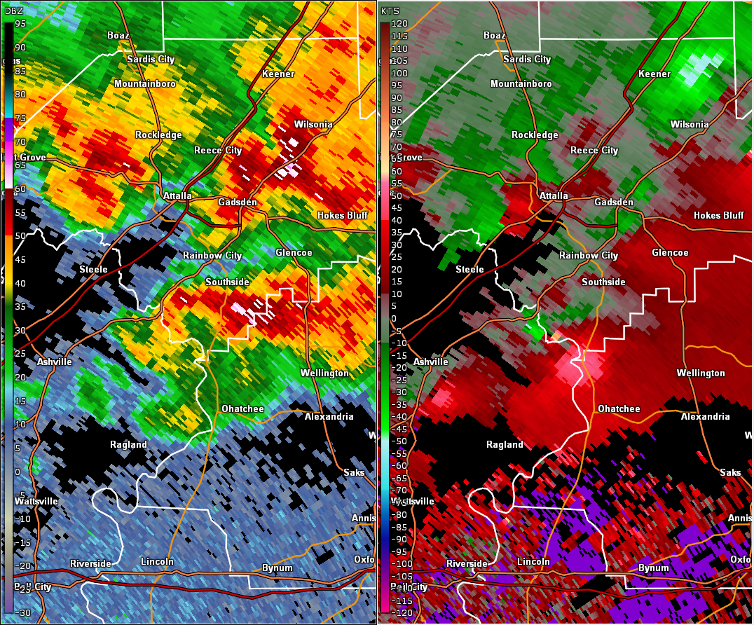
This is an image of the 0.5 degree reflectivity (left) and velocity (right) data from KBMX at 812 pm as the tornado crossed into southern Etowah County.
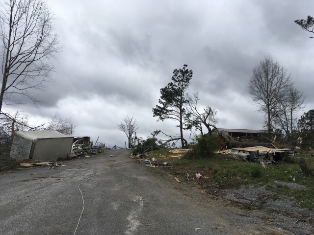


Damage Image Damage Image

Home Destroyed

Debris

Damage Image Damage Image

Tree & Structure Damage

Tree Damage