National Weather Service United States Department of Commerce

Ashcraft Corner Tornado - Lamar and Fayette Counties - March 26, 2009


EF-1
Estimated Maximum Wind:
100 mph
Injuries/Fatalities:
None
Damage Path Length:
3 1/3 miles
Maximum Path Width:
100 yards
Approximate Start Point / Time:
33.5374 / -87.9551
3:20am CDT
Approximate End Point / Time:
33.5610 / -87.9050
3:28am CDT

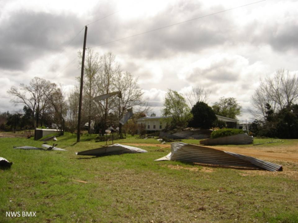
A National Weather Service Damage Assessment Team has surveyed the storm damage in Lamar and Fayette Counties. It has been determined the damage was the result of a tornado. The tornado has been rated an EF-1 on the Enhanced Fujita Scale. Damage estimates were consistent with winds around 100 mph.

The tornado touched down in far southeastern Lamar County and tracked to the northeast, lifting in Fayette County near the intersection of Alabama Highway 159 and Summers Rd. Two homes were damaged, one business was damaged and five outbuildings were either damaged or destroyed.

No hail was reported with this storm.


radar
This image is a KGWX 0.5 degree velocity loop, which runs from approximately the time the tornado touched down until it lifted off the ground. The green indicates wind blowing toward the radar while red indicates wind blowing away from the radar.

damage

Fayette County, AL

EF-1 Tornado damage in Lamar County, AL Innocent looking enough, this EF-1 Tornado did not pick up this travel trailer, instead it was pushed laterally about 3 feet.