Fayette County - April 3, 2000
| Storm Survey | ||||
|---|---|---|---|---|
| The National Weather Service surveyed storm damage in eastern Fayette County and determined it was caused by a tornado. The survey was conducted on Wednesday, April 5th, 2000.
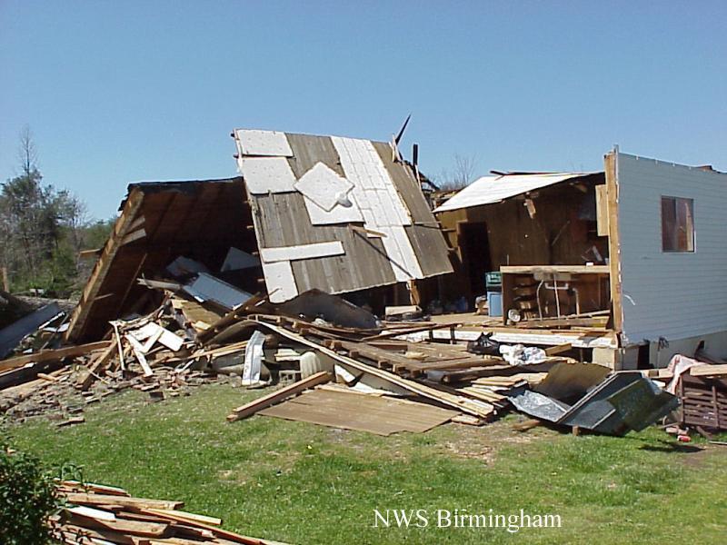
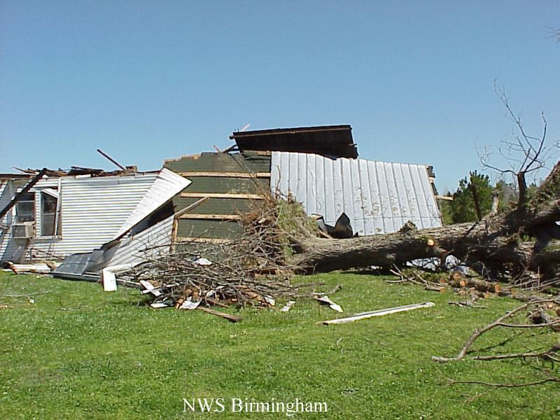
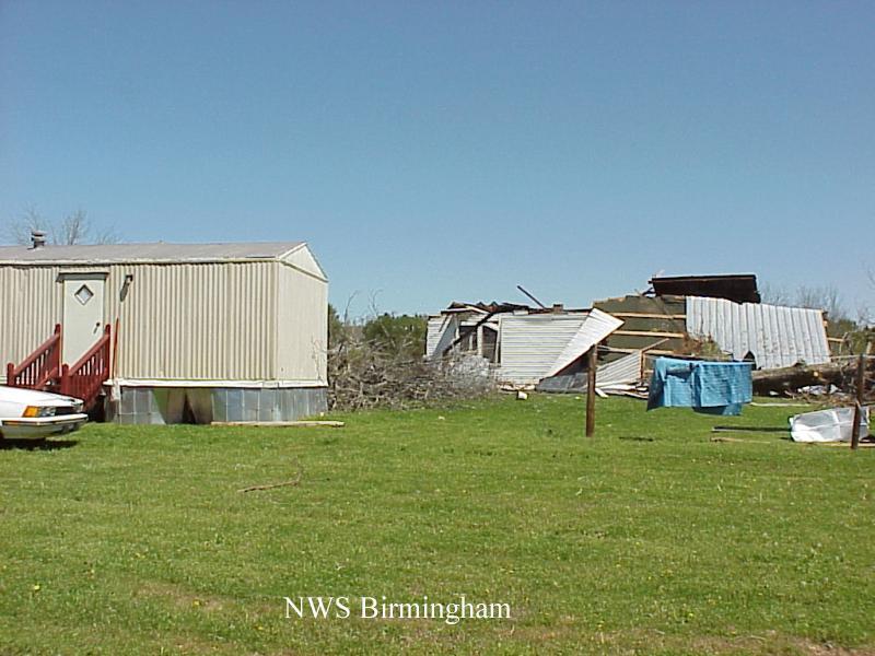
The tornado began 3 miles southwest of Studdards Crossroads. Studdards Crossroads is located at the intersection of State Road 102 and County Road 63. The tornado traveled in a northeast direction for about 3 miles. The damage path was fairly narrow and was estimated to be only 50 yards at its widest point. The damage was primarily downed trees and some snapped trees. There were two residences in the path of the tornado, one of which was a mobile home. The frame house suffered significant damage. The roof was completely blown off, and the back wall was ripped away as the roof was displaced to the back side of the house. The mobile home was located only 20 yards from the frame house, but amazingly, only suffered minor damage. One elderly person, who was in the frame house, sustained minor injuries. By comparing radar images with damage coordinates, the tornado began at 11:39 am CDT and ended at 11:43 am CDT. The tornado was classified as an F1 on the Fujita scale for tornado classification. Fayette County was placed in Tornado Watch number 155, valid from 10:30 am CDT to 4:00 pm CDT. A tornado warning was issued for Fayette County at 11:43 am CDT, valid until 12:30 am CDT. |
|
|||