Jefferson County - April 2-3, 2000
| Storm Survey | |||||||
|---|---|---|---|---|---|---|---|
| The National Weather Service surveyed the damage in Jefferson county on April 4th, 2000 and determined that both events were produced by tornadoes.
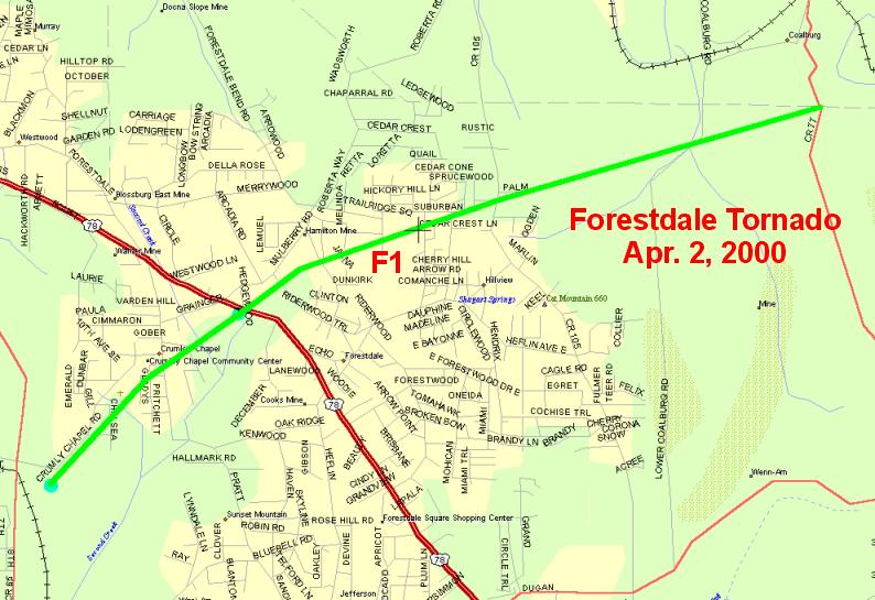
Forestdale, Sunday, April 2, 2000 The tornado first caused damage just east of Minor Parkway and moved northeast along Crumley Chapel Road and through the Crumley Chapel community. The tornado crossed U.S. Highway 78 at the Wal-Mart shopping center and turned on a more easterly track through a residential area of Forestdale. The damage became less severe as the tornado crossed Cherry Lane with only minor tree damage from there to Coalburg Road.
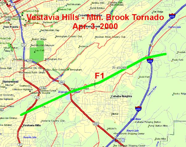
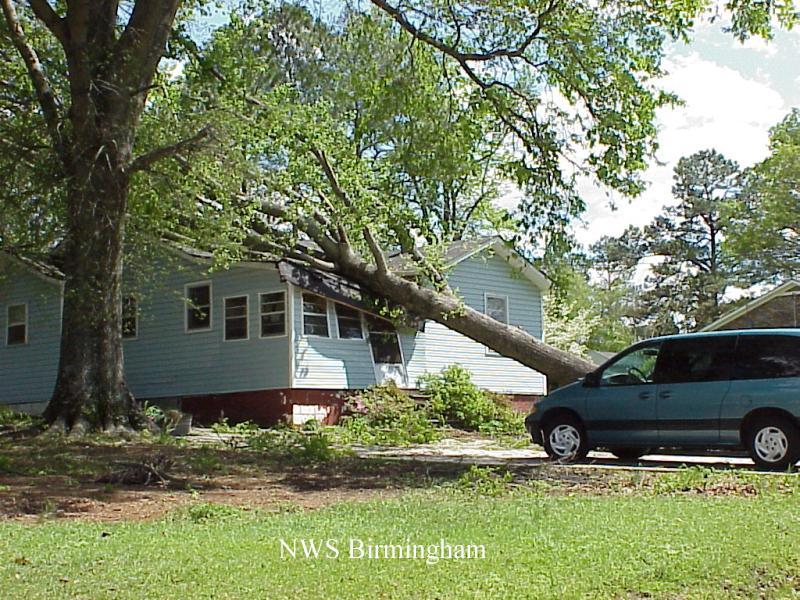
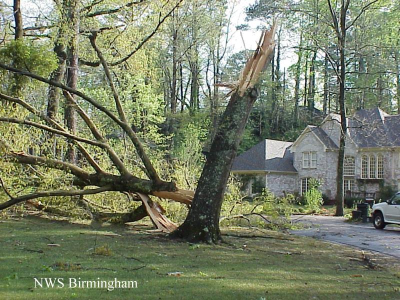
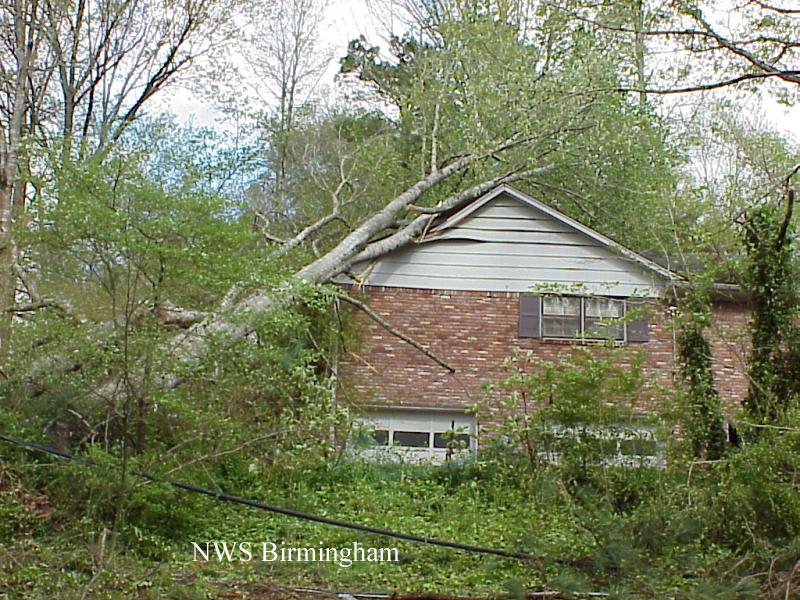
The tornado path was 4.5 miles long and approximately 400 yards wide. Based on radar data, the tornado began at 9:51 PM CDT and ended around 9:59 PM CDT. There have been no deaths or injuries associated with this tornado. The tornado was classified as a marginal F1 on the Fujita Scale for tornado classification putting it in the weak category. Wind speeds associated with an F1 range from 73 to 113 miles an hour. Damage in the area suggested the wind speed was probably on the lower end of this range probably 75 to 90 MPH. Jefferson county was placed in a severe thunderstorm warning at 9:34 PM. The warning was upgraded to a tornado warning at 9:44 PM. Vestavia Hills-Mountain Brook, Monday, April 3, 2000
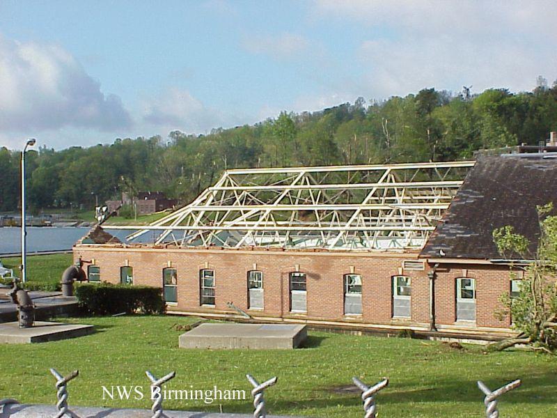
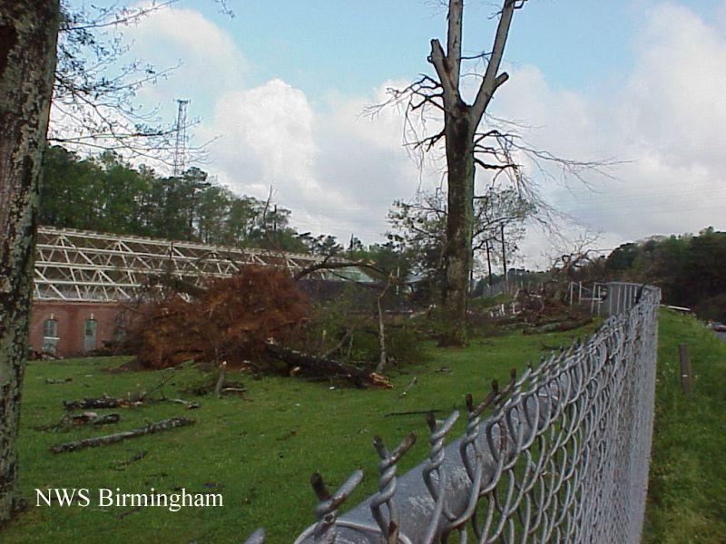
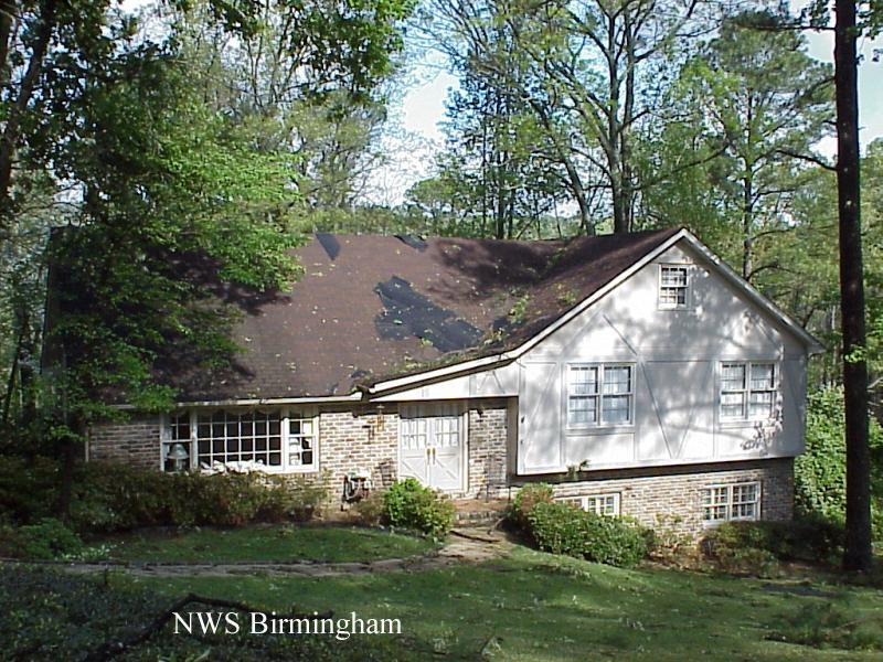
Much like the Forestdale tornado, damage was primarily to trees with generally minor roof damage to structures. Some structures sustained heavy damage when trees fell on them. The tornado was classified an F1 tornado with wind speeds of 73 to 113 MPH. Wind speeds were probably in the range of 80 to 90 MPH. The tornado path was 5.7 miles long and about 350 yards wide. The tornado began at 1:09 PM CDT and ended at 1:18 PM CDT. Jefferson county was placed in tornado watch number 155 valid from 10:30 AM CDT to 4:00 PM CDT. A tornado warning was issued for Jefferson county at 12:29 PM valid until 1:30 PM. |
|
||||||