|
A National Weather Service Damage Assessment Team has surveyed the storm damage in Lee County. It has been determined the damage was the result of a tornado. The tornado has been rated an EF-1 on the Enhanced Fujita Scale. Damage estimates were consistent with winds around 100 mph.
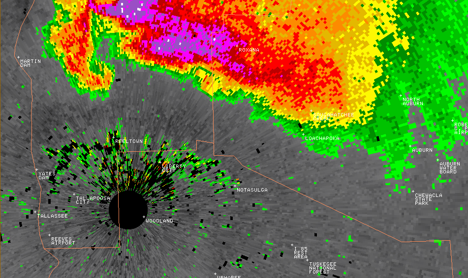
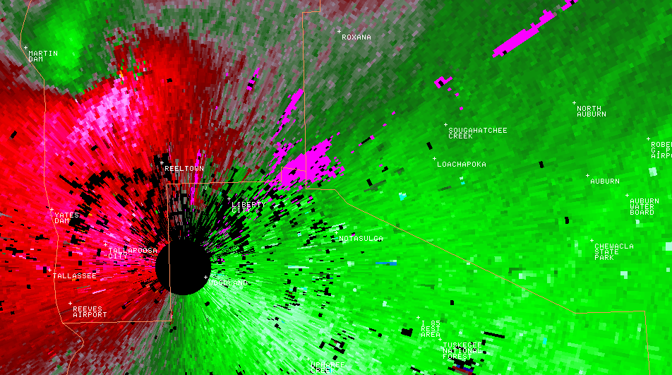
This tornado was produced by the same supercell thunderstorm that dropped the very large hail swath and the Simmons Crossroads Tornado. The tornado touched down just west of Loachapoka along Lee Road 64. The tornado entered Loachapoka near the intersection of County Road 188 and State Highway 14. The tornado nearly paralleled State Highway 14 before lifting just south of State Highway 14 east of Lee Road 51. Numerous trees were snapped off and uprooted along the path. In Loachapoka, a church sustained moderate roof damage, several barns and outbuildings suffered varying degrees of damage, a few vehicles were damaged by the fallen trees. The tornado damage path was 5.50 miles long and was 300 yards wide at its widest point.
|