NWS Birmingham, Alabama
Weather Forecast Office
Macon & Russell County Tornado - April 11, 2007
EF-1
National Weather Service meteorologists surveyed storm damage in eastern Macon County and western Russell County. It has been determined that the damage was the result of a tornado. The tornado has been rated an EF-1 on the Enhanced Fujita Scale with estimated maximum winds around 90 mph.
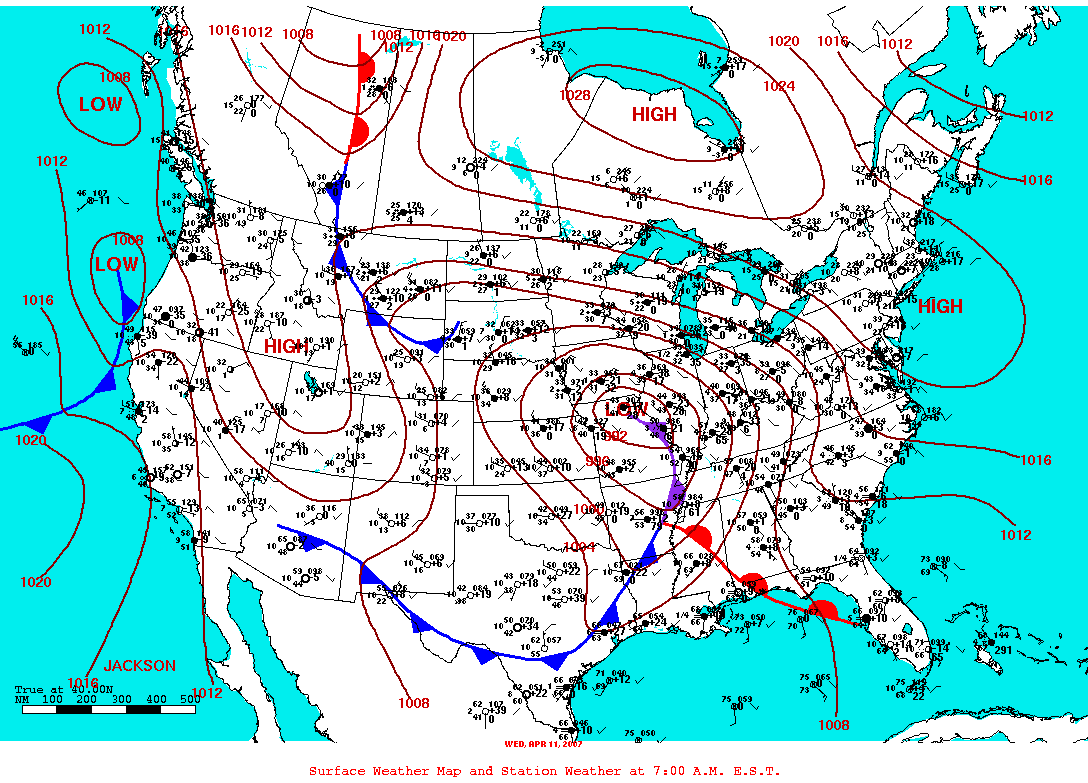
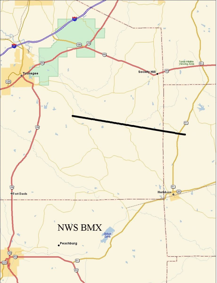
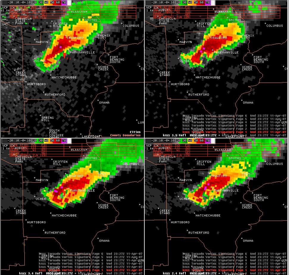
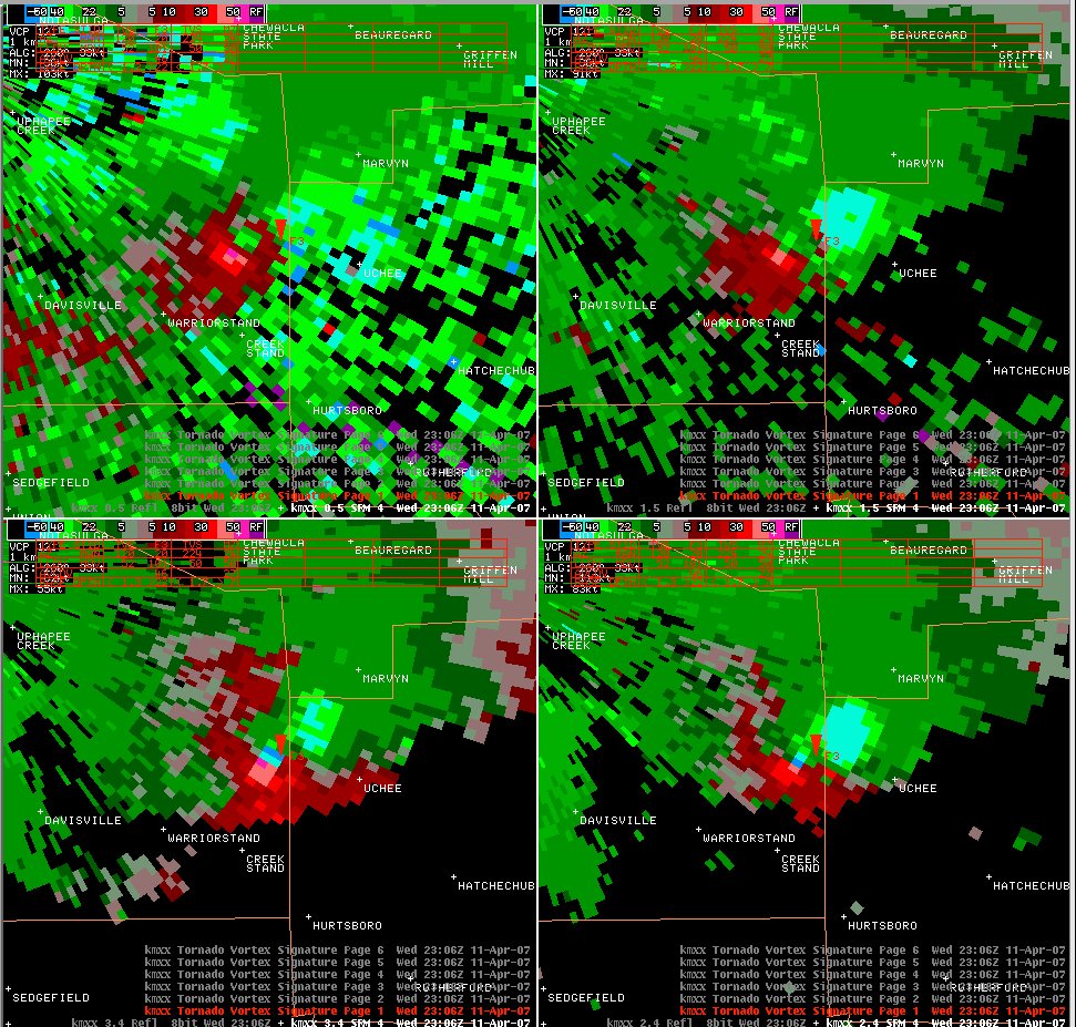
A tornado touched down along County Road 10...approximately 6.8 miles southeast of Tuskegee or 4.4 miles northwest of Warriorstand. The tornado tracked east southeast across the remainder of eastern Macon County and crossed into Russell County. The tornado lifted near the intersection of State Highway 51 and Cowpen Road near the Uchee Community. The tornado damage path was 12.1 miles long and was 400 yards wide at its widest point. Hundreds of trees were either snapped off or blown over along the path. The highest winds were estimated around 90 mph...an EF1 tornado...although much of the damage was consistent with EF0 damage. The tornado was on the ground from approximately 554 PM until 616 PM. A Tornado Watch was in effect for Macon and Russell Counties from 345 PM until 1000 PM. A Tornado Warning was in effect for Macon County from 509 PM until 730 PM. A Tornado Warning was in effect for Russell County from 555 PM until 730 PM.
Click on the images below for larger picture.
|
|
||||||||||||||||
Current Hazards
National Outlooks
Tropical
Local Storm Reports
Public Information Statement
Graphical Hazardous Weather Outlook
Current Conditions
Regional Weather Roundup
Rivers and Lakes
Drought Monitor
Forecasts
Forecast Discussion
Air Quality
Fire Weather
Aviation Weather
Graphical Forecasts
Climate and Past Weather
Past Events
Storm Data
Tornado Database
Daily Rainfall Plots
Tropical Cyclone Reports
Warnings and Other Products
Tornado Warnings
Severe Thunderstorm Warnings
Flash Flood Warnings
Winter Weather Warnings
Special Weather Statements
Non-Precipitation Warnings
Flood/River Flood Warnings
Productos en Español
Conciencia y Preparación
Previsión de 7 Días
Weather Safety
NOAA Weather Radio
Severe Weather Preparedness
Severe Safety Rules
Tornado Safety Rules
Severe Safety w/ ASL
Awareness Weeks
Severe Weather
Hurricane Preparedness
Summer Safety Campaign
Winter Weather
US Dept of Commerce
National Oceanic and Atmospheric Administration
National Weather Service
NWS Birmingham, Alabama
465 Weathervane Road
Calera, AL 35040
205-664-3010
Comments? Questions? Please Contact Us.