NWS Birmingham, Alabama
Weather Forecast Office
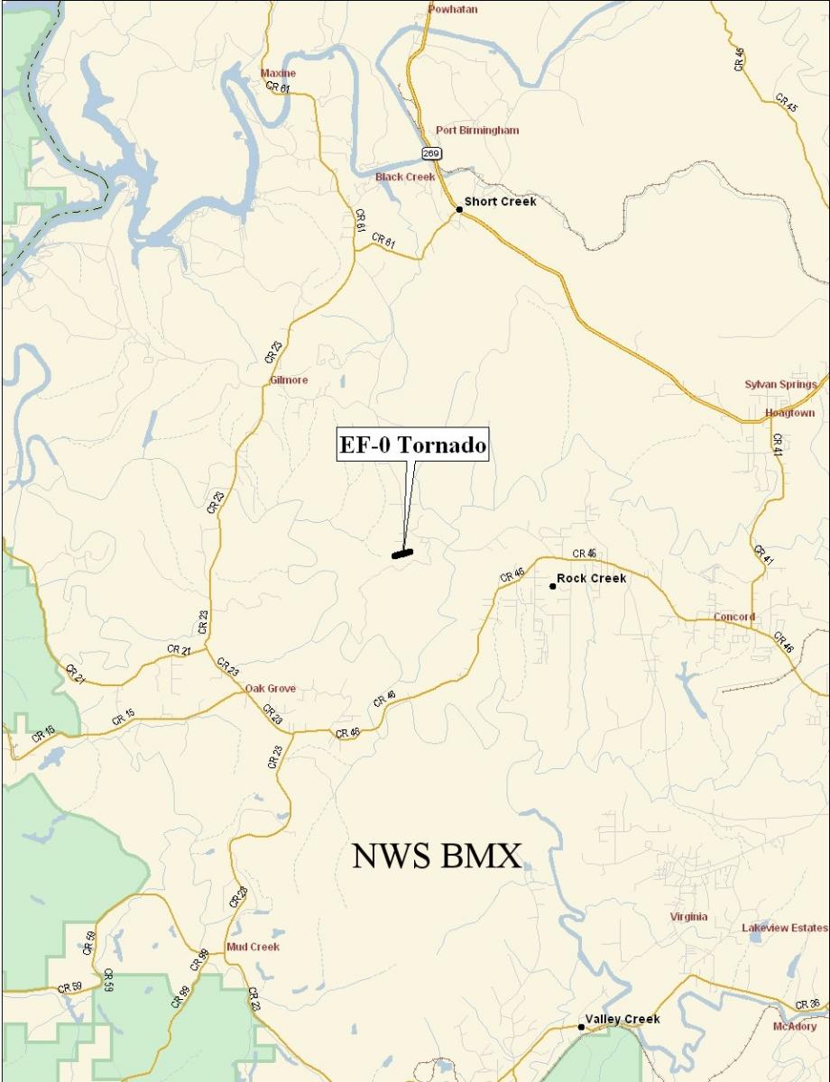
Jefferson County - April 11th, 2008
|
Rating:
(Click for EF Scale) |
EF-0
|
|
Estimated Maximum Wind:
|
70 mph
|
|
Injuries/Fatalities:
|
None
|
|
Damage Path Length:
|
0.1 miles
|
|
Maximum Path Width:
|
30 yards
|
|
Approximate End Point:
|
33.9141/-86.3538 at 408 PM
|
A National Weather Service Damage Assessment Team has surveyed the storm damage in western Jefferson County. It has been determined the damage was the result of a weak tornado.
A tornado briefly touched down in the Rock Creek area near Glaze Drive and the Rock Creek Baptist Church. Damage was limited to a small grove of snapped and uprooted pine trees. The path length was only one tenth of a mile and was 30 yards wide at its widest point. The tornado has been rated and EF-0 on the Enhanced Fujita Scale as damage was consistent with winds of 65 to 75 mph.
|
|
|||||||||
Current Hazards
National Outlooks
Tropical
Local Storm Reports
Public Information Statement
Graphical Hazardous Weather Outlook
Current Conditions
Regional Weather Roundup
Rivers and Lakes
Drought Monitor
Forecasts
Air Quality
Fire Weather
Aviation Weather
Graphical Forecasts
Forecast Discussion
Climate and Past Weather
Past Events
Storm Data
Tornado Database
Daily Rainfall Plots
Tropical Cyclone Reports
Warnings and Other Products
Tornado Warnings
Severe Thunderstorm Warnings
Flash Flood Warnings
Winter Weather Warnings
Special Weather Statements
Non-Precipitation Warnings
Flood/River Flood Warnings
Productos en Español
Conciencia y Preparación
Previsión de 7 Días
Weather Safety
NOAA Weather Radio
Severe Weather Preparedness
Severe Safety Rules
Tornado Safety Rules
Severe Safety w/ ASL
Awareness Weeks
Severe Weather
Hurricane Preparedness
Summer Safety Campaign
Winter Weather
US Dept of Commerce
National Oceanic and Atmospheric Administration
National Weather Service
NWS Birmingham, Alabama
465 Weathervane Road
Calera, AL 35040
205-664-3010
Comments? Questions? Please Contact Us.