National Weather Service United States Department of Commerce

Ashville Tornado - St. Clair County
April 19, 2009


EF-1
Estimated Maximum Wind:
100 mph
Injuries/Fatalities:
None
Damage Path Length:
2.92 miles
Maximum Path Width:
75 yards
Approximate Start Point/Time:
33.8643/-86.2199
at 921 pm
Approximate End Point/Time:
33.8805/-86.1728
at 927 pm

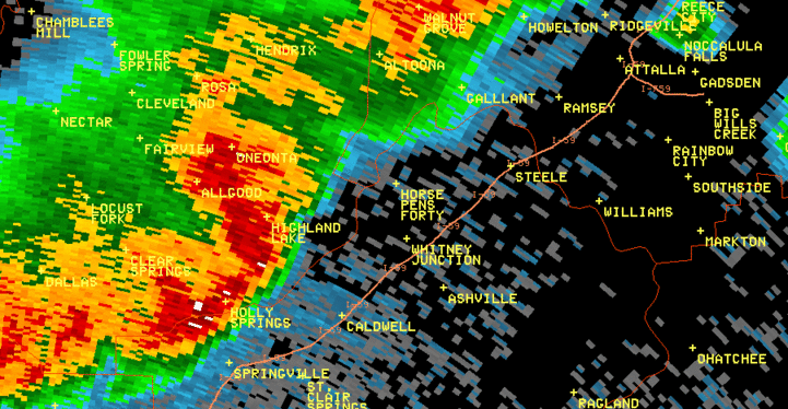
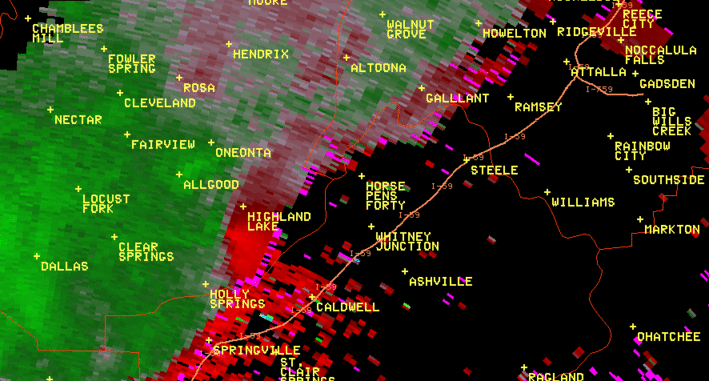
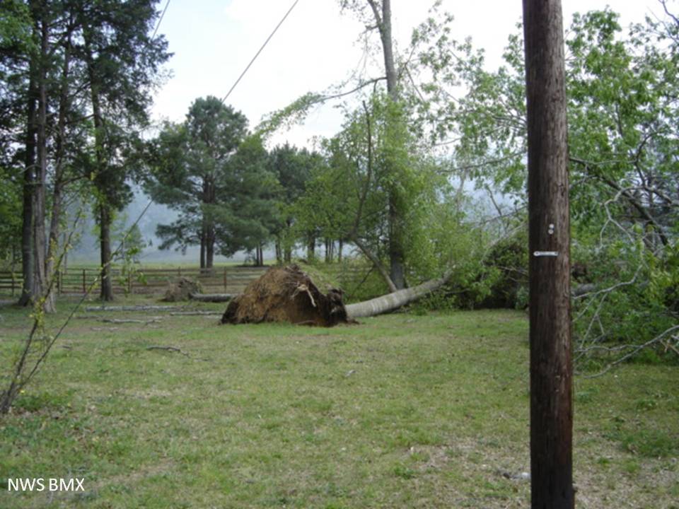
A National Weather Service Damage Assessment Team has surveyed the storm damage in St. Clair County. It has been determined the damage was the result of a tornado. The tornado has been rated an EF-1 on the Enhanced Fujita Scale. Damage estimates were consistent with winds around 100 mph.

A tornado touched down just north of County Road 25 on Joshua Drive and traveled east-northeast paralleling County Road 25 for 2.92 miles before lifting just to the west of Mopar Drive, south of County Road 25. Along the path, approximately 50 trees were snapped or uprooted. At its widest point, the tornado was 75 yards wide.


radar


radar
The top image is a KMXX 0.5 degree reflectivity loop. The bottom image is a KMXX 0.5 degree storm relative velocity loop. The green indicates wind blowing toward the radar while red indicates wind blowing away from the radar. This storm is an excellent example of a bow echo. The first couple of frames in the top image illustrate the weaker reflectivities in the back side of the bow, which are indicative of a Rear Inflow Jet (RIJ), which eventually led to the book-end vortex and the eventual tornado.

St. Clair
Tree Uprooted

St. Clair
Tree Uprooted

St. Clair
Tree Damage

St. Clair
Tree Damage