|
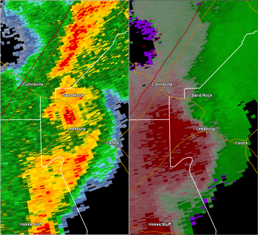
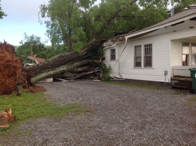
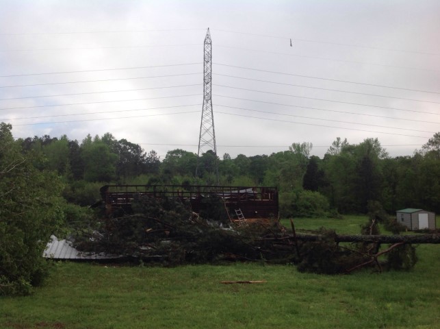
An EF-0 tornado touched down in extreme northwestern Cherokee County just northwest of the city of Leesburg. The tornado touched down along Keener Dr, west of state road 68, uprooting and snapping multiple hard and softwood trees. One of the larger hardwood trees unfortunately fell into a residence causing substantial damage to both the home and vehicle. Just further downstream, a barn was also destroyed by an uprooted tree along Bristow Gap Rd. The tornado was also at its widest point here of approximately 200 yards. The tornado continued north-northeast crossing State Road 68 causing damage to additional trees. The tornado lifted near the intersection of County Road 166 and County Road 670, but not before causing some minor porch and siding damage to another residence.
|