|
Event Summary
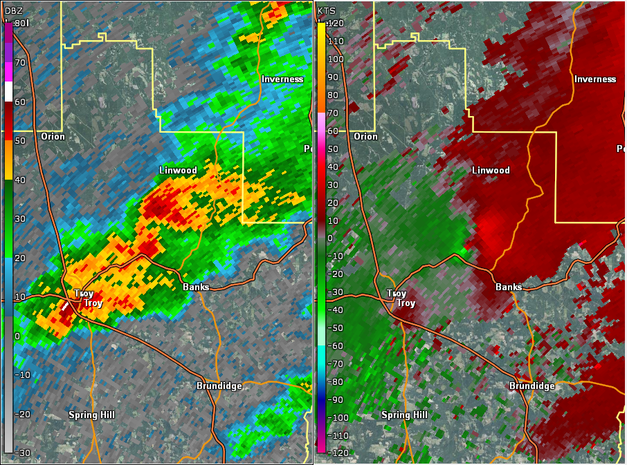
NWS Meteorologists surveyed damage in central Pike County just northeast of Troy and determined it was the result of a tornado.
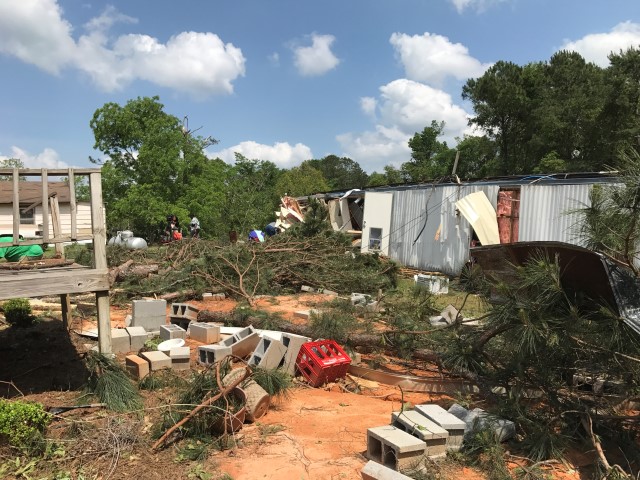
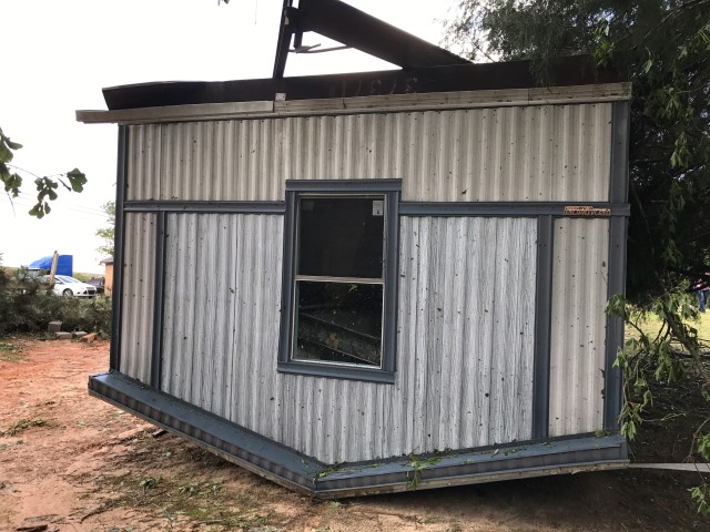
The tornado formed just south of Highway 29 northeast of Troy, as it crossed Radio Station Road. The tornado snapped and uprooted dozens of trees as it moved through residential areas south of Highway 29, damaging or destroying several outbuildings and causing minor shingle and overhang damage to homes. In addition, a mobile home was flipped over onto its roof just before Thomas Road, but did not appear to be well-anchored. The tornado crossed Highway 29 just west of the Dunn Community. As the tornado crossed CR 7757, one large hardwood tree was snapped and another was uprooted, falling on a home. The tornado paralleled CR 7761, continuing to snap and uproot dozens of additional softwood and hardwood trees. A poorly built shed was completely destroyed near the intersection with CR 7759 with tin lofted well downstream. Tree damage began to diminish further northeast and the tornado dissipated before reaching Highway 223. The tornado damage path was 4.89 miles long and was 150 yards wide at its widest point.
|