NWS Birmingham, Alabama
Weather Forecast Office
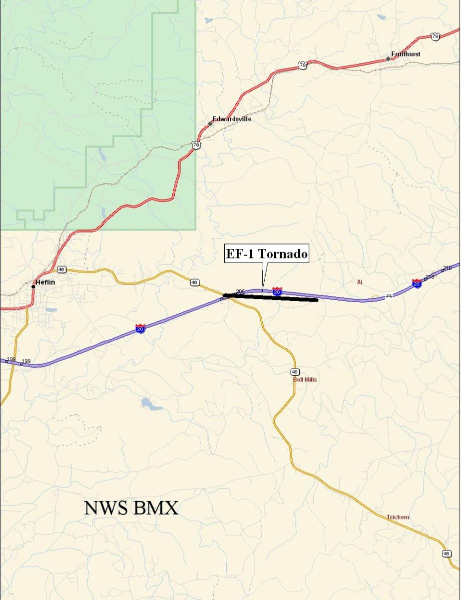
Cleburne County Tornado - May 11th, 2008
|
Rating:
(Click for EF Scale) |
EF-1
|
|
Estimated Maximum Wind:
|
90 mph
|
|
Injuries/Fatalities:
|
None
|
|
Damage Path Length:
|
2.4 miles
|
|
Maximum Path Width:
|
150 yards
|
|
Approximate Start Point:
|
33.64585/-85.50452 at 247 AM
|
|
Approximate End Point:
|
33.64412/-85.46480 at 250 AM
|
|
KML/KMZ File :
|
 |
A National Weather Service Damage Assessment Team has surveyed the storm damage in Cleburne County. It has been determined the damage was the result of a tornado. This additional damage path was produced by the same storm that dropped the Heflin Tornado but the damage paths were not linked. The tornado has been rated an EF-1 on the Enhanced Fujita Scale. Damage estimates were consistent with winds around 90 mph. The tornado damage path was approximately 2.4 miles long and was around 150 yards wide at its widest point.
The tornado touched down near Exit 205 along Interstate 20, or 5 miles east of Heflin and traveled eastward. The tornado affected areas generally along County Road 114 east of State Highway 46. The tornado lifted just west of the intersection of County Road 114 and County Road 62. Several homes were badly damaged and at least two had significant portions of their roofs blown off. Numerous trees were blown down or were snapped off along the path. No injuries were reported.
|
|
|||||||||
Current Hazards
National Outlooks
Tropical
Local Storm Reports
Public Information Statement
Graphical Hazardous Weather Outlook
Current Conditions
Regional Weather Roundup
Rivers and Lakes
Drought Monitor
Forecasts
Aviation Weather
Graphical Forecasts
Forecast Discussion
Air Quality
Fire Weather
Climate and Past Weather
Past Events
Storm Data
Tornado Database
Daily Rainfall Plots
Tropical Cyclone Reports
Warnings and Other Products
Tornado Warnings
Severe Thunderstorm Warnings
Flash Flood Warnings
Winter Weather Warnings
Special Weather Statements
Non-Precipitation Warnings
Flood/River Flood Warnings
Productos en Español
Conciencia y Preparación
Previsión de 7 Días
Weather Safety
NOAA Weather Radio
Severe Weather Preparedness
Severe Safety Rules
Tornado Safety Rules
Severe Safety w/ ASL
Awareness Weeks
Severe Weather
Hurricane Preparedness
Summer Safety Campaign
Winter Weather
US Dept of Commerce
National Oceanic and Atmospheric Administration
National Weather Service
NWS Birmingham, Alabama
465 Weathervane Road
Calera, AL 35040
205-664-3010
Comments? Questions? Please Contact Us.