|
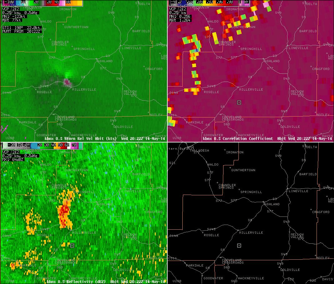
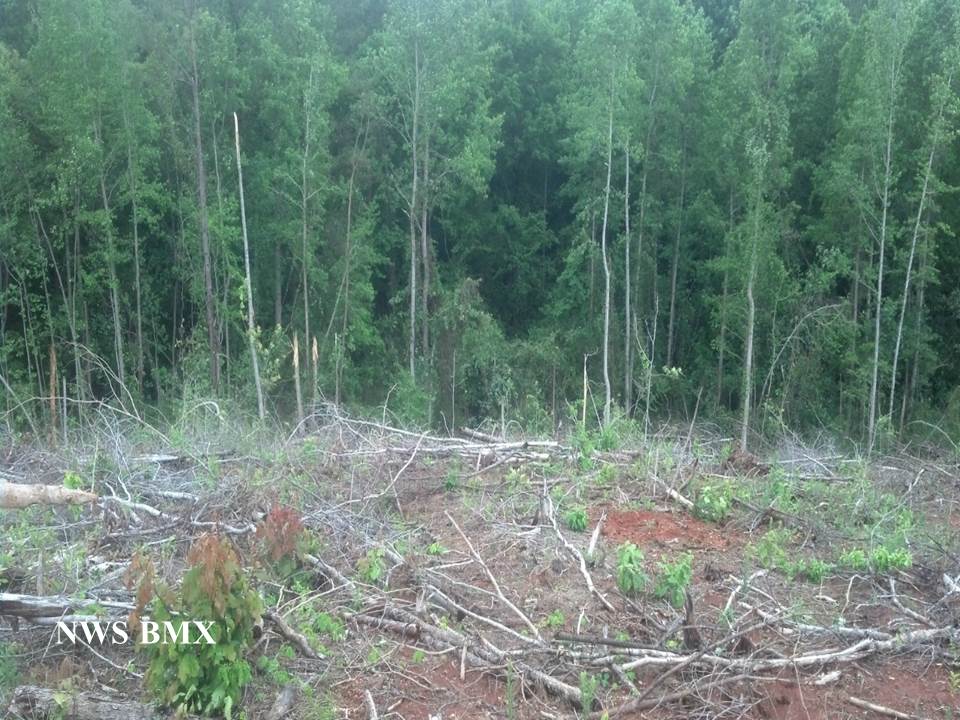
National Weather Service meteorologists surveyed the damage in Clay County and have determined that the damage was due to an EF-0 tornado. Maximum winds were estimated to be 80 mph.
This brief tornado touched down just south of Mines Road northwest of Millerville, with a few tree branches down. Along Mines Road there were several hardwood trees uprooted in a convergent pattern and lots of tree debris on the road. Just north of Mines Road more hardwood and softwood trees were uprooted for about one tenth of a mile, with a few small trees snapped. After that point it appears that the tornado lifted. In all there were about 25 to 30 trees uprooted or severely leaning over. No structure damage was observed.
A special thanks to Eric Parker and David Hester who reported the damage along Mines Road.
|