National Weather Service United States Department of Commerce

Pletcher EF-0 Tornado (Chilton County)
October 7, 2017


EF-0
Estimated Maximum Wind:
60 mph
Injuries/Fatalities:
None
Damage Path Length:
3.0 miles
Maximum Path Width:
50 yards 
Approximate Start Point/Time:
3 NNE Pletcher 32.7383/-86.7677 at 8:20 pm
Approximate End Point/Time:
4 ESE Maplesville 32.7680/-86.8056 at 8:27 pm


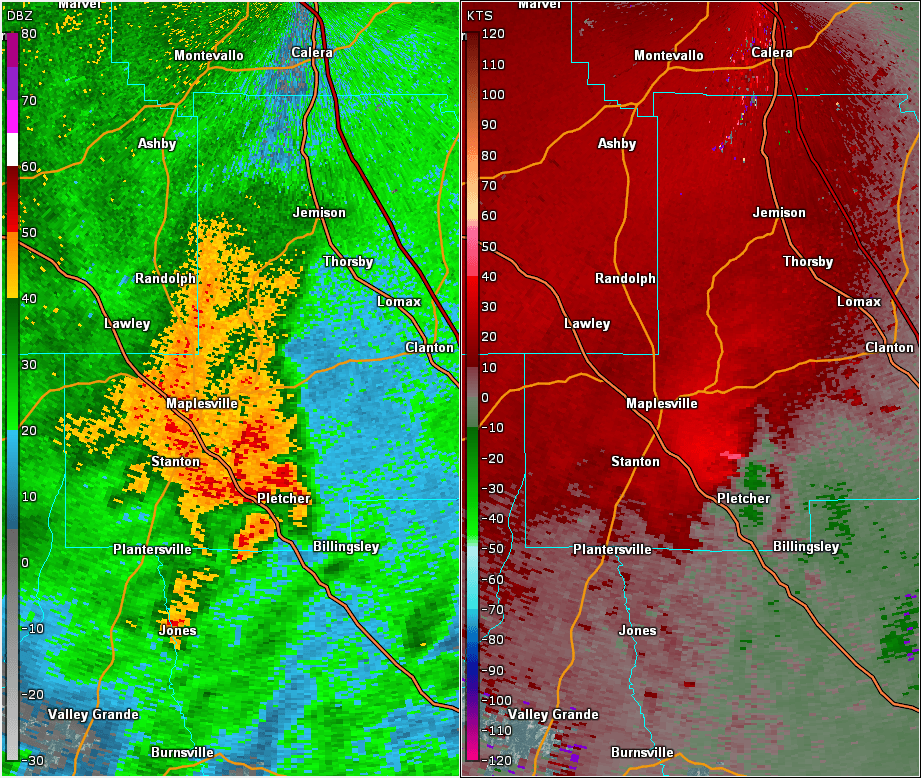
The National Weather Service surveyed damage in rural southern Chilton County, near the Pletcher Community. It was determined that the damage was caused by a tornado. Damage was sporadic along its short path, and primarily consisted of twigs and branches of various size that were broken off of trees. The tornado damage path was 3.0 miles long and was 50 yards wide at its widest point.

***Please see Nate main event page story map and click the tornado tab at the top for the track map.

 
 Radar Data & Damage Pictures
Radar Image  

This is an image of the 0.5 degree reflectivity (right) and velocity (left) data from KBMX at 732 pm as the tornado was in the vicinity of CR 343 and CR 342.


          *Back to Nate Main Event Page