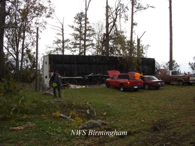
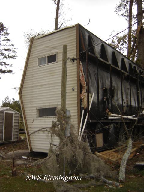
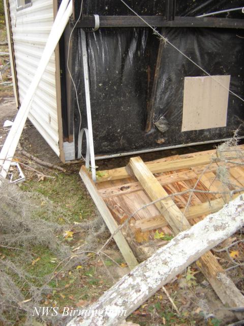
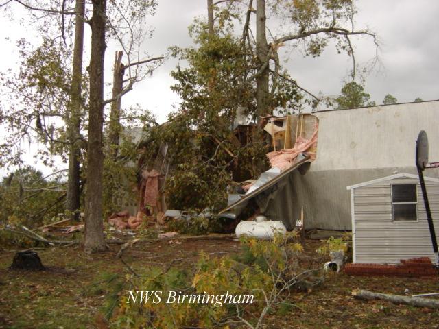
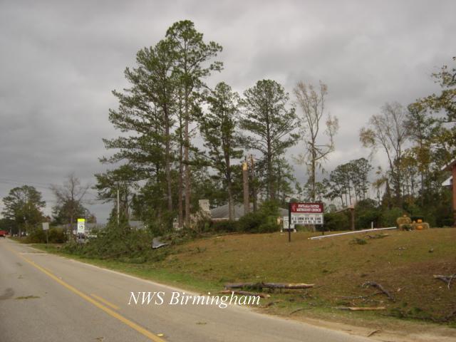
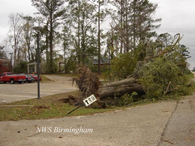
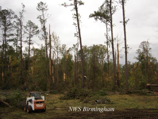
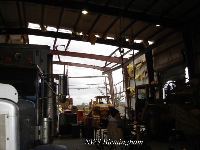
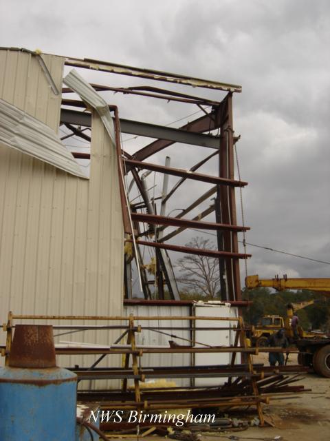
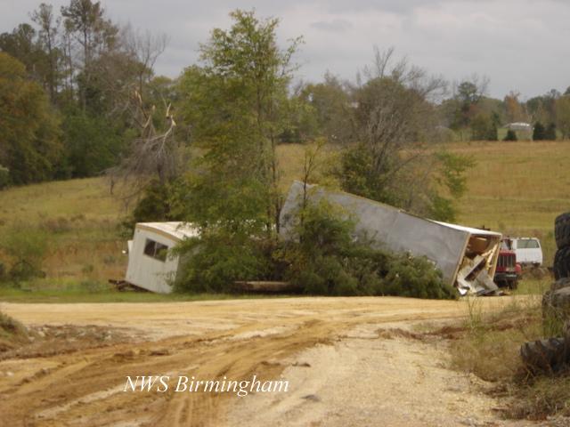
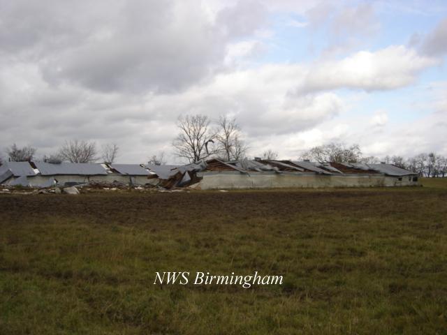
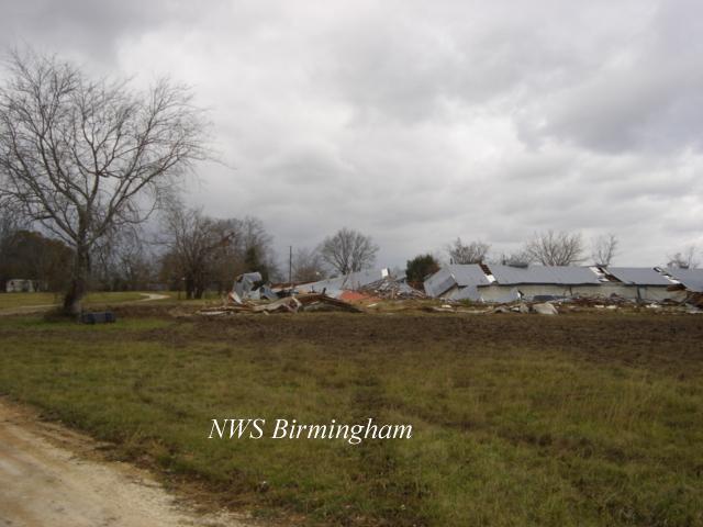
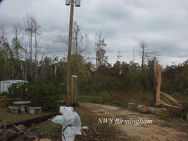
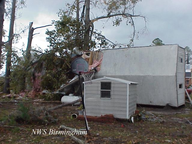
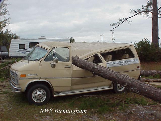
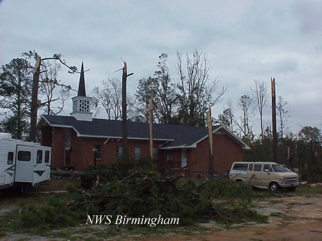
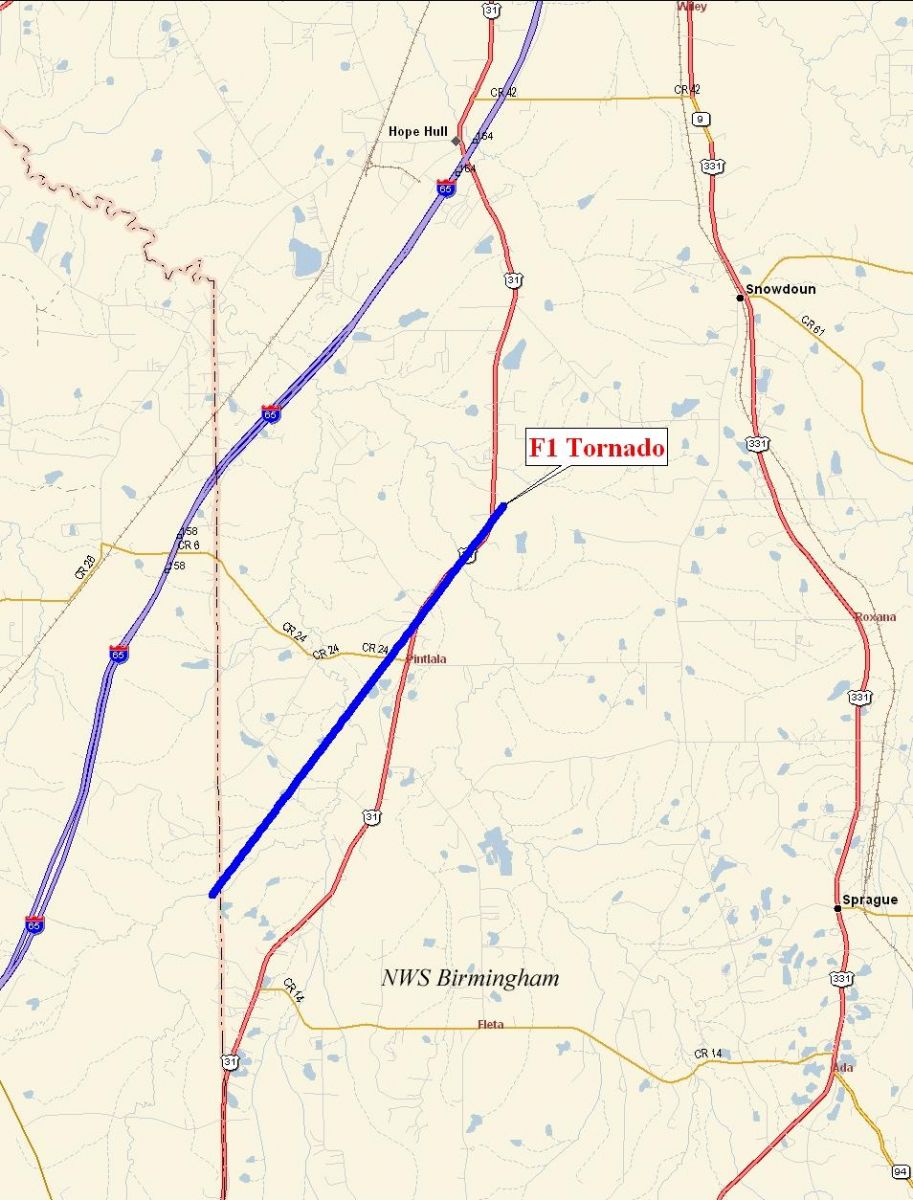
Lowndes & Montgomery Counties F1 Tornado near Pintlala - November 15, 2006
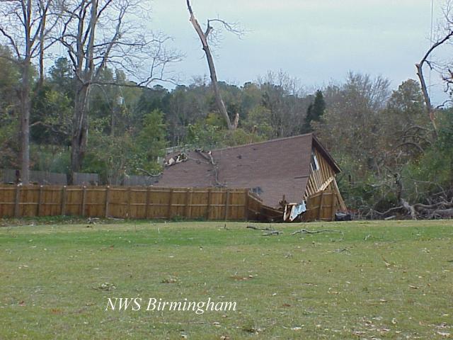
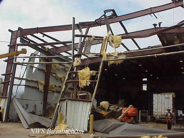
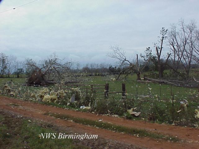
National Weather Service meteorologists surveyed the storm damage that affected areas around Pintlala. It has been determined that the damage was the result of a tornado. The tornado has been rated an F1 on the Fujita Damage Intensity Scale.
The tornado damage path was approximately 6 miles long and 250 yards wide at its widest point as it tracked northeastward from extreme eastern Lowndes County into western Montgomery County. The tornado touched down about 3.8 miles southwest of the intersection of US Highway 31 and Oakridge Lane, near the Lowndes County line and Pinchony Creek. In Montgomery County, numerous trees were snapped off just south of the Pintlala Elementary School. Ten buildings were damaged north of the school. The tornado tracked northeastward along US Highway 31 for another 2.5 miles before lifting near US Highway 31 and Lassiter Lake. The tornado touched down at approximately 955 AM CST and lifted at 1007 AM CST. A Tornado Warning was in effect for Lowndes County from 934 AM CST to 1000 AM CST. A Tornado Warning was in effect for Montgomery County from 953 AM CST to 1045 AM CST.
|
|
||||||||||||||||||||||||||||