NWS Birmingham, Alabama
Weather Forecast Office
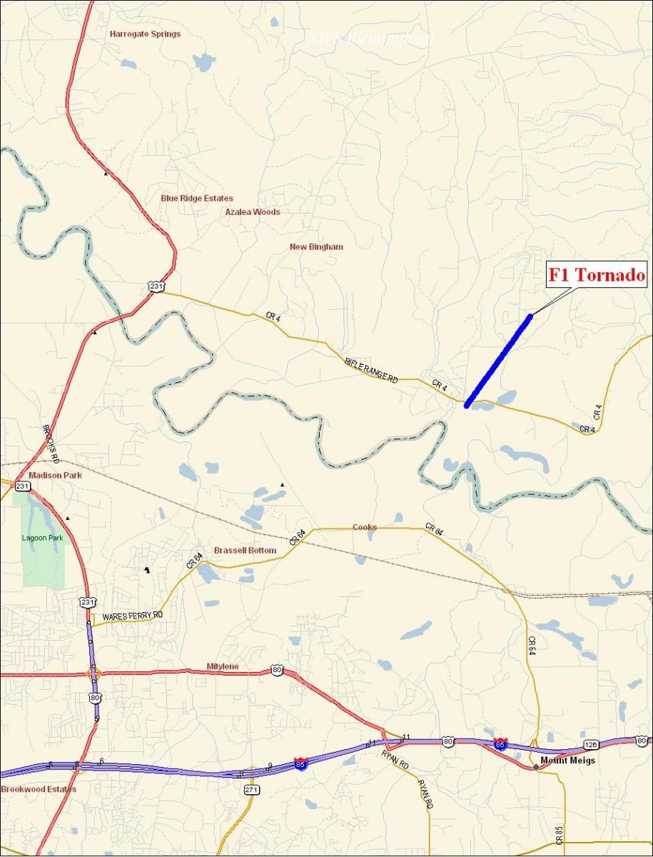
Elmore County F1 Tornado near Emerald Mountain - November 15, 2006
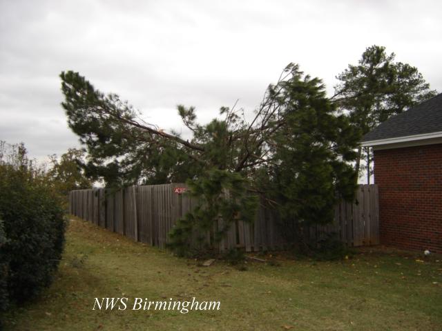
National Weather Service meteorologists surveyed the storm damage that affected southern Elmore County. It has been determined that the damage was the result of a tornado. The tornado has been rated an F1 on the Fujita Damage Intensity Scale.
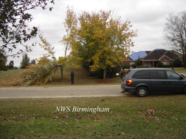
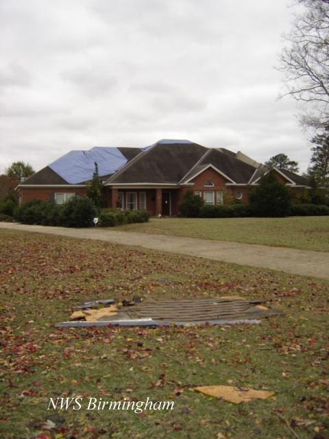
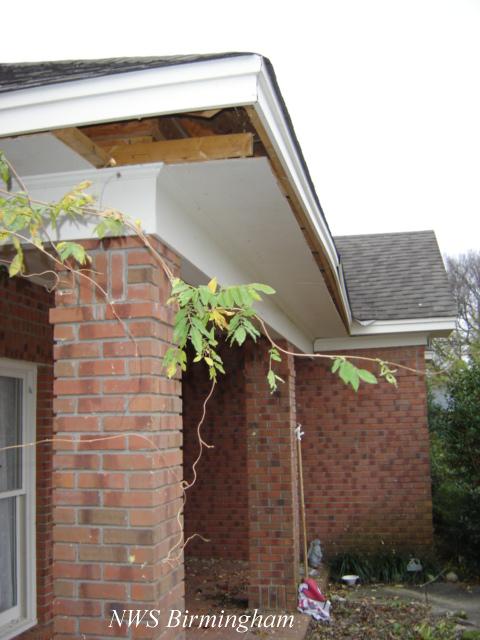
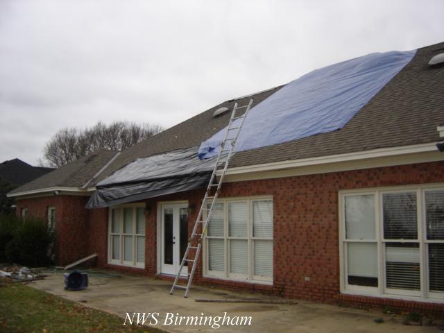
A tornado touched down just north of the Tallapoosa River, just to the northeast of the toll bridge. This location is near the intersection of Emerald Mountain Expressway and County Road 4. A few small trees were blown over and limbs were broken off trees. The tornado tracked northeast into the Emerald Mountain Subdivision. At the top of the hill, a well constructed home sustained fairly substantial roof damage with the entire roof being shifted 3 inches. The tornado lifted in the Emerald Mountain Subdivision east of Grove Park Loop. The tornado damage path was 1.5 miles long and was 150 yards wide at its widest point. The tornado touched down at approximately 1040 AM CST and lifted at 1042 AM CST. A Tornado Warning was in effect for Elmore County from 1035 AM CST to 1115 AM CST.
|
|
||||||||||||||
Current Hazards
National Outlooks
Tropical
Local Storm Reports
Public Information Statement
Graphical Hazardous Weather Outlook
Current Conditions
Regional Weather Roundup
Rivers and Lakes
Drought Monitor
Forecasts
Aviation Weather
Graphical Forecasts
Forecast Discussion
Air Quality
Fire Weather
Climate and Past Weather
Past Events
Storm Data
Tornado Database
Daily Rainfall Plots
Tropical Cyclone Reports
Warnings and Other Products
Tornado Warnings
Severe Thunderstorm Warnings
Flash Flood Warnings
Winter Weather Warnings
Special Weather Statements
Non-Precipitation Warnings
Flood/River Flood Warnings
Productos en Español
Conciencia y Preparación
Previsión de 7 Días
Weather Safety
NOAA Weather Radio
Severe Weather Preparedness
Severe Safety Rules
Tornado Safety Rules
Severe Safety w/ ASL
Awareness Weeks
Severe Weather
Hurricane Preparedness
Summer Safety Campaign
Winter Weather
US Dept of Commerce
National Oceanic and Atmospheric Administration
National Weather Service
NWS Birmingham, Alabama
465 Weathervane Road
Calera, AL 35040
205-664-3010
Comments? Questions? Please Contact Us.