Denver/Boulder, CO
Weather Forecast Office
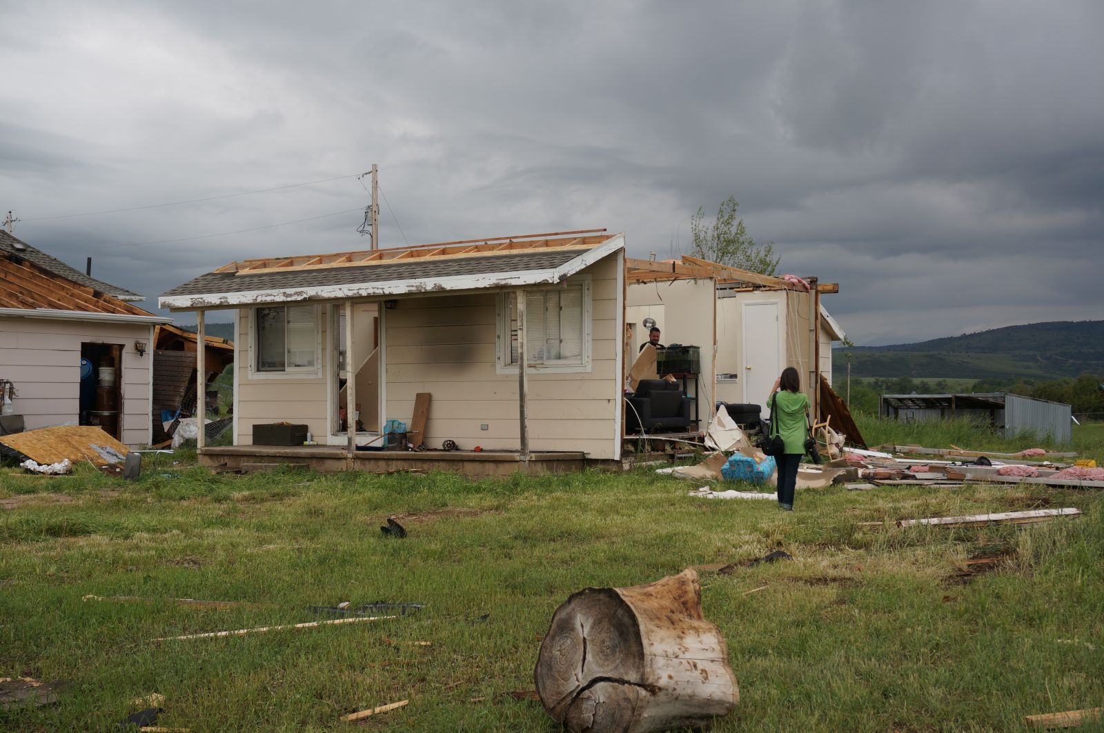
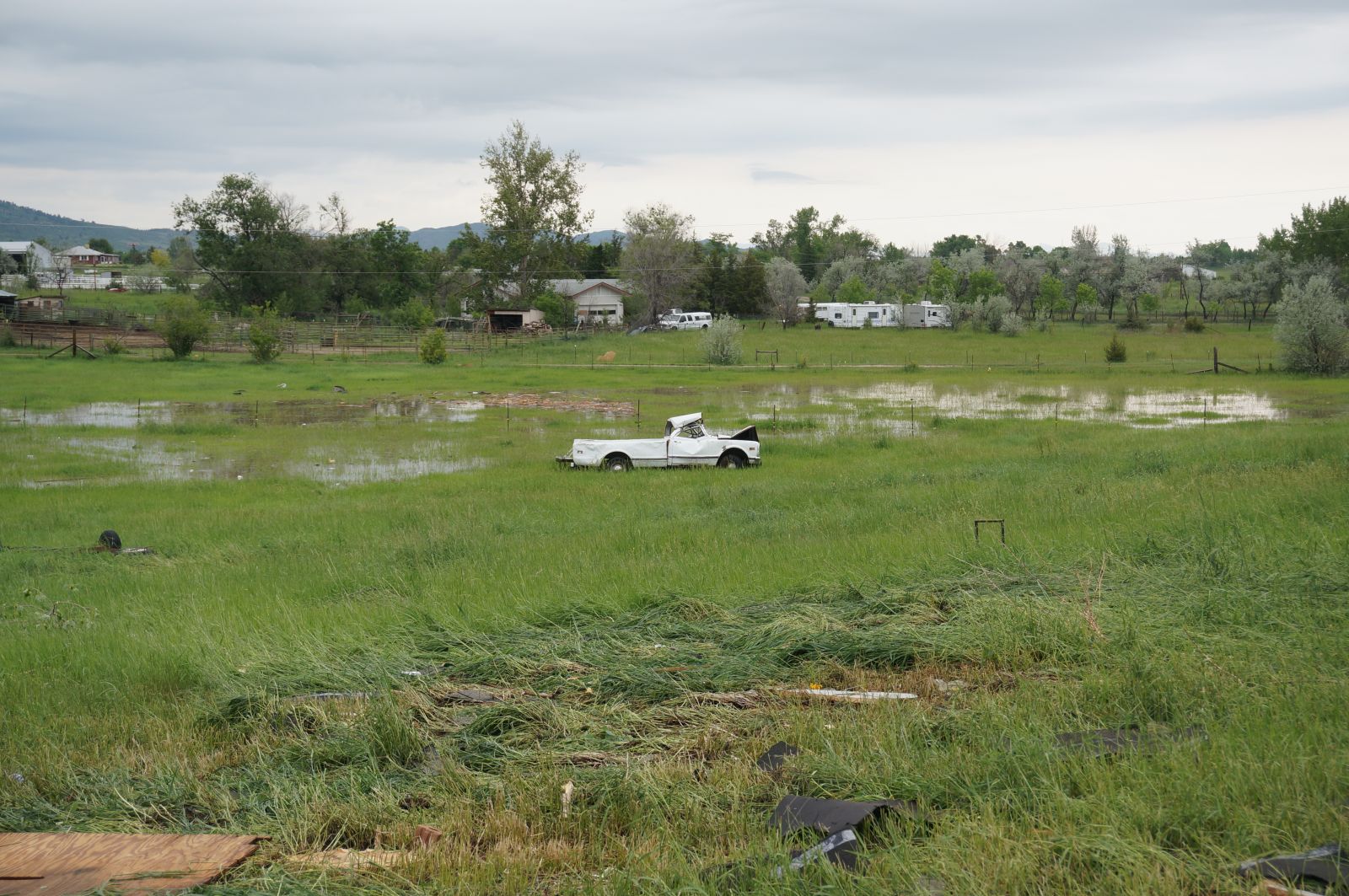
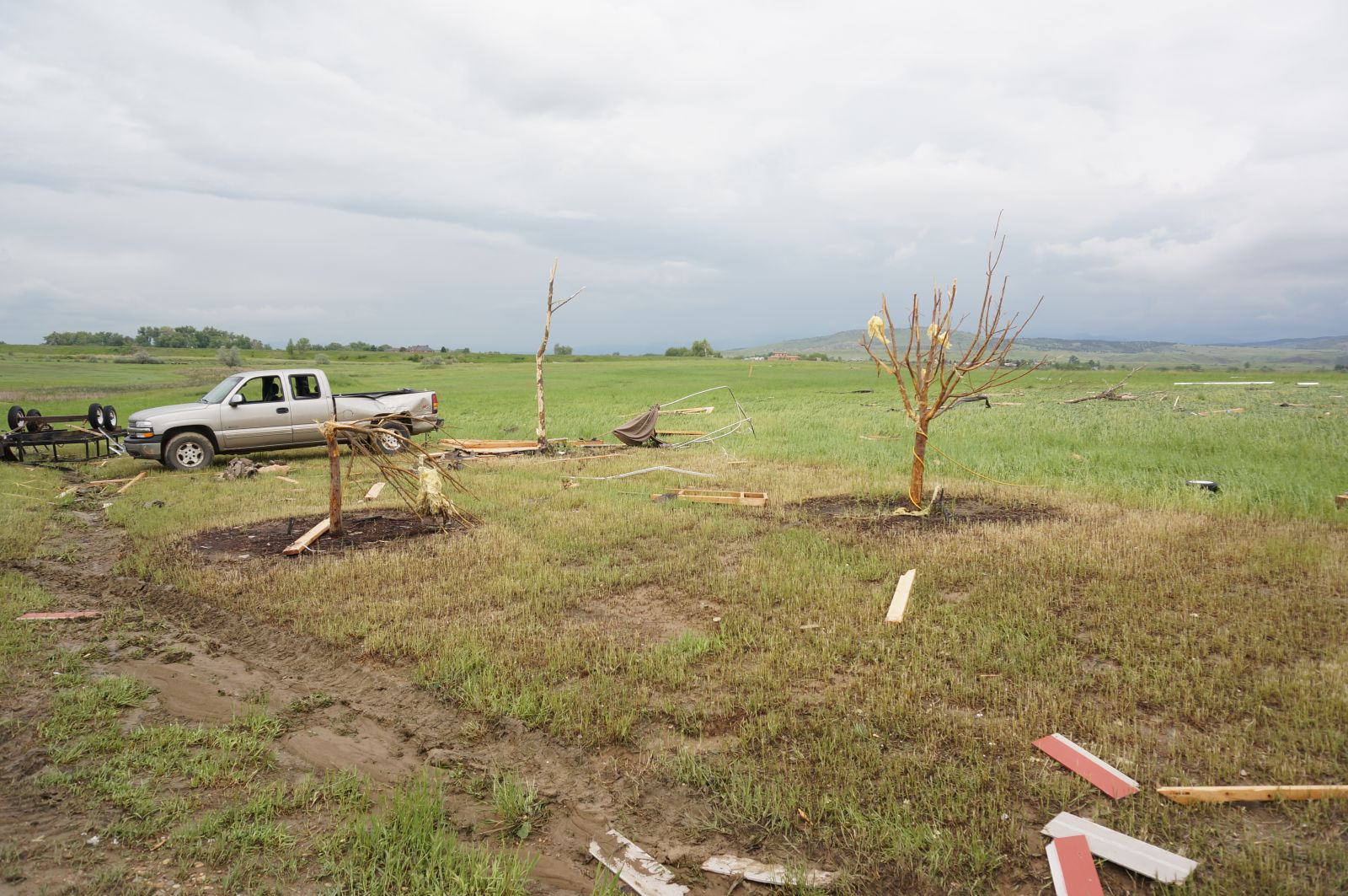
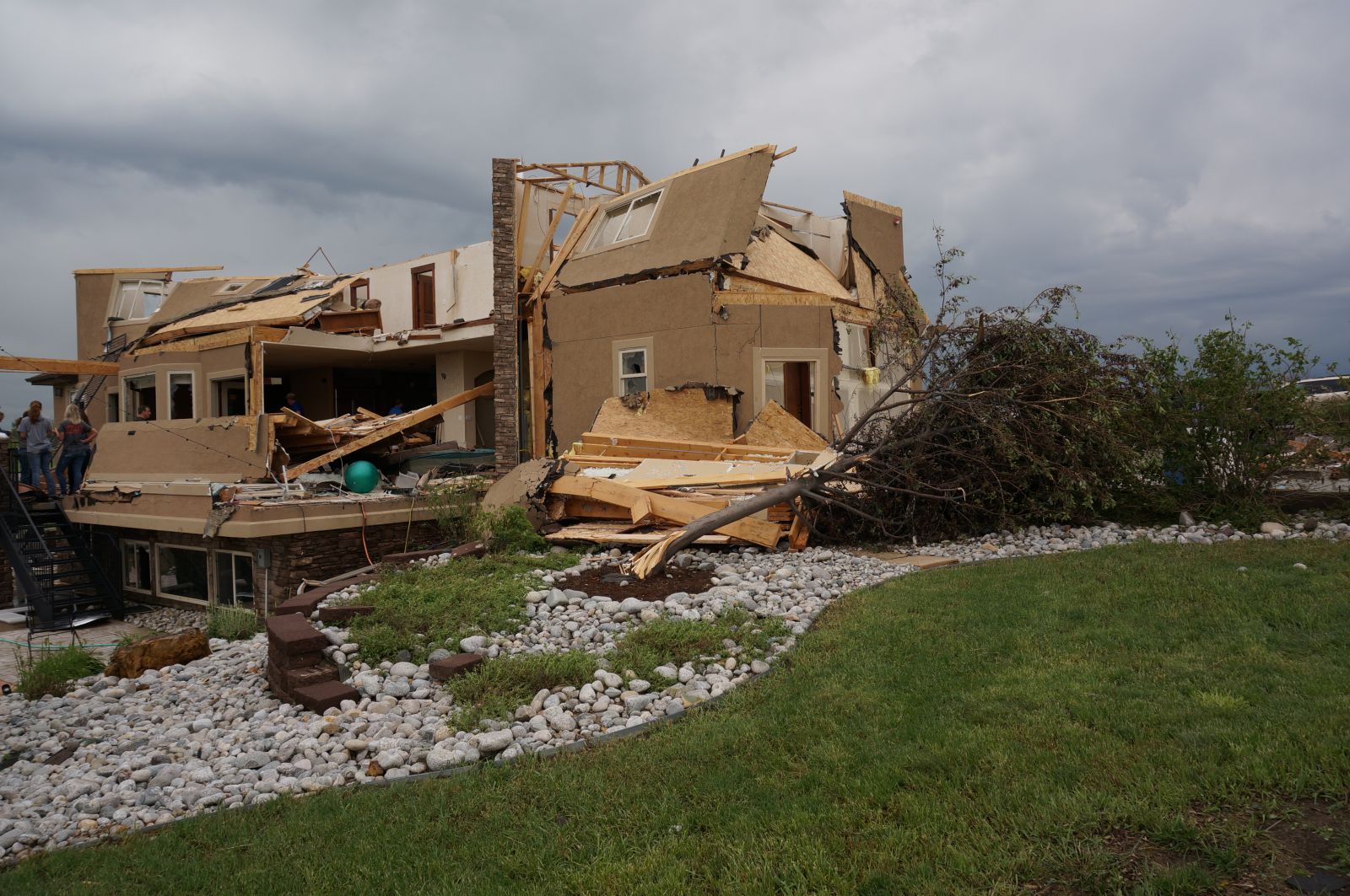
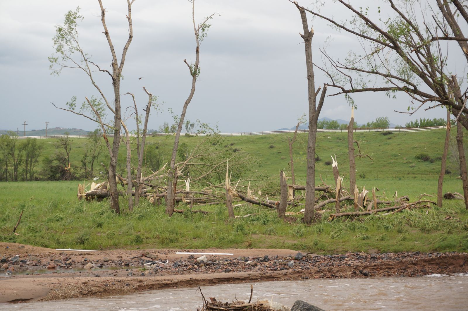
The tornado that occurred along the Boulder and Larimer county line on Thursday, June 4th has been rated an EF3 at it's highest damage point, with maximum winds estimated at 135 to 140 mph. The path length was 6 miles long with a maximum width of 1/4 mile at times. The tornado first touched down at 6:30 PM approximately 3 miles south of Berthoud, and then tracked to the West/Northwest and lifted some time after 708 PM 6 miles southwest of Berthoud. The majority of the damage was EF1, with some areas of EF2, and a few small areas of EF3. Updated Damage Points are shown below.
.png)
.jpg)
.jpg)
.jpg)
.jpg)
.jpg)
.jpg)
The Elbert county tornadoes that affected the Simla area and southeast Elbert county have been rated an EF1. There were a total of 6 tornadoes over Elbert County. 3 of the tornadoes were anti-cyclonic. Damage paths and additional infromation will follow. Below is a map of the Elbert/El Paso county damage points.
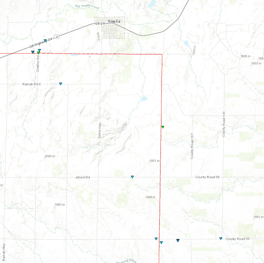
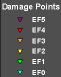
EF scale: The Enhanced Fujita scale classifies tornadoes into the following categories:
EF0...Weak......65 to 85 MPH
EF1...Weak......86 to 110 MPH
EF2...Strong....111 to 135 MPH
EF3...Strong...136 to 165 MPH
EF4...Violent...166 to 200 MPH
EF5...Violent...>200 MPH
NOTE: The information in this statement in preliminary and subject to change pending final review of the event and publication in NWS Storm Data.
This page will be updated as more survey information becomes available.
US Dept of Commerce
National Oceanic and Atmospheric Administration
National Weather Service
Denver/Boulder, CO
325 Broadway
Boulder, CO 80305-3328
303-494-3210 for a recording call 303-494-4221
Comments? Questions? Please Contact Us.

