|
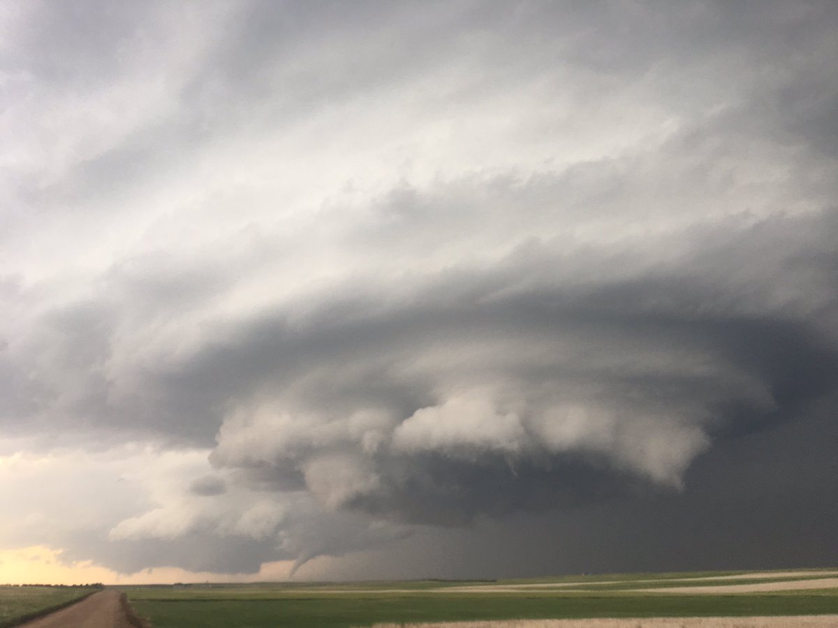
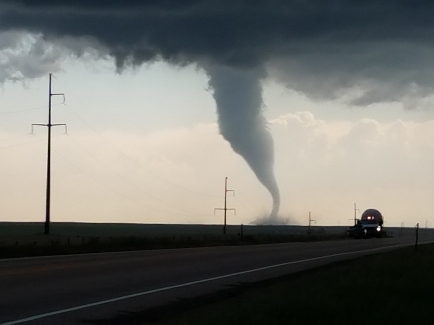
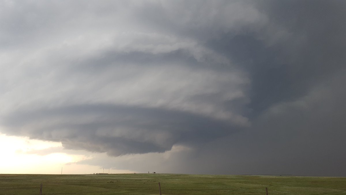
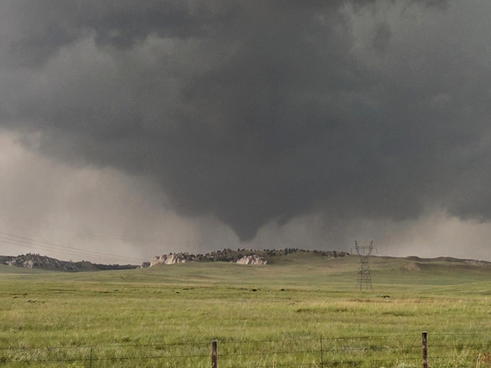
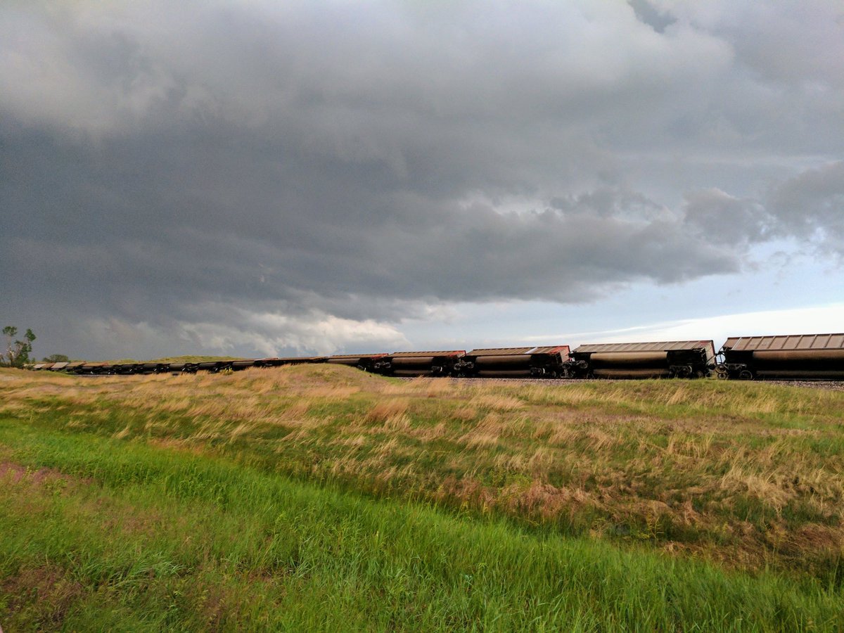
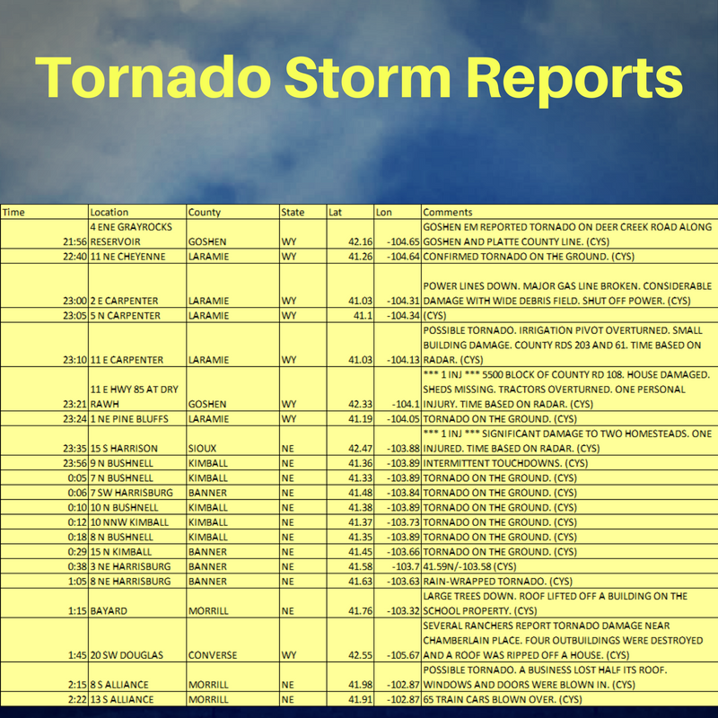
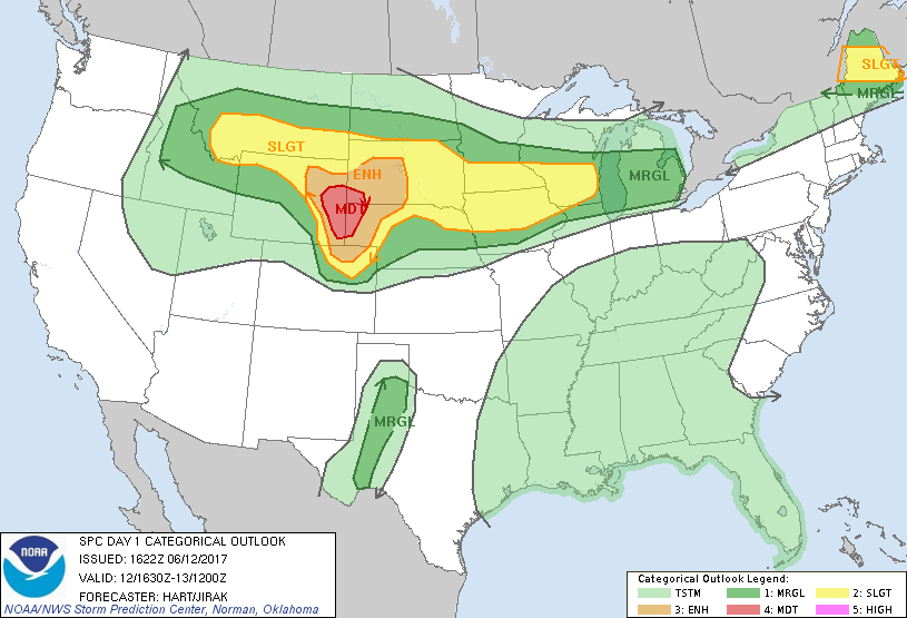
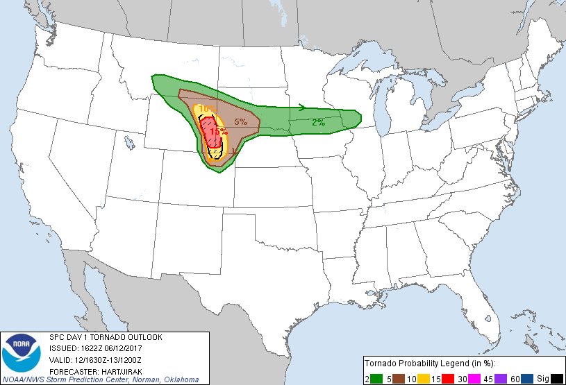
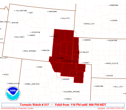
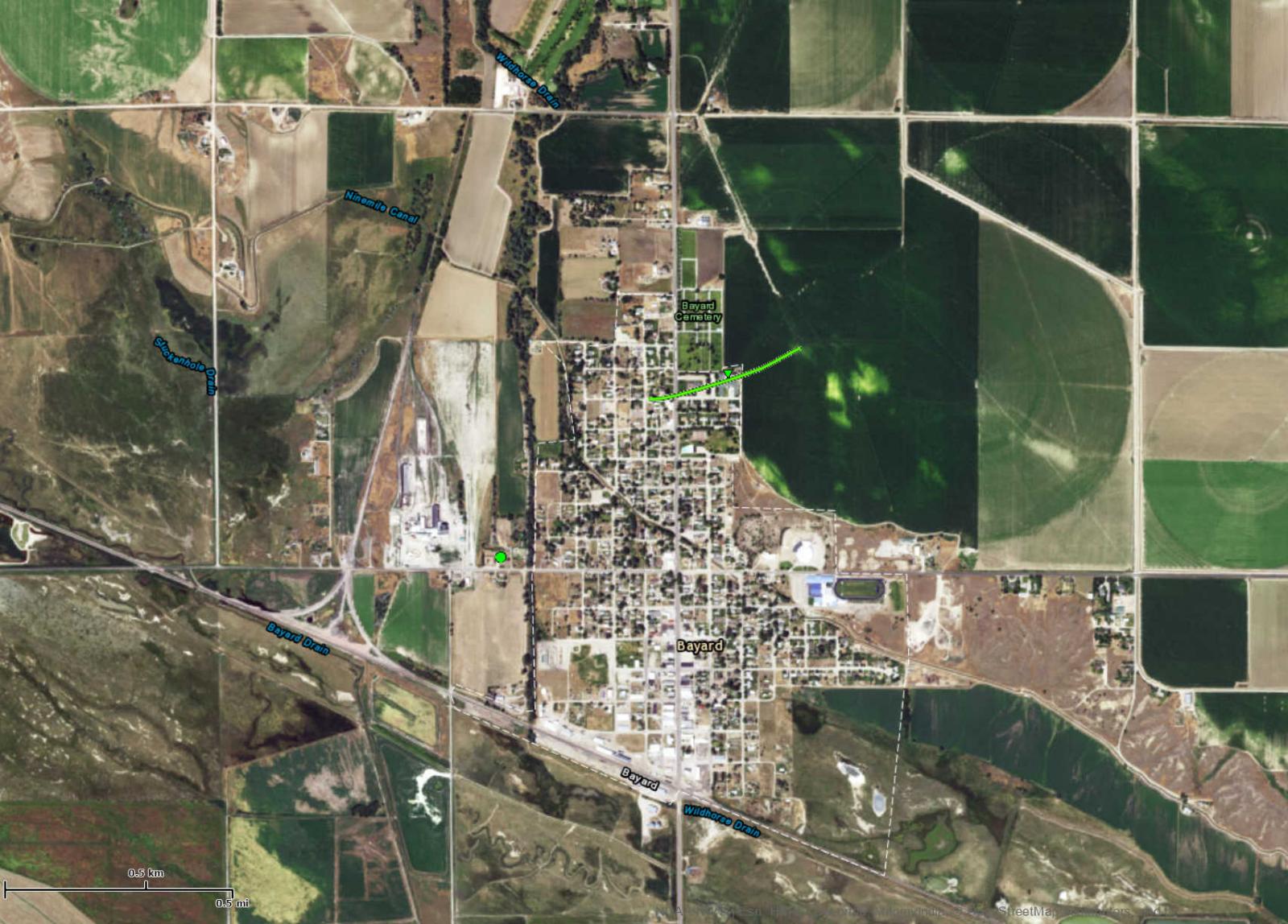
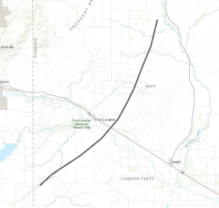
One of the most significant severe weather outbreaks to impact southeast Wyoming and the western Nebraska Panhandle in the past 30 years occurred on the afternoon and evening of June 12, 2017. A strong low pressure system moving across the northern Rockies on Monday triggered widespread severe thunderstorms across the area. The Storm Prediction Center (SPC) issued a moderate risk forecast for Monday. The Storm Prediction Center issued a particularly dangerous situation (PDS) tornado watch around 1:00 pm. This is the first ever PDS tornado watch issued for Wyoming. Throughout the afternoon several tornadoes touched down initially near Fort Laramie, WY and lifted northeast through north central Goshen County, and crossed the state line into Sioux County. Several homesteads were damaged with 2 minor injuries in this area. Another tornado touched down roughly 11 miles northeast of Cheyenne and produced only minor damage. Additional tornadoes formed across the extreme southeast corner of Wyoming and lifted northeast contributing to damage in northwest Kimball County and into Morrill and Box Butte Counties. Numerous homes were damaged with this tornado. The town of Bayard was an area hit the hardest with several homes near complete losses. These storms continued to move northeast until finally weakening later that night. Forty warnings (24 Tornado and 16 Severe Thunderstorm) were issued. Twenty-two reports of tornadoes were received during the afternoon and evening. The False Alarm Rate for warnings issued was 34%, Probability of Detection for events warned was 94%, and the average lead time from warning issuance to beginning of the event was 22 minutes. |
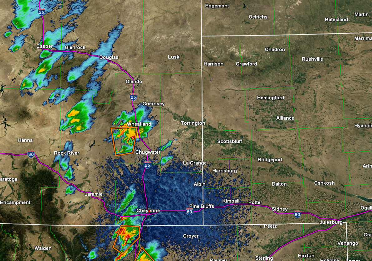
Radar reflectivity of the storms that developed during the afternoon and early evening. |
 |
 |
 |
|
A couple of supercell storms near Bushnell, NE Credit: Jacob Deflitch |
Tornado that formed north of Cheyenne Credit: Chuck Patient |
Supercell storm near Kimball, NE Credit: Tyler Sanders |
Tornadoes:
|
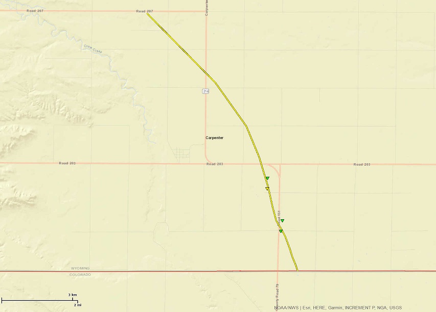
Tornado - Carpenter, WY
|
||||||||||||||||
|
Tornado - Northeast Goshen to West Central Sioux County
Track Map
Downloadable KMZ File |
||||||||||||||||
|
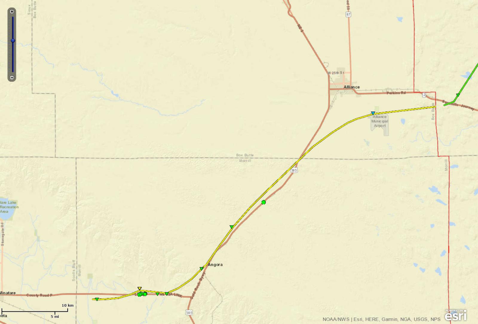
Tornado - North Bayard NE to South of Alliance NE
|
||||||||||||||||
|
Tornado - Bayard NE #2
|
||||||||||||||||
|
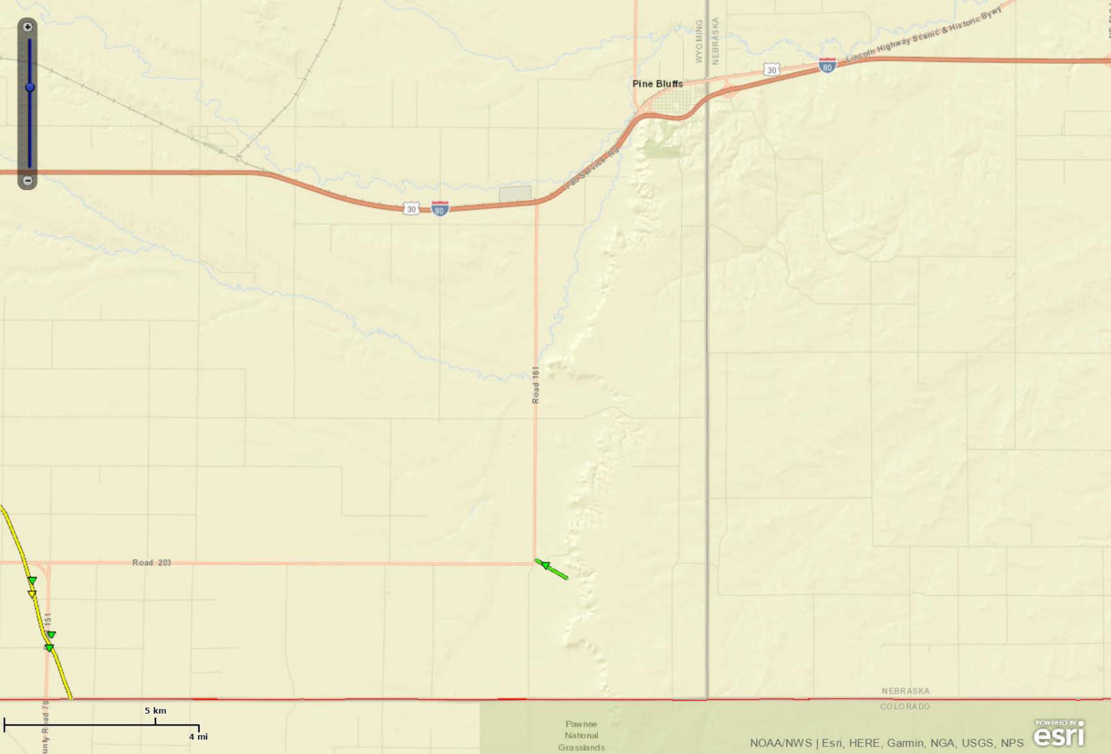
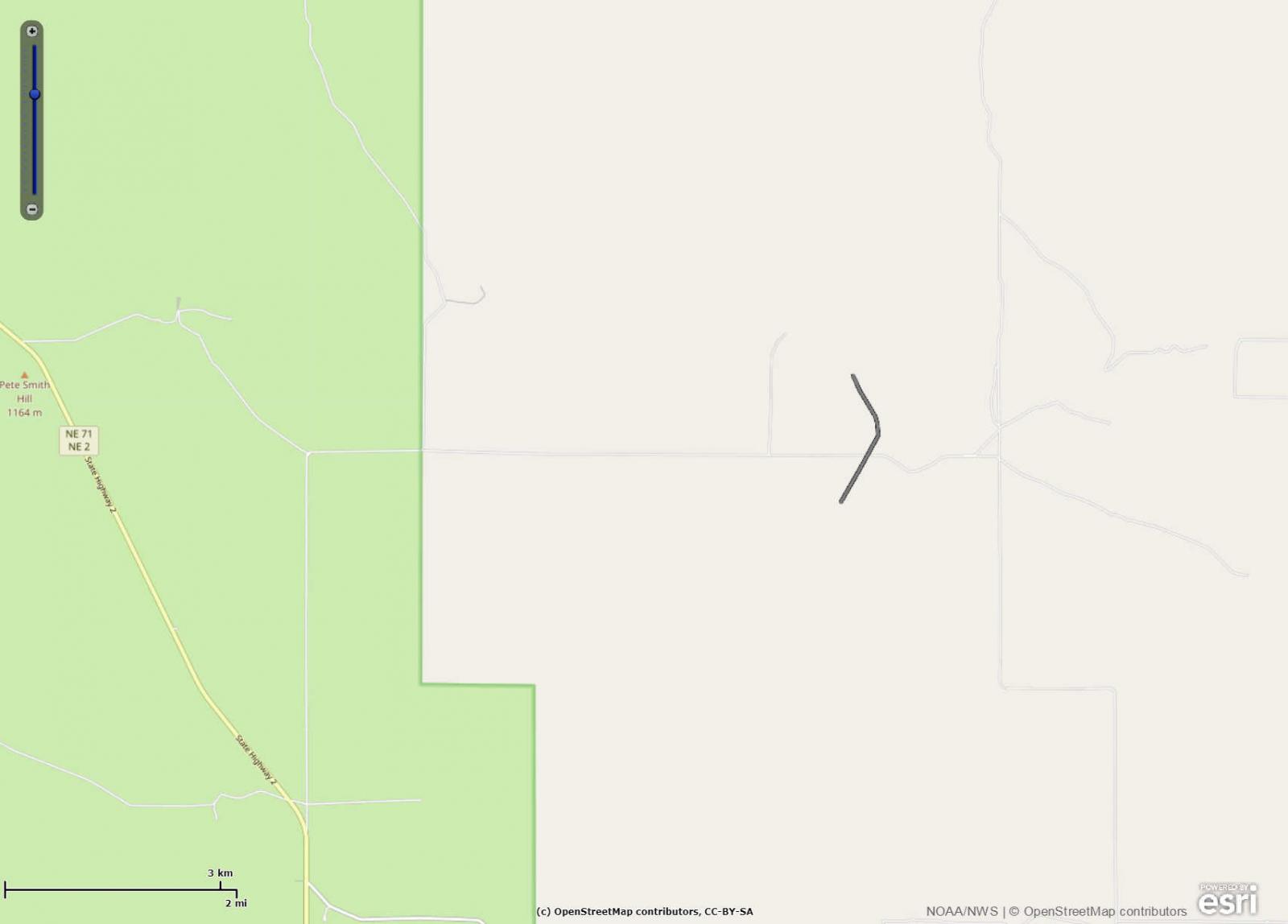
Tornado - Eastern Laramie County
|
||||||||||||||||
|
Tornado - 11 Miles Northeast of Cheyenne
|
||||||||||||||||
|
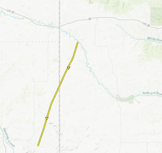
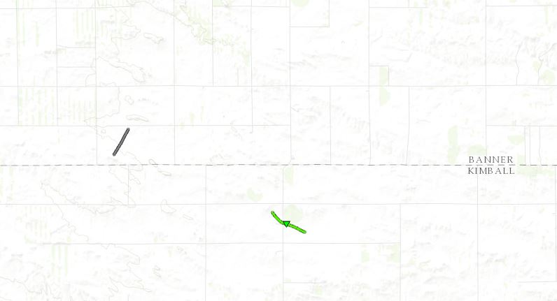
Tornado - 9 Miles North of Bushnell, NE & Southern Banner County
Track Map
Downloadable KMZ File |
||||||||||||||||
|
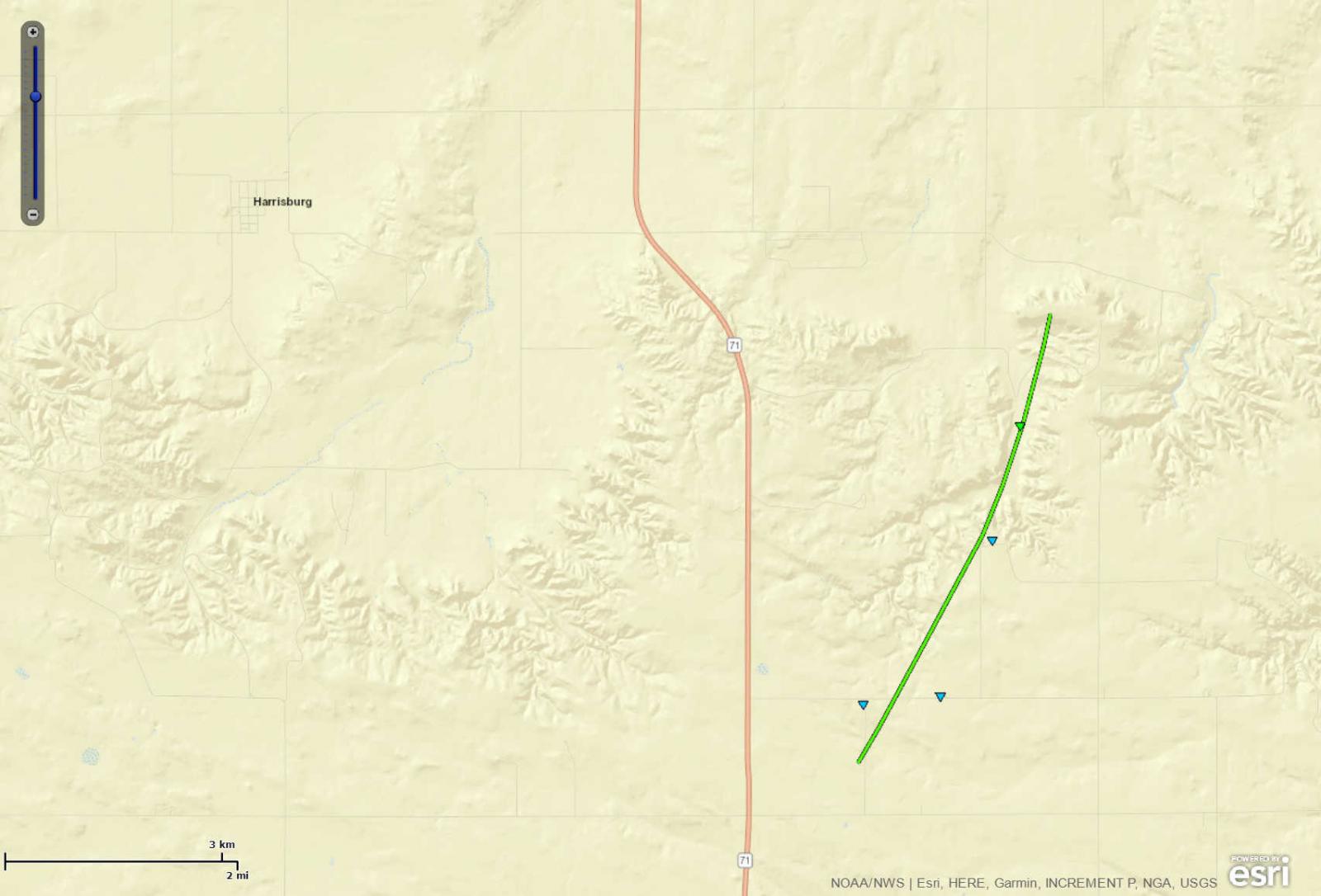
Tornado - 7 Miles Southeast of Harrisburg, NE
|
||||||||||||||||
|
Tornado - North of Whitney, NE
|
||||||||||||||||
|
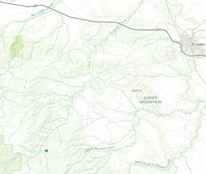
Tornado - Southwest of Douglas, WY
Track Map
Downloadable KMZ File |
||||||||||||||||
|
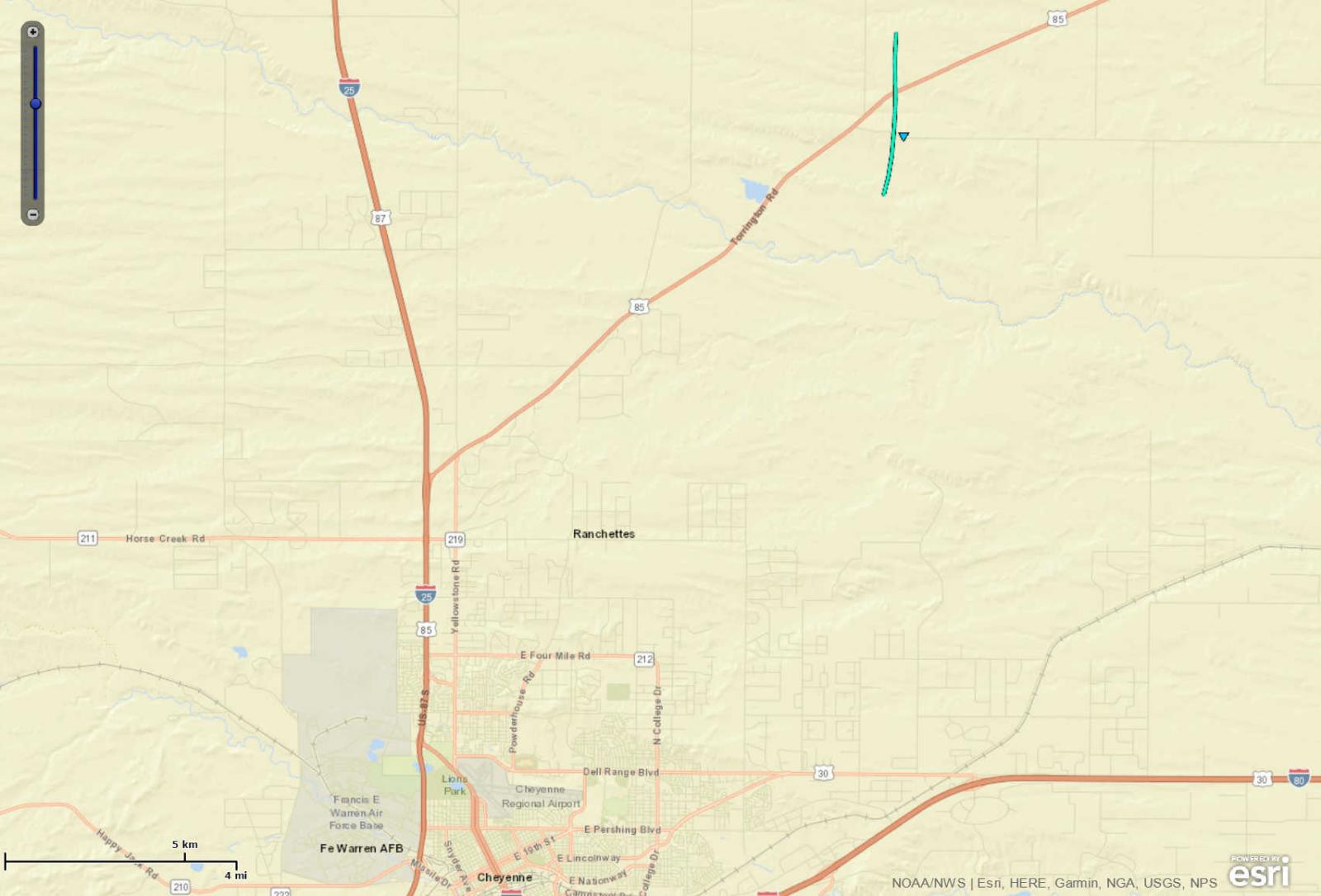
Tornado - Western Goshen County
Track Map
Downloadable KMZ File |
||||||||||||||||
The Enhanced Fujita (EF) Scale classifies tornadoes into the following categories:
| EF0 Weak 65-85 mph |
EF1 Moderate 86-110 mph |
EF2 Significant 111-135 mph |
EF3 Severe 136-165 mph |
EF4 Extreme 166-200 mph |
EF5 Catastrophic 200+ mph |
 |
|||||
Photos & Video:
Click Image to Enlarge
 |
 |
 |
 |
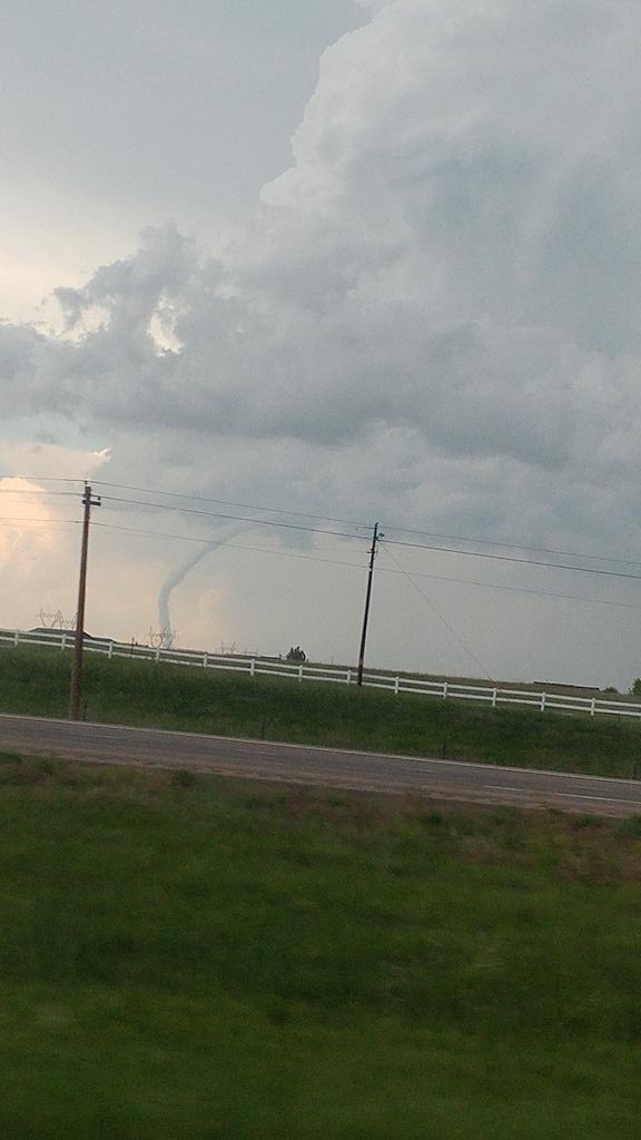
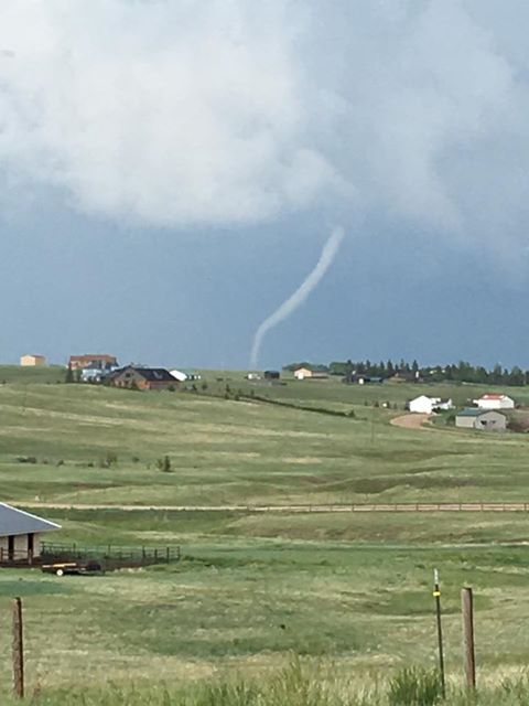
| Northeast of Cheyenne Credit: Andy Carp |
Northeast of Cheyenne Credit: Caroline Hickerson |
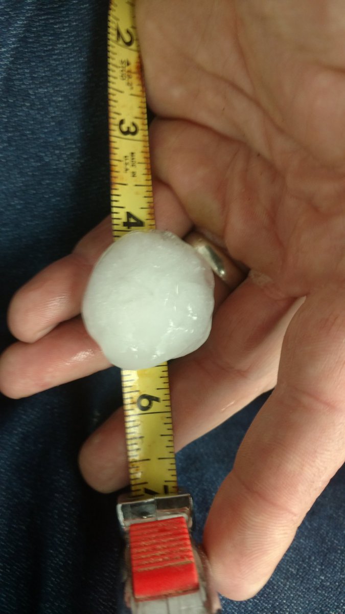
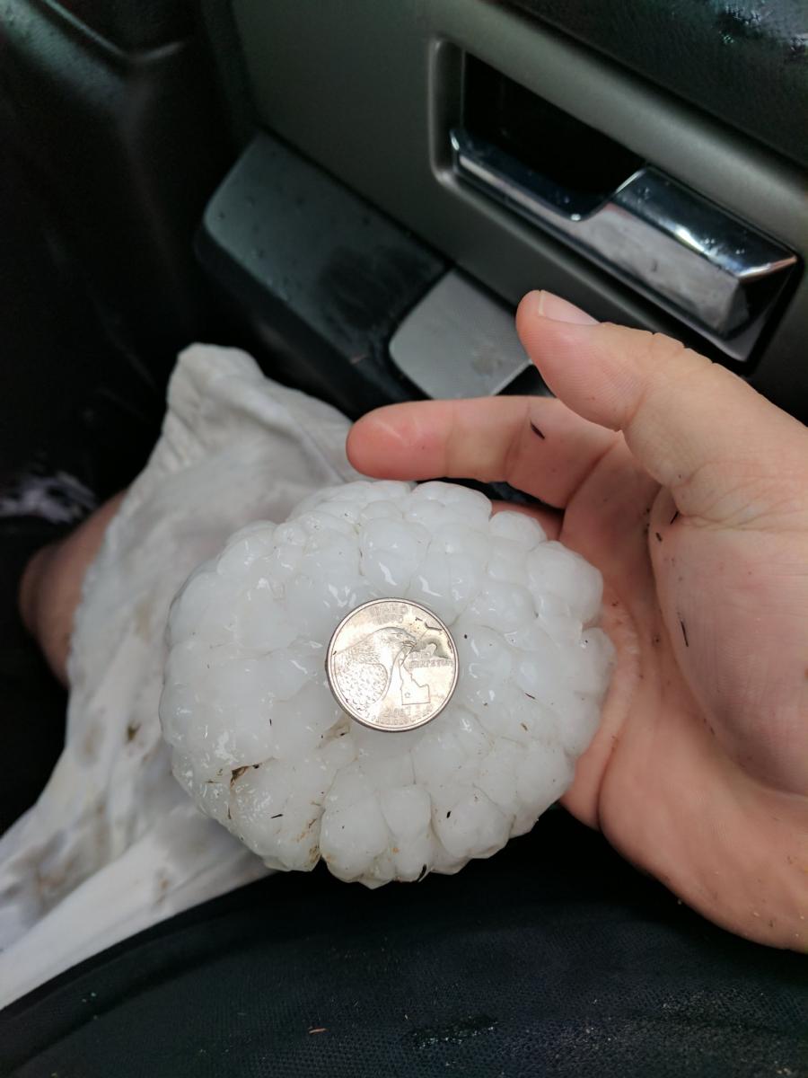
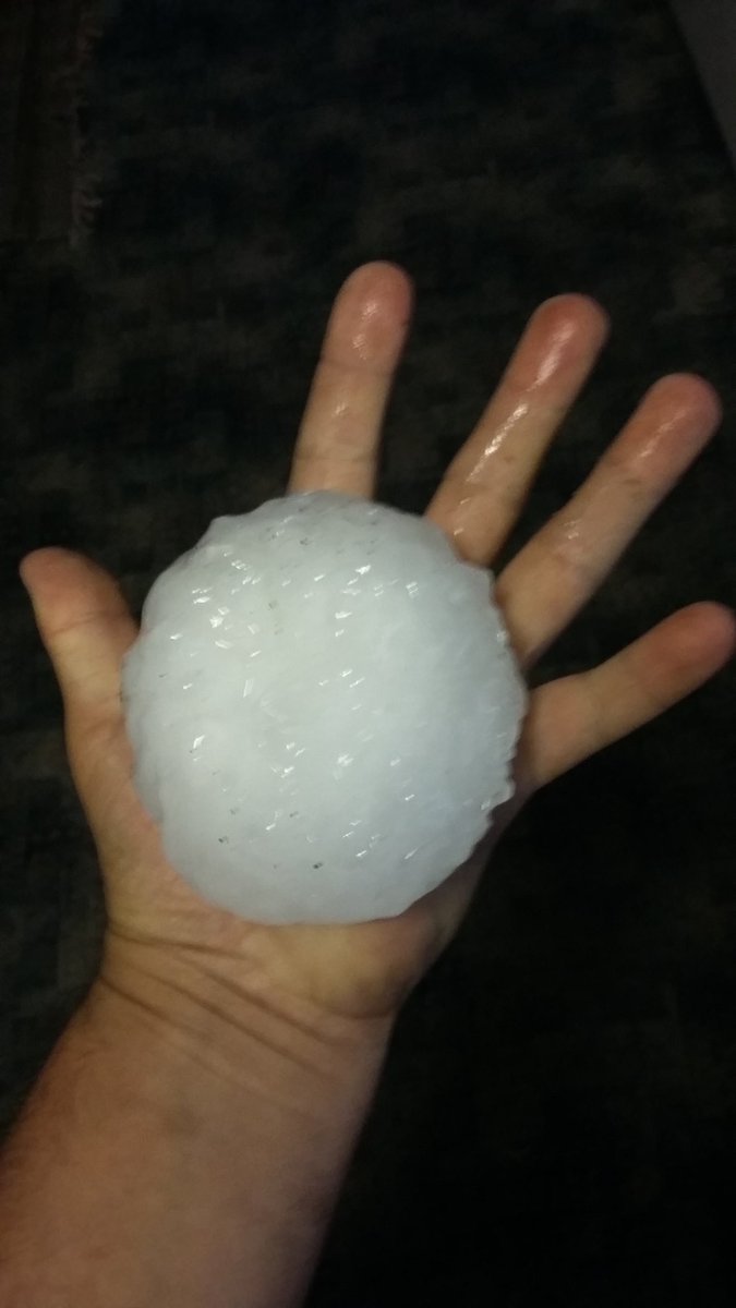
Hail 6 miles south of Wheatland Credit: Dan Fitts |
Softball hail south of Wheatland Credit: Marcus Diaz |
 |
 |
 |
 |
| Hail at Cheyenne Credit: Jena Geis-Johannesen |
Tornado east of Albin, WY Credit: Winston Wells |
Hail at Cheyenne Credit: Cade Kirkham |
Softball sized hail 8 miles north of Bayard, NE Credit: Unknown |
 |
 |
 |
 |
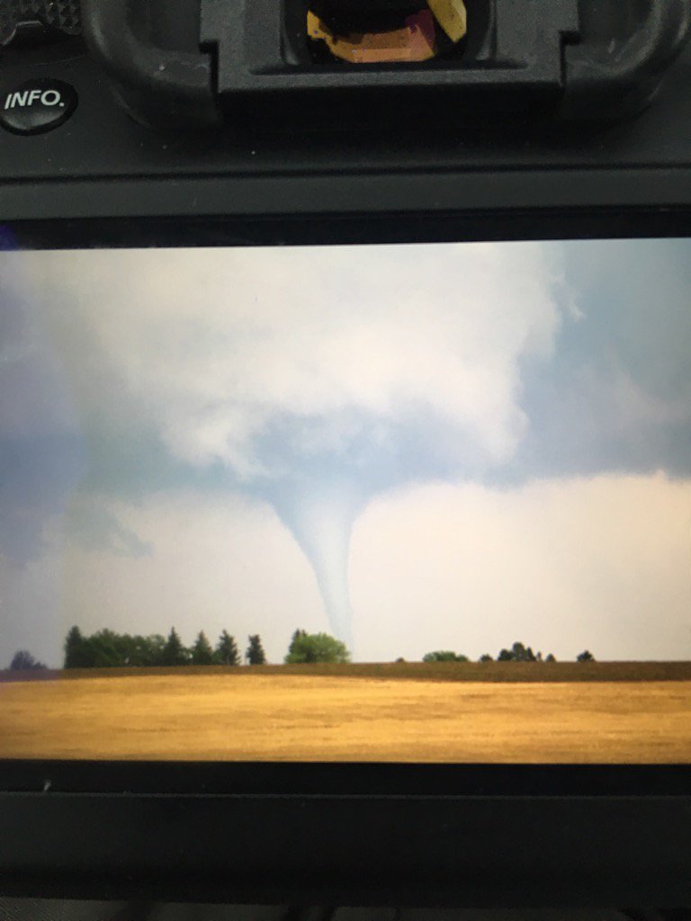
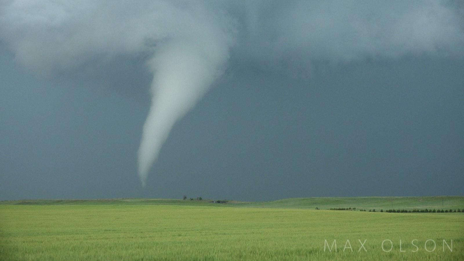
| Tornado near Carpenter, WY Credit: Max Olson |
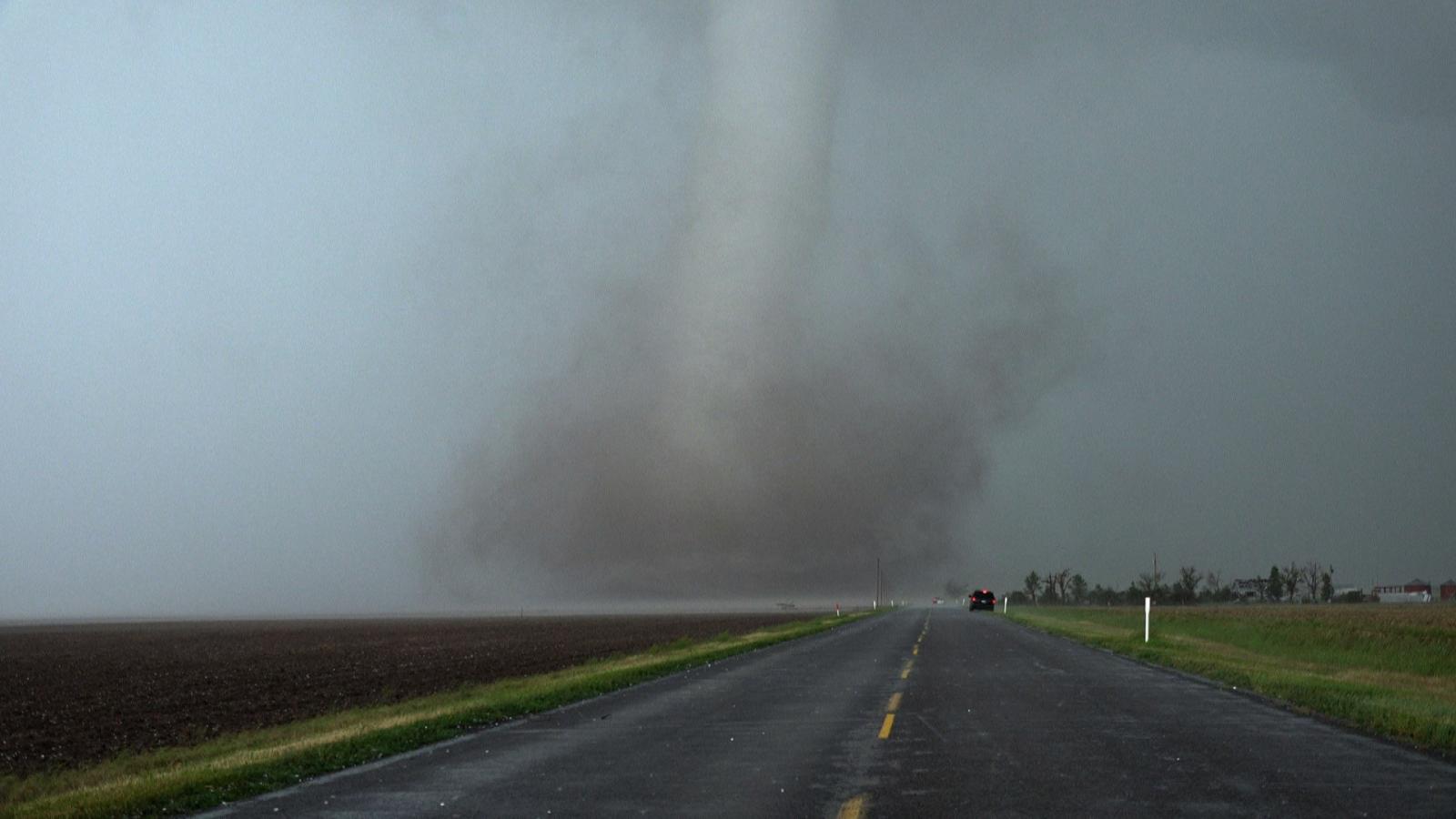
Tornado near Bushnell, NE Credit: Max Olson |
Damage from giant hail southwest of Fort. Laramie, WY Credit: Jane O'Neill |
Tornado in northeast Goshen County Credit: Brendon Melander |
Storm Reports
.jpg) |
.jpg) |
.jpg) |
.jpg) |
| Roof damage to a nursing home in Bayard, NE |
Damage to a home north of Bayard, NE |
Damage to a home north of Bayard, NE | Roof and house damage near Carpenter, WY |
.jpg) |
.jpg) |
.jpg) |
 |
| Damage to a barn near Carpenter, WY |
Chicken coop destroyed near Carpenter, WY |
Shed damage near Carpenter, WY |
Train cars blown over near Alliance, NE |
 |
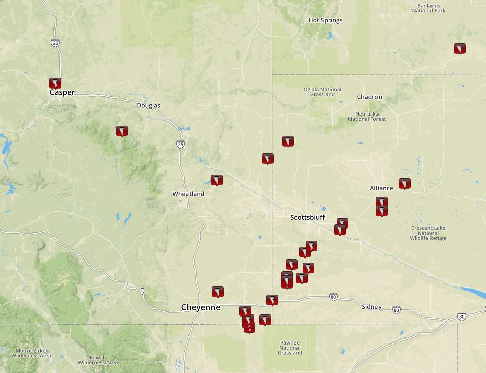 |
| Tornado Reports | Map of confirmed tornadoes |
Storm Prediction Center
The Forecast
 |
 |
|
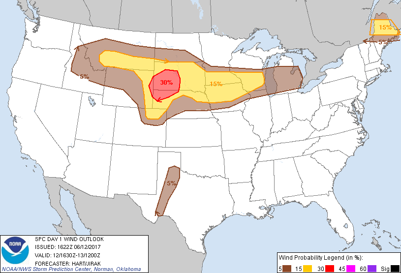 |
| SPC Day 1 Categorical Outlook | SPC Day 1 Hail Outlook | SPC Day 1 Tornado Outlook | SPC Day 1 Wind Outlook |
 |
|||
| SPC PDS Tornado Watch |
 |
Media use of NWS Web News Stories is encouraged! Please acknowledge the NWS as the source of any news information accessed from this site. |
|


 Weather Story
 Weather Map
 Local Radar