Day 1 Wind Gusts |
|
|
|
|
|
|
|
Day 2 Wind Gusts |
|
|
|
|
|
|
|
Day 3 Wind Gusts |
|
|
|
|
|
|
|
Day 4 Wind Gusts |
|
|
|
|
|
|
|
Day 5 Wind Gusts |
|
|
|
|
|
|
|
2-Day Hourly Forecast for Wind-Prone Locations |
|
| Interstate 80 at Arlington | Interstate 80 at Buford |
| Interstate 25 at Bordeaux | Interstate 25 at Wyo Hill |
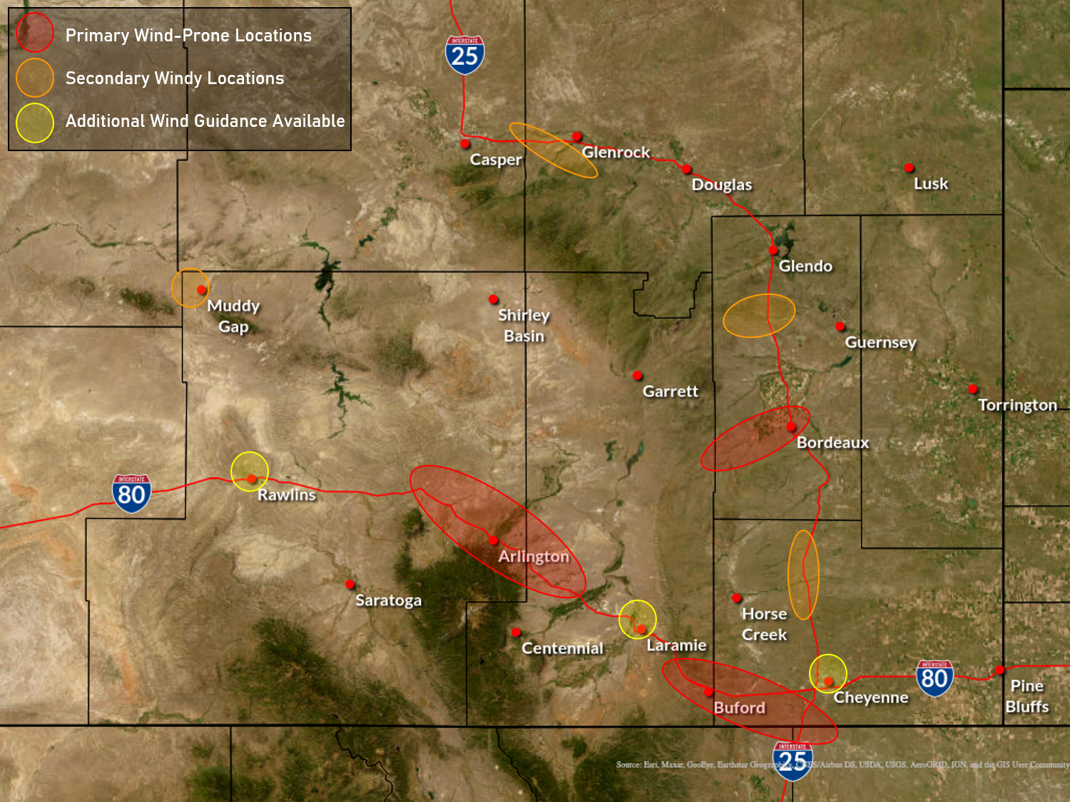
Map of Wind-Prone Locations across Southeast Wyoming(Select Locations on Map to View Local Wind Guidance) |
 |
| Click Here for a description of the graphics linked above |
|
This guidance is based on local wind research conducted at NWS Cheyenne. See this research article in the American Meteorological Society Journal of Weather and Forecasting for more details: Brothers, M. D., and C. Hammer, 2021: Random forest approach for improving non-convective high wind forecasting across southeast Wyoming. Wea. Forecasting, 38, 47-67, https://doi.org/10.1175/WAF-D-21-0215.1 |
|
Latest High Wind Warnings (Non-Precipitation Weather Product) |
|
051 WWUS75 KCYS 262303 NPWCYS URGENT - WEATHER MESSAGE National Weather Service Cheyenne WY 403 PM MST Wed Nov 26 2025 WYZ110-270015- /O.CAN.KCYS.HW.W.0047.000000T0000Z-251127T0000Z/ North Snowy Range Foothills- Including the cities of Arlington and Elk Mountain 403 PM MST Wed Nov 26 2025 ...HIGH WIND WARNING IS CANCELLED... Winds have diminished below warning thresholds. However, wind gusts up to 45 mph will be possible over the hour or so. $$ Zawislak |