Overview
|
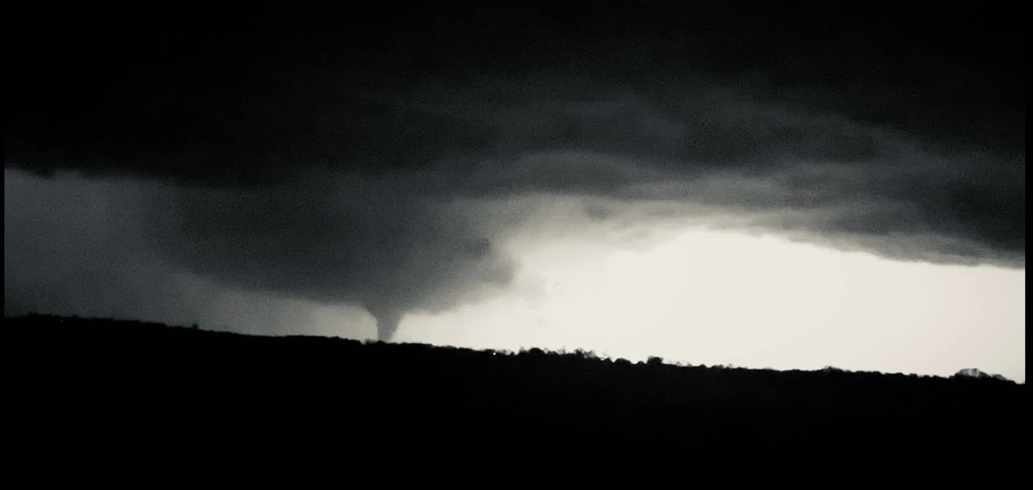
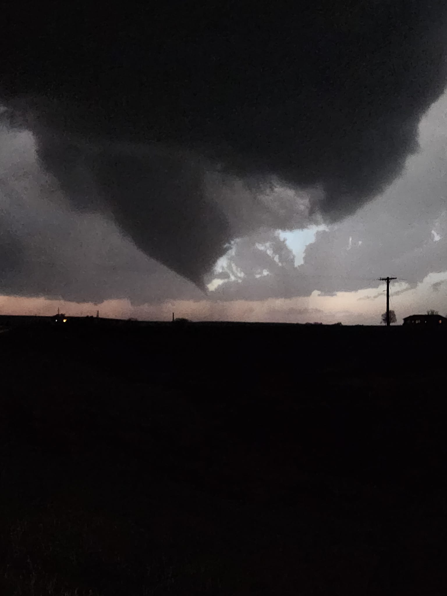
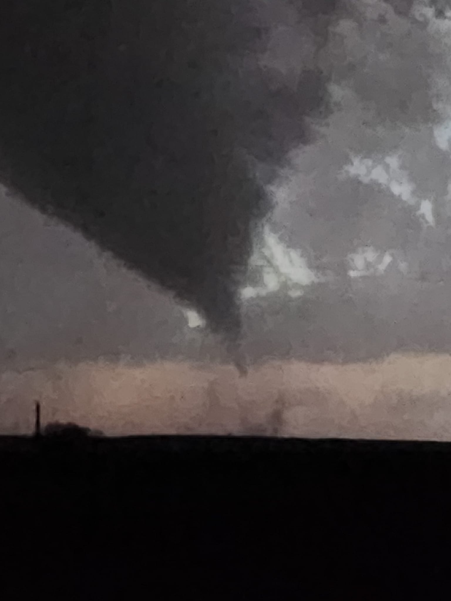
A few storms erupted on the dryline during the early evening hours of April 19th west of I-135. As the storms progressed east they quickly intensified as they encountered better moisture. One storm in particular became the dominant storm that tracked across southern Marion and much of Chase county. This powerful supercell thunderstorm produced numerous tornadoes along with extremely large hail.
A total of 9 tornadoes were identified by NWS Survey teams across Chase County, with the strongest being an EF-2. |
Picture by Bryan Baerg |
Tornadoes:
|
Above are the tornado tracks identified by the NWS survey teams across Chase County. A more detailed list of tornado information can be found here. The KMZ file containing data points and tracks can be found here. |
Below are some damage pictures from this event
|
Damage 1 mile east of Elmdale |
Damage 3 miles west/southwest of Strong City |
Damage 3 miles west/southwest of Strong City |
Damage 2 miles west/southwest of Strong City |
The Enhanced Fujita (EF) Scale classifies tornadoes into the following categories:
| EF0 Weak 65-85 mph |
EF1 Moderate 86-110 mph |
EF2 Significant 111-135 mph |
EF3 Severe 136-165 mph |
EF4 Extreme 166-200 mph |
EF5 Catastrophic 200+ mph |
 |
|||||
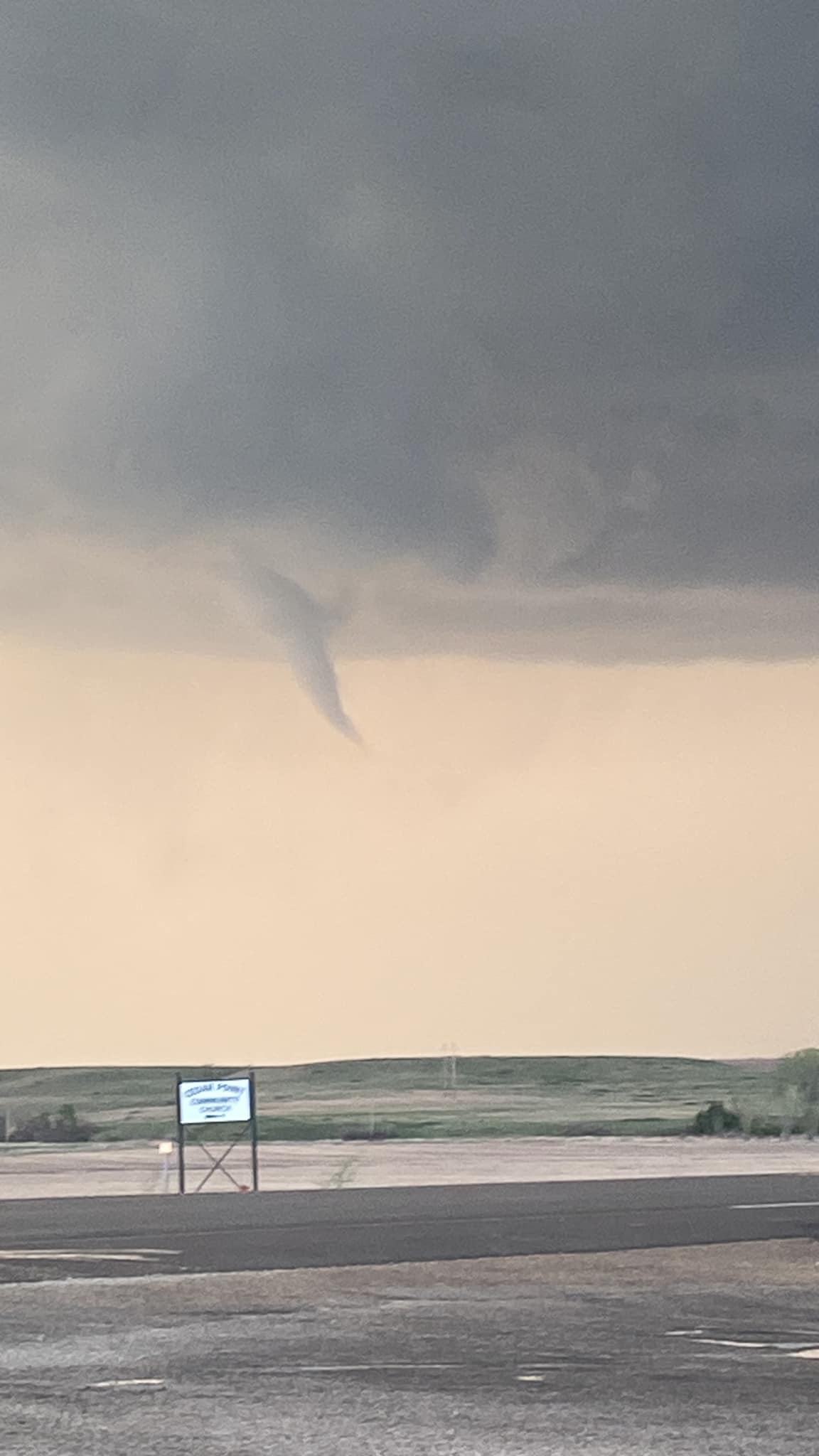
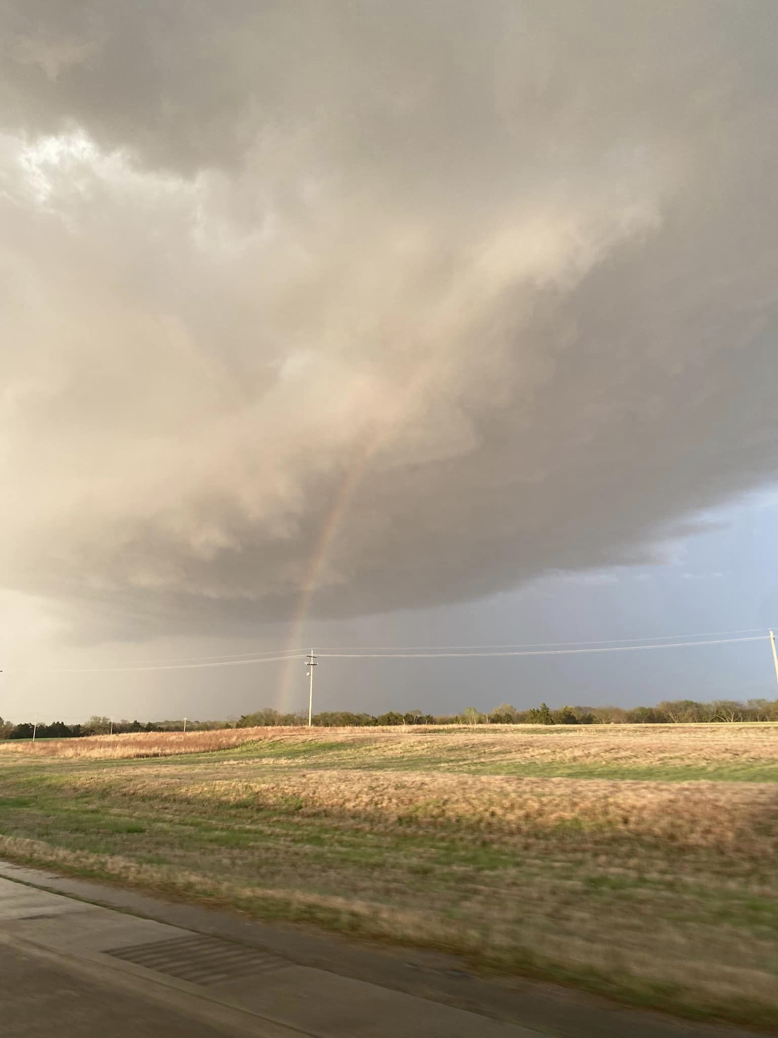
Photos & Video
Storm and tornadoes
 |
 |
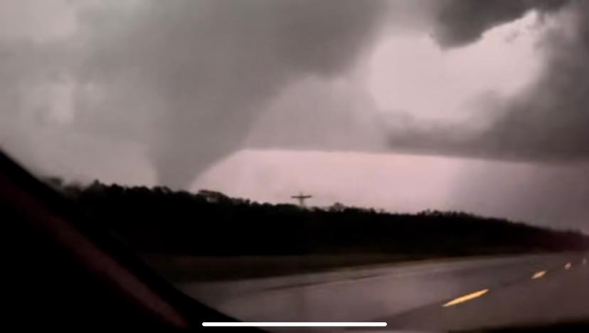 |
| Tornado northeast of Strong City. Taken by Bryan Baerg | Southwest of Elmdale. Picture by Kelly Butler | Near Strong City taken by Kelly Butler |
 |
|
|
| Southwest Chase County taken by Kelly Butler (source) |
||
|
Photo by Doug Crisp |
Photo by Doug Crisp |
Photo by Doug Crisp |
|
Photo by Doug Crisp |
|
|
|
|
|
|
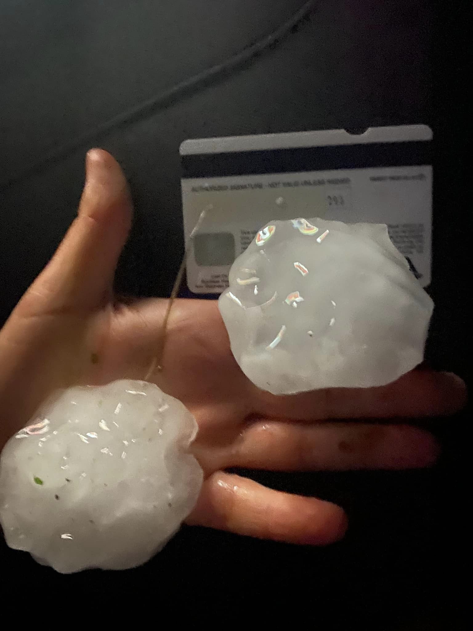
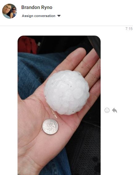
Hail
|
Picture by Kelly Butler |
Large hail near Peabody |
Large hail near Peabody |
|
|
|
Radar & Satellite
Radar
 |
 |
| Radar animation from the radar near Topeka | Radar animation of storm relative velocity from Topeka's radar |
Satellite
|
Visible satellite animation when storms first developed over eastern Kingman County |
Visible satellite animation as the storm was tracking across Chase County |
Visible satellite animation
 |
|
| Satellite animation until around 7:30pm | Satellite animation starting around 7:30pm |
Storm Reports
 |
 |
Environment
Surface Maps
 |
 |
 |
||
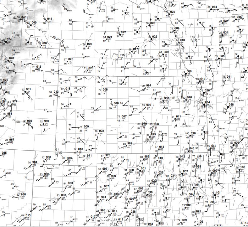
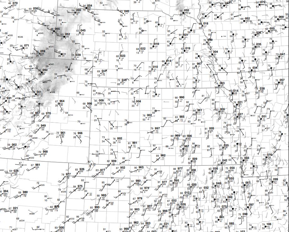
| April 19th 20z | April 19th 21z | April 20th 00z | ||
|
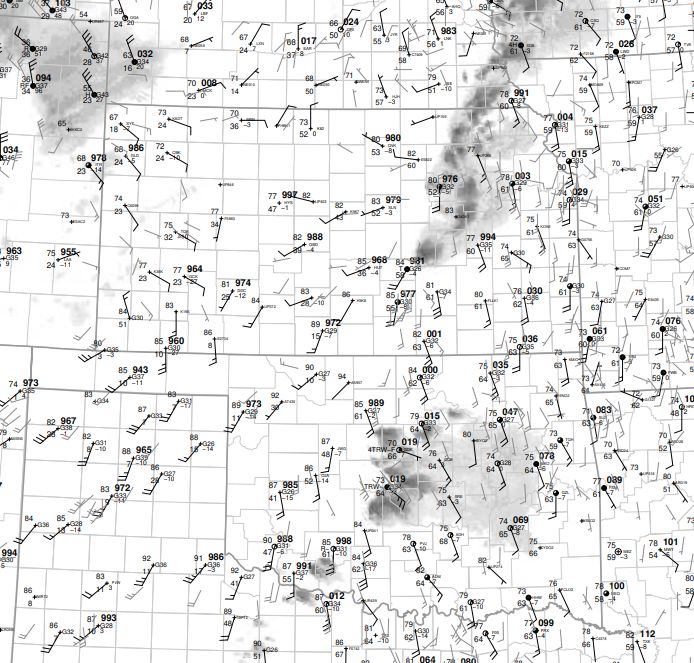
April 20th 01z |
||||
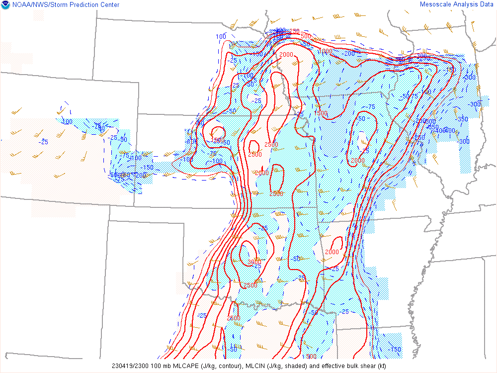
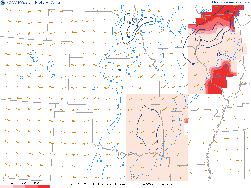
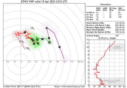
Near-storm environment showing how low level jet increasing really increased storm relative helicity
 |
 |
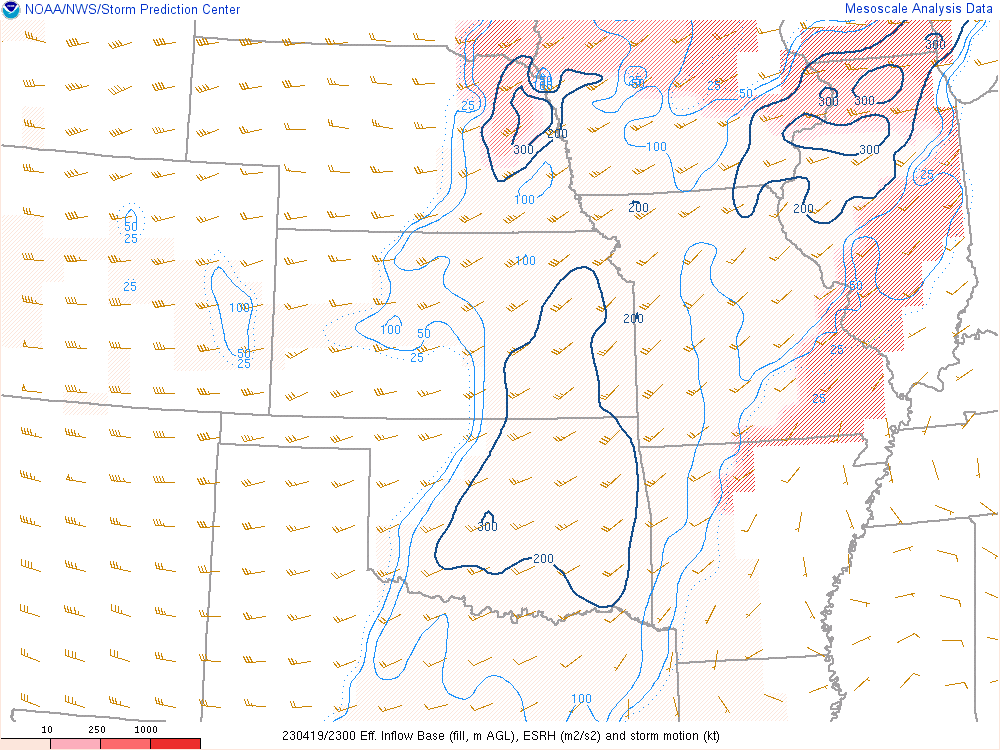 |
| Mixed Layer CAPE at 23z. | Effective Storm Relative Helicity - 22z | Effective Storm Relative Helicity - 23z |
|
Effective Storm Relative Helicity - 00z |
Effective Storm Relative Helicity - 01z |
How Topeka's hodograph changed as low level jet started to increase |
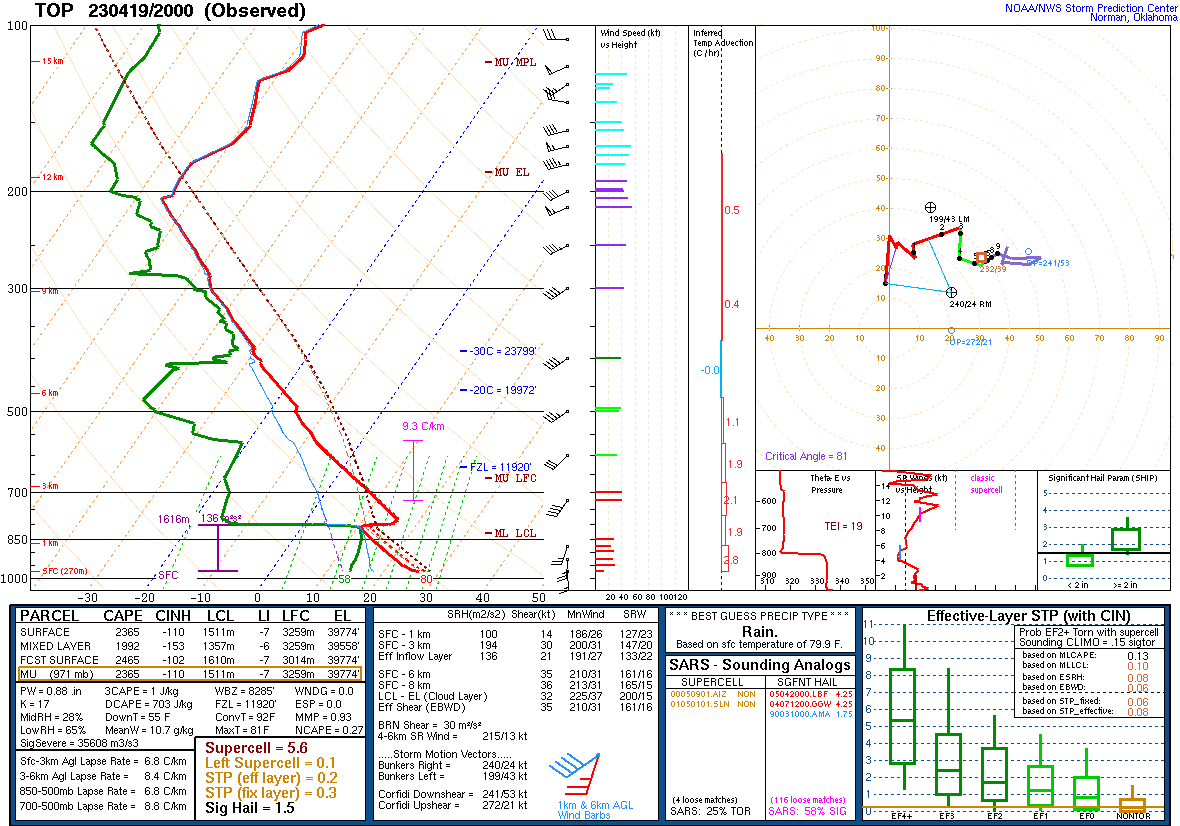
Upper air soundings from Topeka
 |
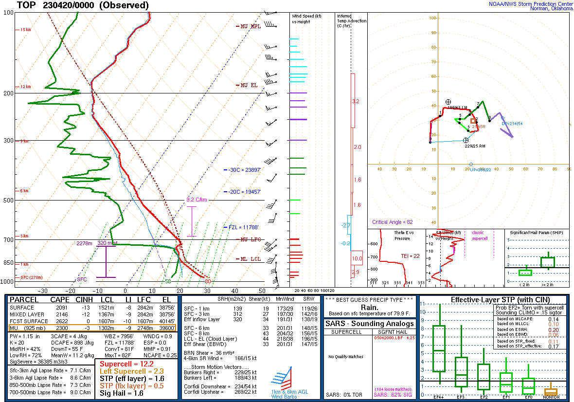 |
| 20z April 19th KTOP sounding | 00z April 20th KTOP sounding |
 |
Media use of NWS Web News Stories is encouraged! Please acknowledge the NWS as the source of any news information accessed from this site. |
|


 Follow us on YouTube