Overview
|
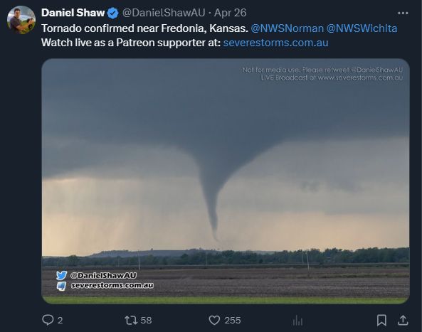
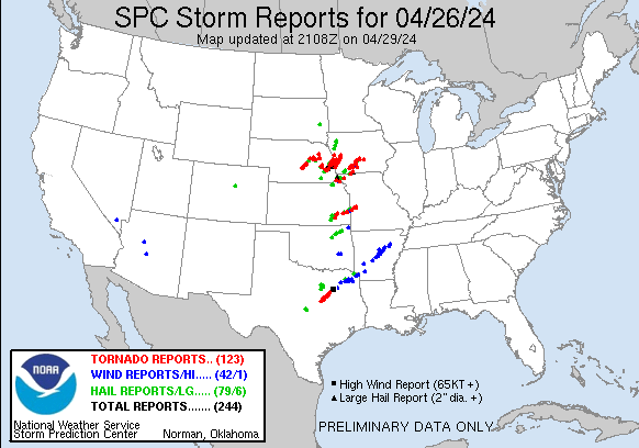
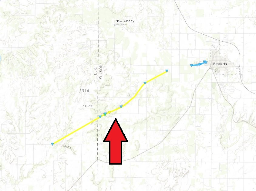
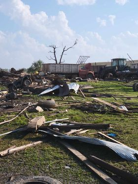
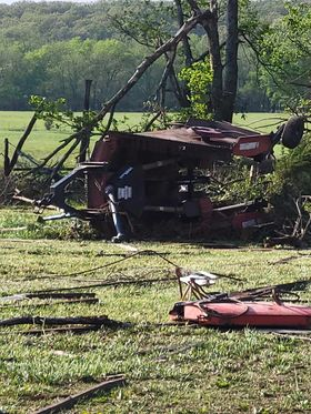
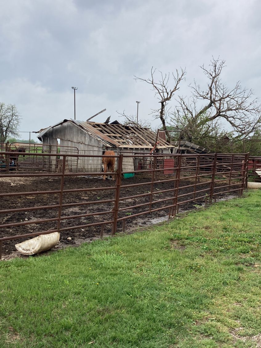
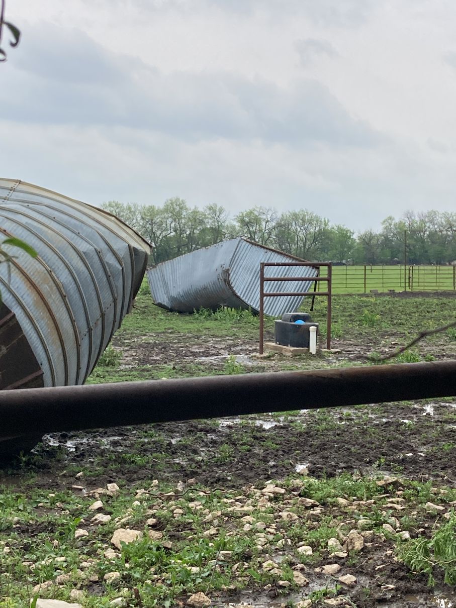
Storms developed during the afternoon hours over the Flint Hills on Friday April 26th along an eastward moving dryline. As the storms progressed east they started to produce tornadoes. Two of the tornadoes were rated an EF-2. One of them struck southwest of Fredonia and the other southwest of Yates Center. Luckily there were no injuries or fatalities with these tornadoes. |
 Caption |
Tornadoes:
|
Southwest of Fredonia
Track Map
|
|||||||||||||||||
|
West of Fredonia
Track Map 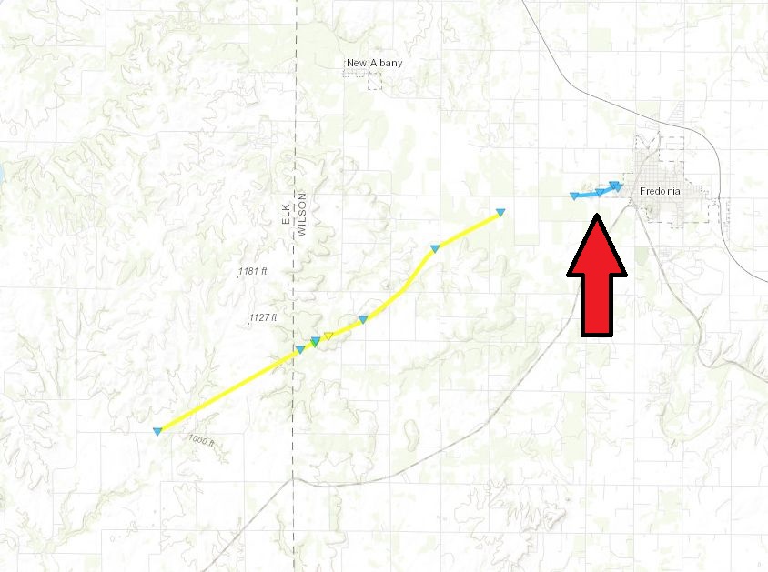 
|
||||||||||||||||||
|
Southwest of Yates Center
Track Map 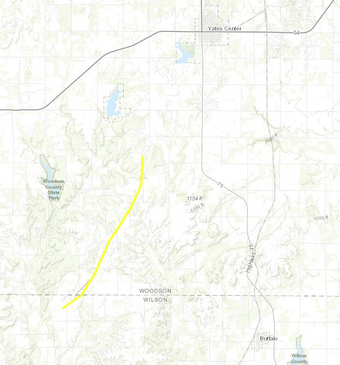
|
|||||||||||||||||
|
East of Benedict
Track Map 
|
|||||||||||||||||||
The Enhanced Fujita (EF) Scale classifies tornadoes into the following categories:
| EF0 Weak 65-85 mph |
EF1 Moderate 86-110 mph |
EF2 Significant 111-135 mph |
EF3 Severe 136-165 mph |
EF4 Extreme 166-200 mph |
EF5 Catastrophic 200+ mph |
 |
|||||
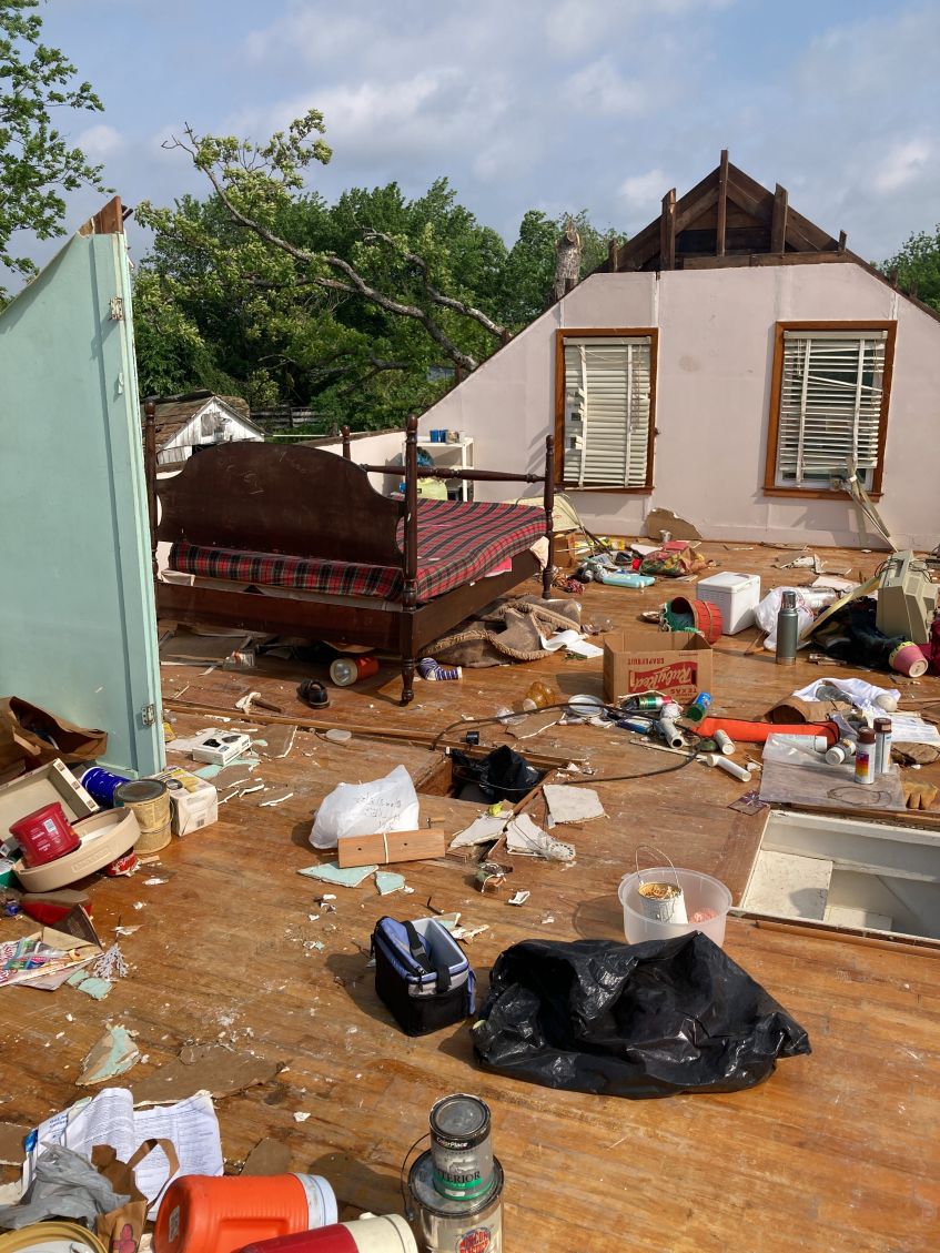
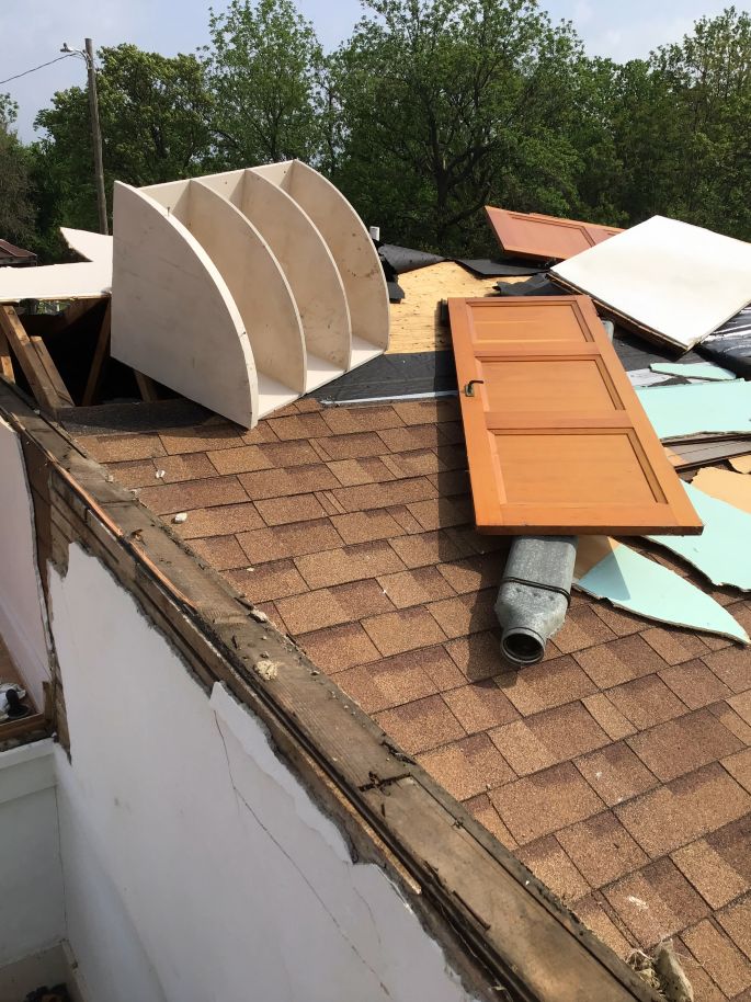
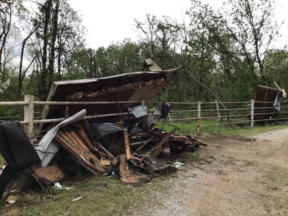
Additional Photos & Video
|
|
|
|
|
| Caption (source) |
Caption (source) |
Caption (source) |
Storm Reports
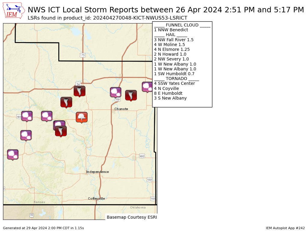 |
 |
Preliminary Local Storm Report...Summary
National Weather Service Wichita KS
748 PM CDT Fri Apr 26 2024

..TIME...   ...EVENT...      ...CITY LOCATION...     ...LAT.LON...
..DATE...   ....MAG....      ..COUNTY LOCATION..ST.. ...SOURCE....
            ..REMARKS..

0251 PM     Hail             2 N Howard              37.50N 96.26W
04/26/2024  M1.00 Inch       Elk                KS   Emergency Mngr


0301 PM     Hail             2 NW Severy             37.64N 96.25W
04/26/2024  M1.00 Inch       Greenwood          KS   Trained Spotter


0303 PM     Hail             4 W Moline              37.36N 96.38W
04/26/2024  E1.50 Inch       Elk                KS   Emergency Mngr


0312 PM     Hail             3 NW Fall River         37.64N 96.07W
04/26/2024  M1.50 Inch       Greenwood          KS   Emergency Mngr


0341 PM     Hail             1 W New Albany          37.57N 95.96W
04/26/2024  E1.00 Inch       Elk                KS   Trained Spotter

            May have had a wall cloud initially.

0342 PM     Tornado          4 N Coyville            37.74N 95.89W
04/26/2024                   Woodson            KS   Storm Chaser

            storm chaser report.

0343 PM     Tornado          3 S New Albany          37.53N 95.94W
04/26/2024                   Wilson             KS   Storm Chaser

            Video confirmation of a tornado.

0352 PM     Tornado          4 SSW Yates Center      37.82N 95.77W
04/26/2024                   Woodson            KS   Fire Dept/Rescue


0400 PM     Hail             1 W New Albany          37.57N 95.95W
04/26/2024  M1.00 Inch       Wilson             KS   Trained Spotter


0420 PM     Funnel Cloud     1 NNW Benedict          37.63N 95.75W
04/26/2024                   Wilson             KS   Storm Chaser

            Video feed relayed funnel cloud.

0437 PM     Hail             1 SW Humboldt           37.81N 95.44W
04/26/2024  E0.70 Inch       Allen              KS   Trained Spotter


0502 PM     Tornado          8 E Humboldt            37.79N 95.30W
04/26/2024                   Allen              KS   Storm Chaser

            Storm chaser video showed brief tornado.

0517 PM     Hail             4 N Elsmore             37.85N 95.15W
04/26/2024  M1.25 Inch       Allen              KS   Trained Spotter
Environment
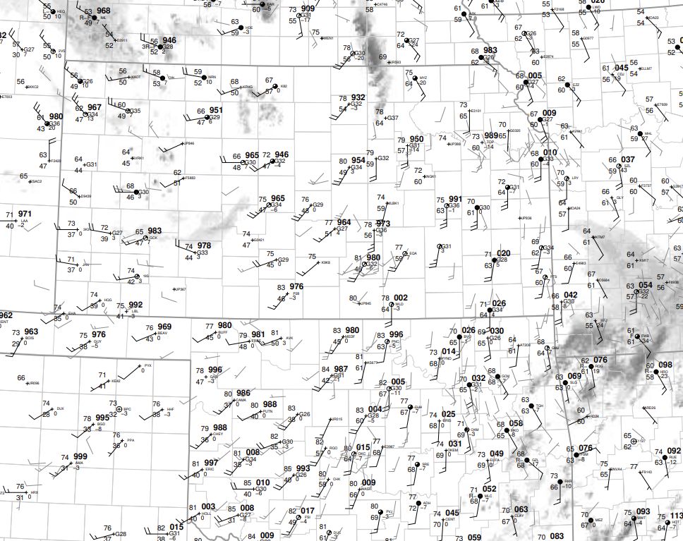 |
 |
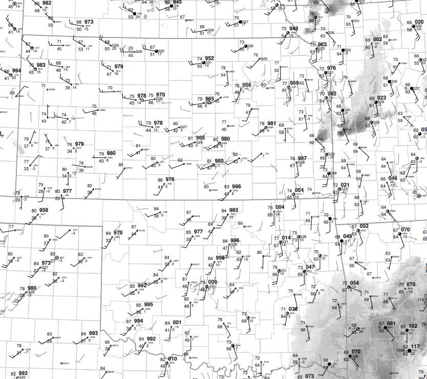 |
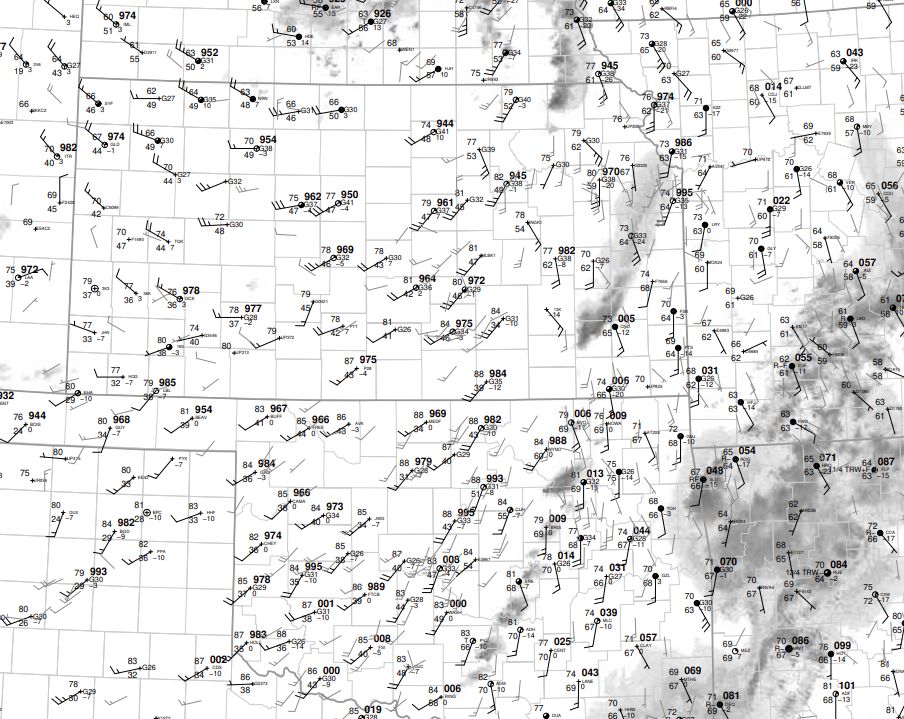
| 18z surface map | 21z surface map | 00z surface map |
 |
 |
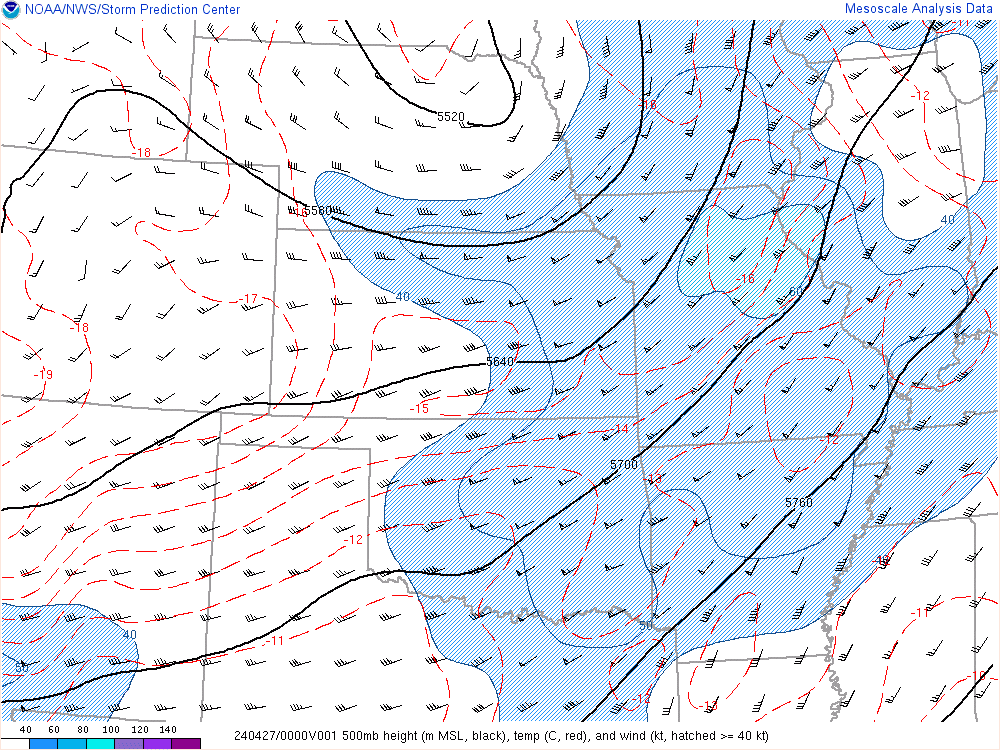 |
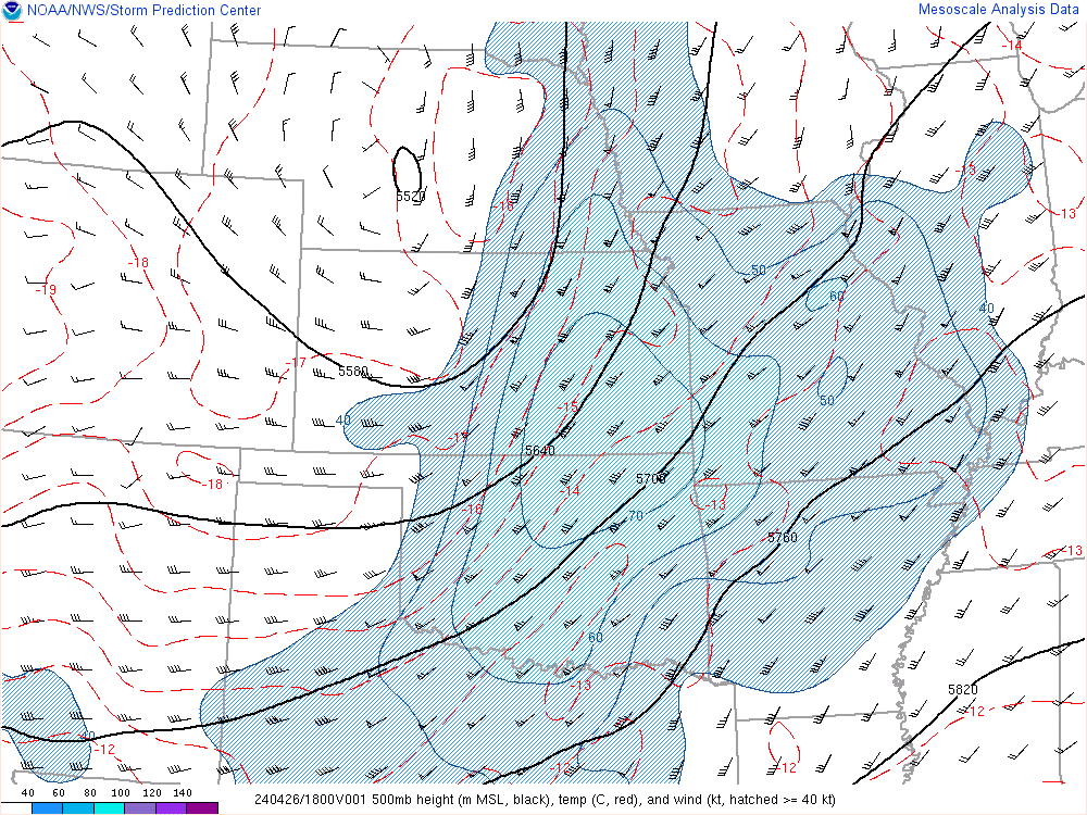
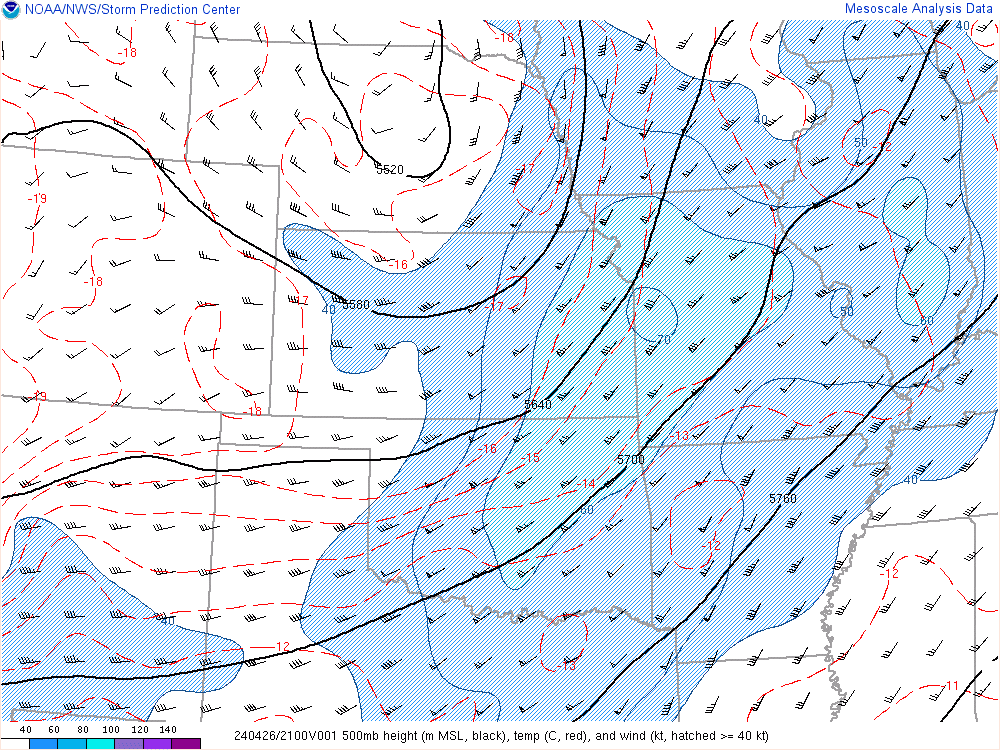
| 18z 500mb | 21z 500mb | 00z 500mb |
 |
 |
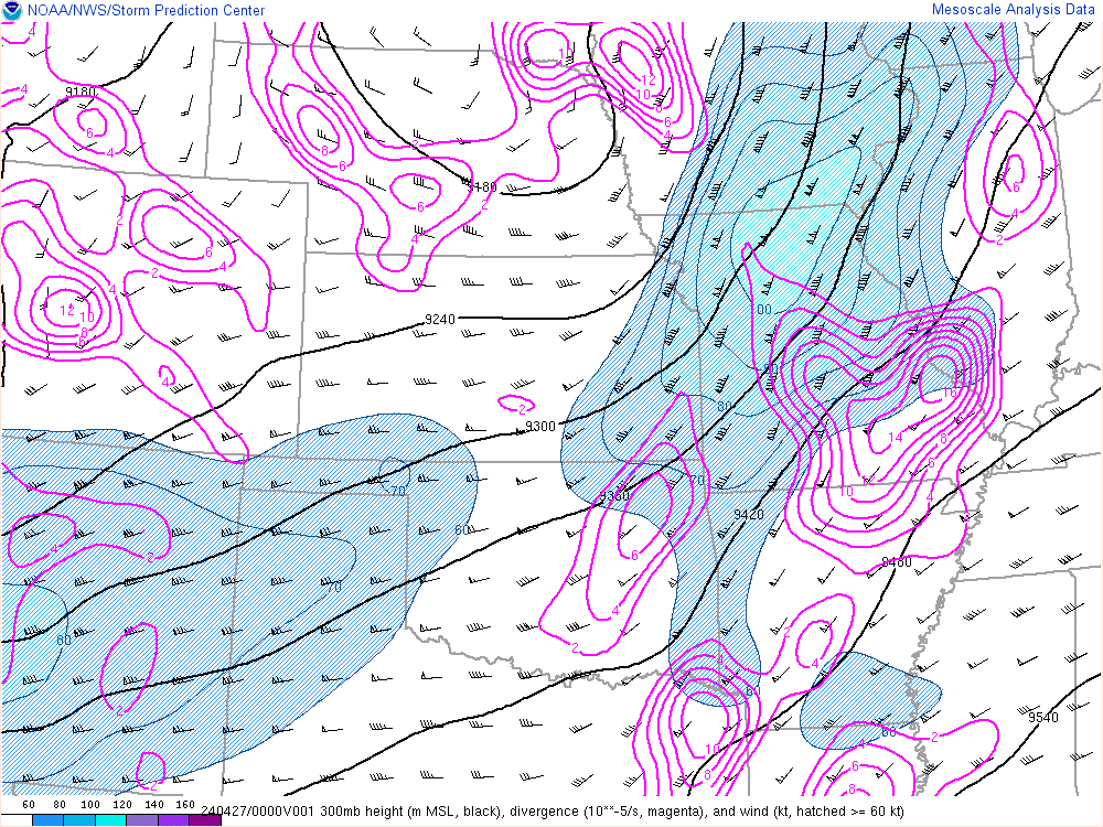 |
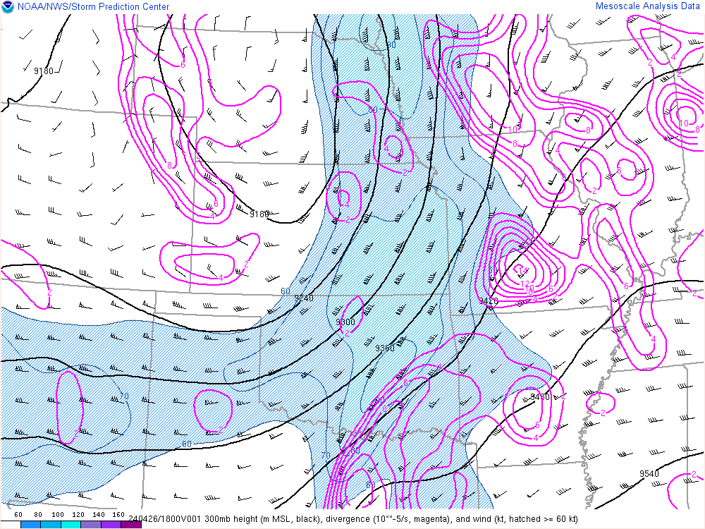
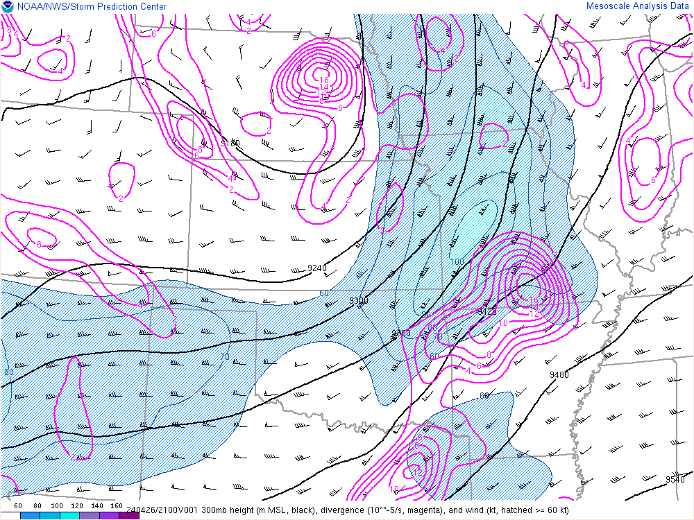
| 18z 300mb | 21z 300mb | 00z 300mb |
 |
 |
 |
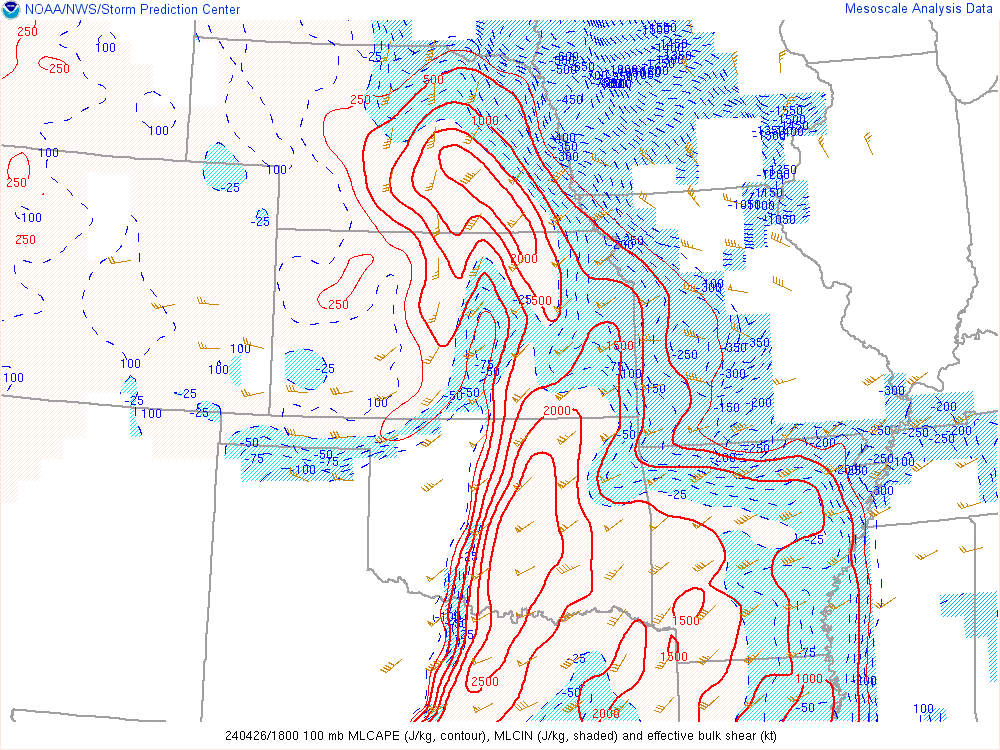
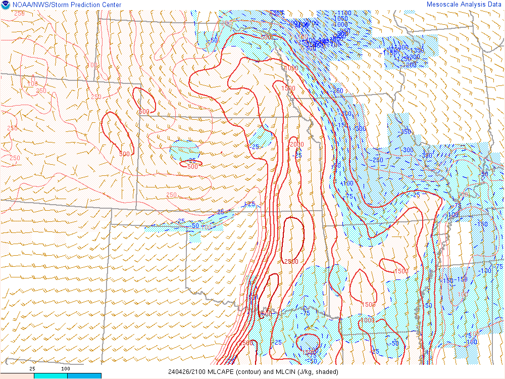
| 18z ML CAPE | 21z ML CAPE | 00z ML CAPE |
 |
 |
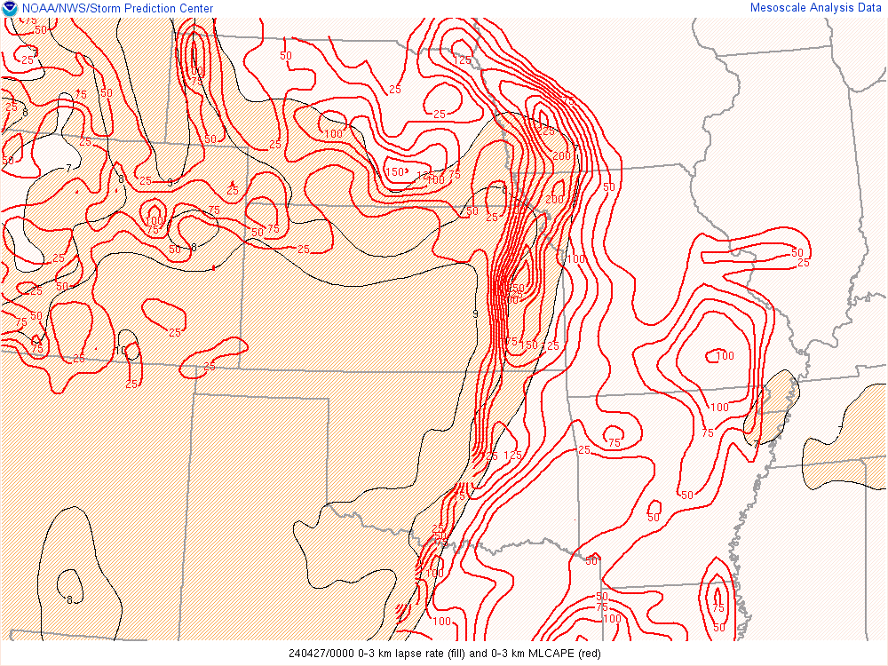 |
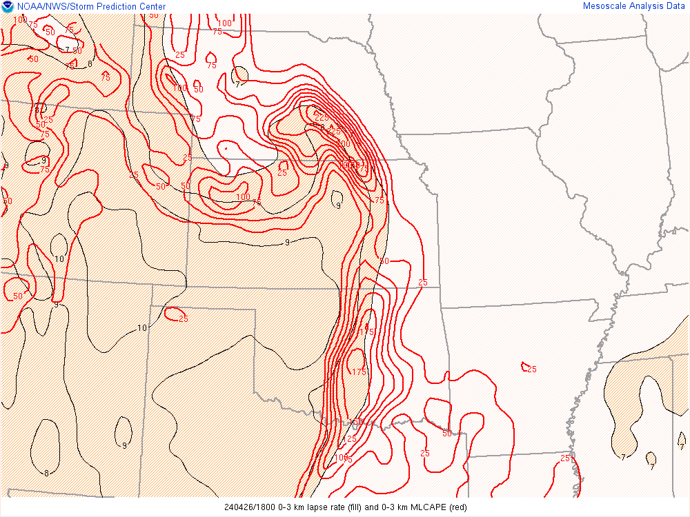
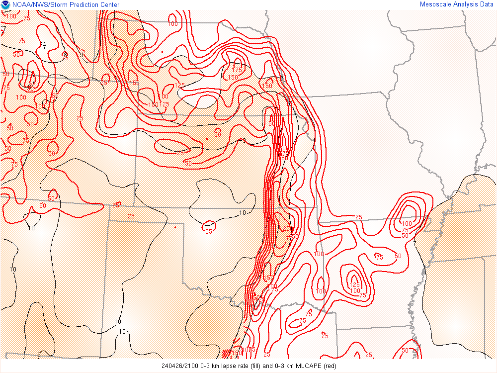
| 18z 0-3km CAPE | 21z 0-3km CAPE | 00z 0-3km CAPE |
 |
 |
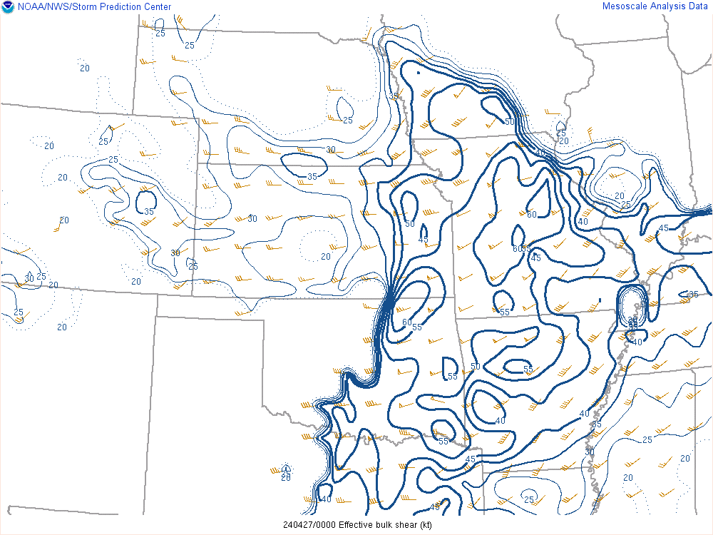 |
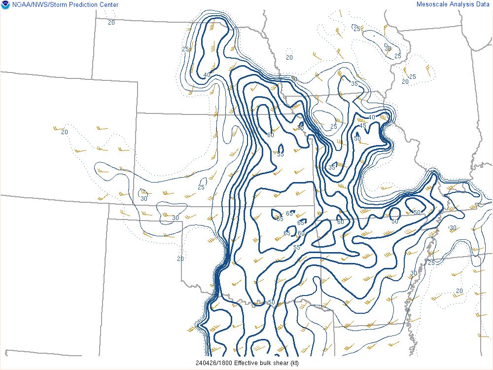
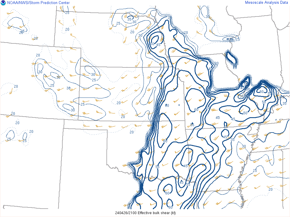
| 18z Effective deep shear | 21z effective deep shear | 00z effective deep shear |
 |
 |
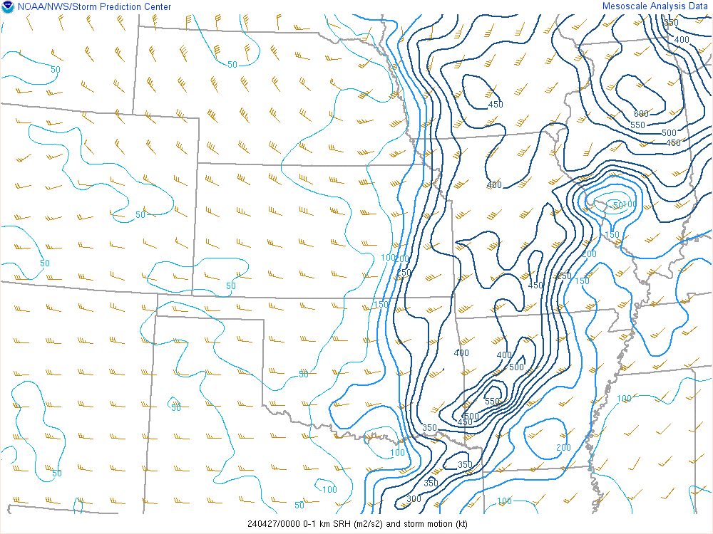 |
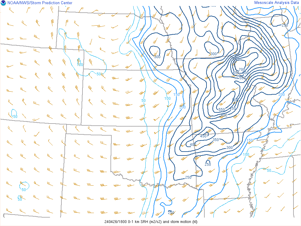
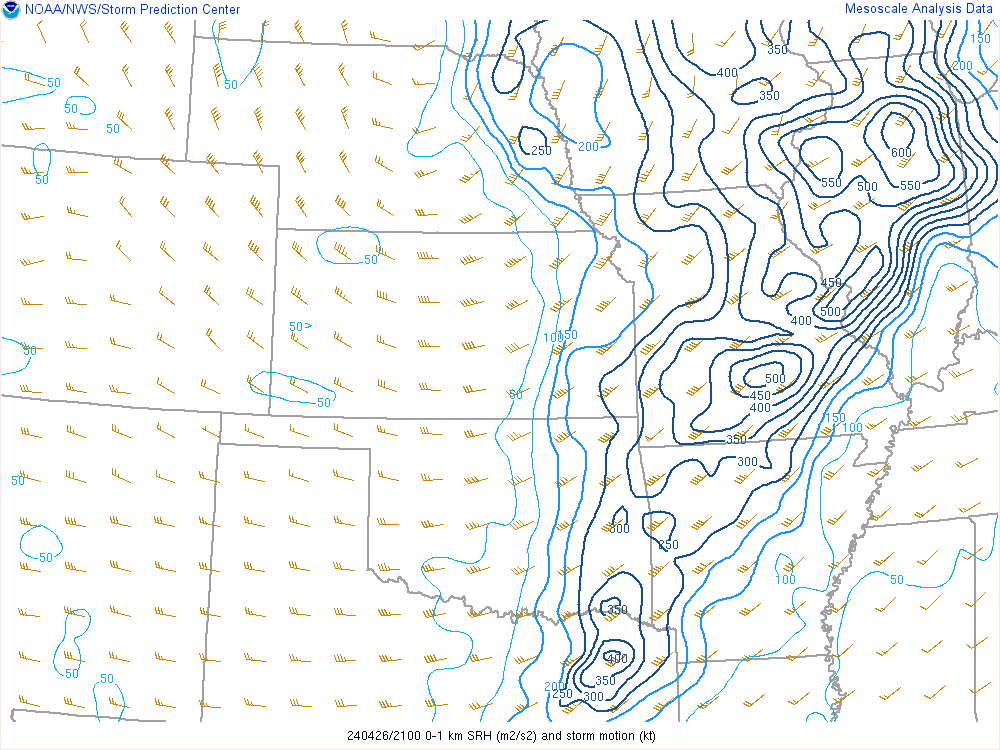
| 18z 0-1km SRH | 21z 0-1km SRH | 00z 0-1km SRH |
 |
 |
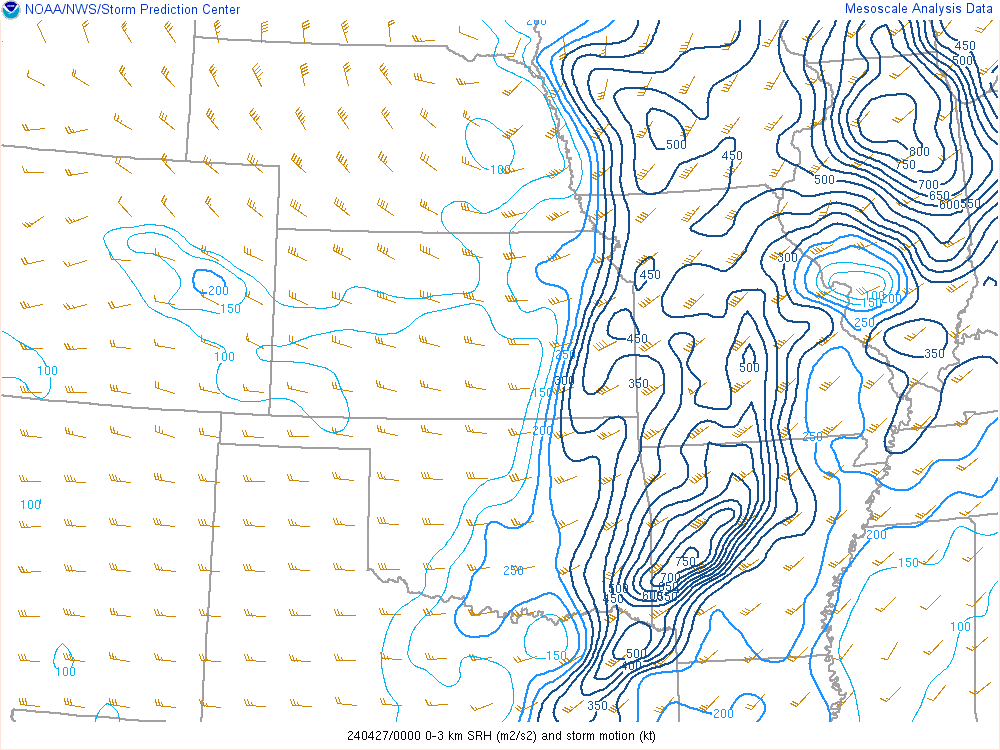 |
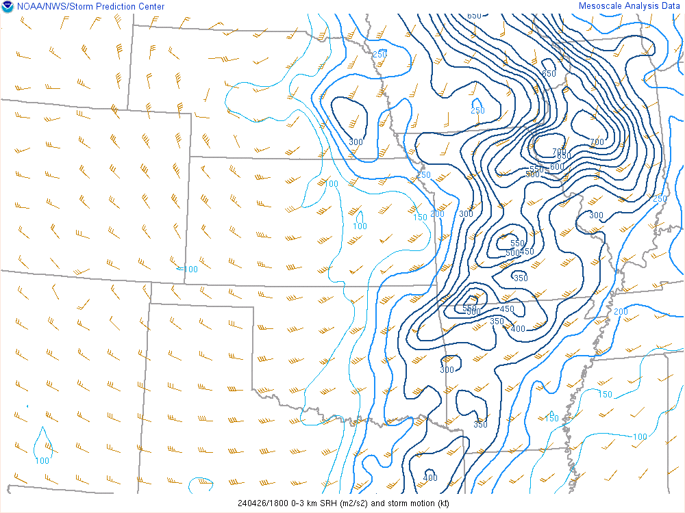
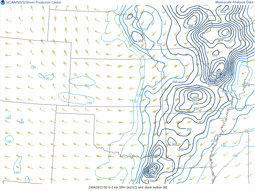
| 18z 0-3km SRH | 21z 0-3km SRH | 00z 0-3km SRH |
 |
 |
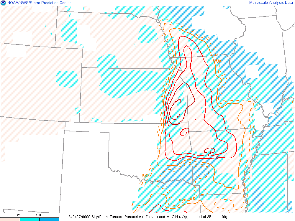 |
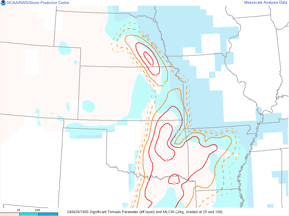
| 18z STP | 21z STP | 00z STP |
| Figure 7: Caption | Figure 8: Caption | Figure 9: Caption |
Radar
|
Radar reflectivity animation |
Storm relative velocity animation |
|
|
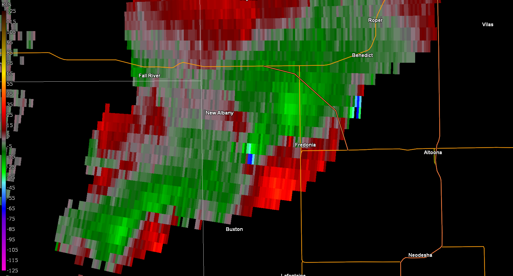
Storm relative velocity from when debris was evident |
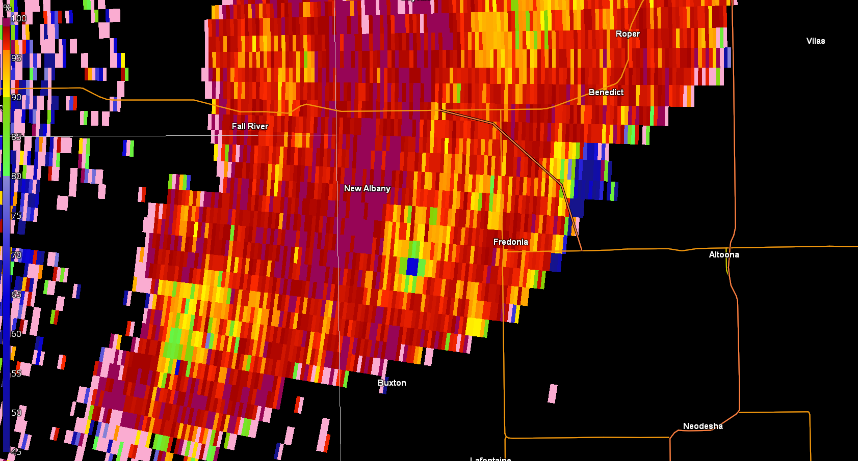
Correlation Coefficient showing debris signature southwest of Fredonia |
 |
Media use of NWS Web News Stories is encouraged! Please acknowledge the NWS as the source of any news information accessed from this site. |
|


.jpg)
.jpg)


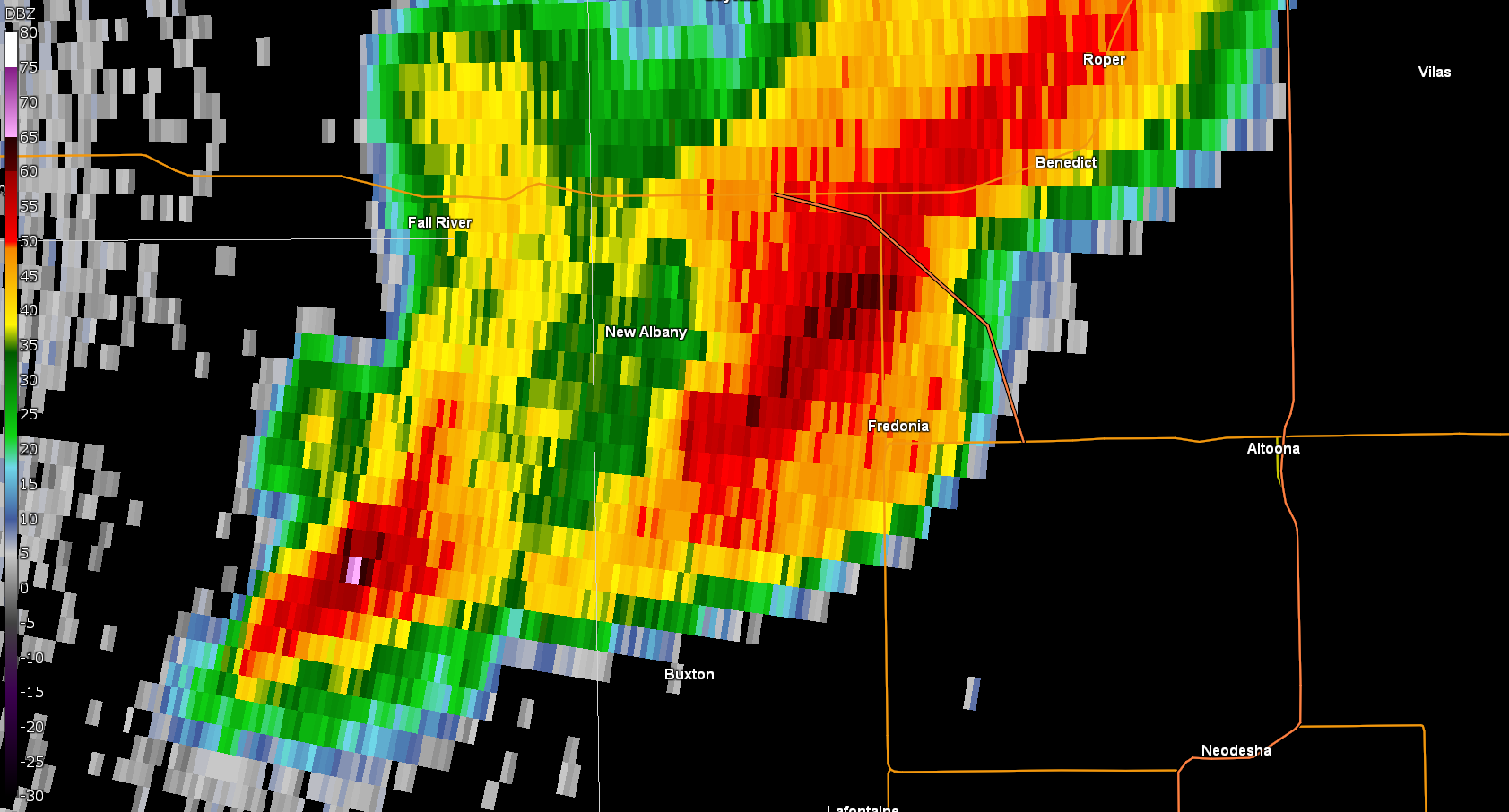 Radar reflectivity from when debris was evident