Record River Flooding of April 2013
Excessive rainfall during the middle of April led to widespread flooding across a large part of northern and central Illinois. Areas from the Chicago metro, southwest along the Illinois River Valley, received 5 to 10 inches over a two day period from the 17-18th. This caused record flooding along portions of the Illinois, Spoon, and Mackinaw Rivers in central Illinois, as well as several rivers in northeast Illinois. The heavy rain shifted southward into southern Illinois and adjacent areas of central Indiana, with moderate to major river flooding in these areas as well.
Overview:
|
|
|
7-day rainfall totals from around the Midwest. Image courtesy of the Midwestern Regional Climate Center. |
A slow-moving storm system dumped copious amounts of rain across central and southeast Illinois during the week of April 15-19th. Rainfall totals between 5 and 7 inches occurred along and west of the Illinois River, as well as further east along a Paris, to Mattoon, to Shelbyville line. Most of the rain fell in a relatively short period of time from Wednesday, April 17th, through Thursday, April 18th. Due to already very wet soil conditions, the excessive rainfall led to widespread flooding of many rural and low-lying areas. In addition, nearly every river across the area exceeded flood stage.
After a late winter and early spring marked by unseasonably cool weather, the pattern made a drastic change on April 15th. The upper-level trough of low pressure that had previously plagued the Great Lakes and Upper Midwest temporarily shifted to the northeast and was replaced by a strong ridge of high pressure across the southeast U.S. This provided a deep-layer southwesterly flow from the Southern Plains to the Great Lakes. Not only did this allow temperatures to climb above normal into the 70s, but it also helped transport large amounts of moisture northward into the area. Upper-air soundings conducted by NWS Lincoln showed precipitable water values rising to around 1.50 inches by Thursday morning. Precipitable water is a measure of the total amount of water contained within the entire depth of the atmosphere, and the 1.50 amount was in the 99th percentile for April 18th. This shows that an unseasonably high amount of moisture was contained within the airmass.
A cold front slowly pushed eastward into this increasingly moist airmass by Wednesday, April 17th; however, the boundary gradually became parallel to the southwesterly upper flow and could no longer move eastward. As a result, the front stalled near the Mississippi River. Showers and thunderstorms developed along and ahead of the stationary boundary and repeatedly "trained" (i.e. moved along the same locations) Wednesday afternoon and night. Many areas along and west of the Illinois River experienced nearly non-stop rain and thunder for several hours on Wednesday, with rainfall amounts reaching the 2 to 4-inch range. The showers and storms finally got a push eastward Thursday morning: however, they weakened considerably as they approached the I-55 corridor.
Showers and thunderstorms re-generated further southeast along and ahead of an outflow boundary on Thursday, April 18th. Once again, thunderstorms tracked from southwest to northeast parallel to the upper-level flow, with cells repeatedly training over the same locations from Shelbyville northeastward to Danville and Paris. Torrential rainfall of 3 to 5 inches fell across this area, resulting in flooding of low-lying areas and rivers across east-central Illinois.
An approaching upper-level trough finally gave the cold front a solid push out of the area by Thursday evening, allowing the persistent rains to gradually taper off and came to an end as a cooler and drier airmass moved in from the northwest. Rainfall from this event was quite impressive, with daily rain records being established at many sites. Peoria set 24-hour rainfall records on Wednesday, April 17th with 2.47 inches, and on Thursday, April 18th with 1.37 inches. Galesburg set a daily record of a whopping 4.16 inches on Thursday, April 18th.
River Stage Crests:
 |
 |
|
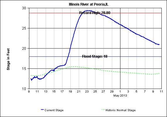
Hydrograph of Illinois River at Peoria |
Hydrograph of Illinois River at Havana |
Here is a list of record river crests from across central and southeast Illinois. This information has not been verified by the U.S. Geological Survey or the U.S. Army Corps of Engineers. Therefore, these crest values should be treated as preliminary.
| Location | Station ID | Highest Stage | Date | Old Record | Date |
| Illinois River | |||||
| Henry | HNYI2 | 32.87 feet | April 22, 2013 | 32.67 feet | March 22, 1979 |
| Peoria | PIAI2 | 29.35 feet | April 23, 2013 | 28.80 feet | May 23, 1943 |
| Kingston Mines | KNGI2 | 26.58 feet | April 24, 2013 | 26.02 feet | May 25, 1943 |
| Copperas Creek | COPI2 | 25.52 feet | April 24, 2013 | 24.70 feet | May 25, 1943 |
| Havana | HAVI2 | 27.78 feet | April 25, 2013 | 27.10 feet | May 26, 1943 |
| Beardstown | BEAI2 | 29.81 feet | April 25, 2013 | 29.60 feet | May 26, 1943 |
| Indian Creek | |||||
| Wyoming | WYGI2 | 23.90 feet | April 18, 2013 | 23.81 feet | June 22, 1974 |
| Spoon River | |||||
| London Mills | LNMI2 | Unknown * | Unknown * | 28.03 feet | June 23, 1974 |
| Seville | SEVI2 | 35.82 feet | April 20, 2013 | 33.10 feet | July 26, 1993 |
| Mackinaw River | |||||
| Green Valley | GNVI2 | 28.48 feet | April 20, 2013 | 28.44 feet | January 16, 2005 |
* - London Mills peak stage missing due to gage malfunction
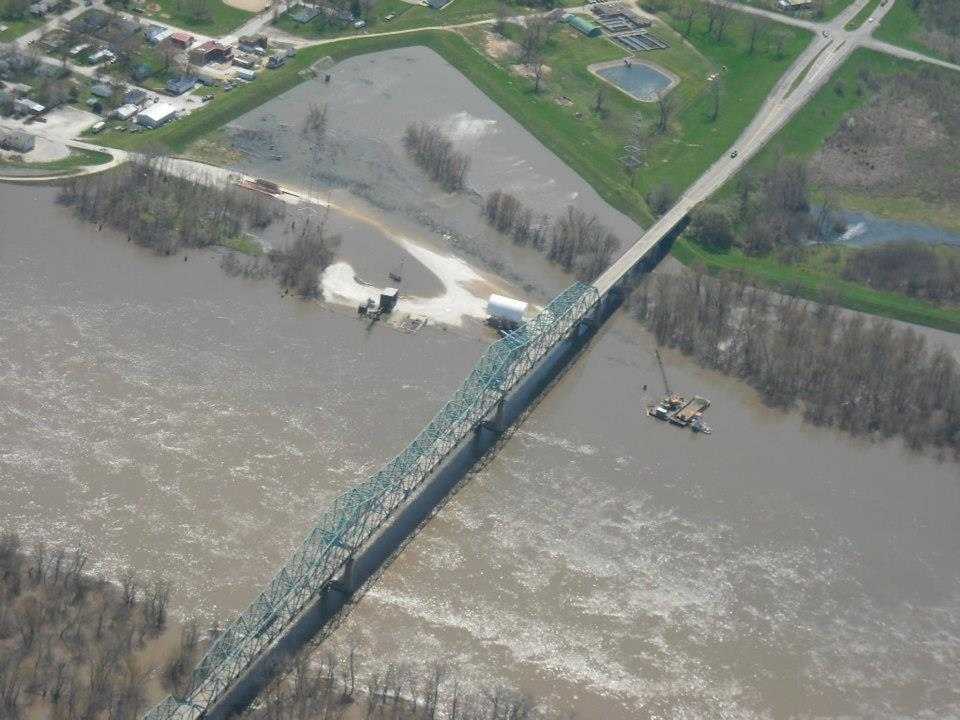
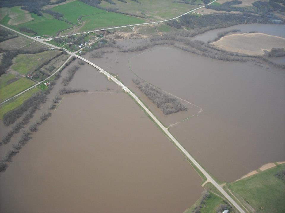
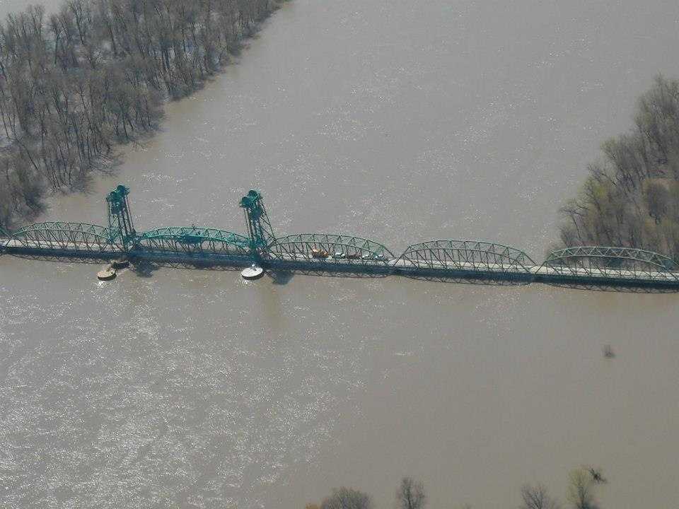
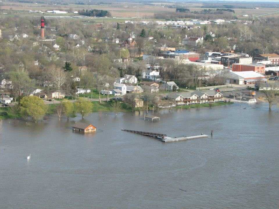
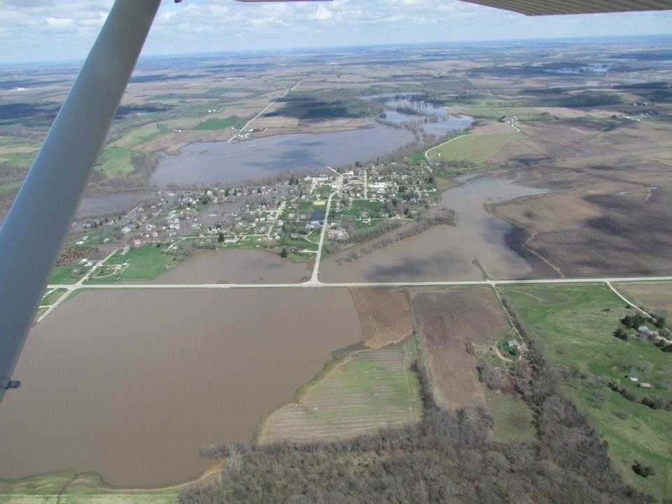
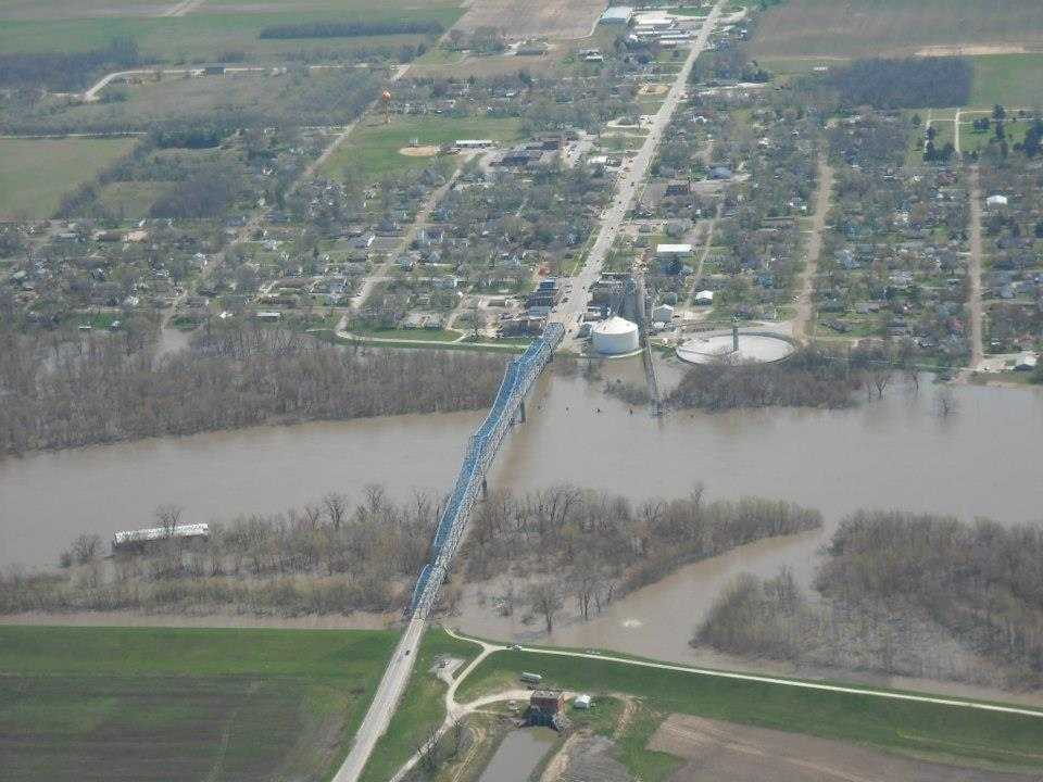
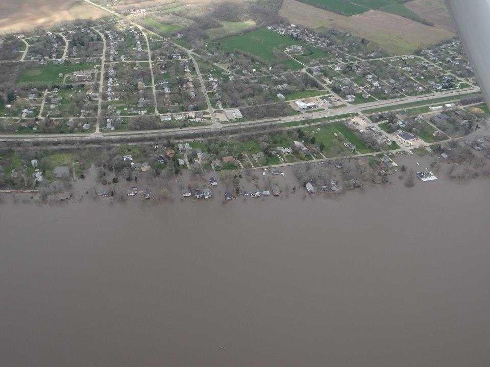
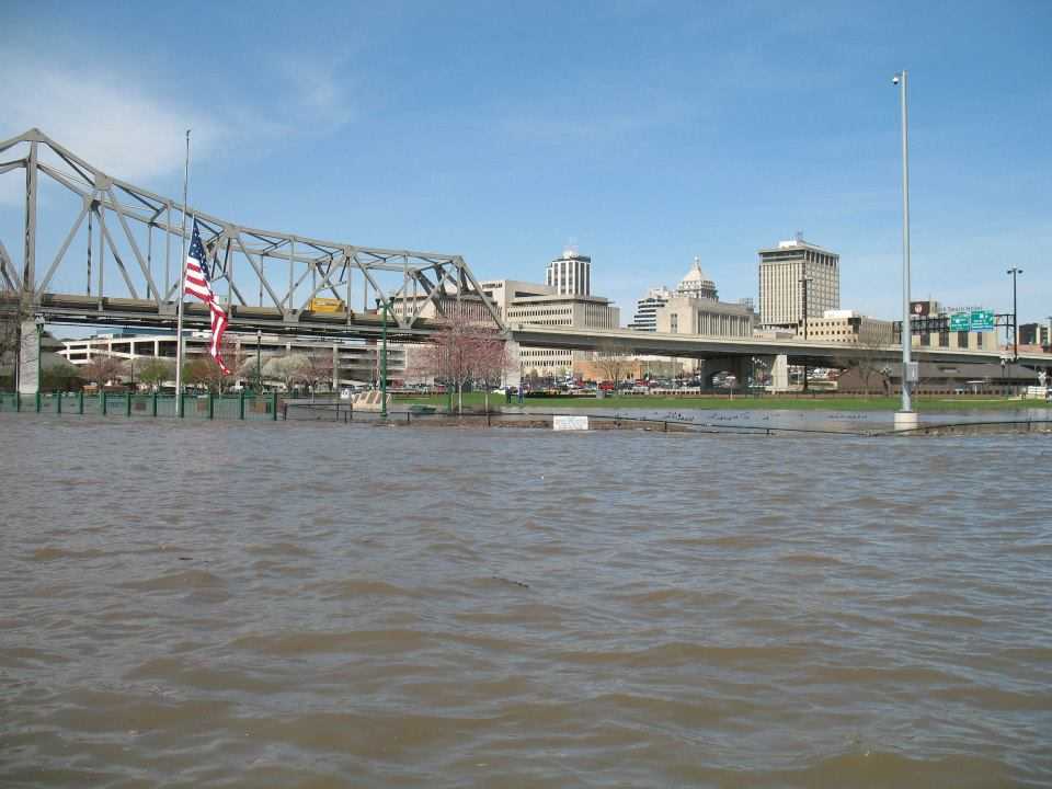
Pictures:
|
|
|
|
|
|
|
|
|
|
|
|
|
|
|
|
|
|
|
|


 Follow us on YouTube