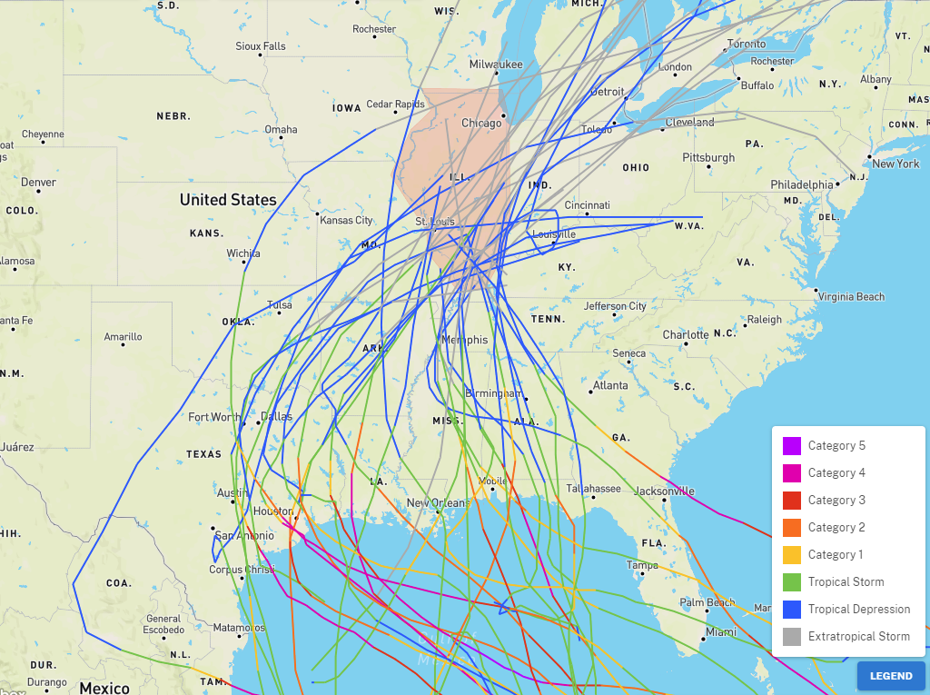
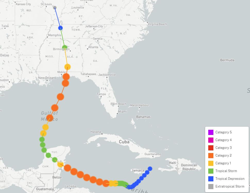
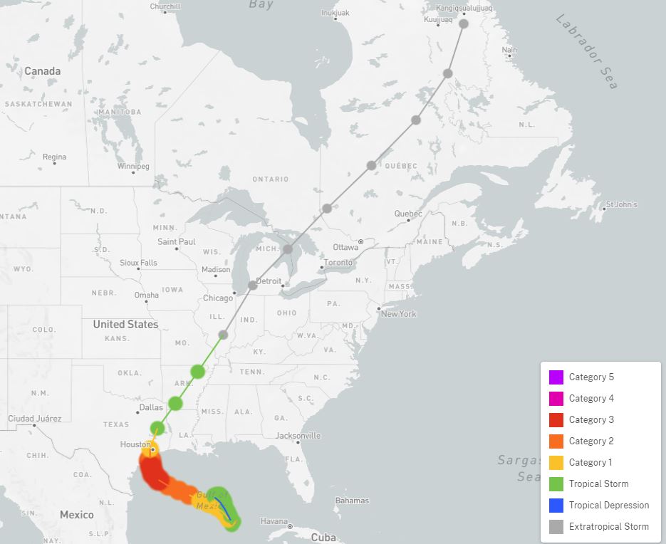
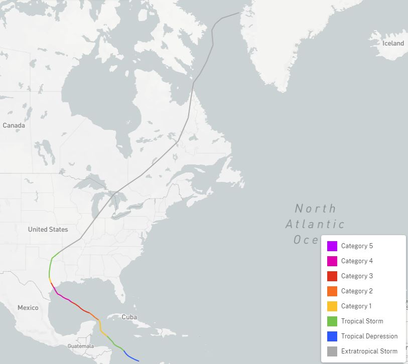
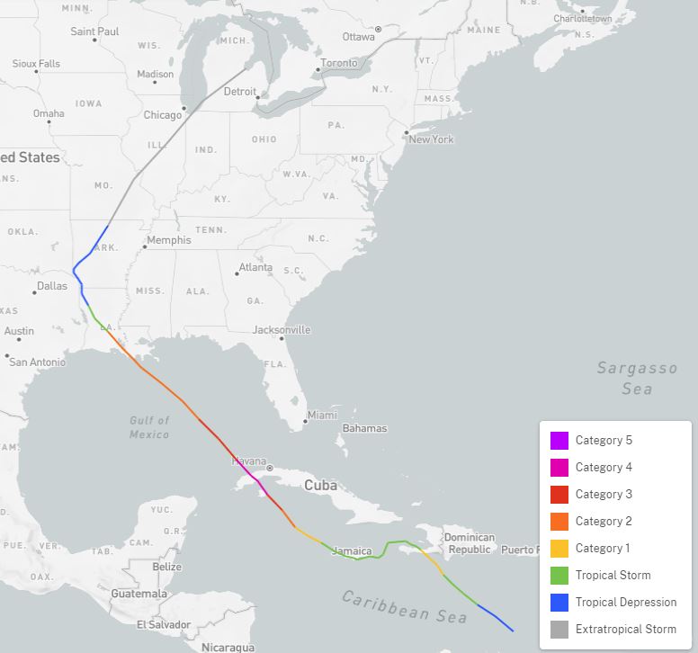
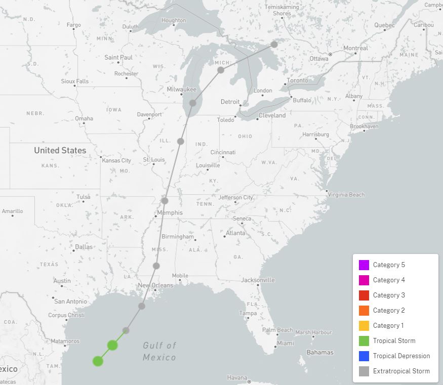
On occasion, the remnants of a hurricane or tropical storm will track across Illinois. The image below, courtesy of NOAA's Office for Coastal Management hurricane mapping system, shows the observed tracks that have occurred within the state between 1850 and 2020. The colors of the lines represent the intensity of the storms, shown by the legend at lower right. Information on the tracks comes from the archives of the National Hurricane Center, as well as NOAA's Historical Hurricane Tracks webpage.
For the most part, such tropical systems make landfall in Texas, Louisiana, or Mississippi before moving up through Illinois. These particular storms maintained an identifiable circulation along the entire track. There have been other systems that have lost the circulation, but the remaining moisture was absorbed by another system moving through the region.
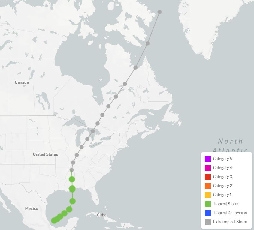
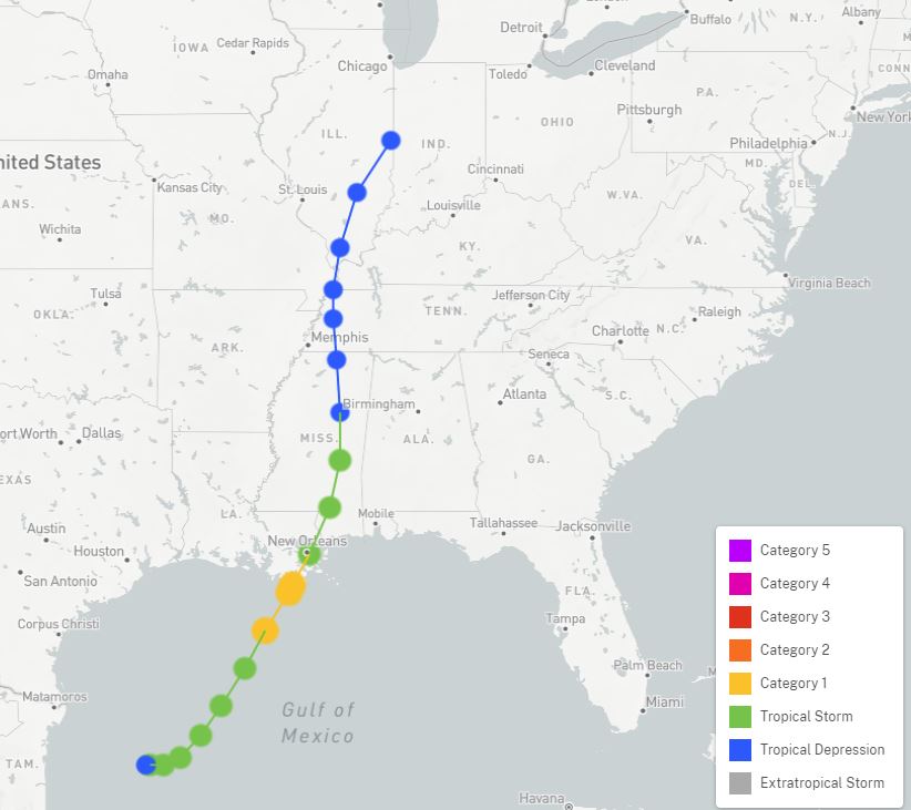
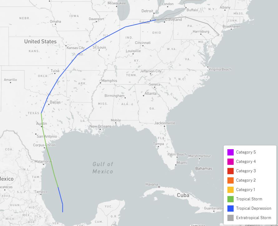
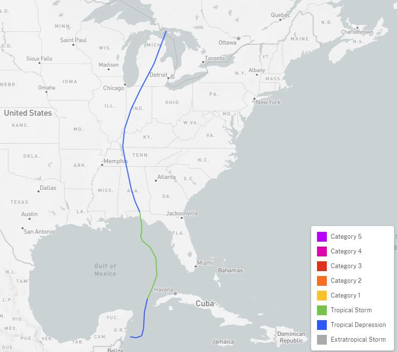
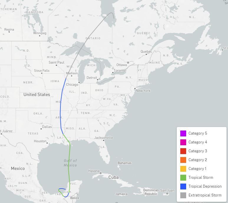
The map below zooms in on Illinois. As one might expect, most systems have lost their tropical characteristics by the time they reach our area (indicated by the gray lines), since they have been long cut off from their fuel source over the Gulf of Mexico or Atlantic Ocean. However, there have been a few still considered to be a tropical depression in our area (blue lines), and a few that made it all the way to southern Illinois as a tropical storm (green line).
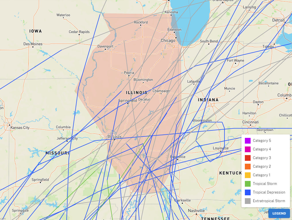
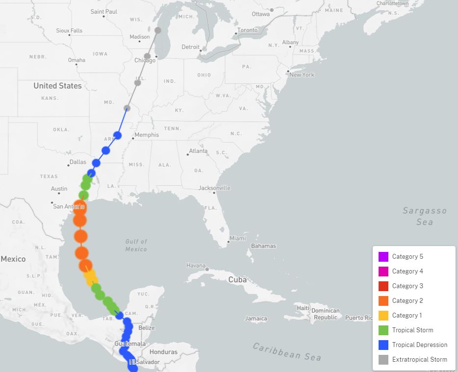
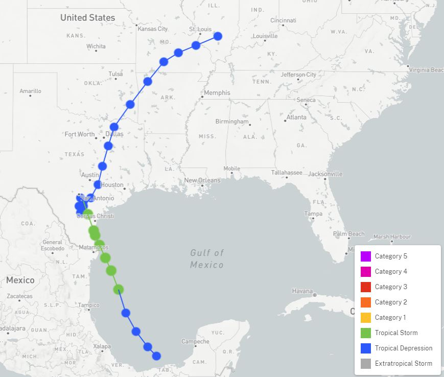
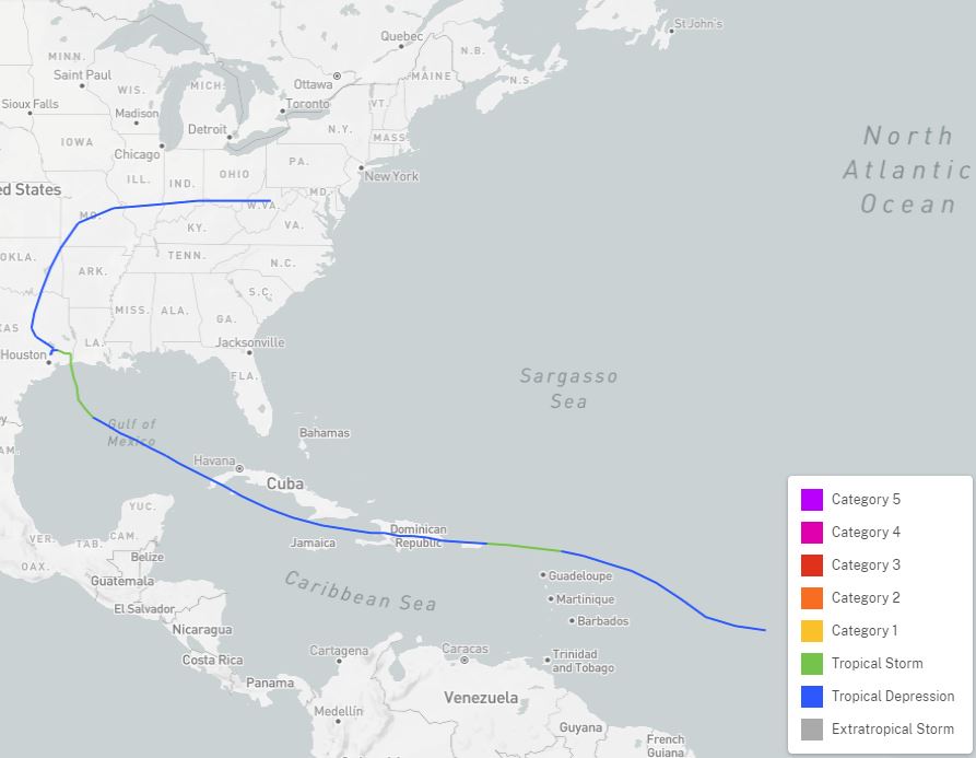
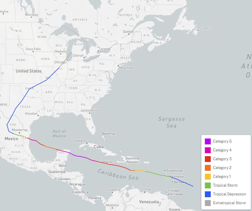
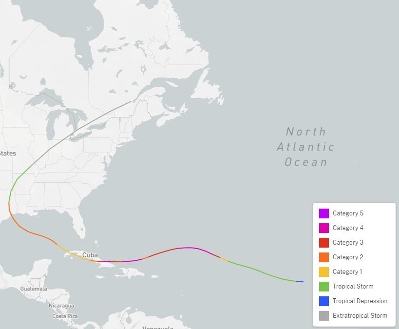
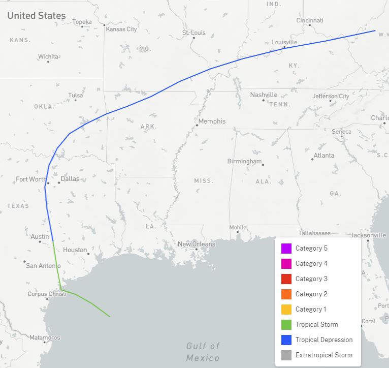
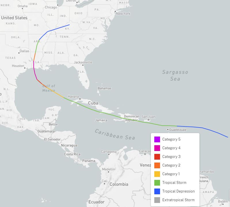
The search identified 33 systems that originated in the tropics, and whose circulation directly moved into Illinois. These are listed below. Clicking on the map thumbnail will show a larger image; click on the storm name to open a separate browser tab with more details on the overall system, including the ability to zoom in on the map.
| Storm Name and Date |
Storm Summary |
|---|---|
|
Hurricane Amanda
|
This storm was named after the USS Amanda, which was serving as part of a blockade by the Union Navy during the Civil War. It was driven ashore on the northwest Florida coast. The remnants tracked along the Wabash River before heading toward northern Indiana. Its effects on Illinois are unknown. |
|
Unnamed Tropical Storm
|
After a landfall as a tropical storm in southwest Louisiana, this system tracked north and passed near St. Louis as a tropical depression before dissipating in central Illinois. Its effects on Illinois are unknown. |
|
1898 Georgia Hurricane
|
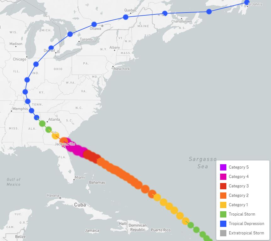
This storm made landfall a short distance north of Jacksonville, FL, as a category 4 hurricane, killing 179 people in Georgia. It tracked northwest, passing just west of Nashville, TN as a tropical depression, before curving north along the Wabash River into northern Indiana. Its effects on Illinois are unknown. |
|
1900 Galveston Hurricane
|
This Category 4 hurricane was the deadliest natural disaster in U.S. history, resulting in between 6,000 and 12,000 fatalities. It made landfall near Galveston, Texas, where most of the casualties occurred. The storm became extratropical over southern Iowa and tracked between Chicago and Madison on the 11th, on its way to the Canadian Maritimes. Aside from some stronger wind gusts, it did not appear to have a significant impact on Illinois. |
|
Unnamed Tropical Storm
|
The first tropical storm of the 1901 season made landfall in the central Florida panhandle, before tracking northwest and dissipating near St. Louis. |
|
1901 Louisiana Hurricane
|
This hurricane clipped the Louisiana Delta region before a second landfall in southern Mississippi. It took an erratic track northward, crossing over far southern Illinois on August 17 while producing 1 to 1.5 inches of rain. |
|
Unnamed Hurricane
|
This hurricane moved northward across the western Gulf of Mexico and made landfall over deep south Texas. It began curving northeast as it passed Dallas and tracked just north of the present I-70 corridor in Illinois as an extratropical system. Heavy rain of 1.5 to 3 inches occurred from near St. Louis east and northeast to the Indiana border. |
|
Unnamed Tropical Storm
|
After moving north over the eastern Gulf of Mexico and making landfall as a tropical storm over the Florida panhandle, this system tracked north-northwest, crossing Illinois from south to north as an extratropical system. Rainfall over the state was generally less than 1/2 inch. |
|
1906 Mississippi Hurricane
|
This hurricane tracked northwest from a landfall just west of the Mississippi/Alabama border, becoming extratropical over southeast Missouri and then curving southeast into Kentucky. |
|
1915 Galveston Hurricane
|
This hurricane made landfall as a low-end Category 4 storm near Galveston, before curving northeast and tracking across far southern Illinois as an extratropical system. Rainfall over 3 inches was observed, iwth a localized area of 6-8 inches closer to St. Louis. Extensive flooding was reported, and significant damage occurred to the corn crop. |
|
Unnamed Hurricane
|
This system made landfall as a category 2 hurricane along the Alabama/Florida border. It tracked north-northwest and entered Illinois near Paducah, KY, as a tropical depression, before dissipating near Mount Vernon. Its remnants brought 1 to 2 inches of rain to most of northern and central Illinois. |
|
Unnamed Tropical Storm
|
Forming over the southwest Gulf of Mexico, this tropical storm made landfall near Gulfport, MS, then tracked northward. It passed over far southeast Illinois as an extratropical system, producing a widespread rainfall of 1 to 2 inches over the eastern half of Illinois. |
|
1926 Nassau Hurricane
|
The remnants of this hurricane, which was at Category 4 strength in the Bahamas, tracked along the Ohio River before heading northeast to Lake Erie. Rainfall exceeded an inch in portions of eastern Illinois. |
|
1932 Florida-Alabama Hurricane
|
This category 1 hurricane made landfall along the Mississippi/Alabama border, tracking northwest to near Memphis before curving north-northeast. Its extratropical remnants passed west of Effingham and Danville before curving northeast. Heavy rain of 2-4 inches occurred over southeast third of Illinois, heaviest along the Wabash River. |
|
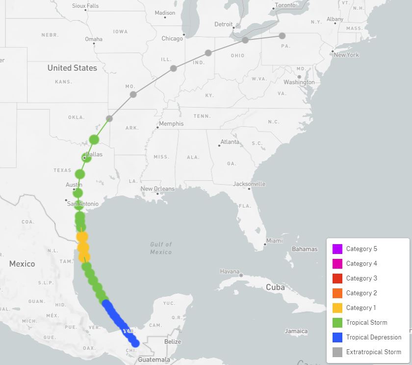
1941 Texas Hurricane
|
This category 3 hurricane made landfall southwest of Galveston, TX, then tracked northeast and caused extensive damage in Houston. It made it all the way into southern Illinois as a tropical storm, before becoming extratropical northwest of Flora. It followed a line through Effingham and Danville. A large area of 1.5 to 2.5 inches of rain occurred along the Chicago to St. Louis corridor. |
|
Hurricane Charlie
|
This hurricane (named by the Air Weather Service, utilizing the phonetic alphabet) made landfall in southeast Louisiana, tracking over New Orleans. It moved northward across eastern Mississippi and reached Illinois as a tropical depression, tracking just east of Carbondale and Effingham, before dissipating near Danville. Heavy rainfall of 1-3 inches occurred from about Effingham southward. |
|
1949 Texas Hurricane
|
This system started as a tropical depression in the Pacific Ocean south of Guatemala, tracking northward through the western Gulf of Mexico. It made landfall as a category 3 hurricane southwest of Houston, then tracked northeast. As an extratropical system, it passed over St. Louis and Springfield before dissipating north of Milwaukee. Widespread rainfall of 1 to 3 inches occurred over Illinois on October 5-6, heaviest across the southern third of the state. |
|
Unnamed Tropical Storm
|
This system made landfall in southern Texas as a tropical storm, then tracked northeast as a depression. The circulation came into Illinois south of St. Louis, tracking just east of Decatur and Bloomington before dissipating near Joliet. Minimal effects were noted in Illinois, although the system may have enhanced severe thunderstorms that occurred in northern Illinois on the evening of the 28th. |
|
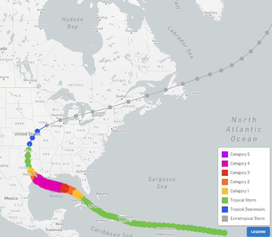
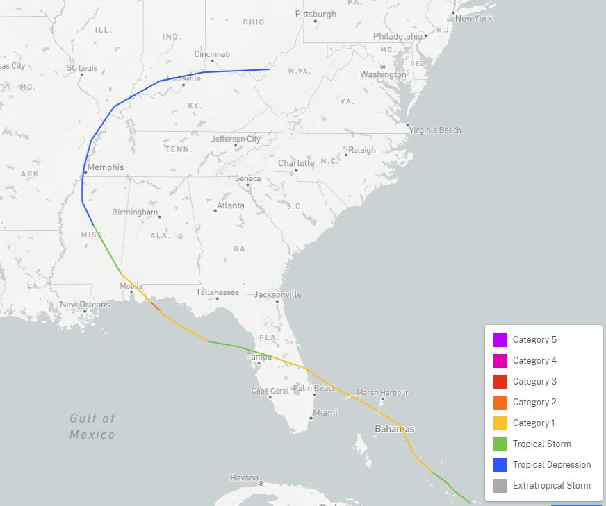
Hurricane Carla
|
This category 5 hurricane weakened slightly before making landfall southeast of Victoria, TX. It became extratropical in southern Oklahoma, then tracked northeast. It tracked just east of the St. Louis to Chicago corridor in Illinois, before moving into Canada. It produced flooding across the northern half of Illinois, especially in northwest, west central, and northeast Illinois. Rainfall totals of 3 to 5 inches were common in these areas. |
|
Tropical Storm Candy
|
This tropical storm made landfall near Corpus Christi, TX, then the remnants moved northeast as a tropical depression just north of Springfield and Champaign. The heaviest rain was centered along a Quincy to Kankakee line. Two-day totals of 3 to 5 inches were common, with some areas close to 7 inches, resulting in flooding. |
|
Tropical Storm Claudette
|
This tropical storm made landfall near the Texas-Louisiana border, and produced a then-U.S. record of 42 inches of rain in 1 day at Alvin, TX. Its remnants tracked across Illinois roughly along a St. Louis to Lawrenceville line. Heavy rainfall of 2 to 4 inches occurred from south central Missouri into central Indiana. Some 3-4 inch totals were observed east and southwest of Effingham. |
|
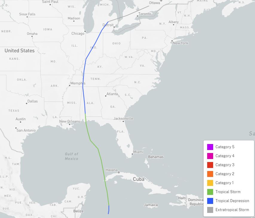
Hurricane Gilbert
|
This hurricane, a category 5 intensity and at one time the Atlantic basin record-holder for lowest barometric pressure, made its second of two landfalls over northeast Mexico, where it killed 202 people. It tracked into north central Mexico before curving northeast, and the depression reached central Illinois before becoming extratropical just west of Mason City. Rainfall generally around 1/2 inch occurred across central Illinois. |
|
Hurricane Erin
|
After the second of two landfalls in Florida, the remnants of Erin tracked just north of the Ohio River as a tropical depression. Rainfall of 1 to 3 inches occurred over southern Illinois. |
|
Tropical Storm Arlene
|
The remnant tropical depression skimmed the Wabash River area of southeast Illinois on the night of the 13-14th, as the storm tracked north/northeast toward lower Michigan. Rainfall amounts over an inch occurred from near St. Louis northeast to near Decatur. |
|
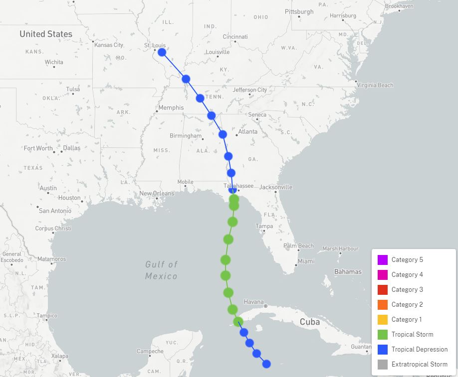
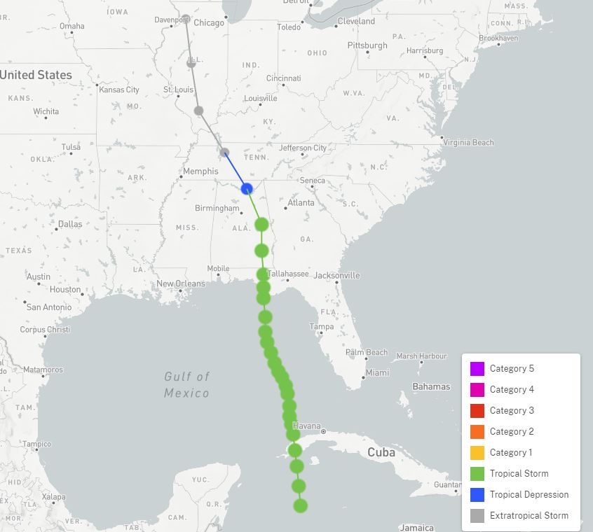
Hurricane Dennis
|
The remnants of Dennis moved into southern Illinois on July 12, with the circulation completing a loop over southern Indiana the next few days before tracking northeast again. Rainfall over far southern Illinois ranged from 1 to 2 inches. |
|
Hurricane Rita
|
A former category 5 hurricane, it made landfall at category 3 strength near the Texas/Louisiana border, killing 113 people in Texas (total U.S. death toll was 120). It curved northeast in Arkansas and moved into southeast Illinois before degenerating into a remnant low northeast of Effingham. Rainfall of 1/2 to 1 inch occurred between I-55 and the Indiana border, which was welcome due to an ongoing drought. |
|
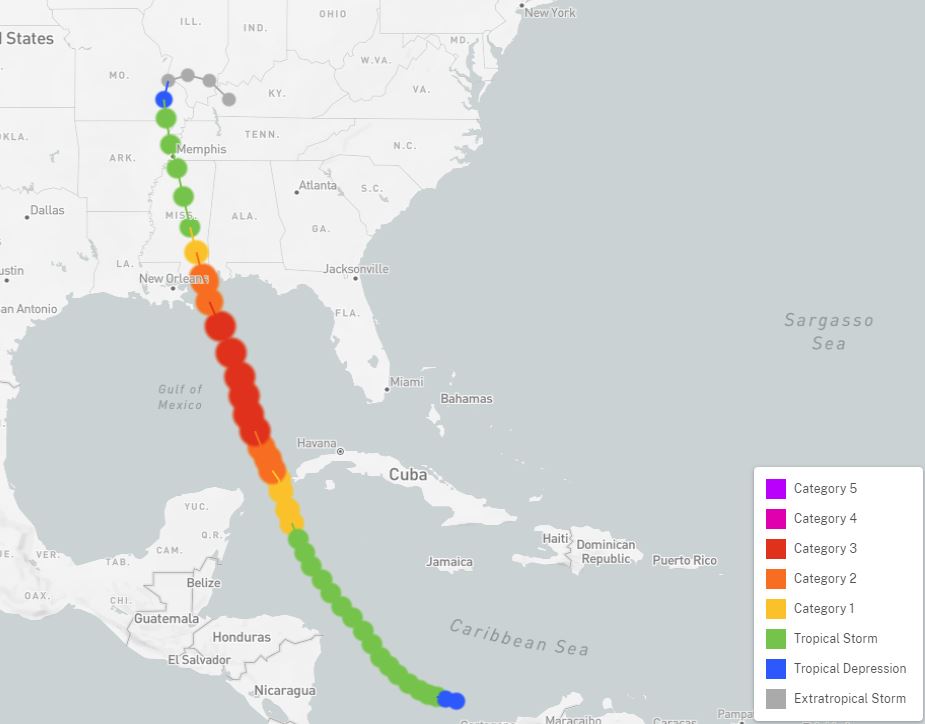
Hurricane Gustav
|
This hurricane made landfall in south central Louisiana at category 2 intensity, and tracked northwest to southwest Arkansas, before curving northeast. The extratropical system passed between Springfield and Decatur before merging with a cold front. Rainfall of 2 to 4 inches was centered along the I-55 corridor. One person in Shelby County was injured by a lightning strike. U.S. damages totaled $4.3 billion. |
|
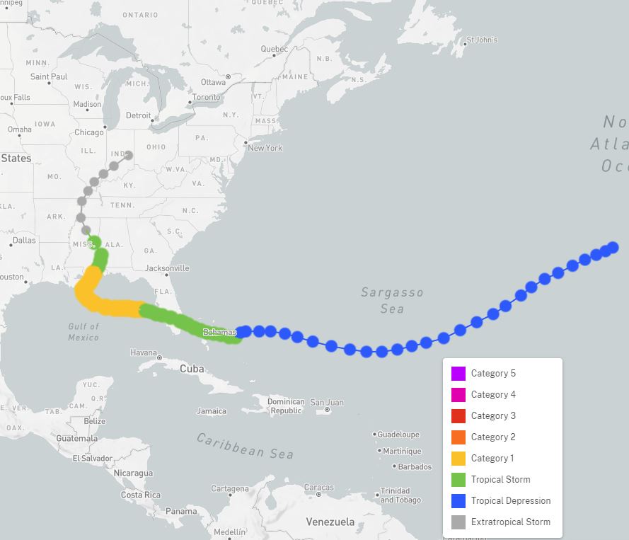
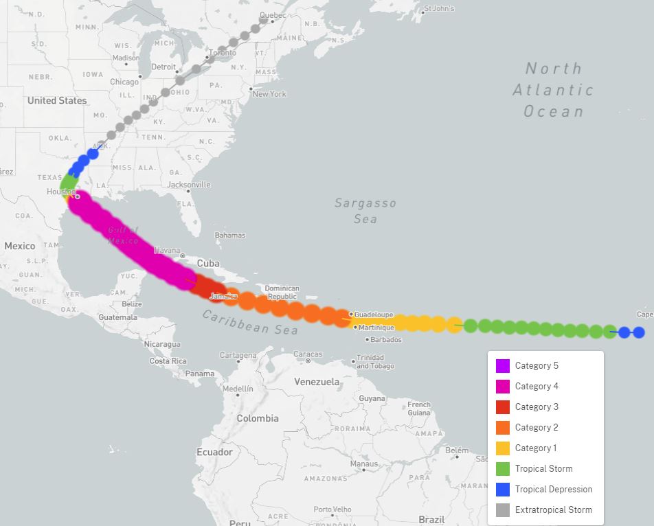
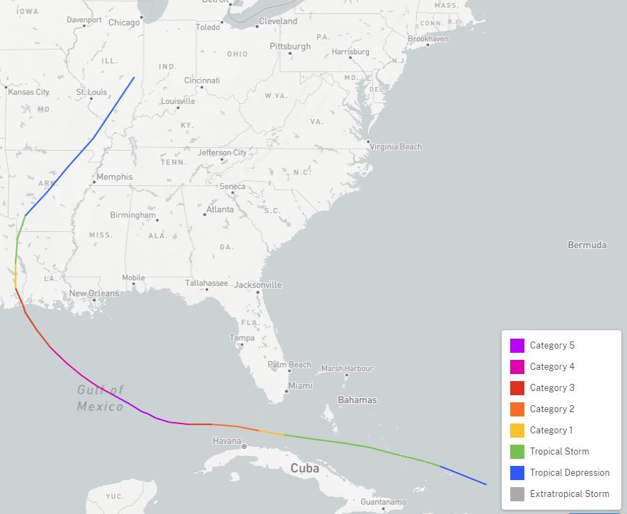
Hurricane Ike
|
After earlier landfalls in Cuba, this hurricane reached the U.S. and hit Galveston, TX. U.S. damages totaled $29.5 billion, ranking it as the 3rd costliest Atlantic hurricane on record. It curved northeast and the extratropical remnants tracked just south of a St. Louis to Champaign line before ultimately dissipating over far southern Quebec. Wind gusts of 50-60 mph occurred over some areas south of I-70 on the 14th. The tropical moisture was absorbed into a frontal system, which produced 4-6 inches of rain from the 13-15th over most of the northwest 2/3 of Illinois, and resulted in flash flooding. |
|
Tropical Storm Bill
|
The remnants of this tropical storm tracked across southeast Missouri and the Ohio Valley. Five tornadoes were spawned over southern Illinois. Click here for details. |
|
Tropical Storm Alberto
|
This storm initially was considered subtropical, but developed enough tropical characteristics to be classified as a tropical storm when it made landfall in the Florida Panhandle on May 28th. It tracked northwest and was still considered a tropical depression as it moved along the Wabash River in southeast Illinois the morning of the 30th. Rainfall of 1.5 to 2.5 inches occurred along the Illinois/Indiana border from near Danville southward, as well as further west from near Springfield north to Rochelle. A weather station west of Sparland (Marshall County) reported 4.26 inches of rain from the storm. |
|
Tropical Storm Olga
|
This tropical storm formed in the northwest Gulf of Mexico, but became embedded in a cold front and quickly turned extratropical. The resulting system accelerated northeast and moved roughly along I-57 in eastern Illinois during the afternoon of October 26th. Widespread rainfall of 1.5 to 2.5 inches occurred over much of central and eastern Illinois. |
|
Tropical Storm Cristobal
|
Tropical Storm Cristobal formed from the remnants of eastern Pacific Tropical Storm Amanda, and emerged off the Yucatan Peninsula on June 5th. It made landfall near New Orleans, and held together as a tropical depression all the way to Dubuque, Iowa, by the afternoon of the 9th. Most of the heavy rain impacts remained along and west of the Mississippi River, but it did produce wind gusts of 40 to 50 mph in central Illinois. |
|
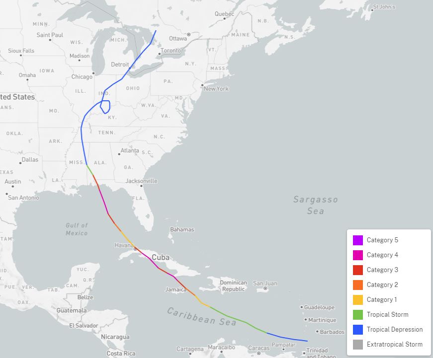
Hurricane Laura
|
Laura made landfall as a Category 4 hurricane in southwest Louisiana, then tracked north before beginning a northeast curve along the Ohio River as a tropical depression. Rainfall along the Ohio Valley was less than an inch. |


 Follow us on YouTube