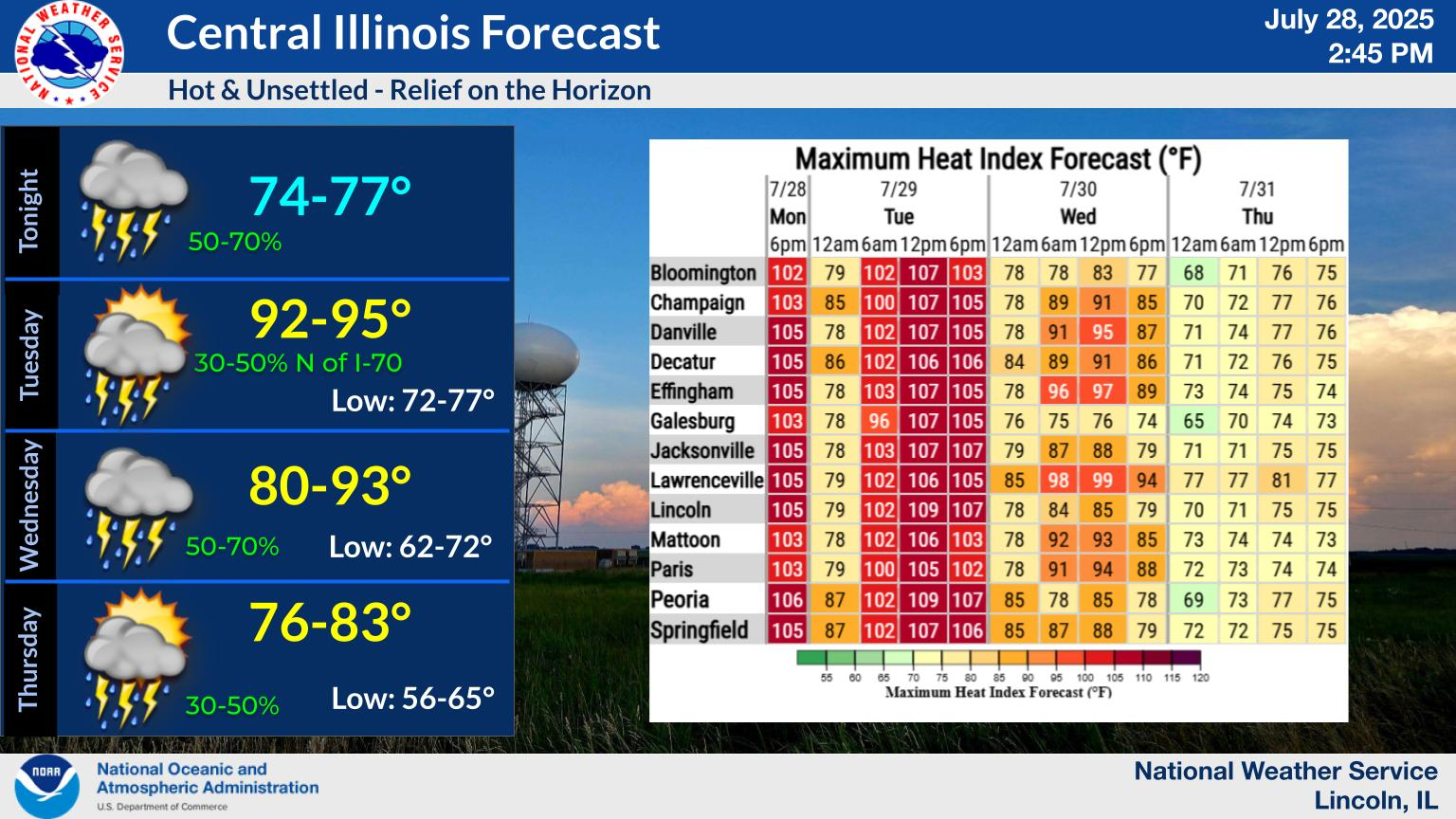
National Weather Service United States Department of Commerce

Snow will arrive in the area this afternoon. By late evening, most locations should see 2 to 4 inches of accumulation. High temperatures will be in the upper 20s to lower 30s today, mid 20s to around 30 Tuesday, the 30s Wednesday, then much colder air will arrive. Lows will range from a few degrees below zero to the teens Wednesday night and Thursday night. Highs Thursday will range from lower teens to mid 20s. The coldest temperatures will be north of I-72 and the warmest temperatures will be south of I-70.
Snow will return to the area this afternoon and continue into evening. Snow will develop early in the afternoon west of I-55, extending southeastward past the I-70 corridor by late afternoon or early evening. Highest accumulations of 3 to 4 inches look to be from I-72 northward, but most areas should see between 2 and 4 inches. Snow covered, slippery roads can be expected during the evening commute, and may linger into Tuesday morning. Allow extra travel time, slow down, and increase following distance between you and the vehicle in front of you.