
Critical fire weather conditions, severe thunderstorms capable of producing severe wind gusts, large hail, strong tornadoes and heavy rainfall remain on tap for the central U.S. this evening. Flash flooding is also possible for portions of the Plains and Mississippi Valley. Very large hail up to 3 inches in diameter will be possible this evening across western Kansas. Read More >
Six Tornadoes Affect Northern Indiana
April 20, 2004
National Weather Service Lead Time with the Tornadoes
(How long before touchdown the NWS got the warning out):
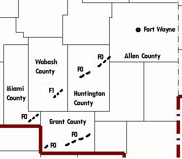
Miami County...12 minutes
Grant County...16 minutes
Huntington County...24 minutes
Wabash County...53 minutes
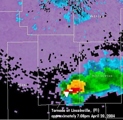
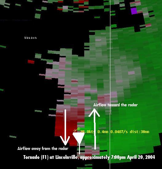
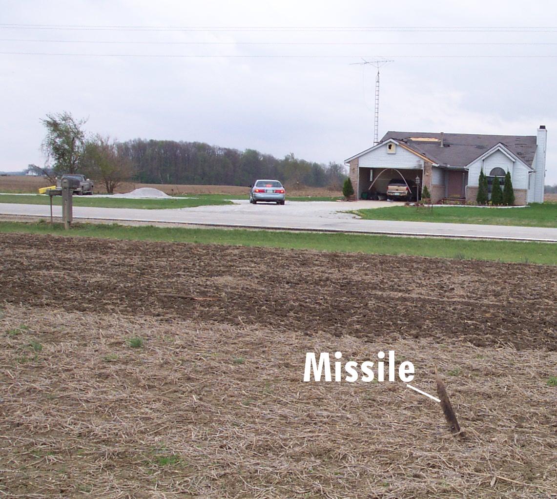
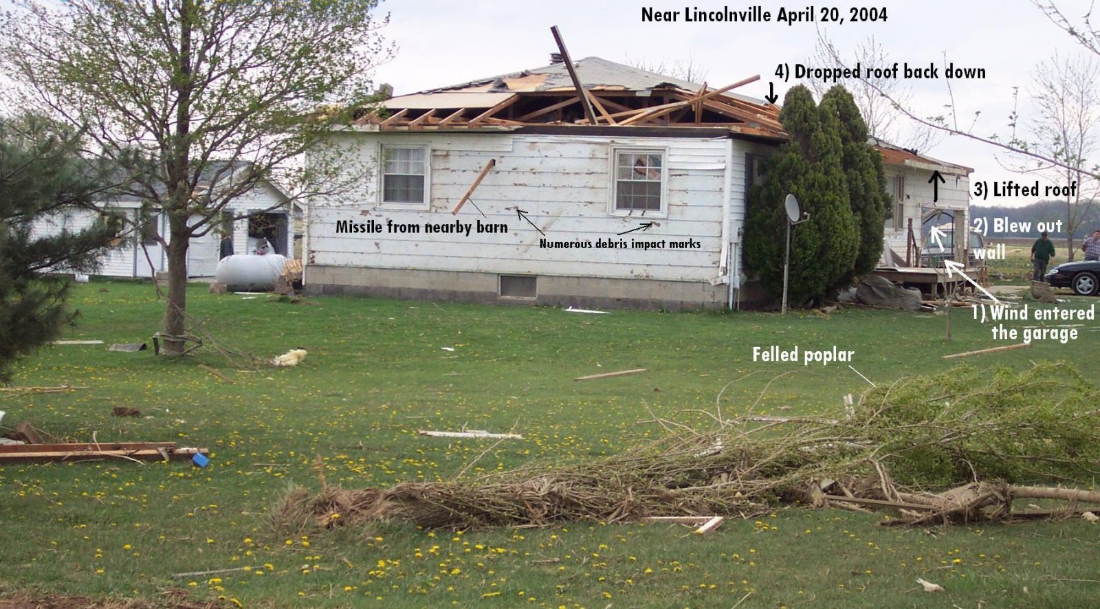
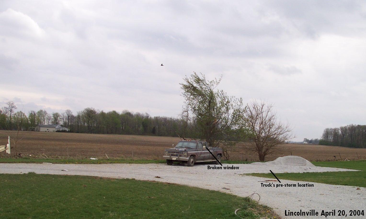
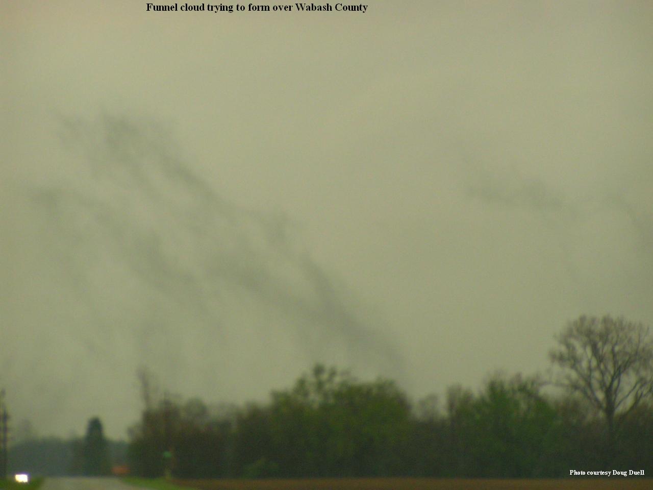
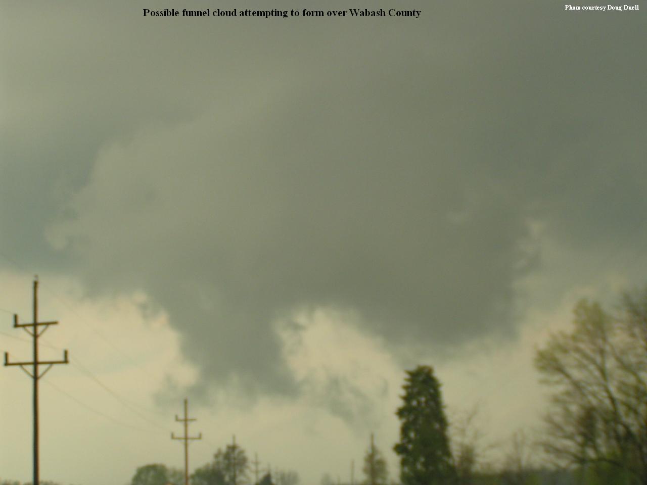
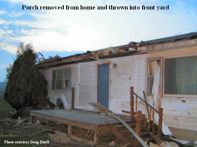
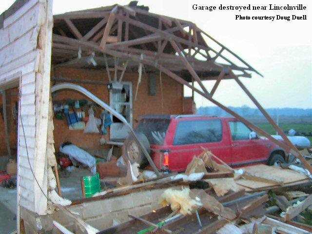
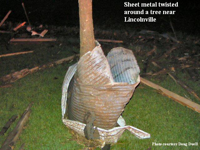
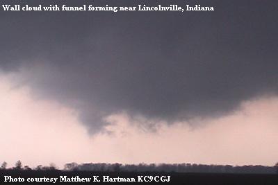
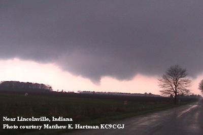
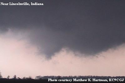
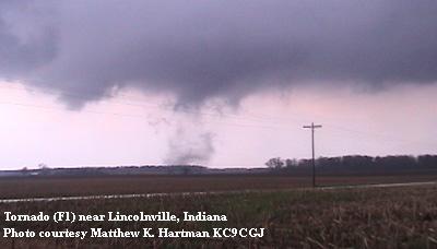
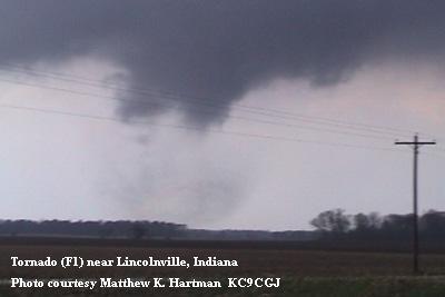
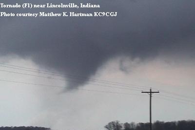
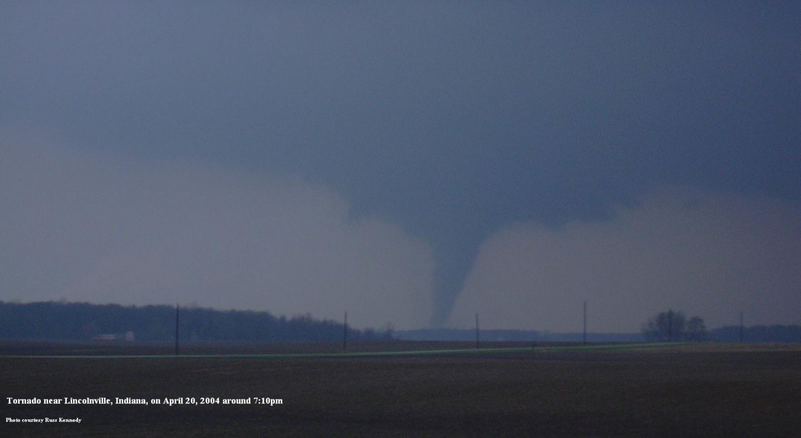
Wabash County
F1, skipping (not in contact with the ground at all times)
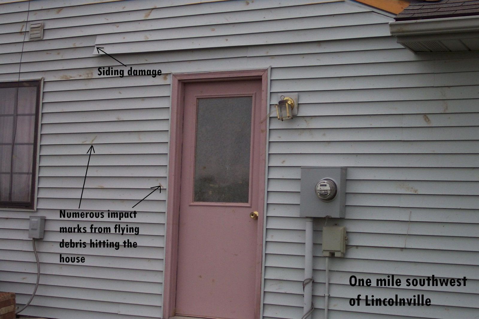
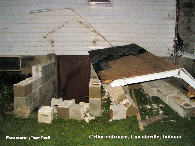
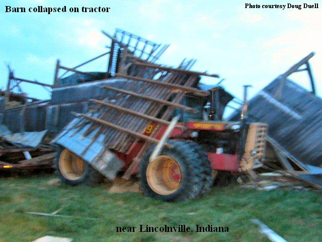
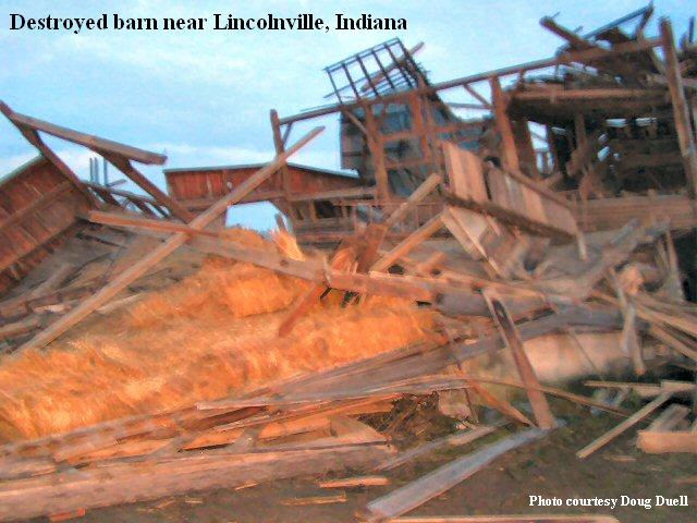
Touchdown at 7:08pm one mile southwest of Lincolnville
Two mile path length
150 yards wide
Two homes heavily damaged, one barn destroyed
Huntington County
Tornado #1:
F0, skipping (not in contact with the ground at all times)
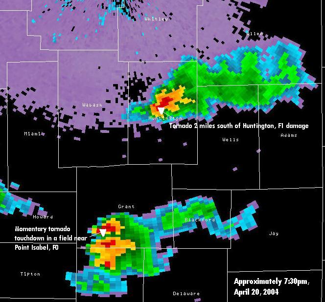
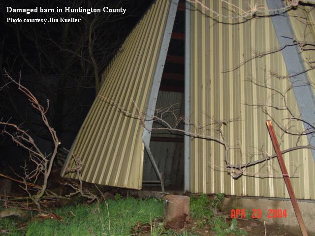
Touchdown at 7:25pm five miles southwest of Huntington.
Three and a half mile path length
50 yards wide
Five houses damaged, tree damage
Tornado #2:
F0, skipping (not in contact with the ground at all times)
Touchdown approximately 7:40pm two and a half miles east of Huntington. Lifted two miles southeast of Roanoke.
Six mile path length
50 yards wide
Tree damage
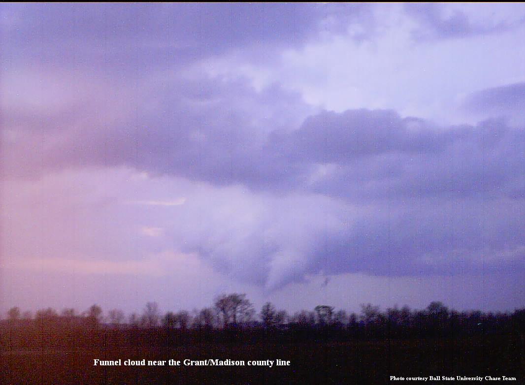
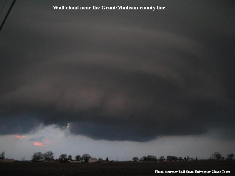
Grant County
Tornado #1: F0, touched down for a moment in a field, no damage, at Point Isabel. Touched down at 7:31pm.
Tornado #2: F0, skipped (not in contact with the ground at all times) from two miles west of Fairmount to Upland. Power lines blown down. Touched down at 7:26pm.
Miami County
F0, skipping (not in contact with the ground at all times)
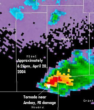
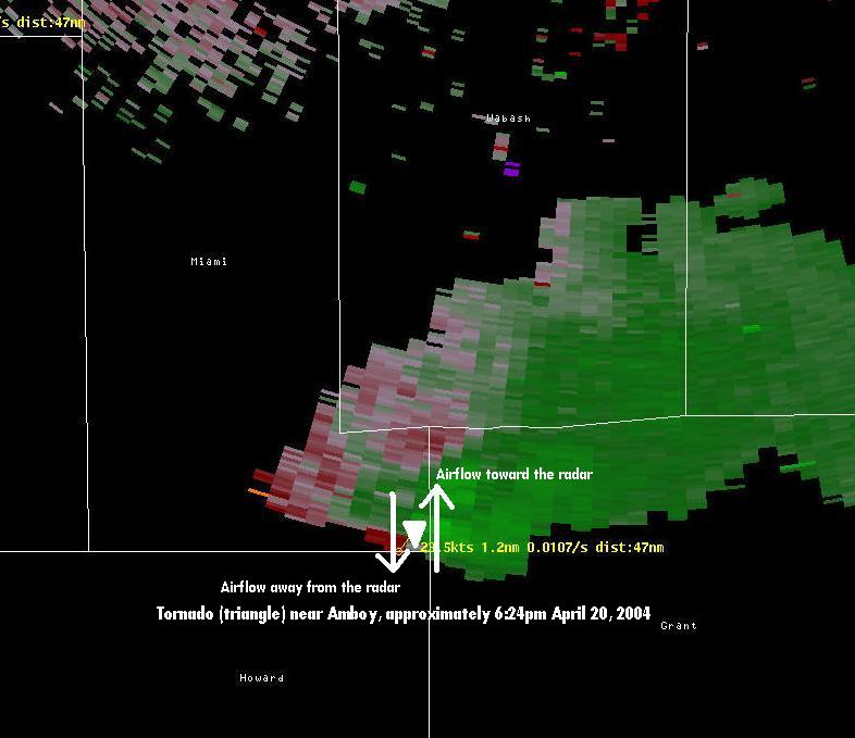
Touchdown at 6:24pm near Amboy
One mile path length
50 yards wide
Event Overview
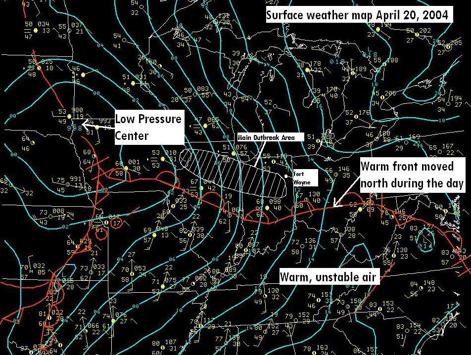
A warm front, located across central Indiana during the afternoon hours began to move north as a strong southerly flow rode over the warm front, creating an favorable environment for rapid thunderstorm development along and just south of the front. Favorable wind shear existed along the boundary ( east to southeast surface winds north of the boundary, south to southwest surface winds just south of the boundary), leading to the rapid evolution of the storms into rotating supercells responsible for the severe weather reports received during the late afternoon and early evening hours.
One storm, which was responsible for most of the severe weather, moved into southern Miami County, from the Kokomo area, where emergency officials reported a brief touchdown near Amboy. The storm quickly moved into southern Wabash County. Reports of funnel clouds were received south of Wabash, with one of these funnels eventually touching down about a mile southwest of Lincolnville, causing damage to several homes and a barn in the area. Another brief touchdown was reported as the storm moved through Huntington County, just south of the city of Huntington. The storm continued across the county, with another report of a tornado touchdown noted just to the southeast of Roanoke. Reports of funnel clouds were received as this storm tracked across the northern part of Fort Wayne, however, there were no reports of touchdowns or damage there.
Flooding of roads near Spy Run Creek was reported as the storm dropped over an inch of rain in about a half hour. The storm then began to weaken as it encountered less unstable air well north of the warm front.
Another storm produced a brief tornado touchdown at Point Isabel in Grant County (10 miles west of Fowlerville). No damage was reported from this touchdown. Damage reports were received near Upland, where approximately 100 yards of power lines were blown down. Penny size hail was also reported in Gas City with this storm.
Pictures
 |
 |
 |
 |
 |
 |
(garage door found in a field a mile away) |
 |
 |
 |
 |
|
 |
 |
 |
 |
 |
 |
 |
 |
 |
 |
 |
 |
 |
 |
 |
 |
 |
 |
 |
 |
 |


 Follow us on YouTube