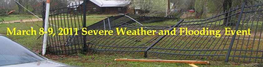
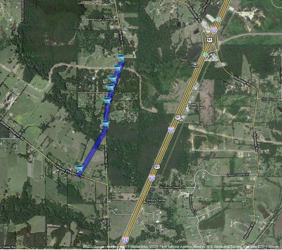
March 9, 2011 Terry MS Tornado
Click on Map Below for More Details
|
Event Summary The tornado first touched down along Lebanon-Pinegrove Road and then tracked north-northeast following a path along Terry Road. Numerous hardwood trees were uprooted and snapped in a convergent pattern and several sheds and a carport were damaged or destroyed. Some of the trees fell across a power line bringing the line and a power pole down. Several houses sustained minor damage and one well built brick house had significant damage to the roof. At the same location where the significant roof damage occurred...a steel gate was torn from its hinges and heavy metal fencing was blown down.
|
|


 Follow us on YouTube