During the early afternoon of 2 August, a strong thunderstorm produced a wet microburst over Pensacola, Florida between approximately 1230 and 1245 PM. The feature produced wind gusts measured as high as 49 mph just west of Pensacola Regional Airport. There were numerous reports of powerlines and some power poles that were downed during this time frame. The Mobile-Pensacola National Weather Service (NWS) began highlighting the relatively higher wet microburst threat as early as 1110 AM CDT when they issued an Area Forecast Discussion Update. In that product, they explained how unstable the air was becoming over the region just southeast of I-65 and along the coast.
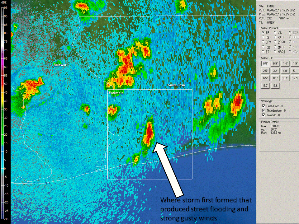
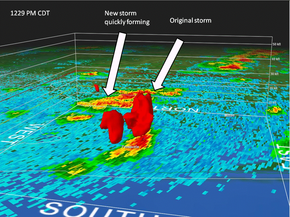
Clouds quickly developed into a thunderstorm between approximately 1200-1220 PM. Figure 1 is valid at 1225 PM CDT and shows the thunderstorm near the time of its peak updraft intensity but prior to the strongest down rush of winds to the ground (according to radar and public reports). As strong gusty winds began to develop after 1230 PM (according to numerous public reports stating this time frame was the peak of the event), another thunderstorm quickly formed on the outflow from the previous storm (see Figure 2). Around 1228 PM CDT, the National Weather Service issued a Special Weather Statement highlighting wind gusts up to 55 mph for coastal Escambia County Florida with this storm.
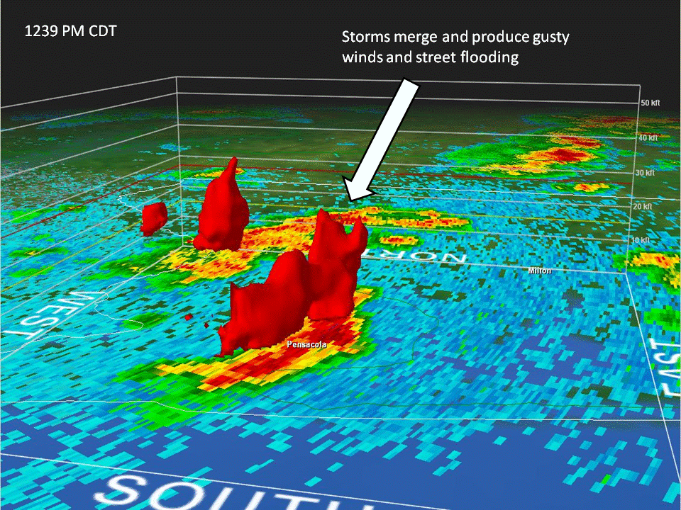
Finally by 1239 PM CDT, the two thunderstorms merged (see Figure 3) to produce additional extremely heavy rainfall which later caused area street flooding (according to publish officials and public reports). An Urban Flood Advisory was issued around 102 PM CDT for the rainfall runoff that was expected. Reports as high as 2” were received, and radar estimated that as much of three inches could have fallen near where the storms merged.
In a continuing effort to make its citizens aware of the products that are issued by your local NWS office during an event such as this, NWS Mobile-Pensacola wishes to emphasize the difference between the Special Weather Statement and the Severe Thunderstorm Warning. The former product can be used to highlight the potential for winds up to around 57 mph (as was the case on this day). The Severe Thunderstorm Warning is issued when winds of greater than 57 mph are expected. The storm that formed over Pensacola that day was not very intense with regard to some its precursor signatures (i.e., there were much stronger storms elsewhere and even one that formed later requiring the issuance of a severe thunderstorm warning had more intense precursor signatures. We should point out that it is important to equally heed Special Weather Statements when they are issued because they are often a precursor to the issuance of a warning and can elicit greater public awareness.

