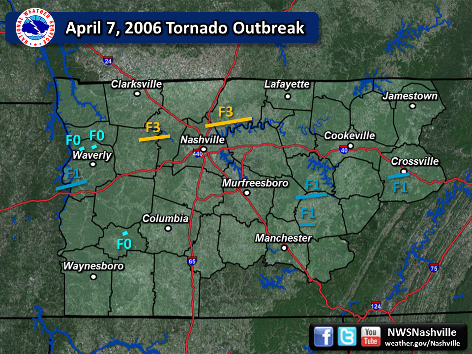
| Tornado Statistics | ||||||||
| # | Counties | Rating | Time (CST) | Length (miles) | Width (yards) | Fatalities | Injuries | |
| 1 | Humphreys | F0 | 1149 | 0.20 | 20 | 0 | 0 | |
| 2 | Humphreys | F0 | 1158 | 0.20 | 20 | 0 | 0 | |
| 3 | Dickson/Cheatham | F3 | 1225 | 15.10 | 880 | 0 | 0 | |
| 4 | Humphreys | F1 | 1302 | 11.00 | 100 | 0 | 0 | |
| 5 | Davidson/Sumner | F3 | 1306 | 23.75 | 880 | 7 | 128 | |
| 6 | Lewis | F0 | 1343 | 0.30 | 100 | 0 | 0 | |
| 7 | Cannon/Warren | F1 | 1545 | 11.00 | 150 | 2 | 0 | |
| 8 | Cumberland | F1 | 1646 | 9.00 | 150 | 0 | 4 | |
| 9 | Warren | F1 | 1728 | 5.42 | 100 | 1 | 0 | |
| Reports & Outlooks | |||
| SPC Storm Reports | SPC Day 1 Outlook | SPC Event Archive | |
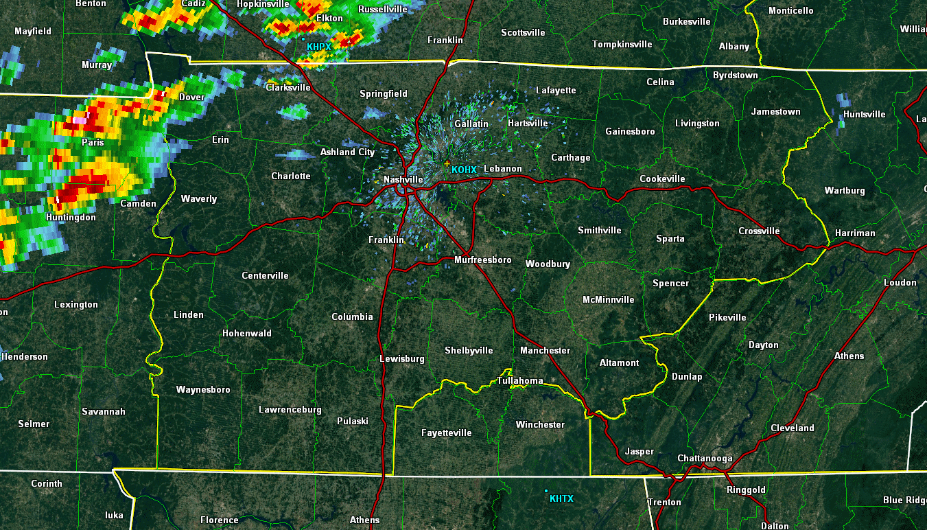
| Original April 7, 2006 Webpage | OHX Base Reflectivity Radar Loop - 11 AM CST to 122 PM CST | ||
| F0 Humphreys County Tornado | |
| Counties: | Benton |
| Time: | 11:49 AM CST |
| EF Scale: | F0 |
| Damage Path Length: | 0.20 miles |
| Damage Path Width: | 20 yards |
| Fatalities: | 0 |
| Injuries | 0 |
| Damage: STORM DATA: The storm touched down on Clydetown Road breaking and uprooting trees and causing roof damage to two homes. SHAMBURGER (2015): NCDC and Storm Data incorrectly lists the time and location of this tornado, which were corrected based on radar data. Of note, Storm Data erroneously spells Clydetown Road, which should be spelled Clydeton Road. |
|
| F0 Humphreys County Tornado | |
| Counties: | Humphreys |
| Time: | 11:58 AM CST |
| EF Scale: | F0 |
| Damage Path Length: | 0.20 miles |
| Damage Path Width: | 20 yards |
| Fatalities: | 0 |
| Injuries | 0 |
| Damage: STORM DATA: The tornado touched down along the intersection of Arnold Hollow Road and Deer Creek Road. There was structure damage to outbuildings, and a barn was destroyed on Deer Creek Rd. SHAMBURGER (2015): NCDC lists the incorrect time and location for this tornado, which was corrected based on radar data and the narrative in Storm Data. Of note, maps indicate that Arnold Hollow Road is also named Wheeler Road. |
|
| F3 Dickson/Cheatham County Tornado | |
| Counties: | Dickson/Cheatham |
| Time: | 12:25 PM CST |
| EF Scale: | F3 |
| Damage Path Length: | 15.10 miles |
| Damage Path Width: | 880 yards |
| Fatalities: | 0 |
| Injuries | 0 |
| Damage: STORM DATA: The tornado touched down on Maple Valley Road in northern Dickson County as an F2. 3 mobile homes were leveled and demolished at this location. Numerous trees were uprooted and snapped. The tornado continued along Highway 49 and reached Bellsburg, TN as an F3. A one story brick home was demolished. No walls or roof were left standing, leaving only a basement and a garage. A truck was thrown into the basement by the tornado. The drywall, furniture, and appliances were hurled into the woods at least 100 yards. An aerial survey determined spotty rural damage to trees as this tornado continued into Cheatham County where it hit Greenbrier and then Ashland City. Dickson County had a total of 25 homes destroyed, 8 homes with major damage, and 24 homes and businesses with moderate damage. One home was destroyed in Cheatham County, 13 homes had major damage, and 9 homes, farms and businesses had moderate damage. The tornado hit Greenbrier, TN in Cheatham County as an F1. Several homes had shingles off their roofs. Large trees were snapped and uprooted. This tornado also did F1 damage in Ashland City. There was roof damage to a hospital and nearby buildings. A large communications tower was blown down near the hospital. Many residential homes had roofs peeled, and large trees were snapped and uprooted in Ashland City. SHAMBURGER (2015): NCDC incorrectly lists the path length, time and location of this tornado, which was corrected based on radar data and the damage path visible on Google Earth aerial imagery. |
|
Dickson County Photos: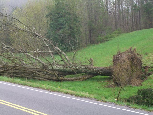 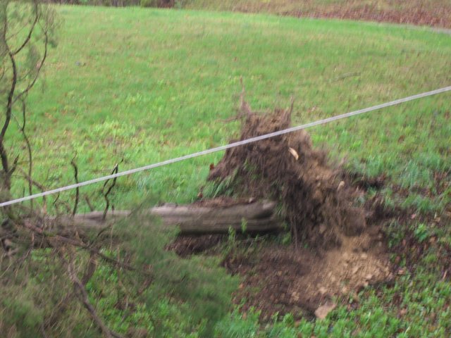 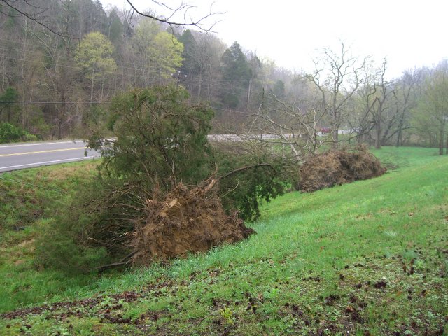 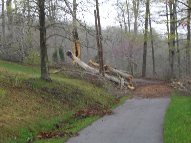 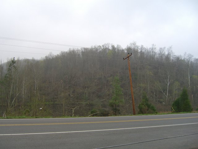  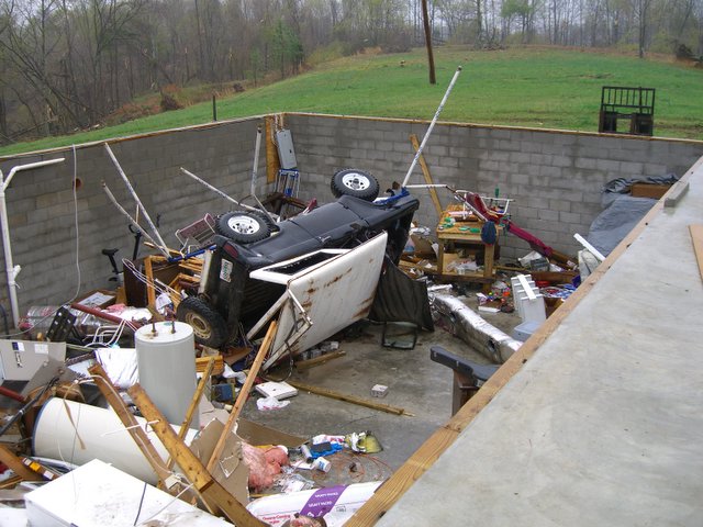  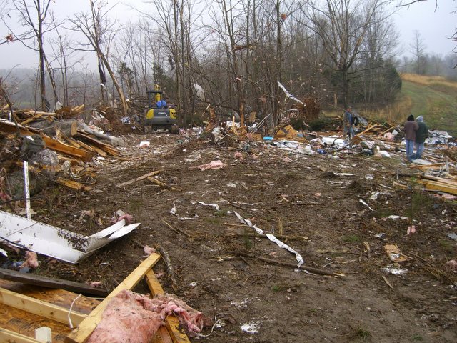 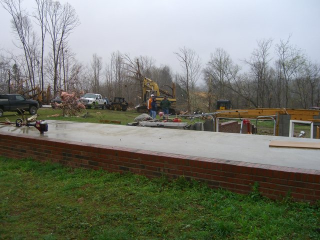 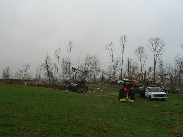  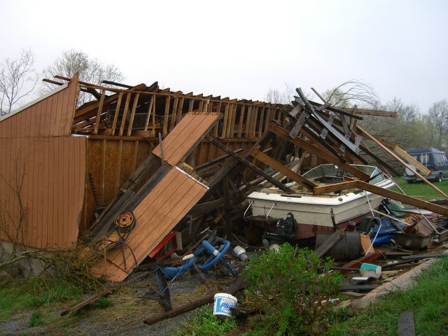 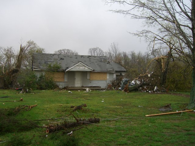 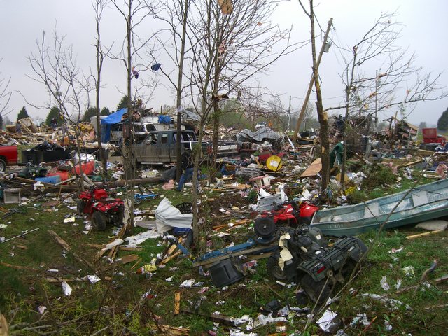 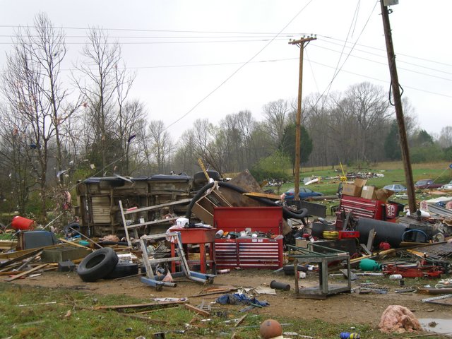 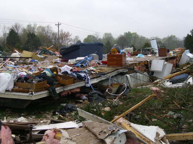 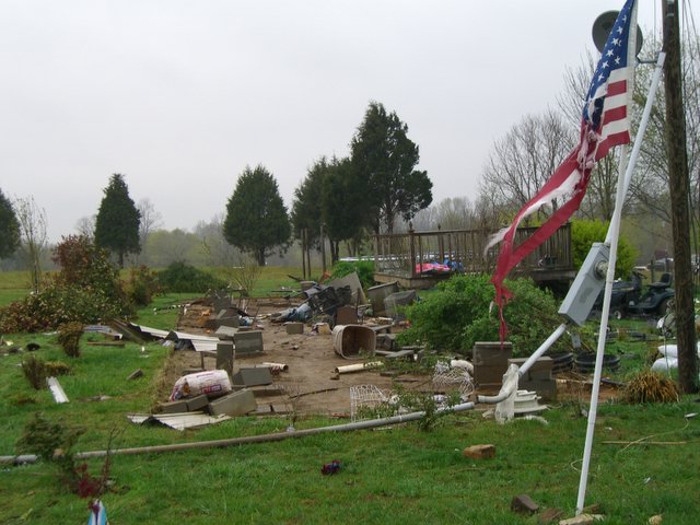 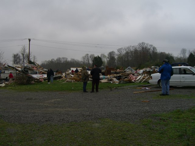  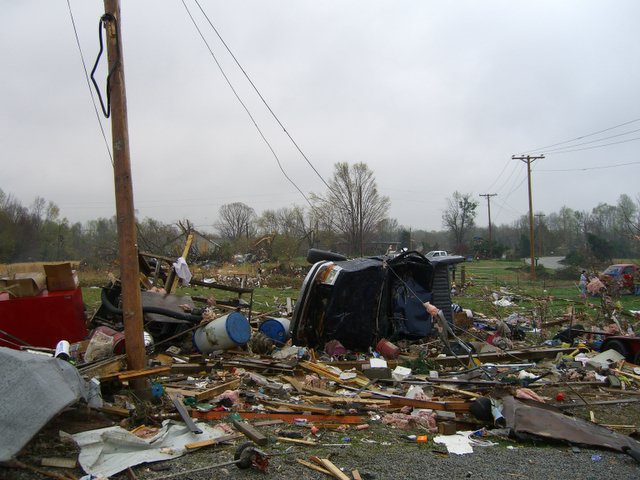 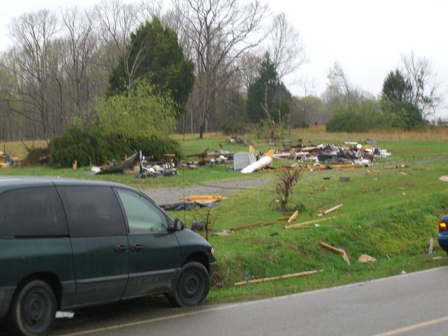 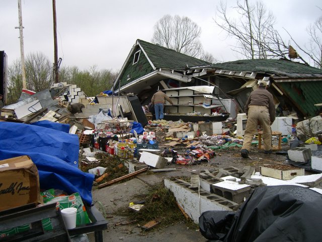  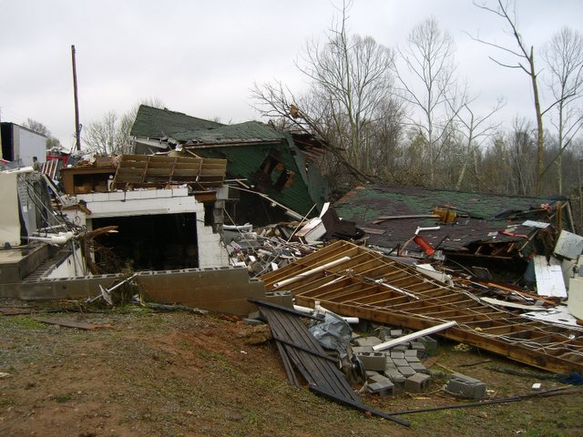 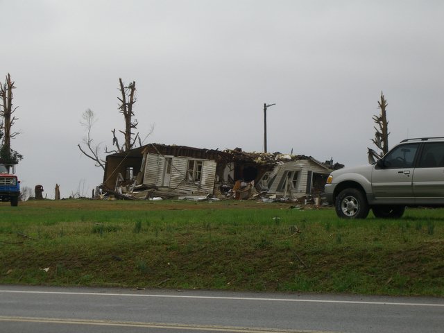 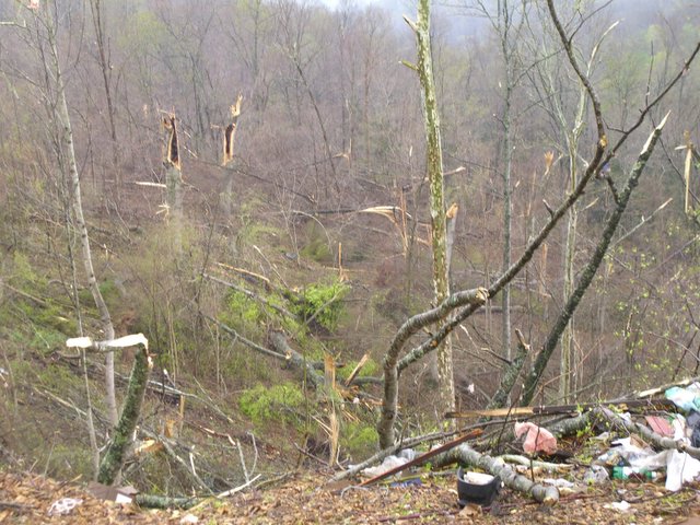 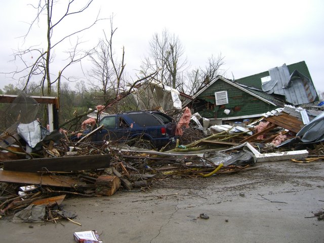 |
|
Cheatham County Photos: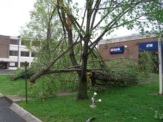 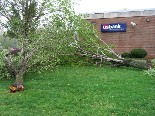 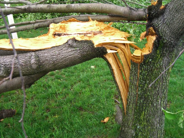 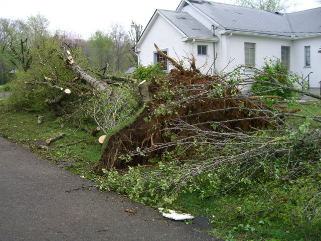 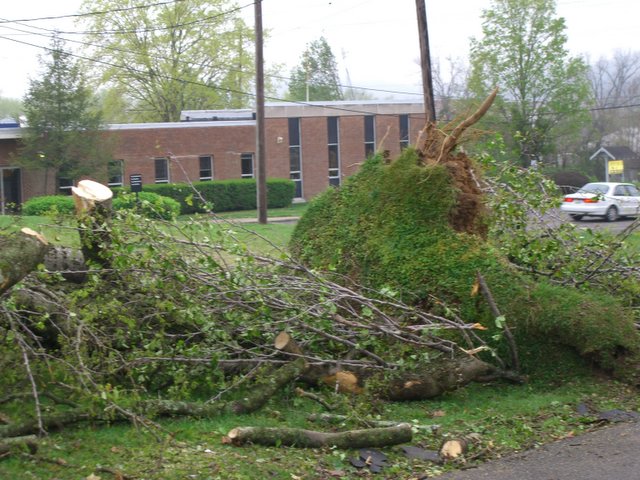 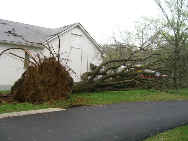 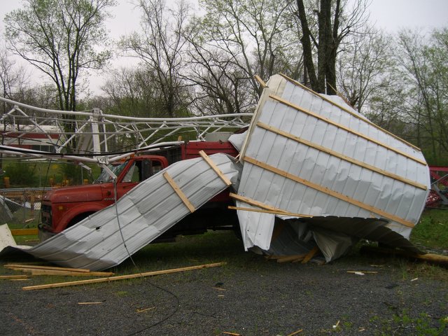 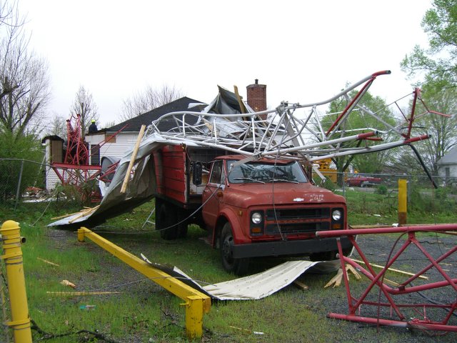 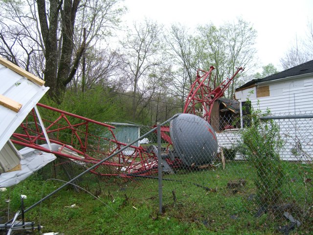      |
|
| F1 Benton/Humphreys County Tornado | |
| Counties: | Benton/Humphreys |
| Time: | 1:02 PM CST |
| EF Scale: | F1 |
| Damage Path Length: | 15.10 miles |
| Damage Path Width: | 100 yards |
| Fatalities: | 0 |
| Injuries | 0 |
| Damage: STORM DATA: The storm touched down just south of Carroll Hollow along Cuba Landing Rd. Large trees were snapped, uprooted or blown down. The tornado crossed Bakerville Road where a brick home was 40 percent destroyed. A mobile home was demolished with only a twisted metal frame left at the mobile home's original site. The tornado went across Jack Rudolph Road and lifted up along Old Highway 13 where trees were destroyed and another mobile home was pushed off its foundation. SHAMBURGER (2015): Radar data and aerial imagery from Google Earth indicate this tornado actually began in southeast Benton County west-southwest of the Eagle Creek Road and Highway 191 intersection, then tracked east-northeast across the Tennessee River into Humphreys County before lifting near the Mayberry Drive and Old State Highway 13 intersection. The path length, path width, time, and location of the tornado has been corrected based on the radar data and damage path on aerial imagery from Google Earth. |
|
| F3 Goodlettsville/Gallatin Tornado | |
| Counties: | Davidson/Sumner |
| Time: | 1:06 PM CST |
| EF Scale: | F3 |
| Damage Path Length: | 23.75 miles |
| Damage Path Width: | 880 yards |
| Fatalities: | 7 |
| Injuries | 128 |
| Damage: STORM DATA: This F3 tornado destroyed many residential homes in Goodlettsville. Significant damage was done to the Metro Baptist Church with part of the roof blown off and front of church blown away. This tornado destroyed 25 homes, 13 homes or businesses with major damage and 31 with moderate damage. The tornado struck the hardest in Sumner County. It entered Hendersonville from Goodlettsville at 1312 CST, and struck Gallatin at 1325 CST. An aerial survey determined this tornado had a path length of 22.75 miles from Davidson County and into Sumner County. 7 people died directly as a result of the tornado. One woman, who was 83 years old, died of a heart attack the day the tornado swept through Gallatin, and is considered an indirect death. All 7 fatalities happened in Gallatin. There was extensive damage to homes and businesses. 700 homes and businesses were damaged or destroyed in Sumner County. The City of Hendersonville had 80 homes destroyed, As a result, Hendersonville city officials are considering installing tornado sirens in the city. Volunteer State Community College in southwest Gallatin was heavily damaged as were several car dealerships across the road. Vol State reopened 10 days after the tornado struck on Monday, April 17. There were about 400 faculty, staff and students on campus at the time the tornado struck. that day. Ms. Angie Jowers, public relations director for the college, stated that having routine tornado safety drills paid off on April 7th. Mr. Steve Doremus, spokesman for the Sumner County Schools, said that all 25,500 students were safe from the tornado because of routine tornado drills done in the county's 42 schools. Vol State school officials placed damage at the campus around $56 million. There was $69 million in damage in Sumner County alone. One estimate for damage done by tornadoes across Middle Tennssee on April 7 was placed at $391 million. Unfortunately, at night, looters came out to Gallatin. A nightly curfew was imposed for a while to curb the looting. The National Guard was called in to help with security matters and debris removal. By May 4, 2006, 23 people were arrested for looting in Gallatin. Several people died inside their homes. A NWS Storm Survey Team discovered that 1/2 million dollar brick homes were not built as well as one might have expected. Cinder blocks were filled with concrete, and boards were nailed to the cinder block as the base for the foundation. The strong winds caused some brick homes to move off the cinder blocks and collapse. This was observed in the Woodhaven Subdivision in Gallatin. SHAMBURGER (2015): NCDC incorrectly lists the time and path location of this historic tornado, which was corrected to begin along Dry Creek Road west of Goodlettsville based on radar data and satellite imagery from Google Earth. In addition, although radar data is not available for the end of this tornado due to a tornado-caused power failure at NWS Nashville, satellite imagery from Google Earth clearly indicates the tornado continued to blow down trees east of Bledsoe Creek State Park before lifting northwest of Emerald Valley Drive, approximately 2.5 miles southwest of Castalian Springs. Therefore, the path length was extended by 1 mile to 23.75 miles. |
|
Gallatin Tornado Pictures (Sumner County):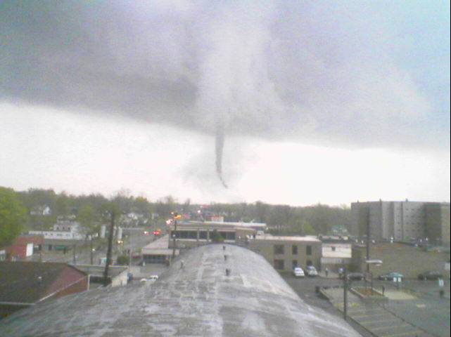 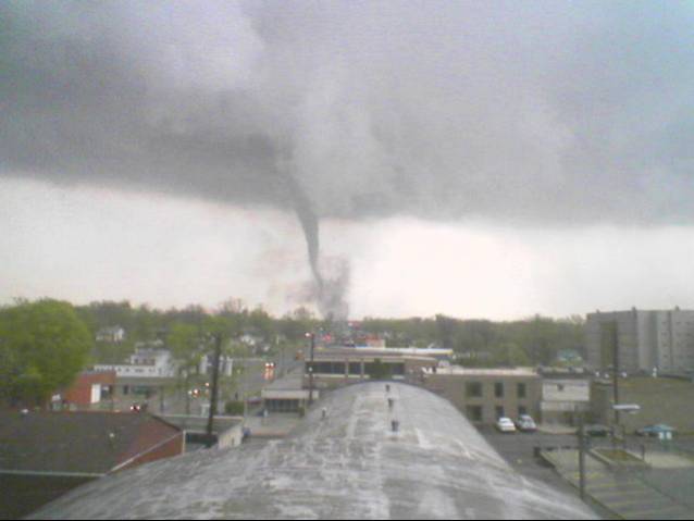 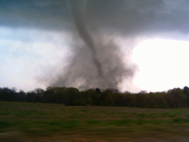 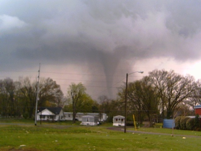 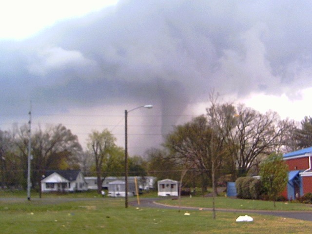 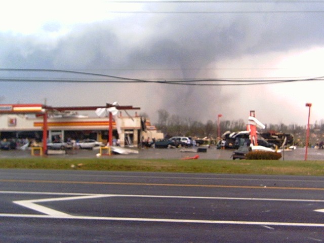 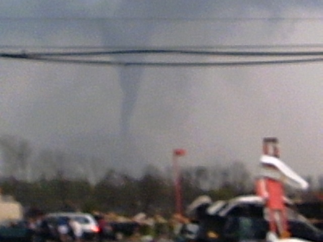 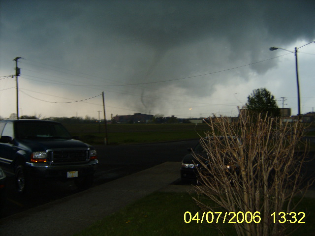 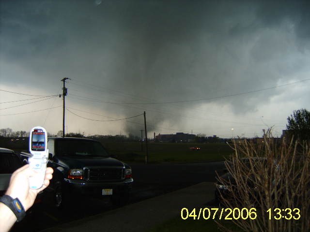 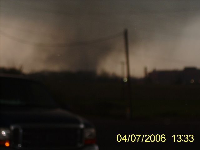 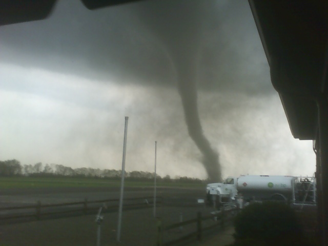 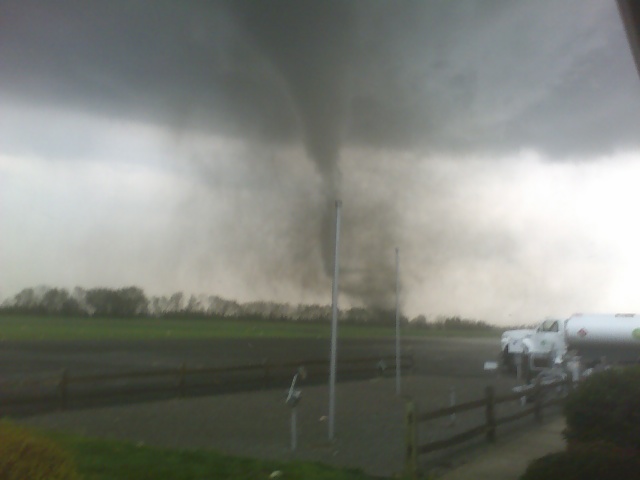 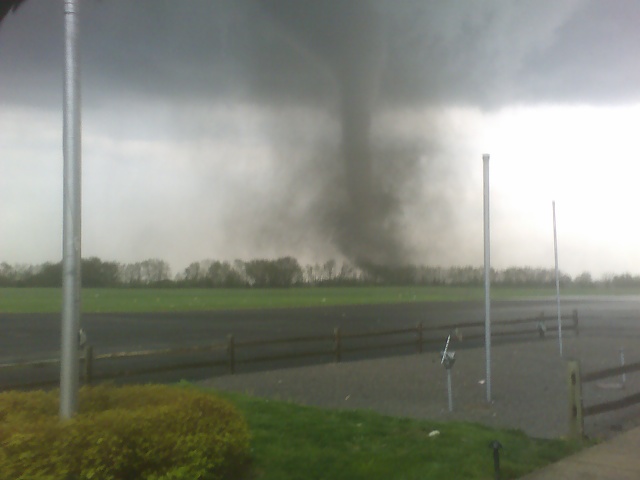 |
|
Davidson County Photos: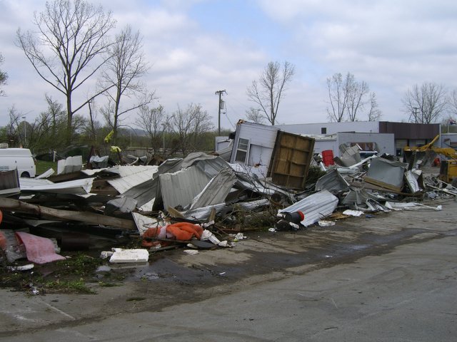 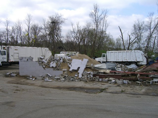 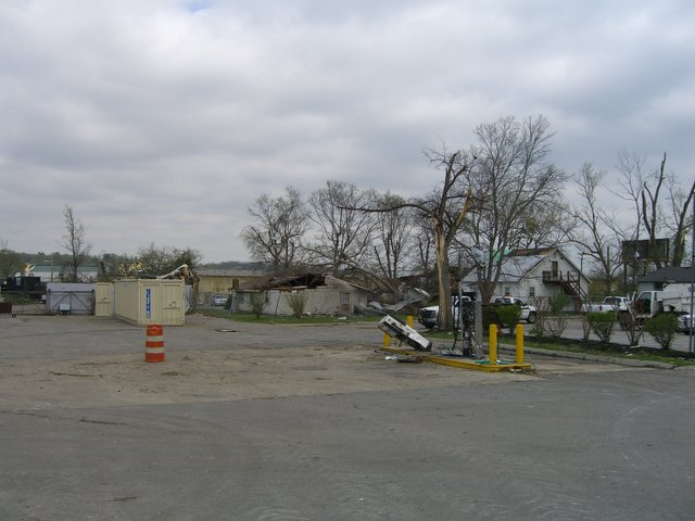 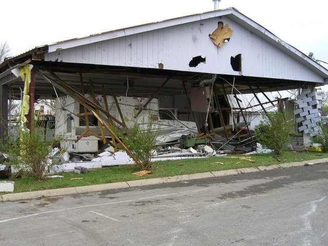 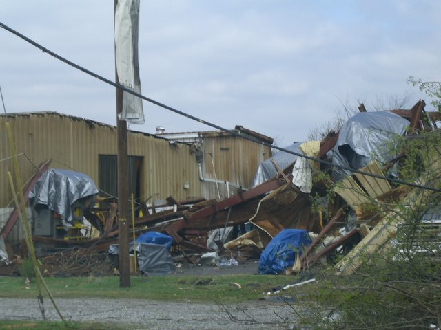 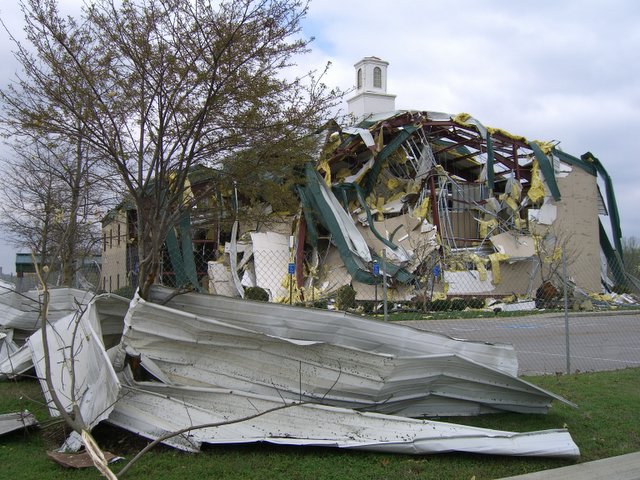 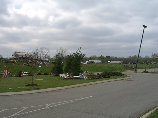  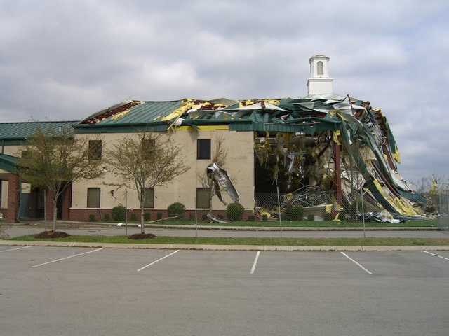 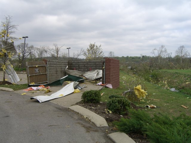 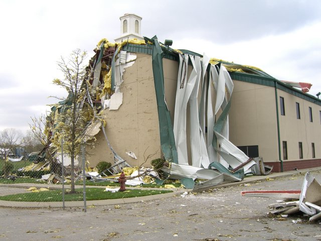 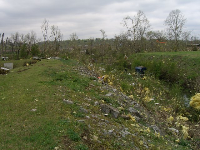 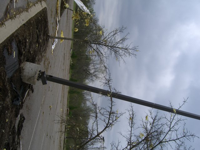 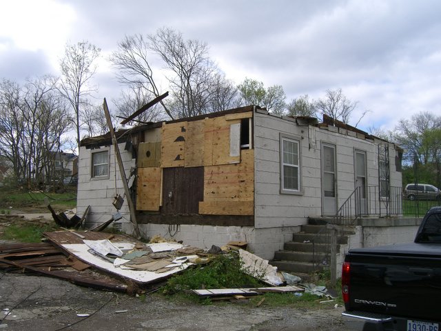 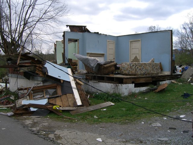 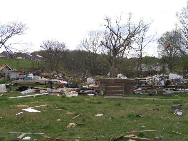  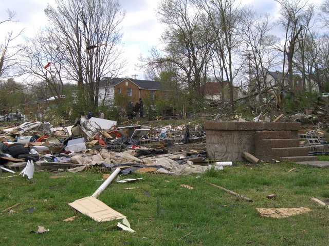 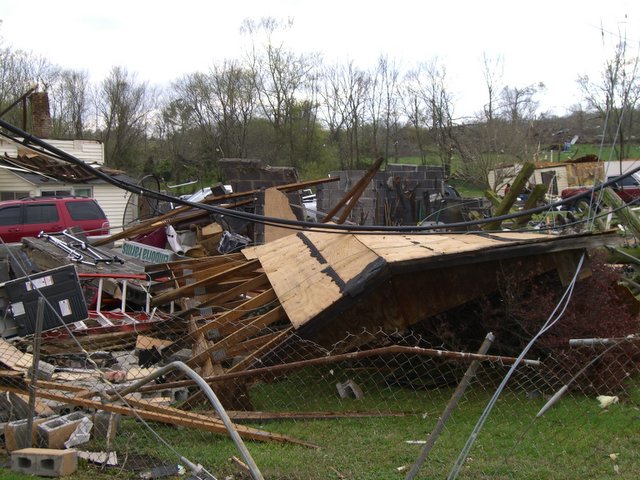 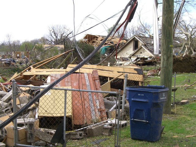  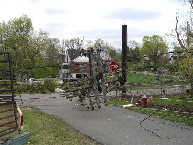 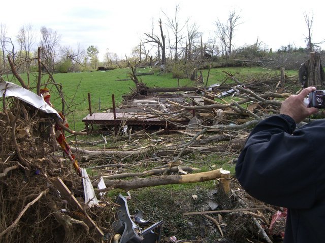 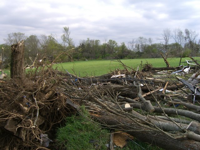 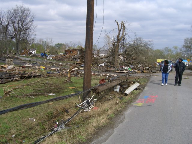 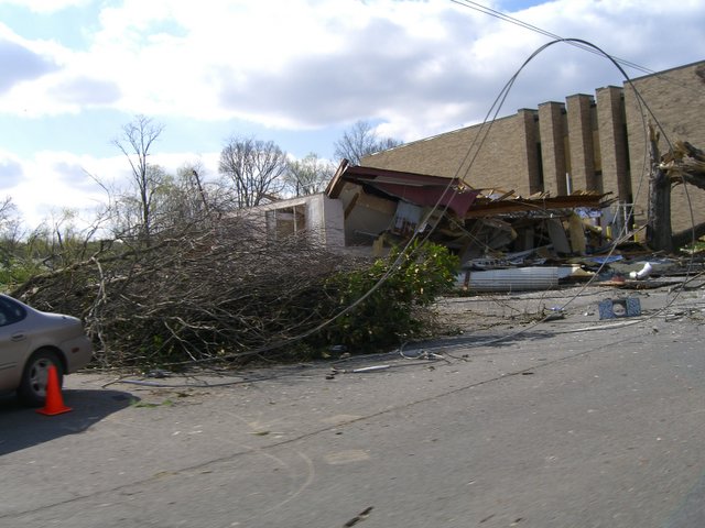 |
|
Sumner County Photos: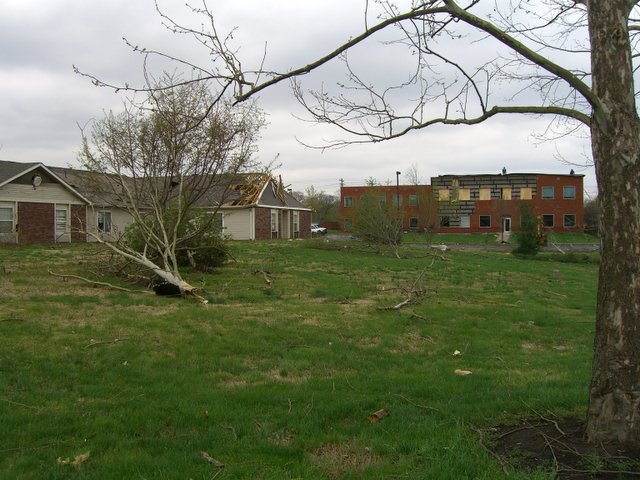 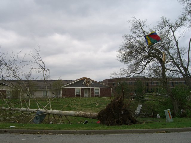    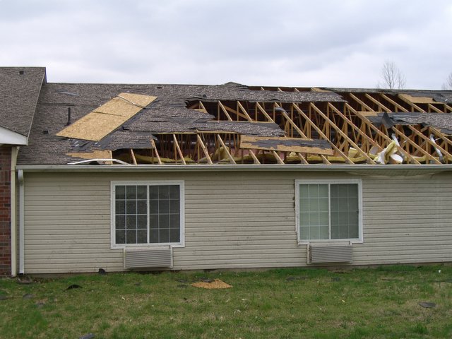 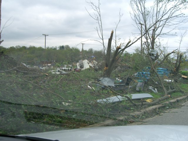 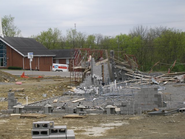 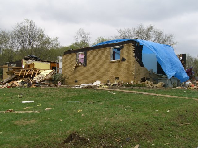 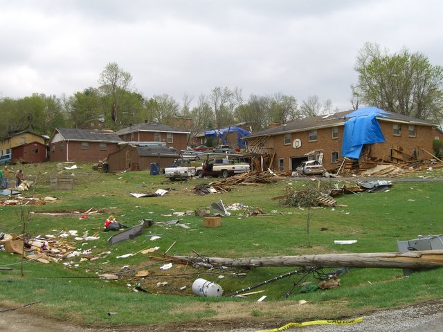 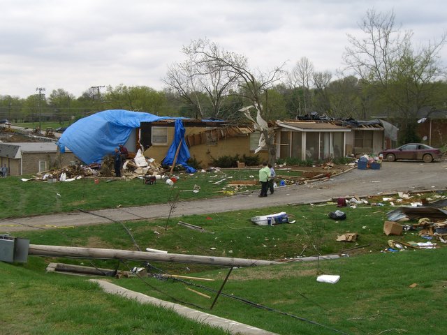 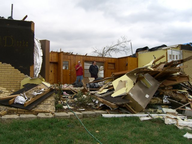 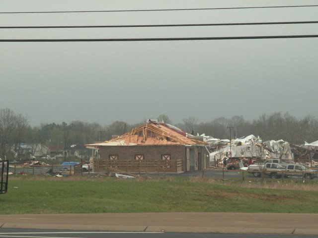 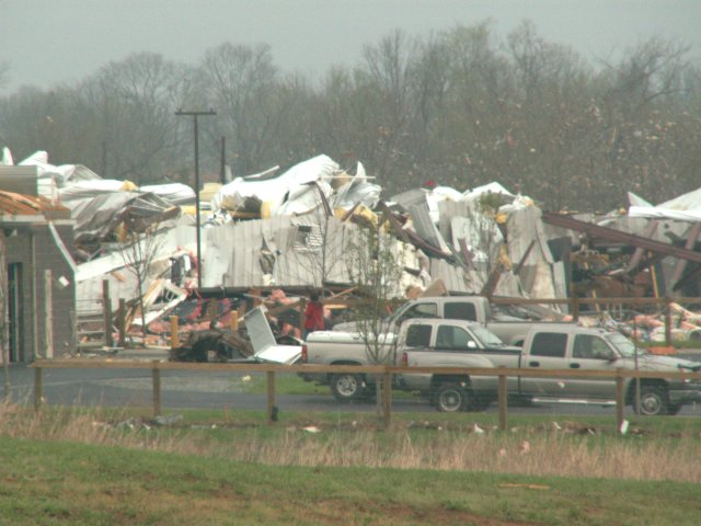 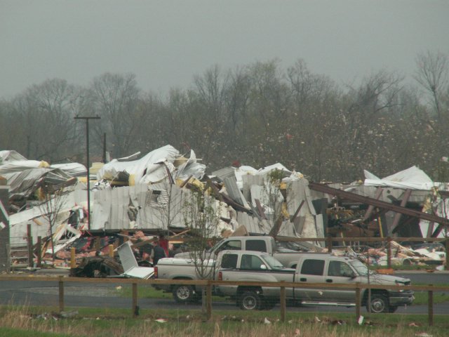 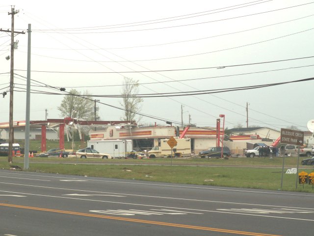 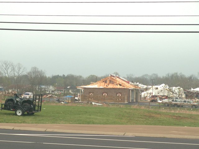 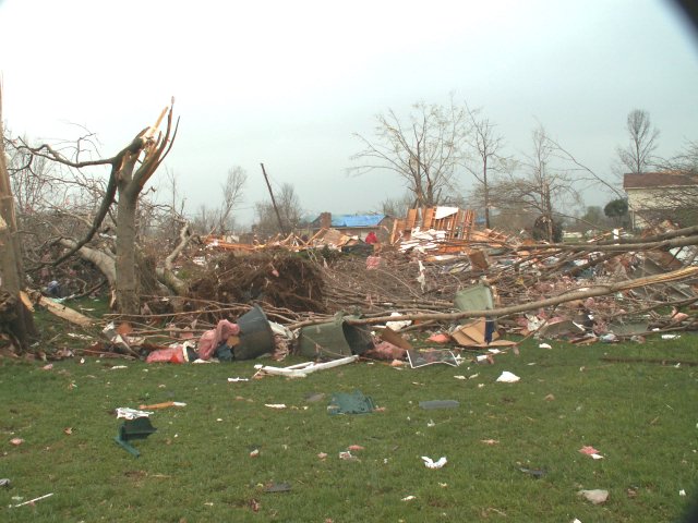 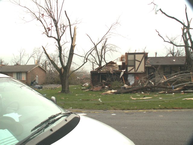 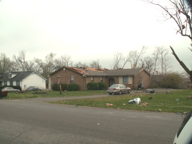 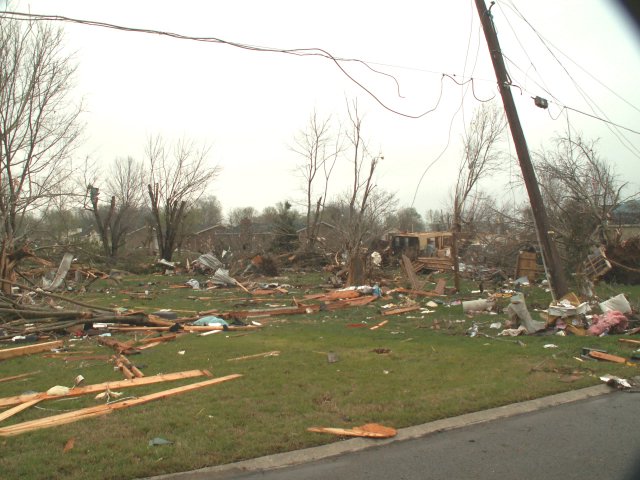  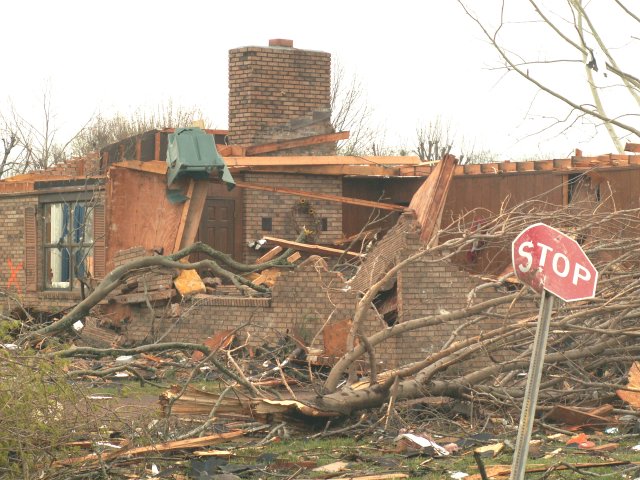 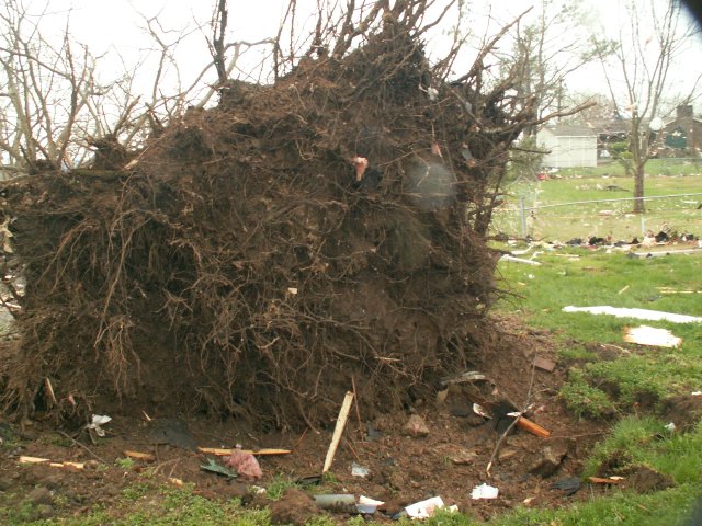 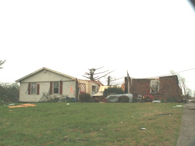 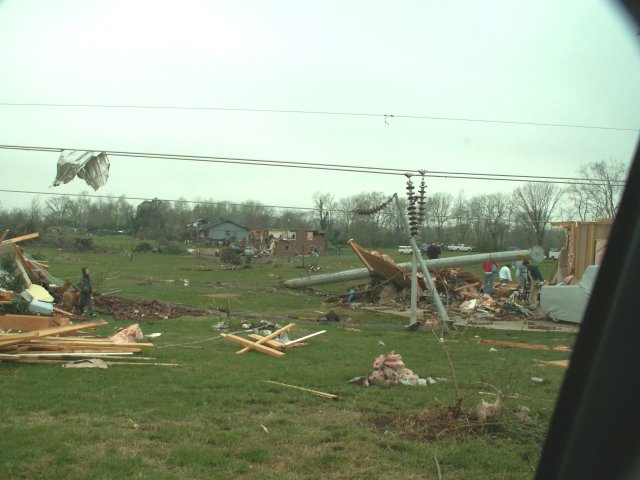 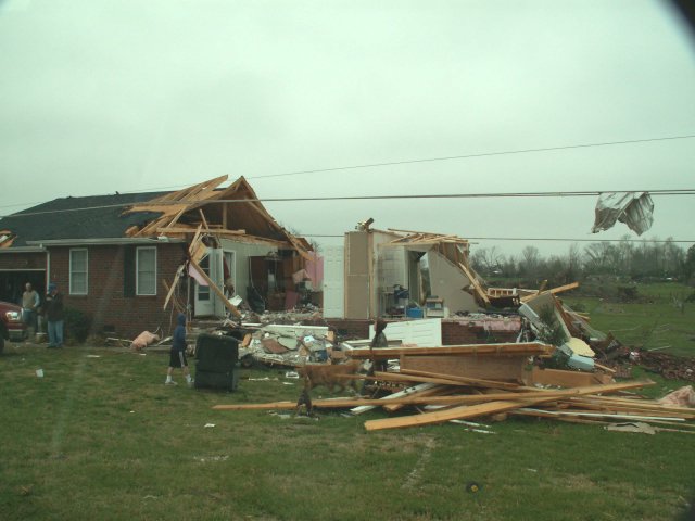 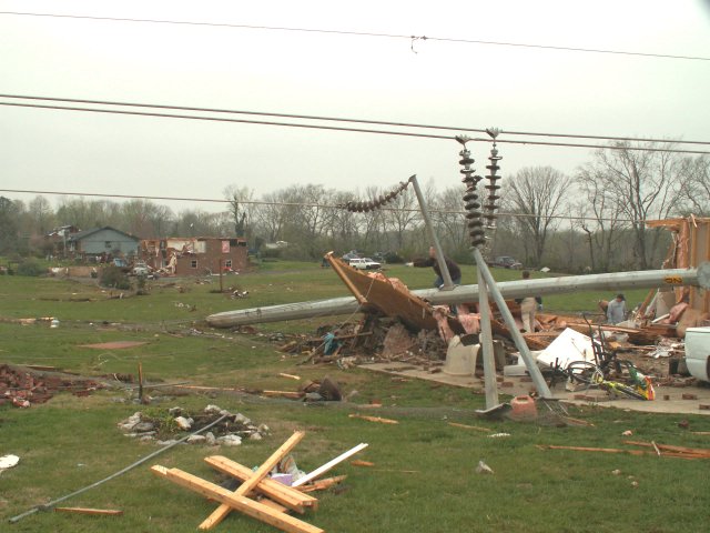 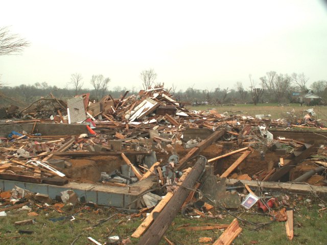 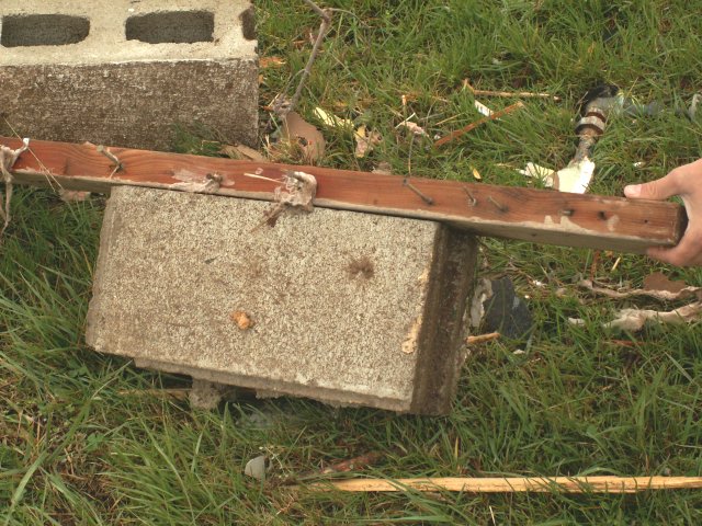  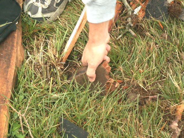  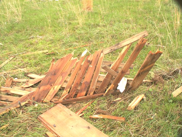 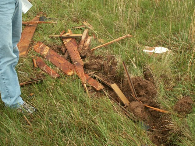 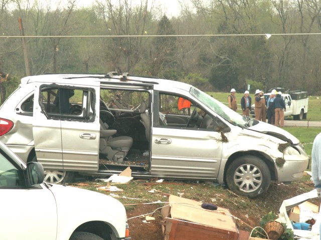 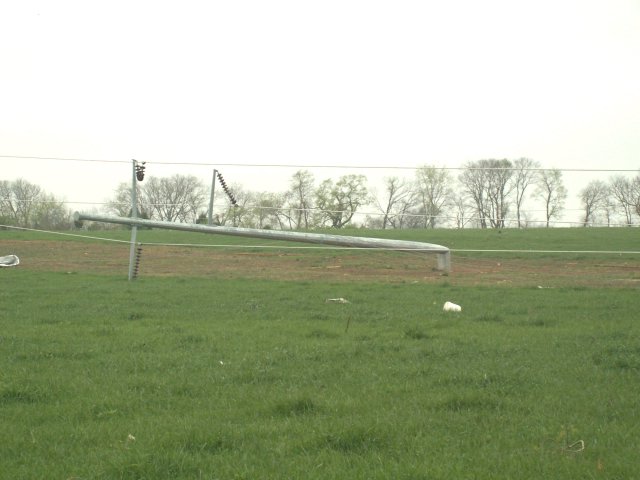 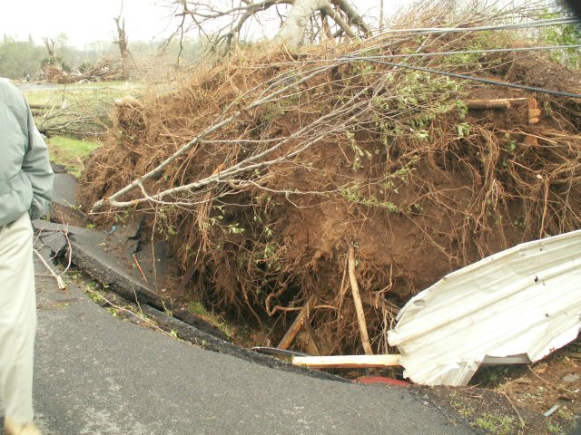  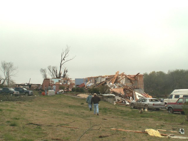 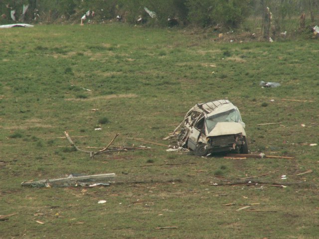 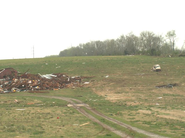 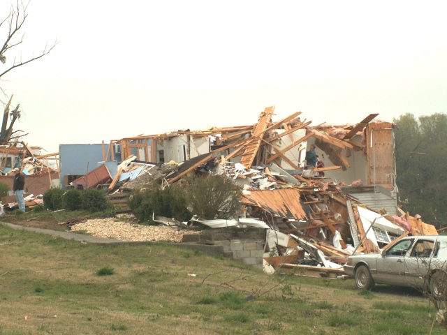 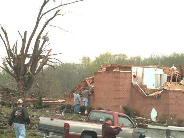 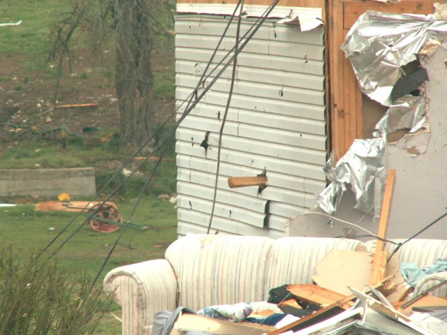 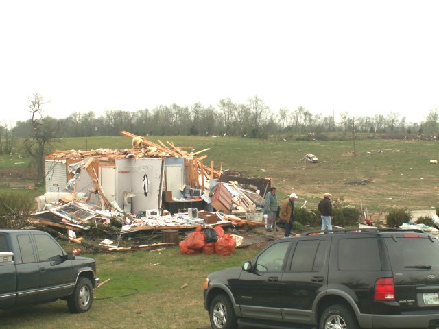 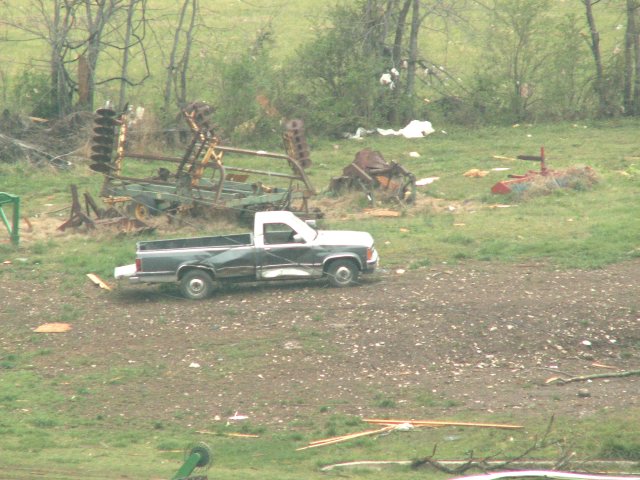   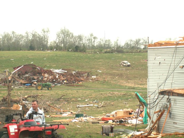 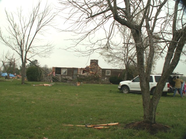 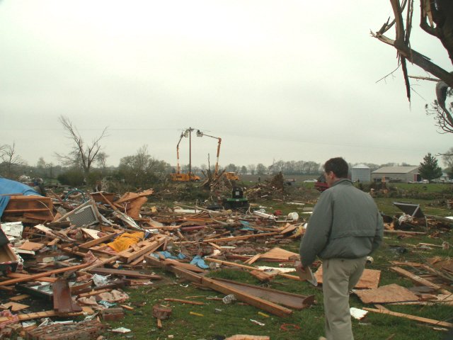 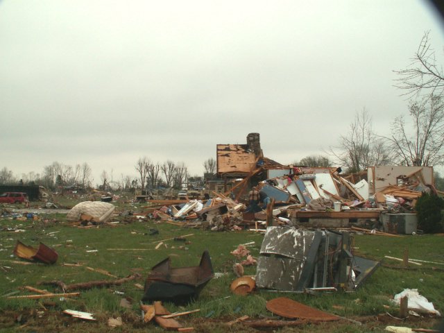 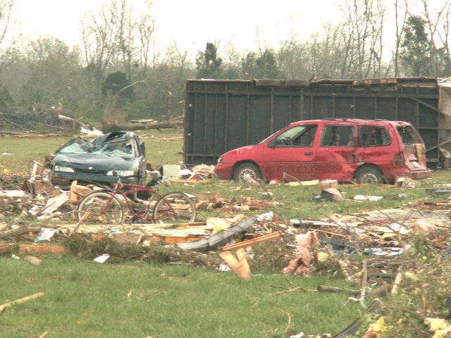  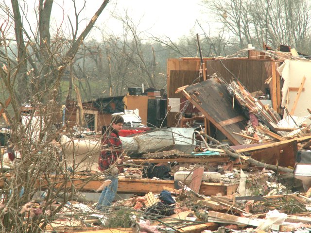 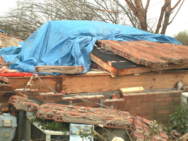 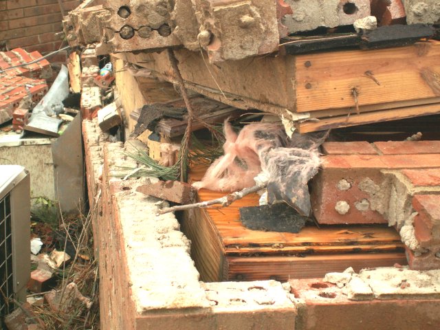 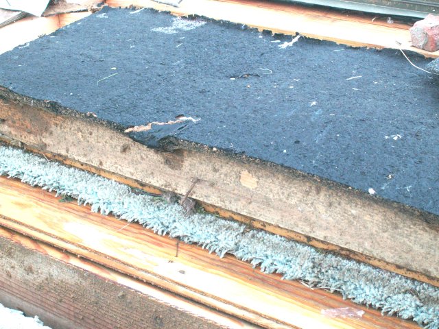 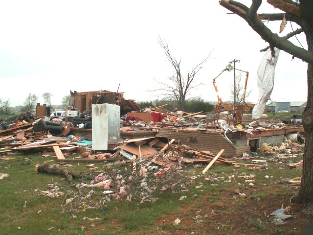 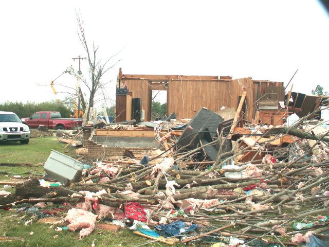  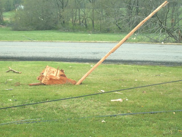  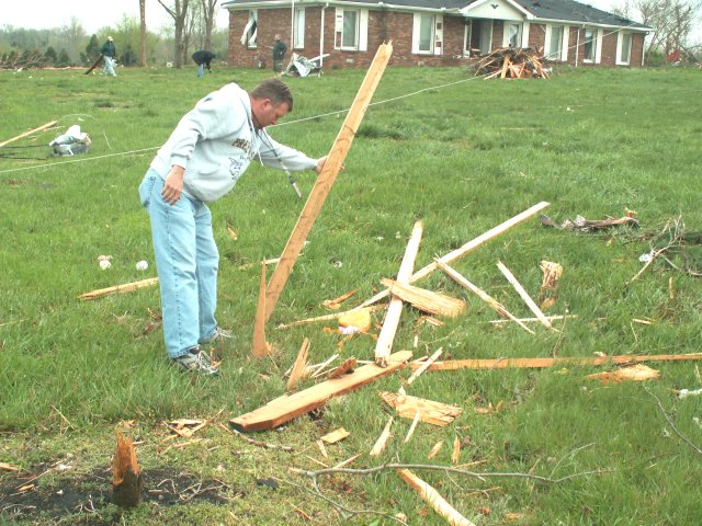 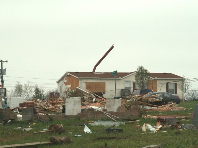 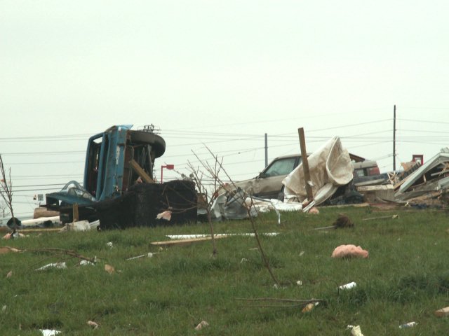 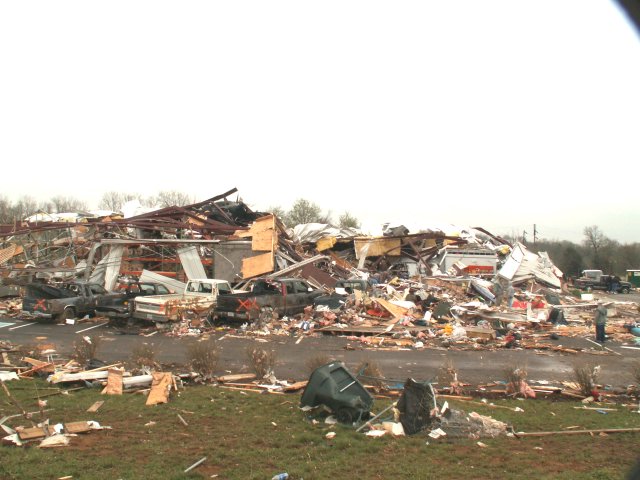 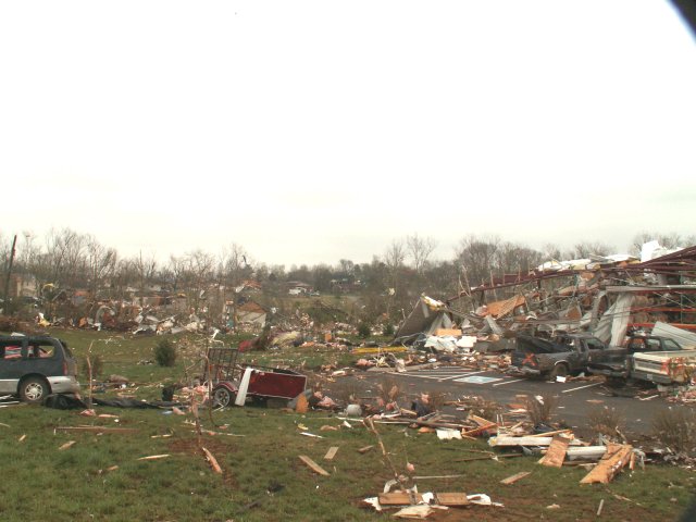 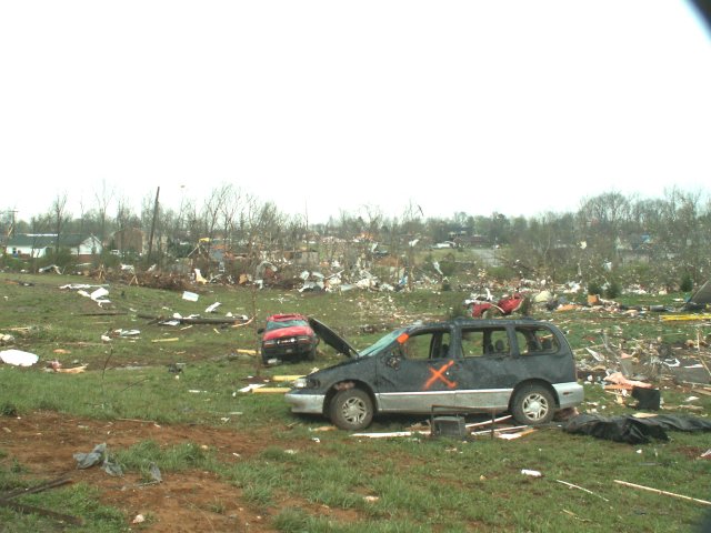 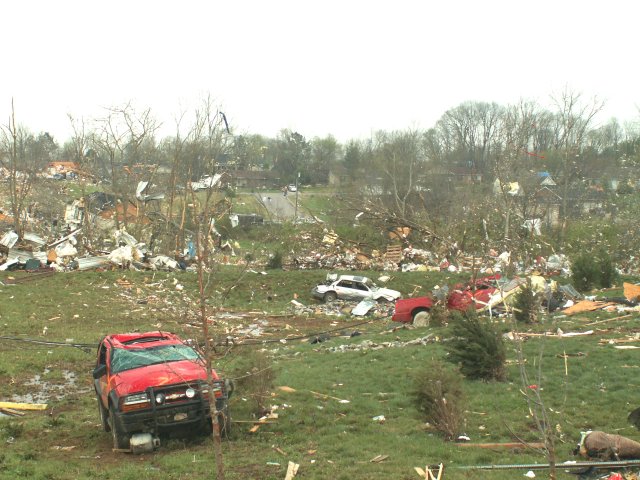  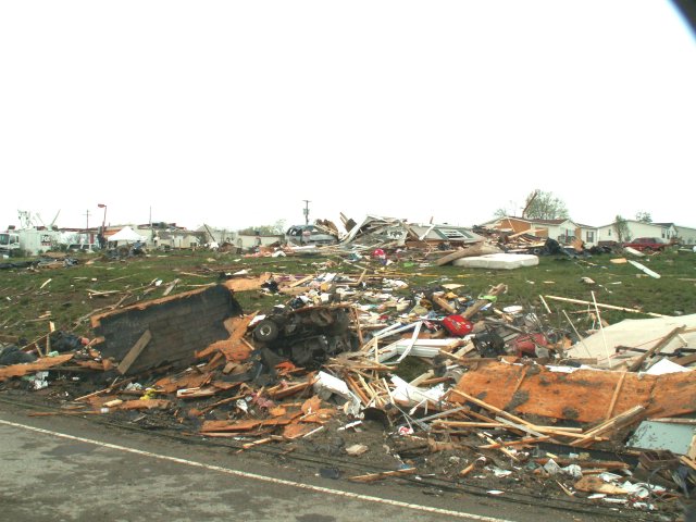 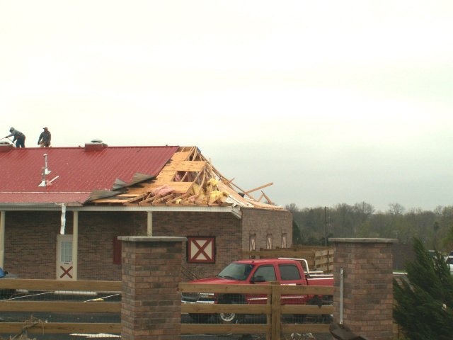 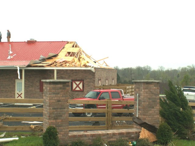 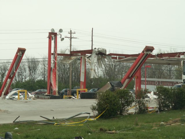 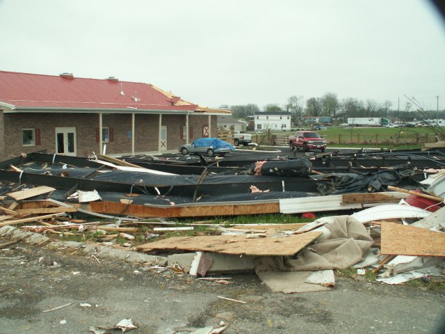 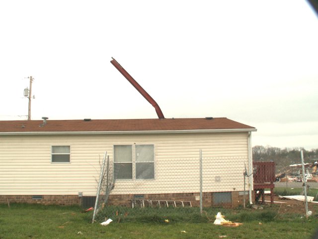     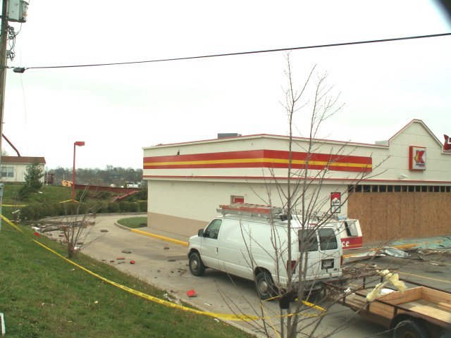   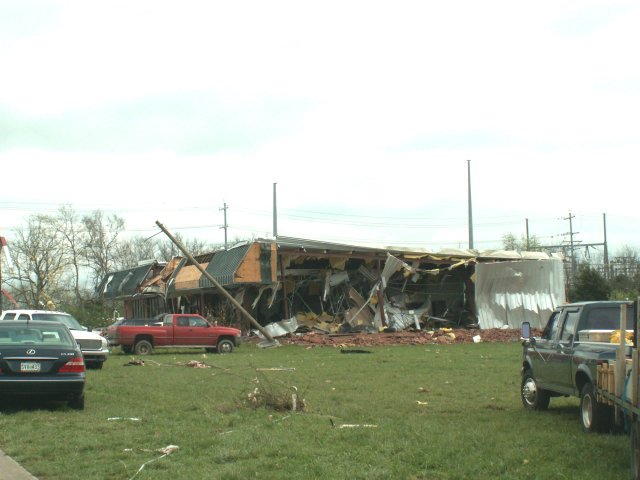 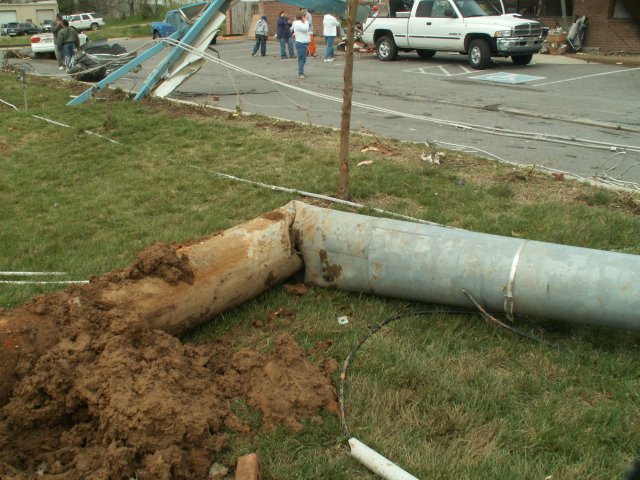 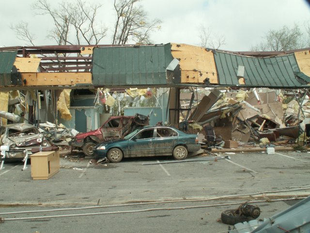 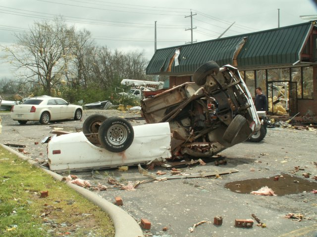 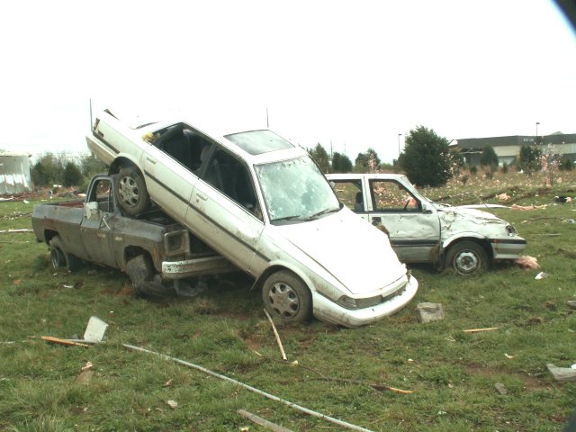 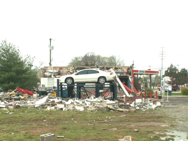 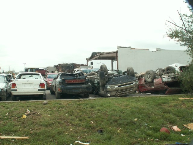  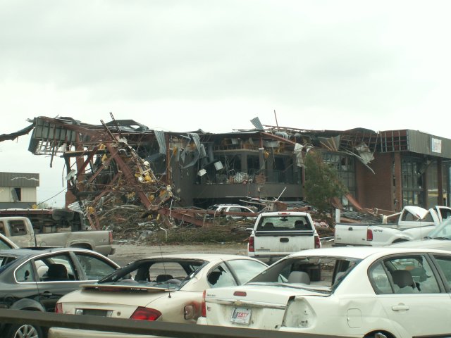 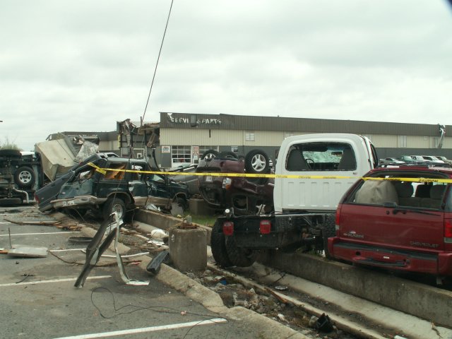  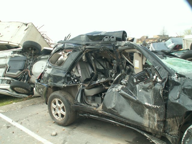 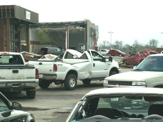 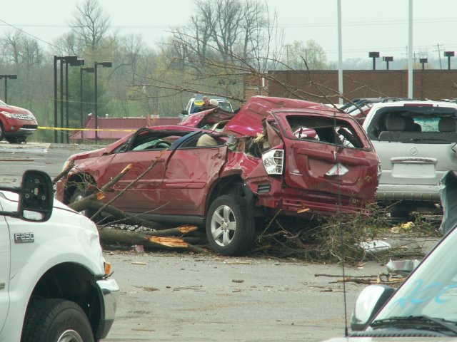 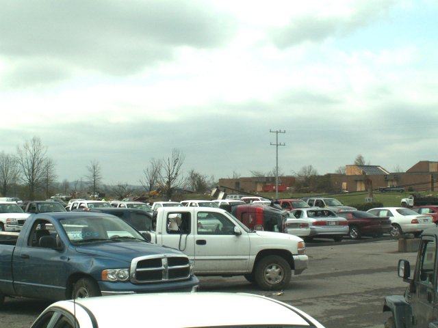  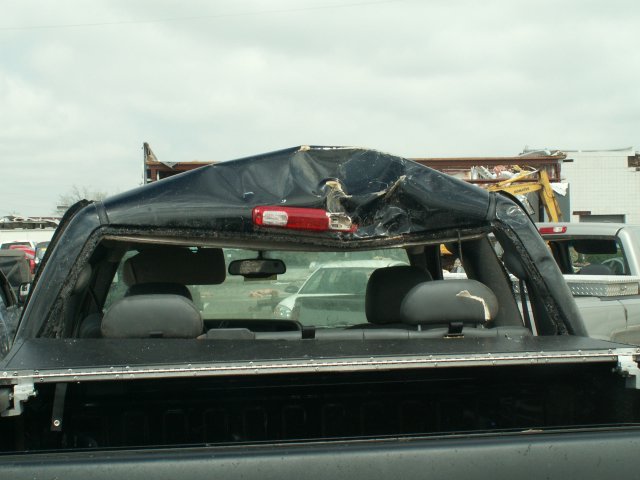 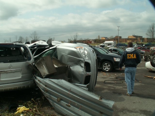 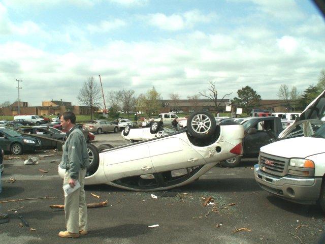 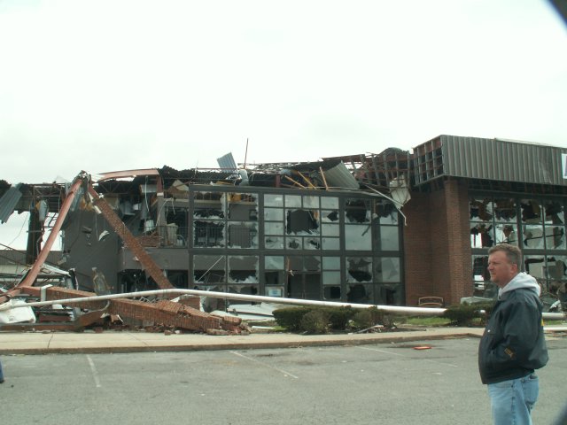 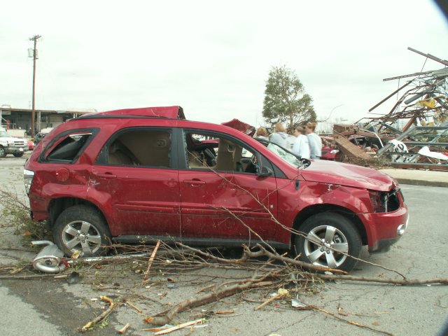   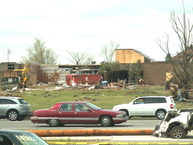  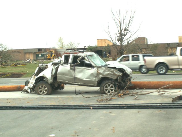  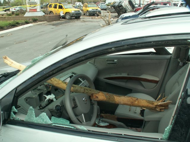 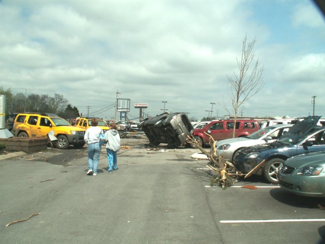  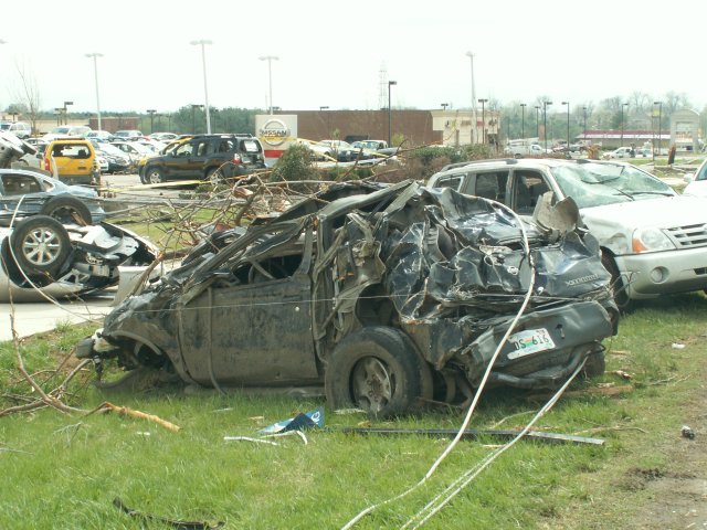 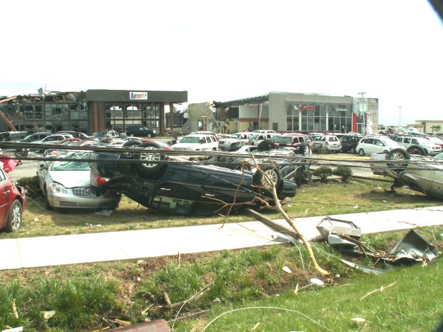 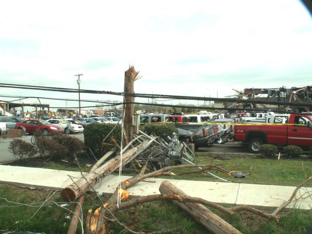  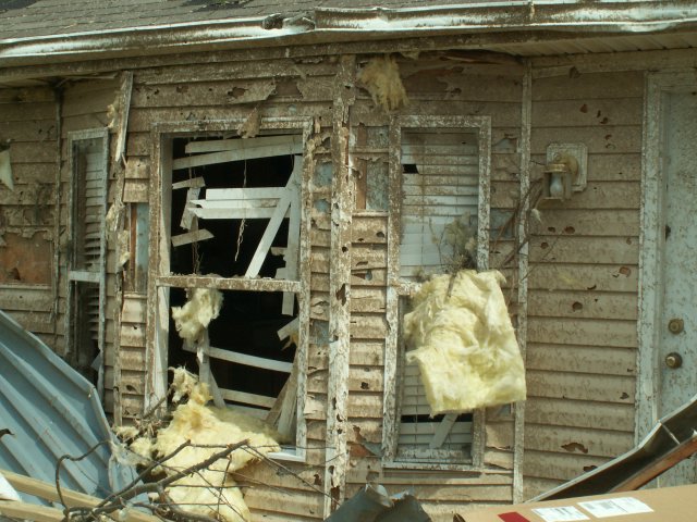 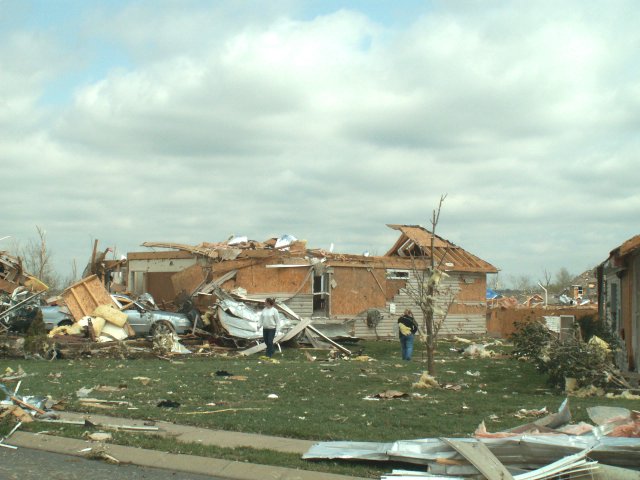 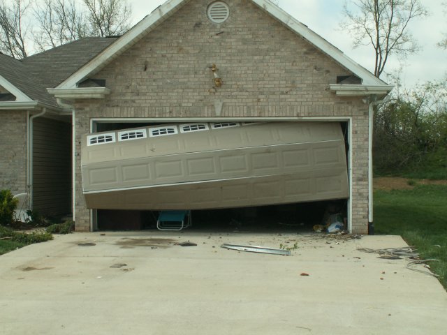 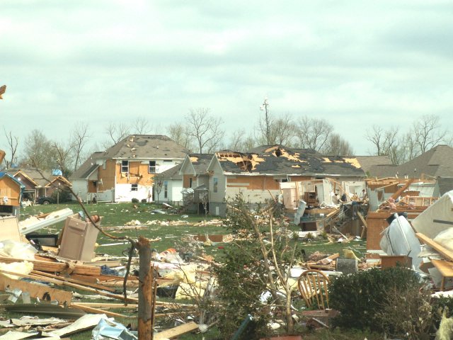 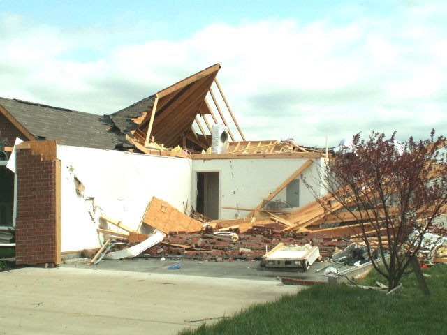  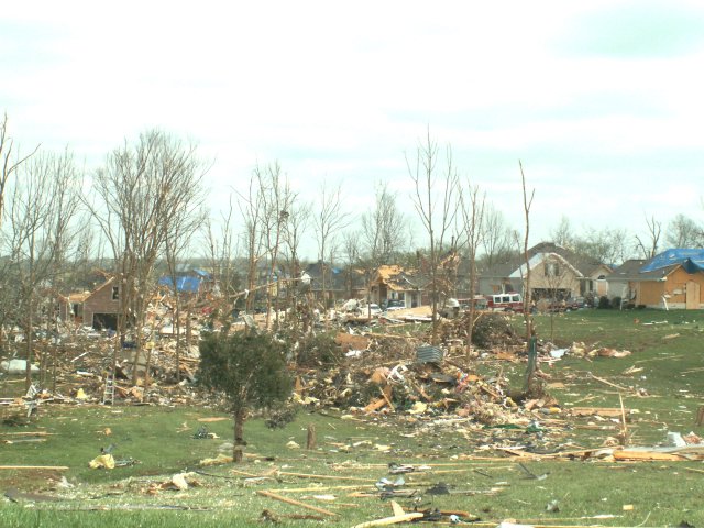 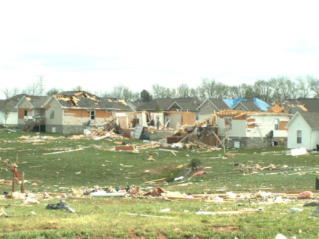 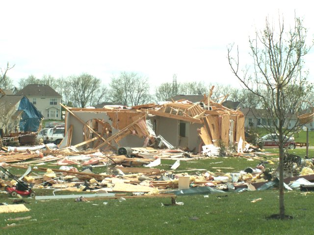 |
|
| F0 Lewis County Tornado | |
| Counties: | Lewis |
| Time: | 1:43 PM CST |
| EF Scale: | F0 |
| Damage Path Length: | 0.30 miles |
| Damage Path Width: | 100 yards |
| Fatalities: | 0 |
| Injuries | 0 |
| Damage: STORM DATA: The tornado snapped a few trees near U.S. Highway 412. There was no property damage. SHAMBURGER (2015): NCDC incorrectly lists the location of this tornado, which was corrected based on a map of all tornado tracks on April 7, 2006 by NWS Nashville. |
|
| F1 Cannon/Warren County Tornado | |
| Counties: | Cannon/Warren |
| Time: | 3:45 PM CST |
| EF Scale: | F1 |
| Damage Path Length: | 11.0 miles |
| Damage Path Width: | 150 yards |
| Fatalities: | 2 |
| Injuries | 0 |
| Damage: STORM DATA: F1 tornado killed 2 people in a mobile home on Foster Rd. A 53 year-old woman was caring for an eldery male friend who also died in the mobile home. He was 81 years-old. She worked at the Federal Mogul plant in Smithville. Shingles were off roofs. Large trees were snapped, uprooted, or blown down. This tornado touched down on Lance Road, near Blue Hill Road. There was damage to a large barn, and shingles were torn off a portion of the roof. The tornado continued along a path due east where it crossed Highway 56 and Highway 287. Damage was noted on this path. SHAMBURGER (2015): Radar data and aerial imagery from Google Earth and radar data indicated this tornado began in far eastern Cannon County along Will Daniel Road and then moved into Warren County. The time, path length, and path location for this tornado have been corrected based on radar data and aerial imagery from Google Earth. |
|
|
Warren County Photos: 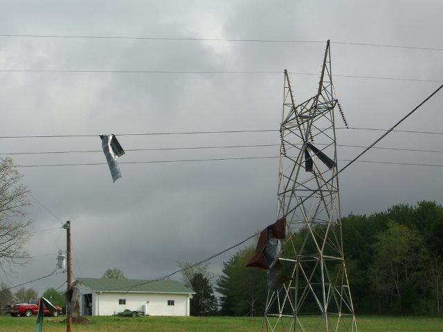 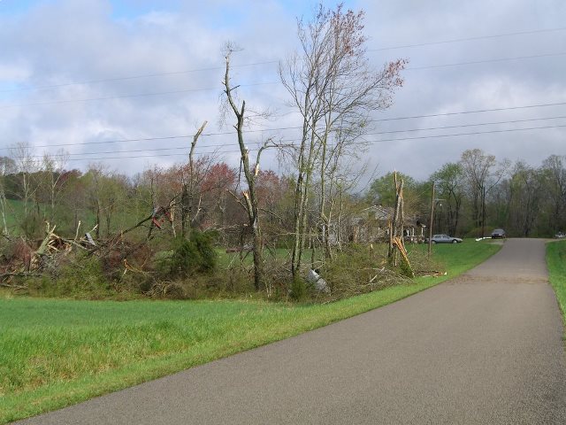 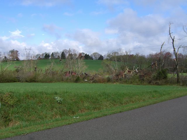 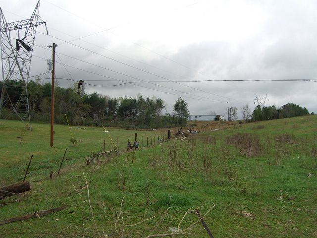 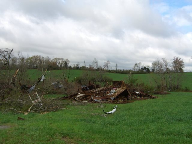 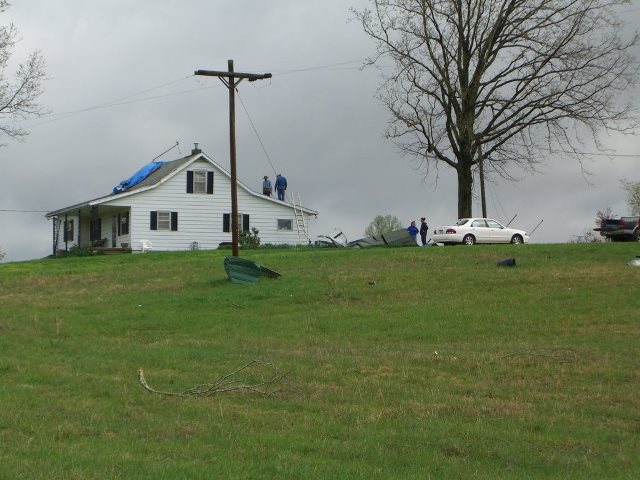  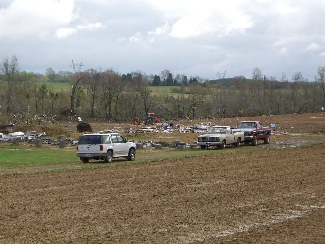 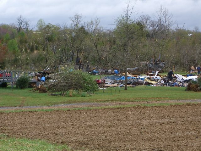 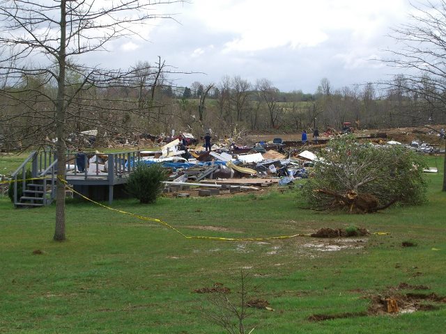 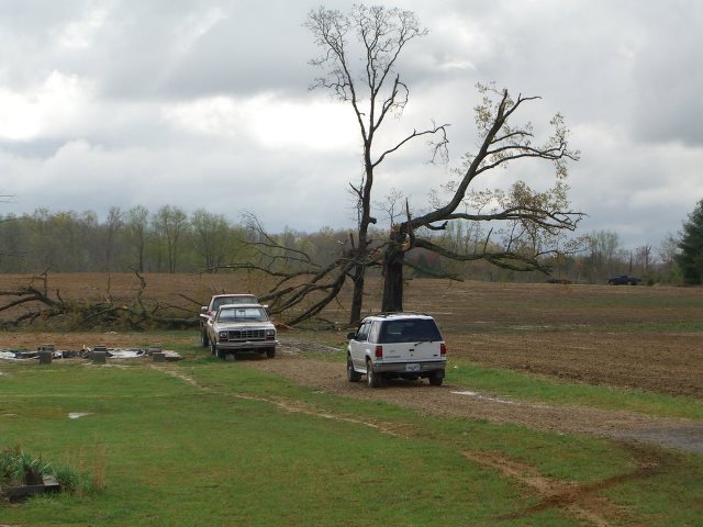 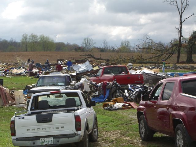  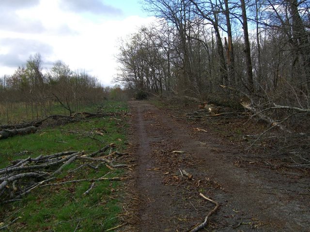 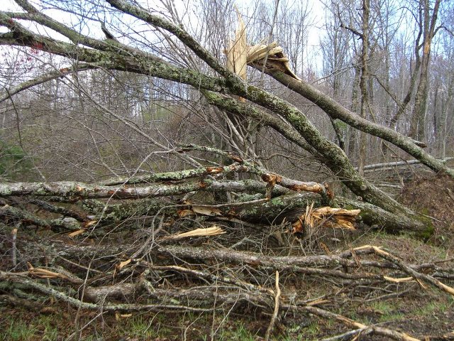 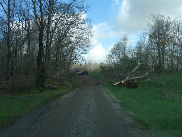 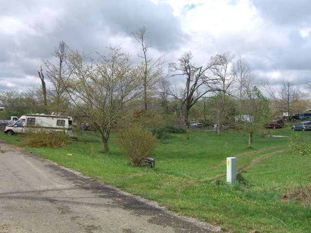 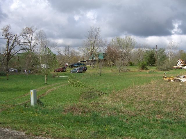 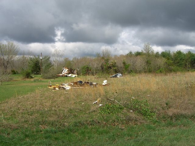 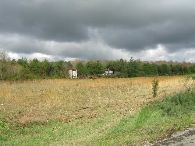 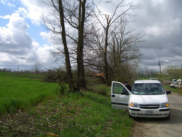 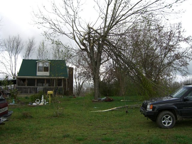  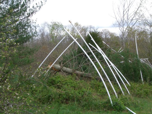  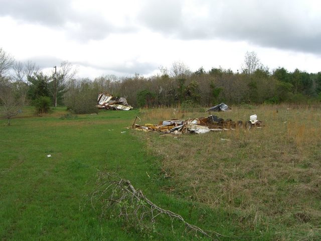 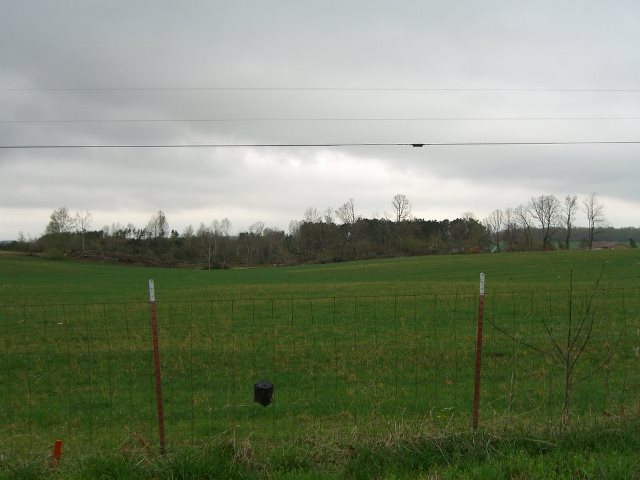 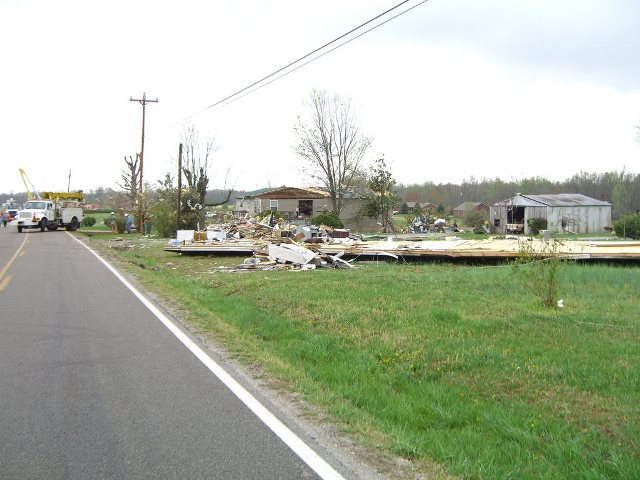 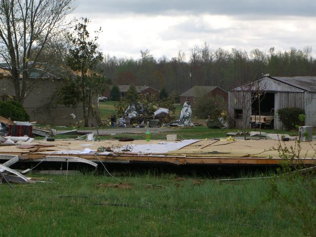 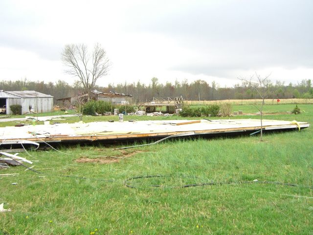 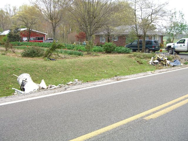 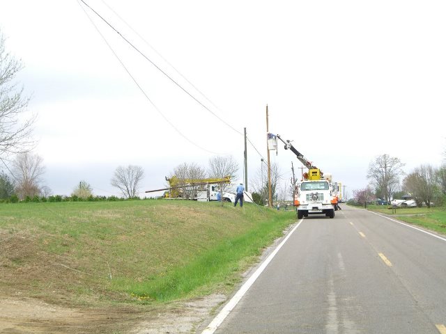 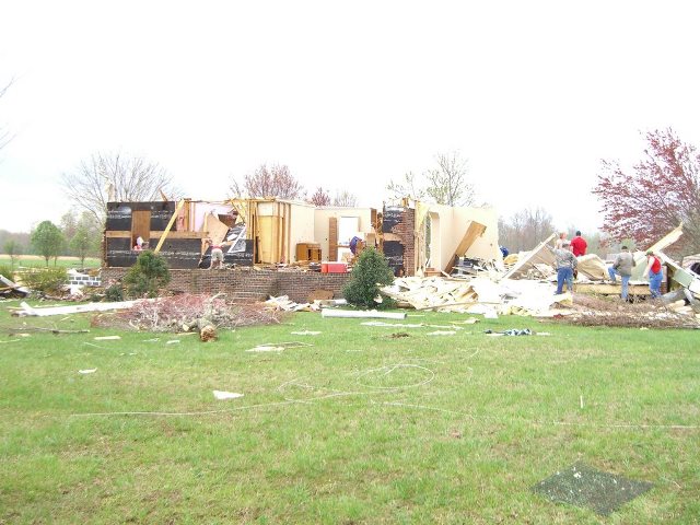 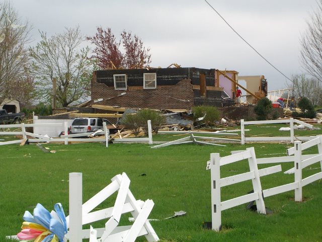 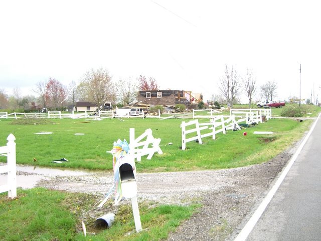 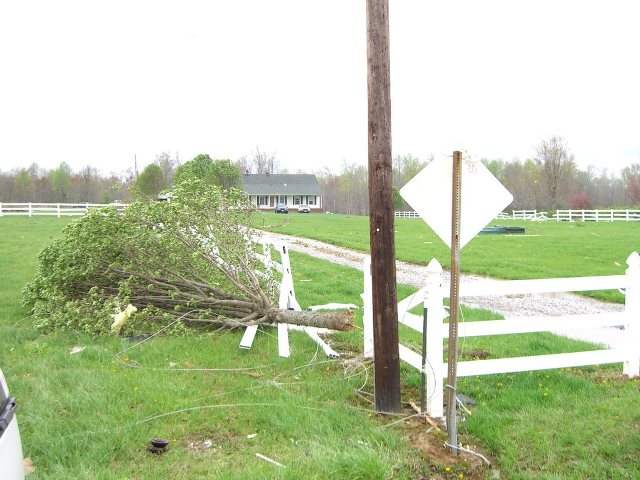  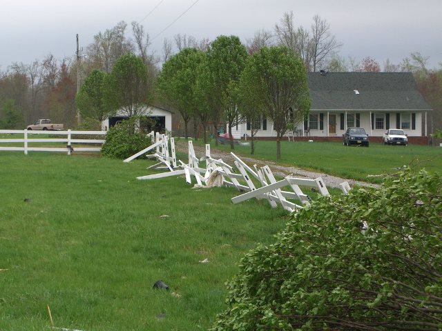 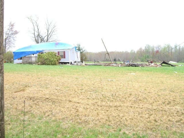 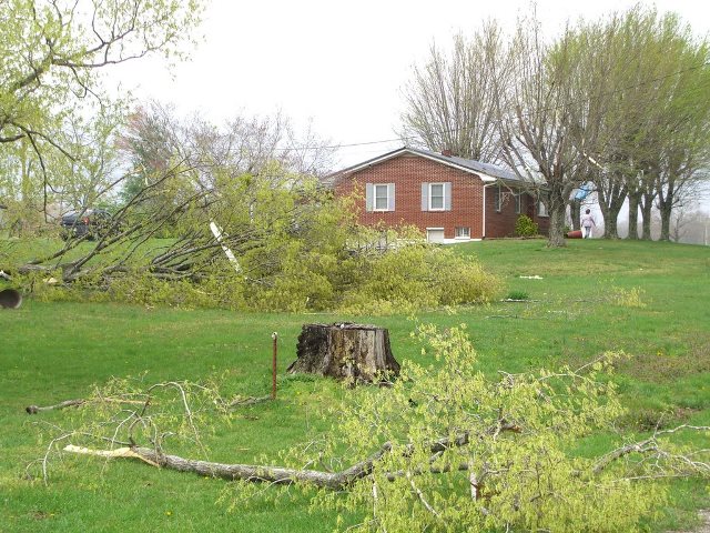 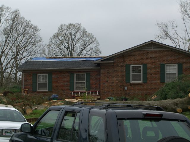 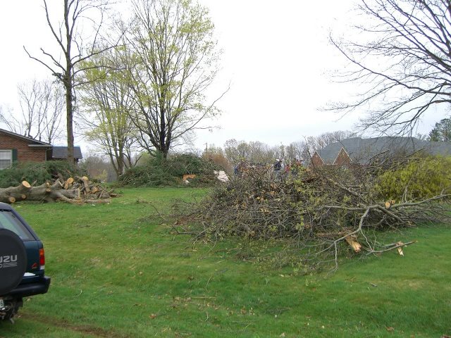 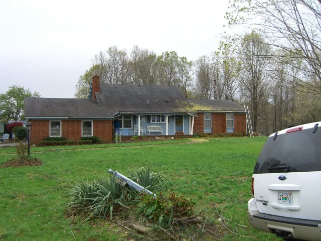 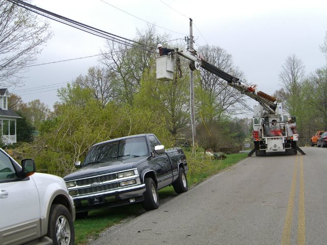 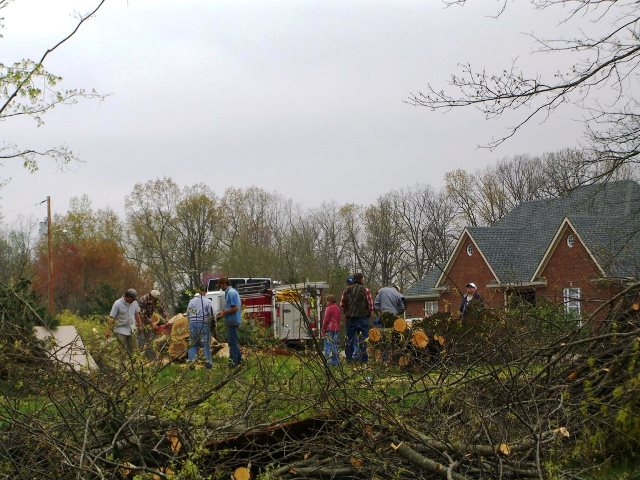 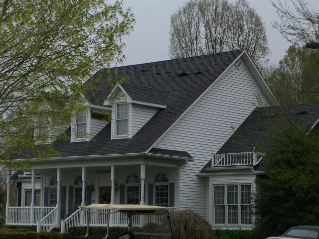 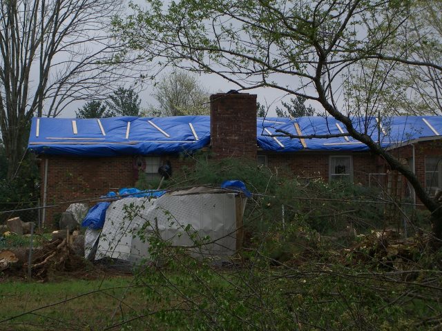 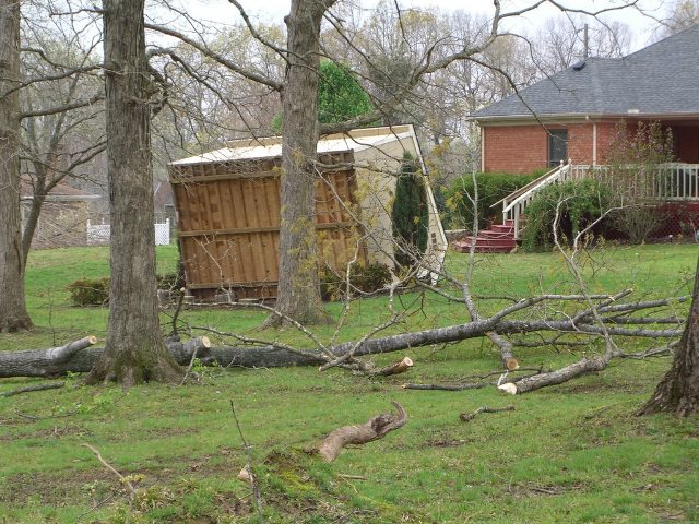   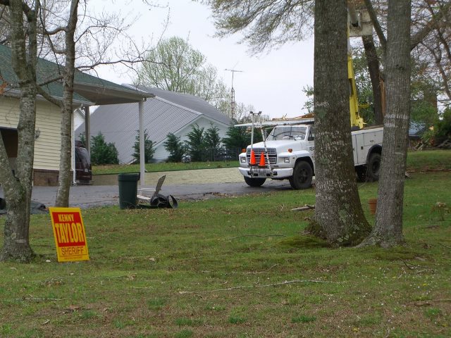 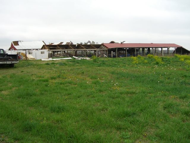 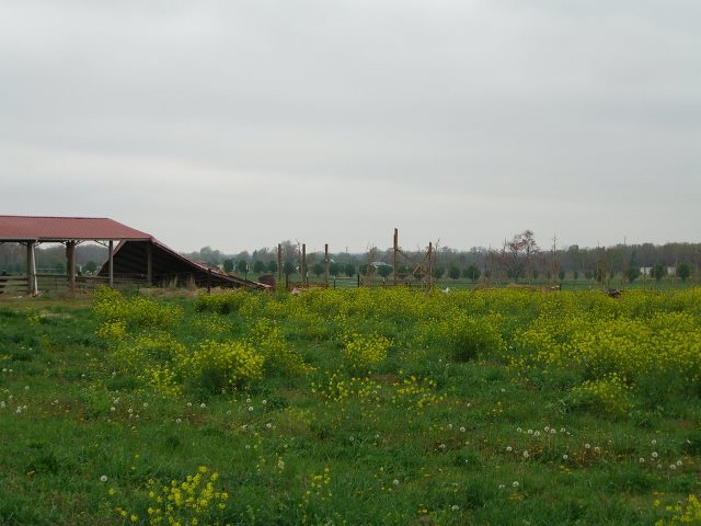 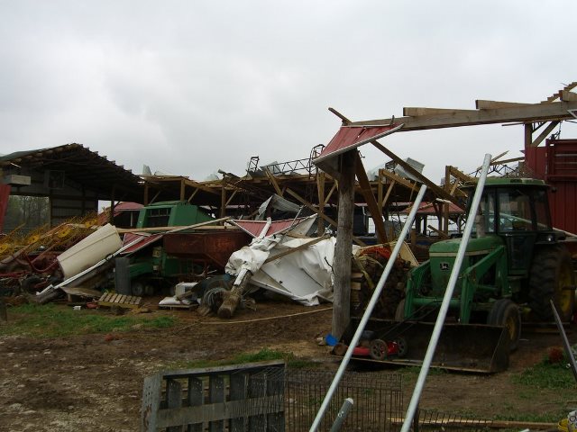  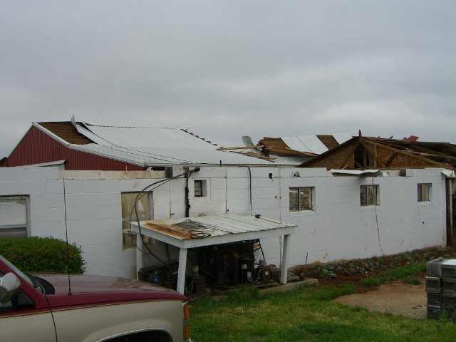   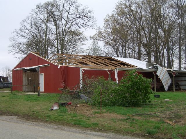 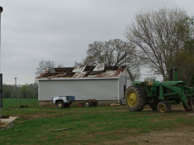 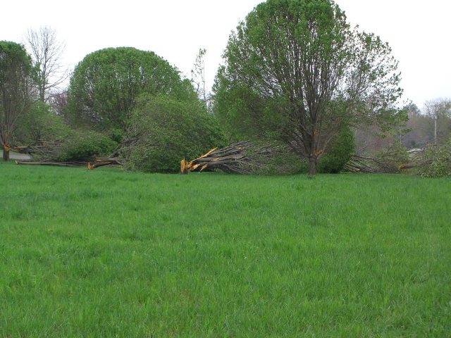 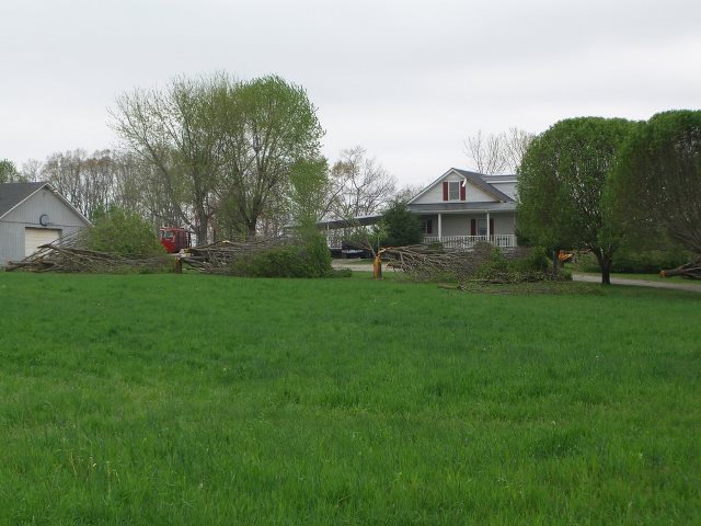 |
|
| F1 Cumberland County Tornado | |
| Counties: | Cumberland |
| Time: | 4:46 PM CST |
| EF Scale: | F1 |
| Damage Path Length: | 6.20 miles |
| Damage Path Width: | 150 yards |
| Fatalities: | 0 |
| Injuries | 4 |
| Damage: STORM DATA: 6 homes were destroyed (2 were mobile homes). 6 other homes with 50% of the structure damaged and a total of 181 homes damaged. There was $3.2 million estimate for just homes. This estimate did not include out-buildings or vehicles. Final debris estimates on clean-up have reached over $200,000. Final damage estimate will approach $4 million. SHAMBURGER (2015): Radar data and Google Earth aerial imagery indicate this tornado began further southwest and had a longer path than originally listed in NCDC and Storm Data, and the time and path length of this tornado were corrected accordingly. Of note, this tornado was the 5th tornado since 1995 to affect the same two mile wide zone on the south side of Crossville. |
|
Cumberland County Photos: 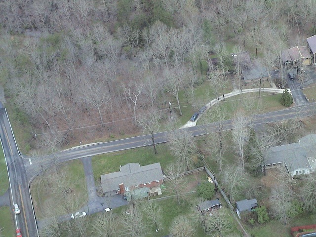    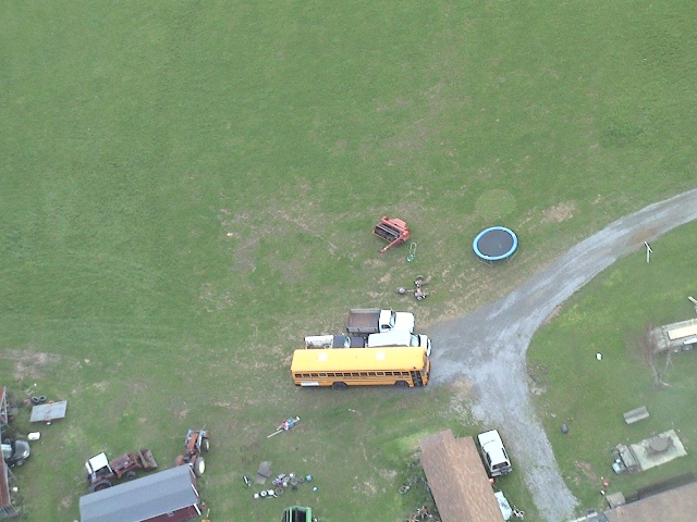 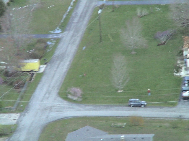 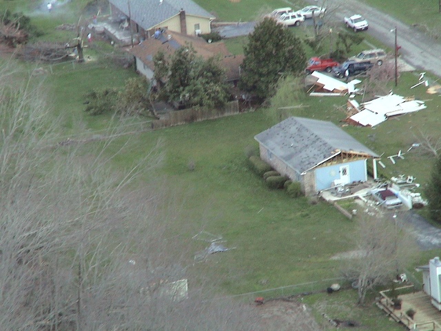 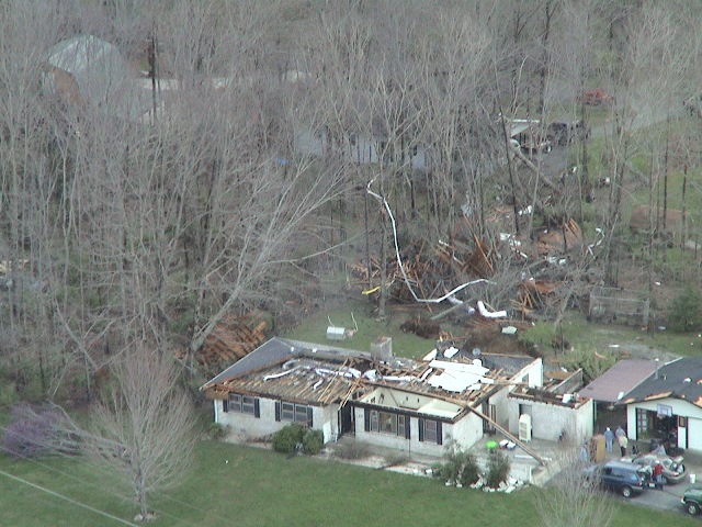 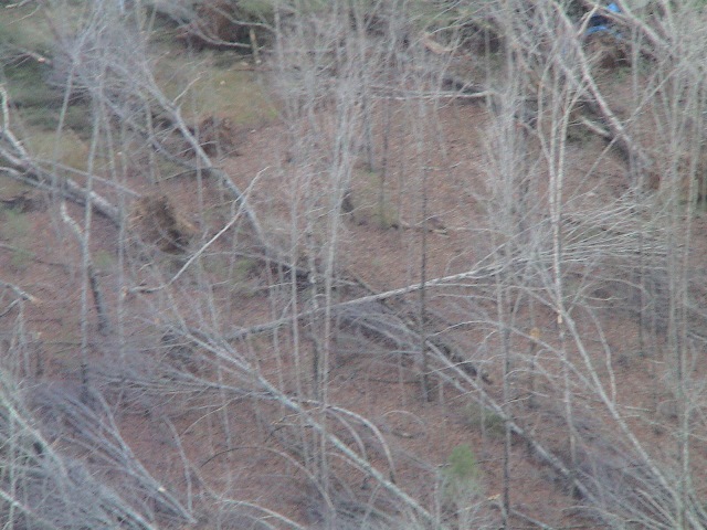 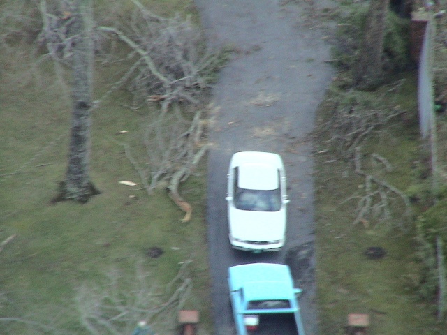 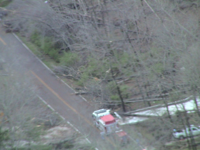 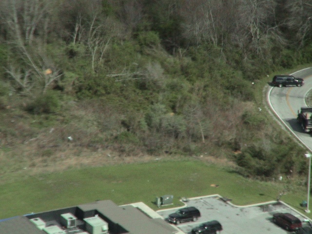  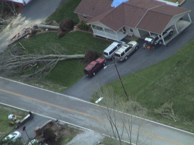 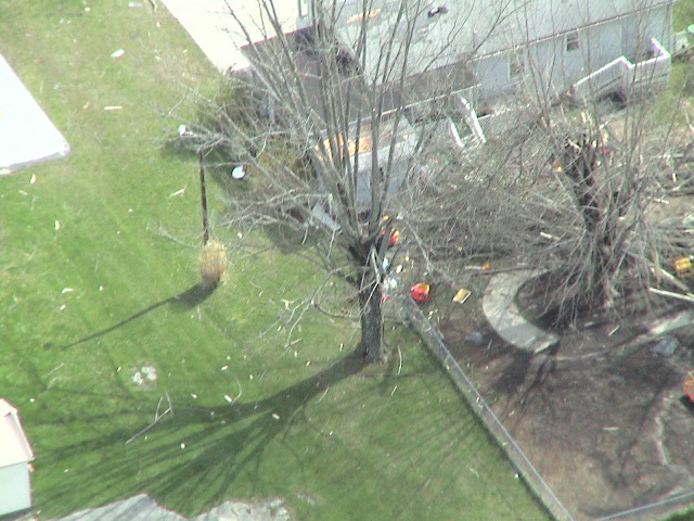 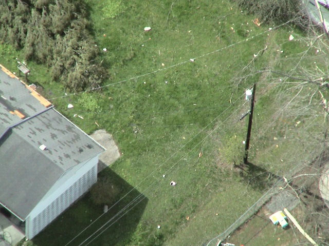  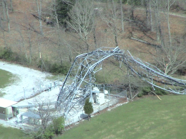 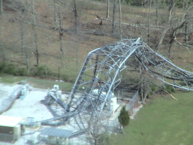 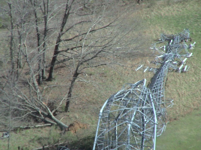  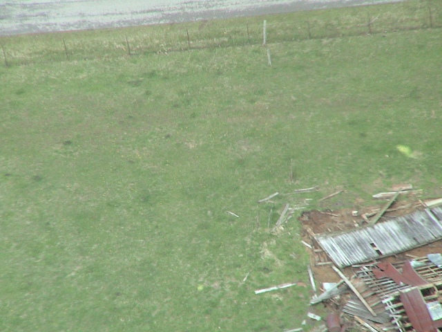    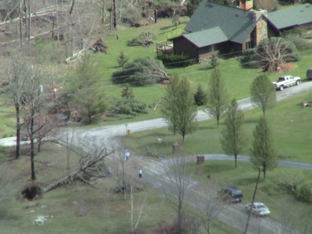  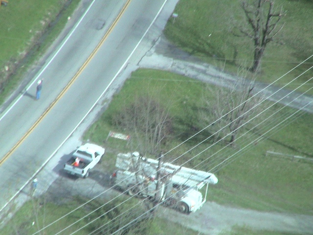   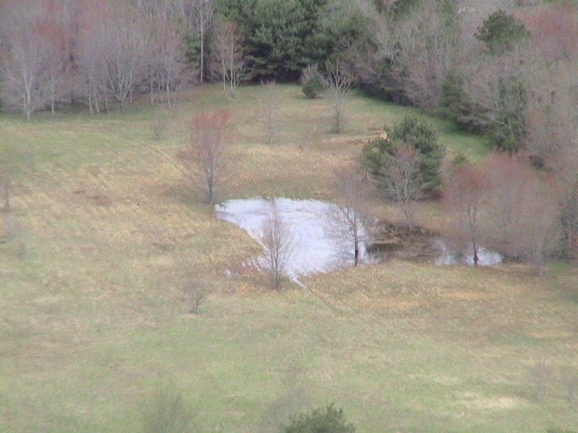  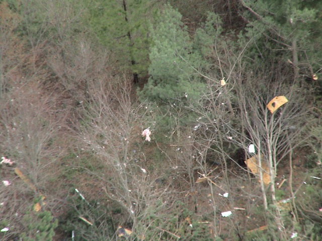 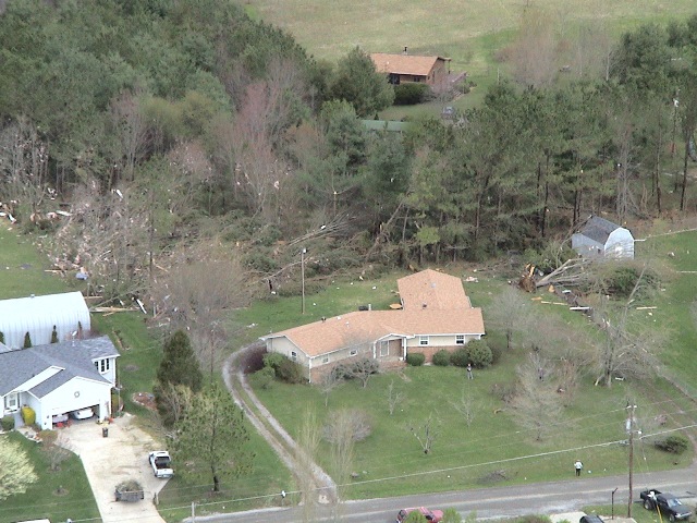  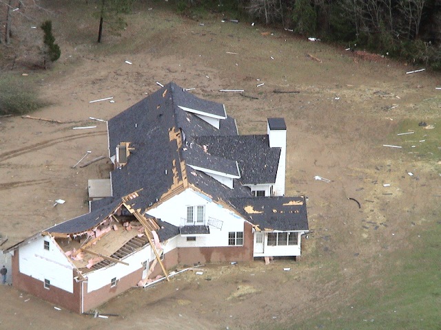 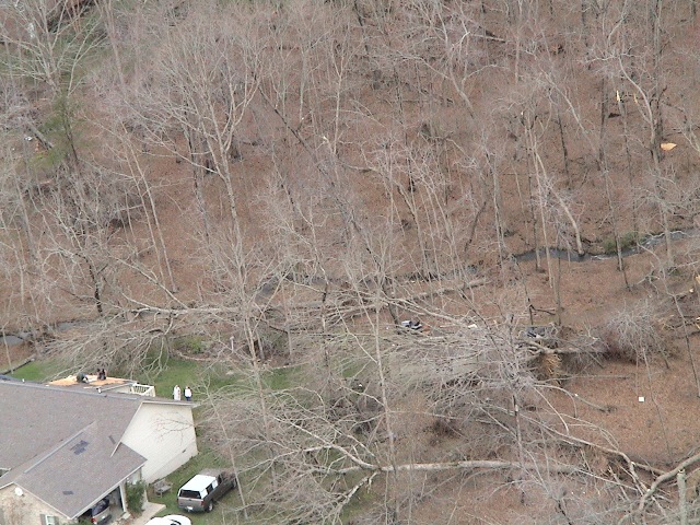 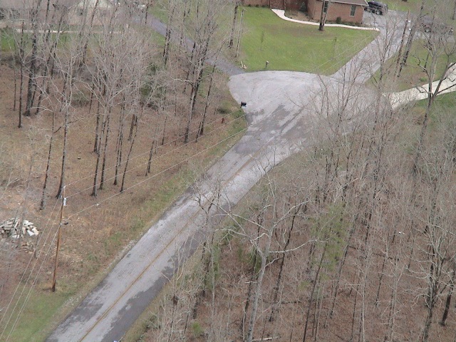 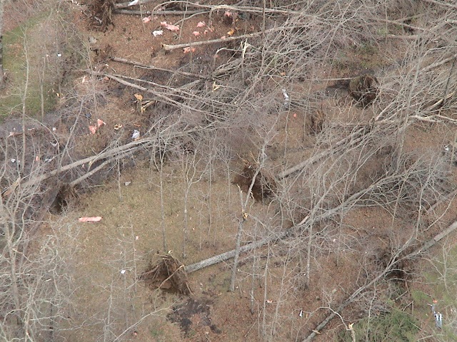 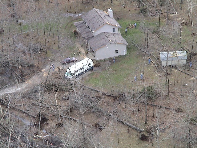 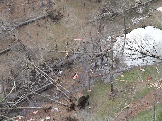 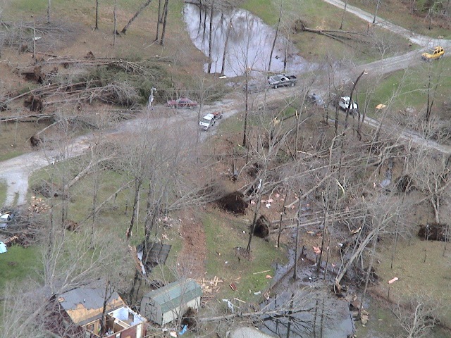 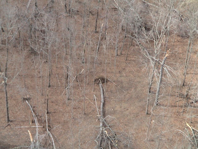 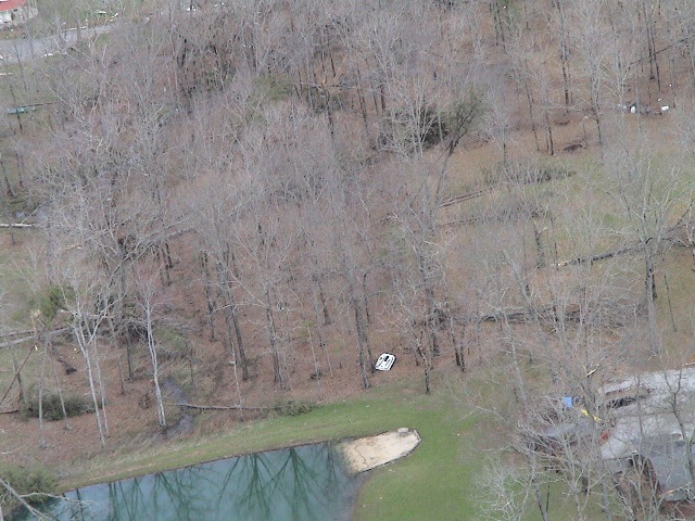 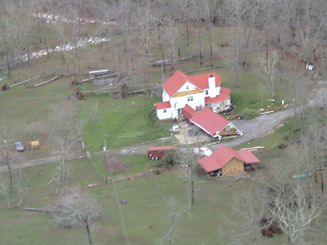   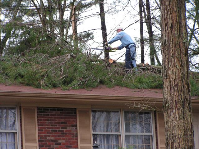 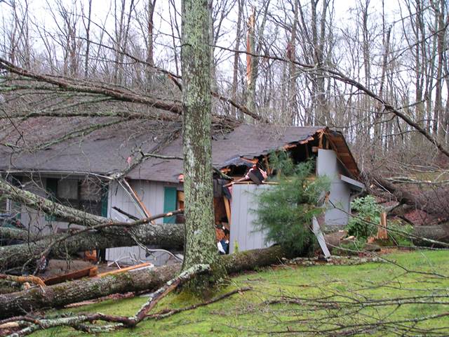 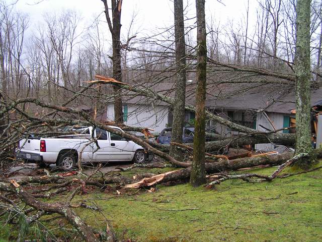 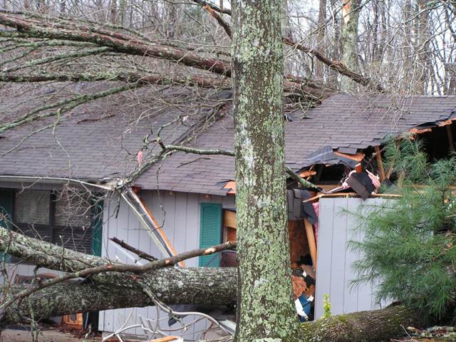 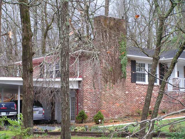 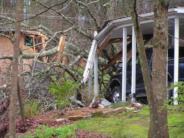 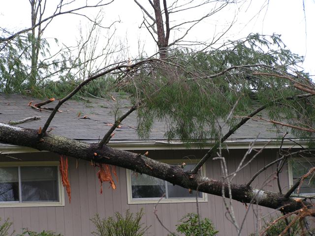 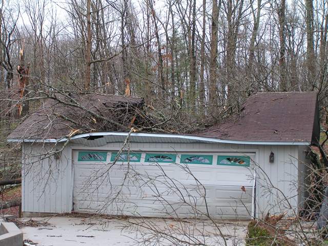 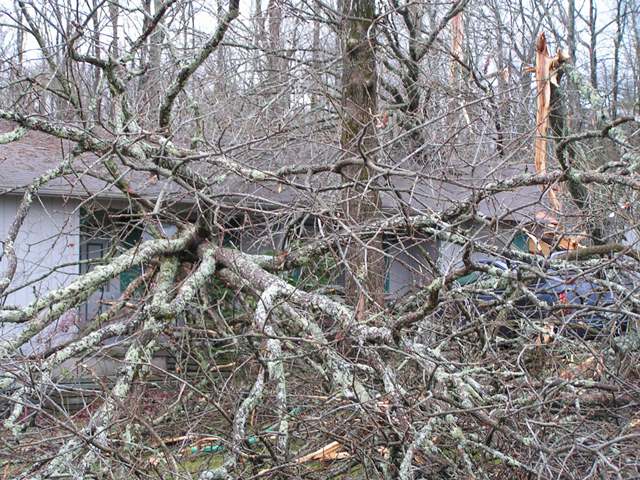 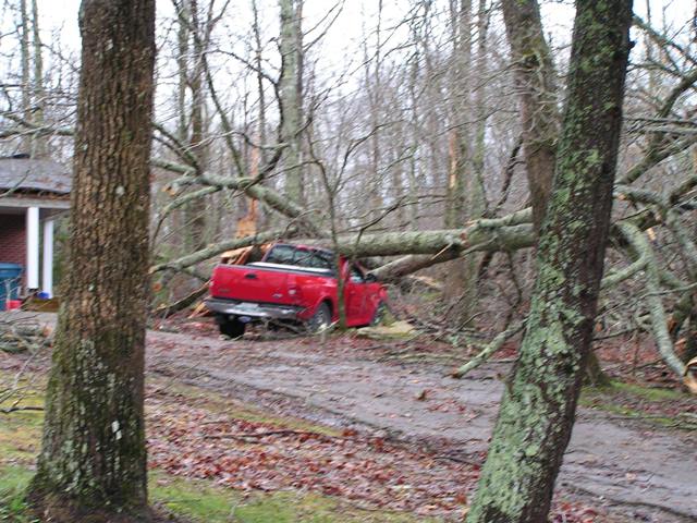 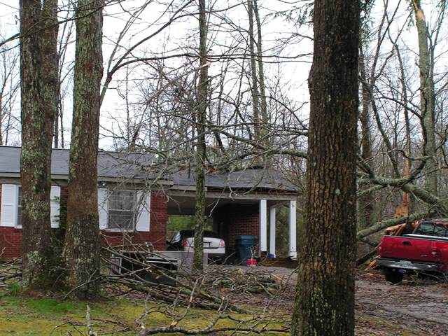 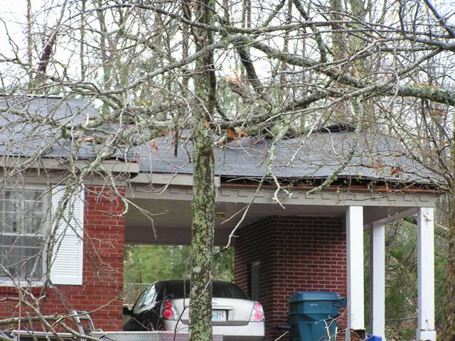 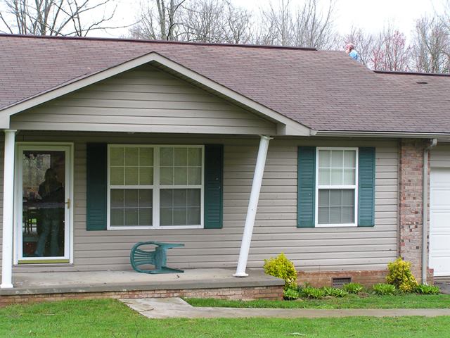 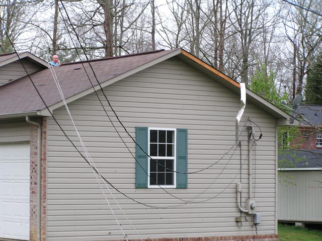 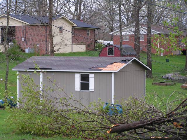 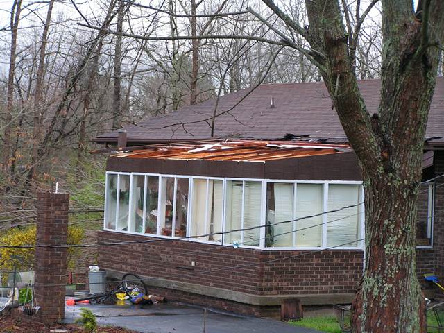 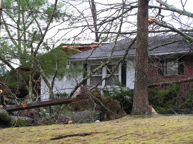 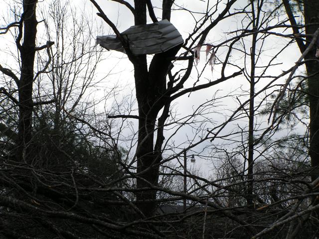 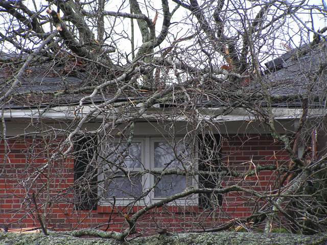 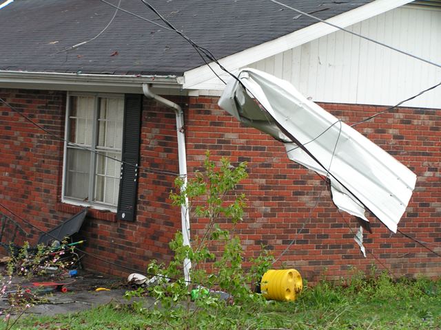 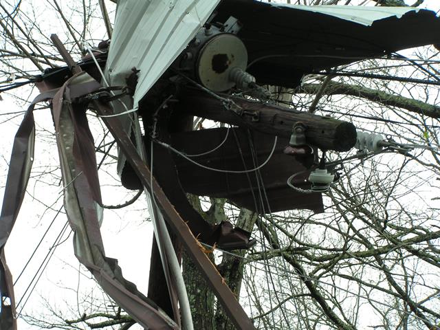    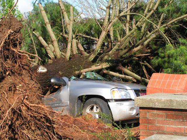 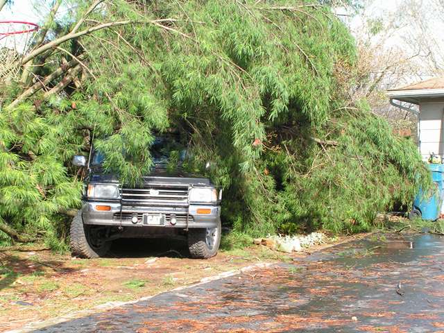 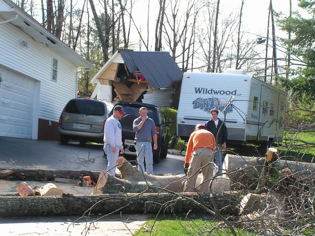    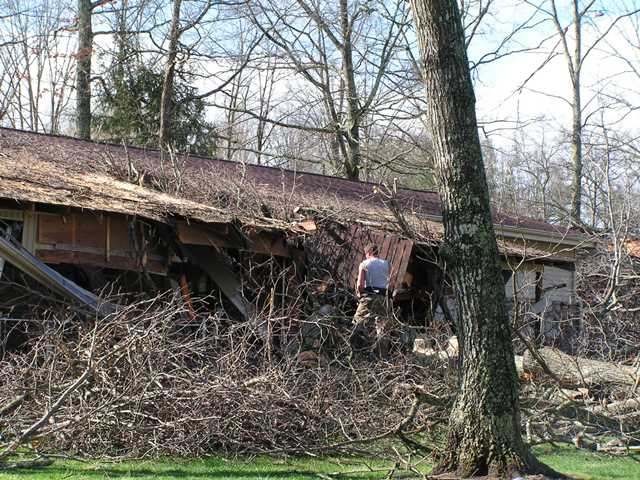 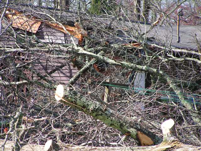 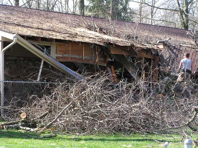   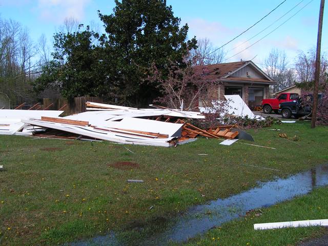 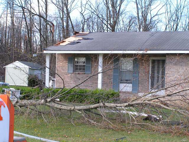 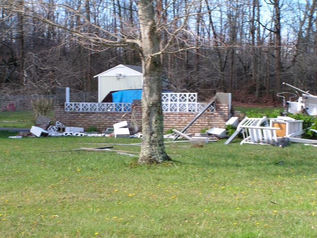 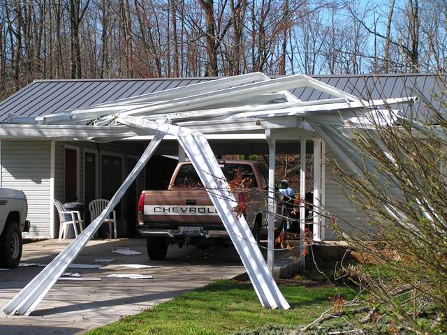  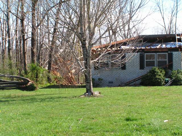 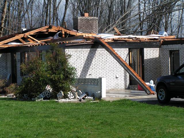  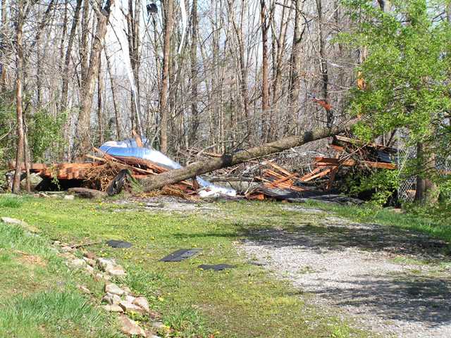 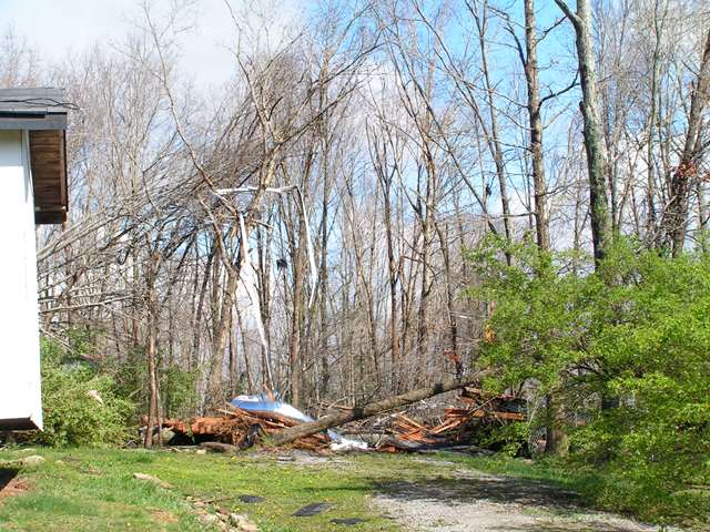 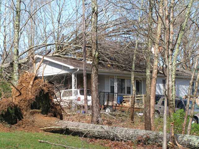 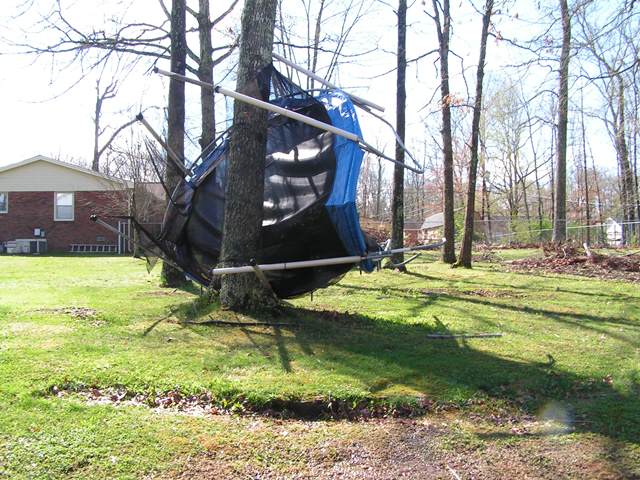 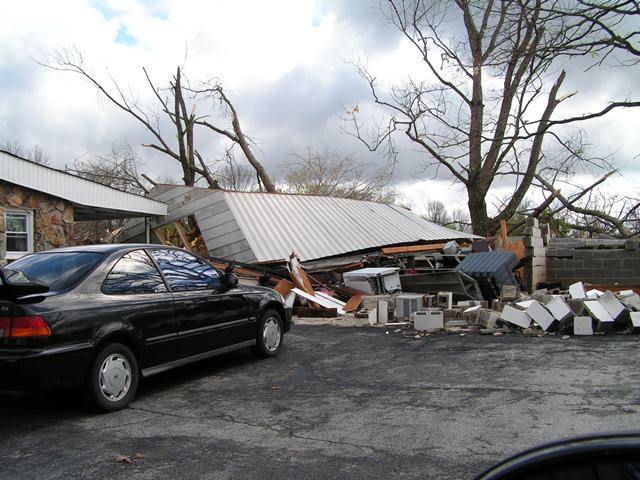     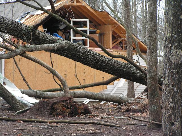 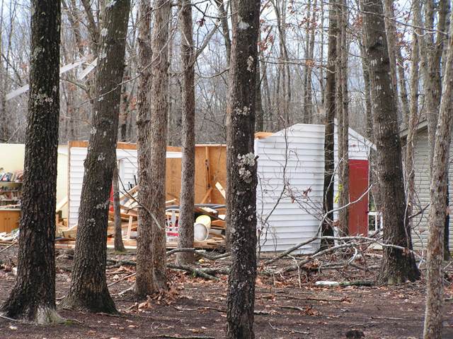 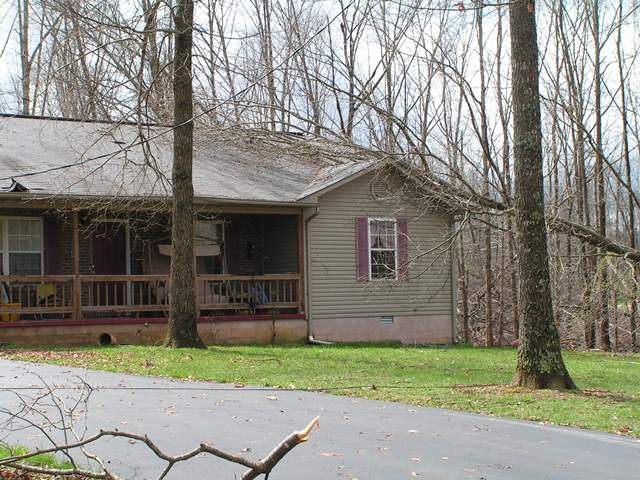 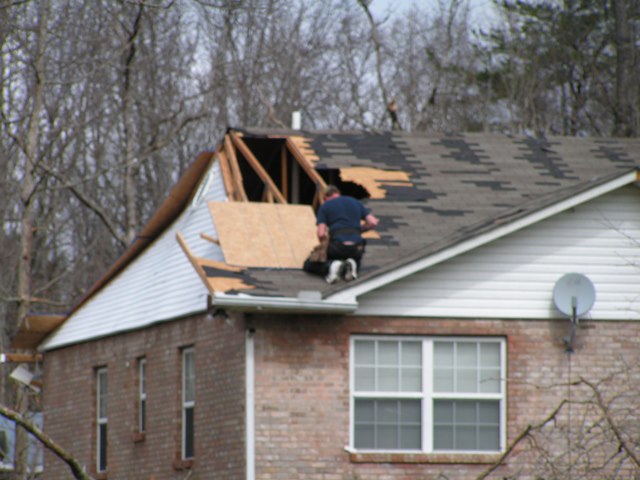 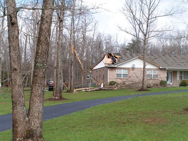 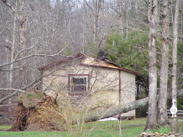 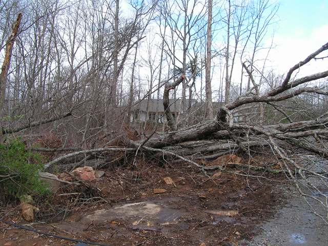 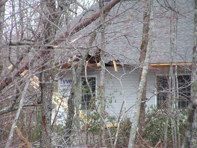 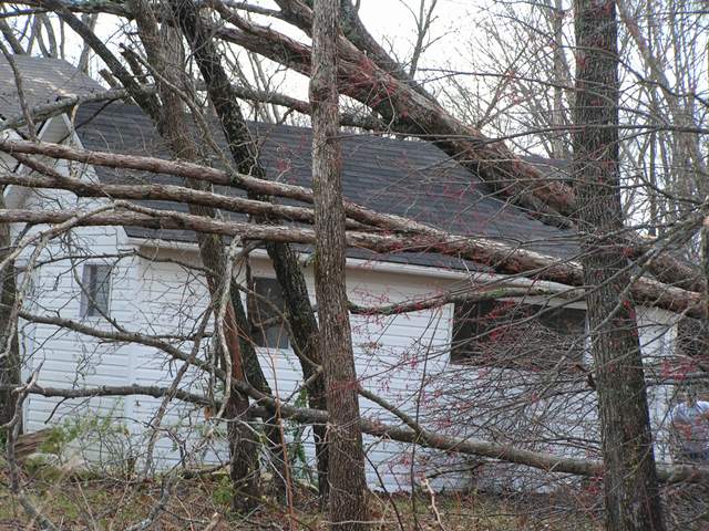 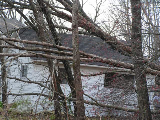 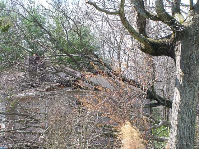   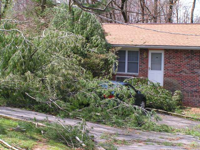 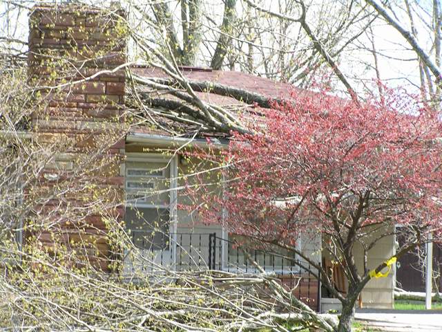 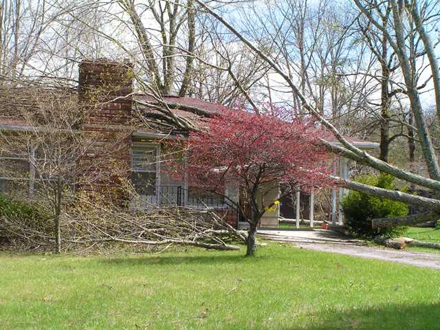 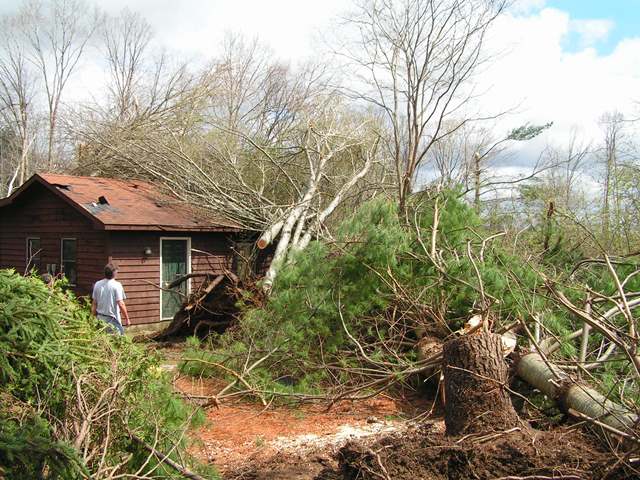 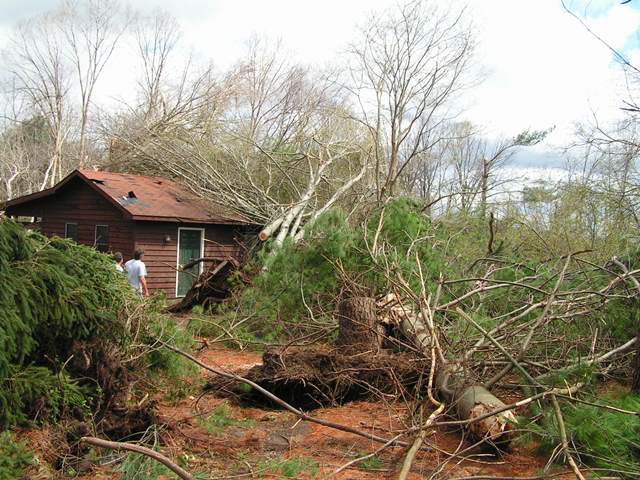 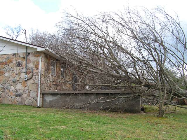  |
|
| F1 Warren County Tornado | |
| Counties: | Warren |
| Time: | 5:28 PM CST |
| EF Scale: | F1 |
| Damage Path Length: | 5.42 miles |
| Damage Path Width: | 100 yards |
| Fatalities: | 1 |
| Injuries | 0 |
| Damage: STORM DATA: A second F1 tornado hit Warren County almost two hours later from the first tornado. The tornado touched down near Morrison, TN along Caney Branch Road. This storm complex came out of Coffee County. There was extensive damage to a barn. A cinder block building was badly damaged. Numerous trees were down. The third fatality in Warren County occurred in a trailer home on Bonner Road to a 48 year-old female nurse. The trailer was destroyed. Three Weather Channel reporters were arrested for trespassing for being on the property where this fatality occurred. The tornado continued slightly south of east in the Country Club Subdivision. Several houses had roof damage, outbuildings were destroyed and a wooden shed was on its side. SHAMBURGER (2015): NCDC incorrectly lists the path of this tornado, which was corrected based on radar data and the narrative in Storm Data. |
|


 Follow us on YouTube