Overview
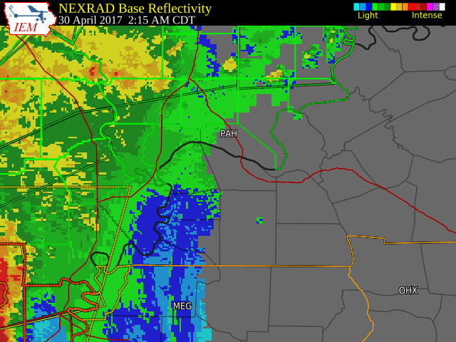
A complex of thunderstorms moved from northeast Arkansas and south central Missouri into southeast Missouri during the early morning hours of April 30, 2017. The thunderstorms produced some areas of wind damage in southeast Missouri, along with an EF-2 tornado in northern New Madrid County, Missouri.
Tornadoes:
|
|
||||||||||
|
||||||||||
|
Tornado - between Matthews and Sikeston Missouri
Track Map 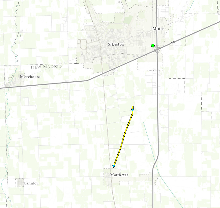 
|
||||||||||||||||
The Enhanced Fujita (EF) Scale classifies tornadoes into the following categories:
| EF0 Weak 65-85 mph |
EF1 Moderate 86-110 mph |
EF2 Significant 111-135 mph |
EF3 Severe 136-165 mph |
EF4 Extreme 166-200 mph |
EF5 Catastrophic 200+ mph |
 |
|||||
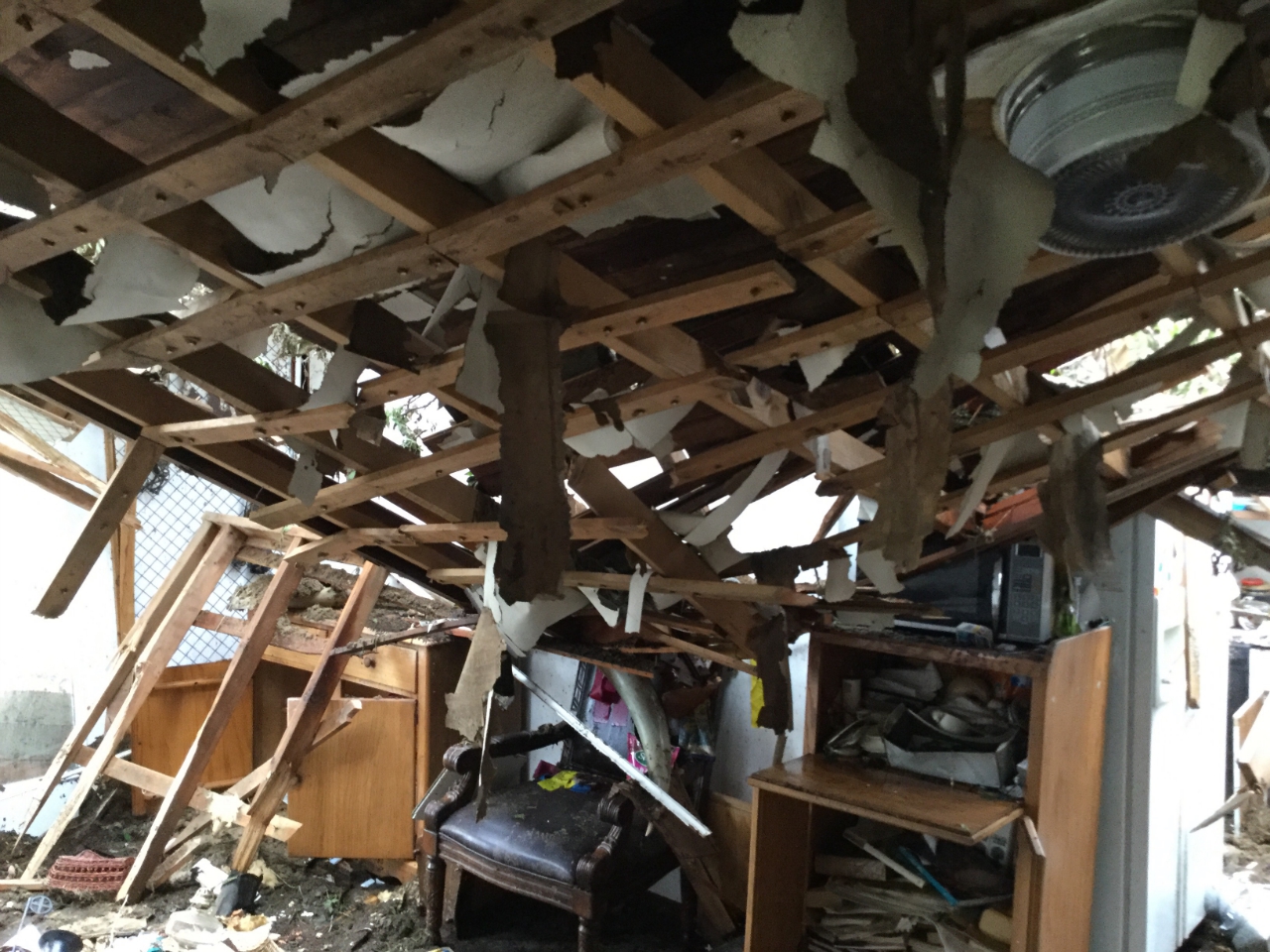
Photos:
 |
 |
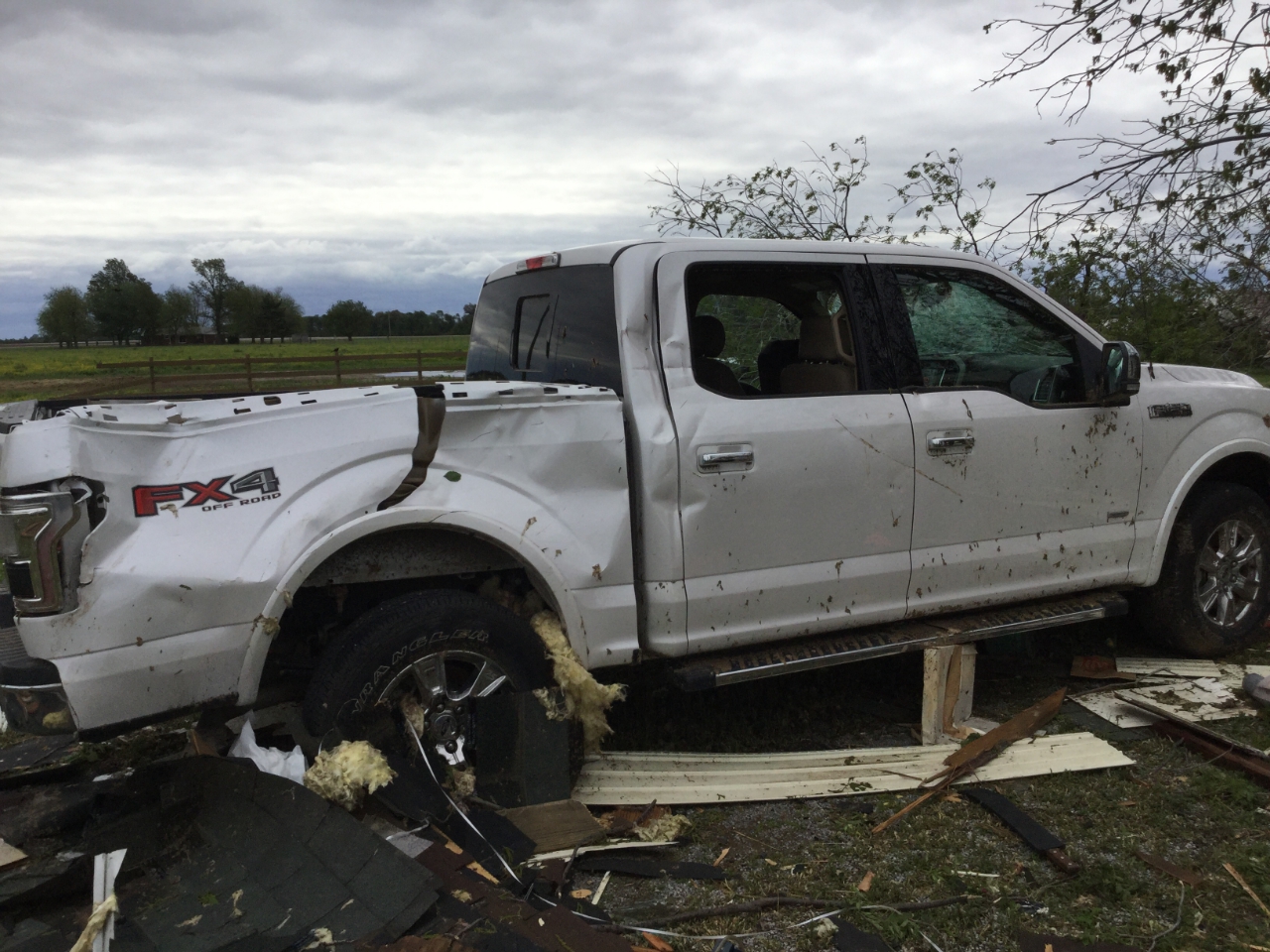 |
| Damaged Outbuilding north of Matthews, MO - NWS Storm Survey | Inside of house north of Matthews, MO - NWS Storm Survey | Damaged truck north of Matthews, MO - NWS Storm Survey |
 |
Media use of NWS Web News Stories is encouraged! Please acknowledge the NWS as the source of any news information accessed from this site. |
|