Overview
From the evening of February 6th into the early morning hours of February 7th, much of the region experienced minor ice accumulations. Temperatures gradually fell below freezing from near the Ohio River southeastward through the night, changing the rain over to freezing rain. Even though ice amounts were light, numerous accidents were reported, especially across the Tri-State area of northwest Kentucky and southwest Indiana Thursday morning as wet roads turned to black ice due to temperatures falling into the 20s.Ice Amounts
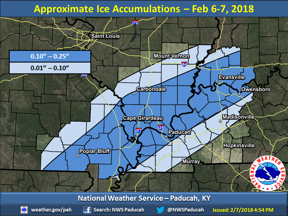
The graphic below depicts the approximate ice accumulations from this event based on local storm reports and airport observations we received. The zone of highest amounts generally stretched from portions of southeast Missouri into parts of Illinois, Kentucky, and Indiana along the Ohio River.
 |
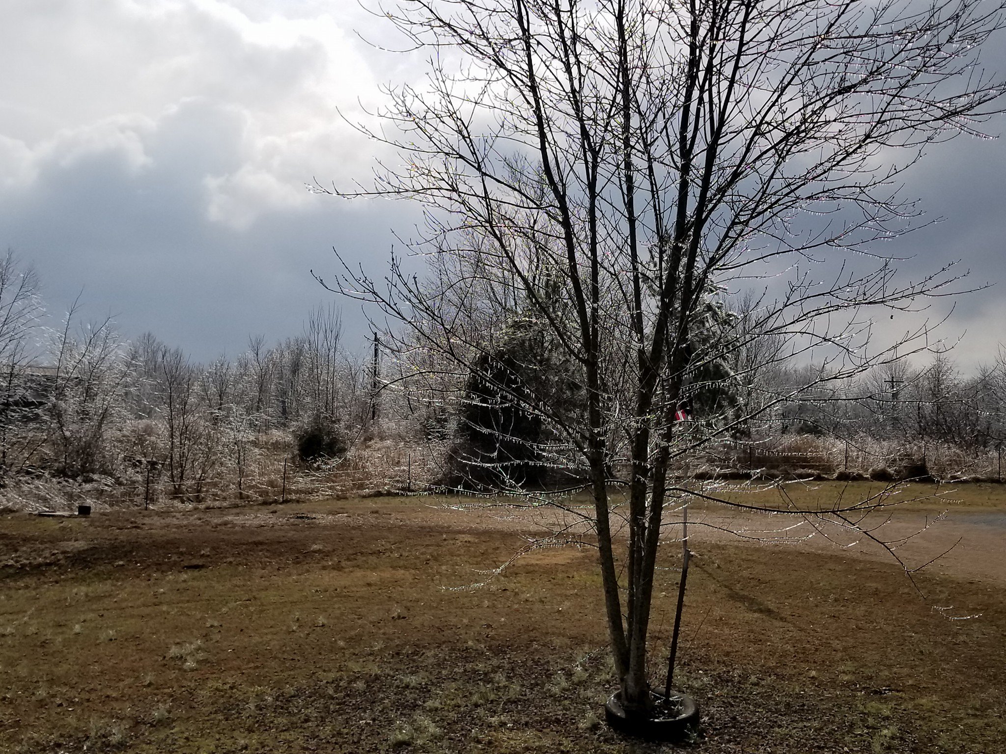
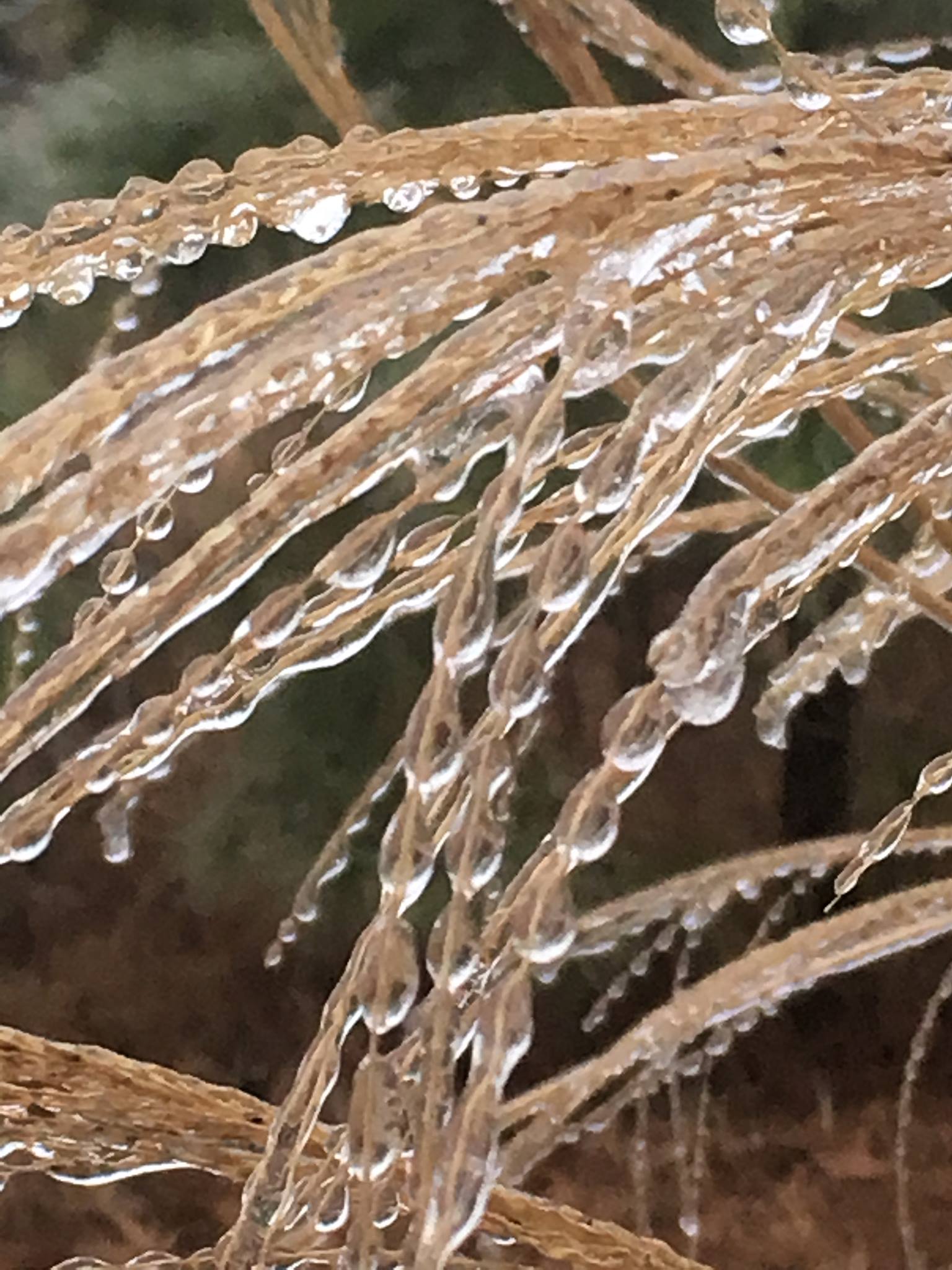
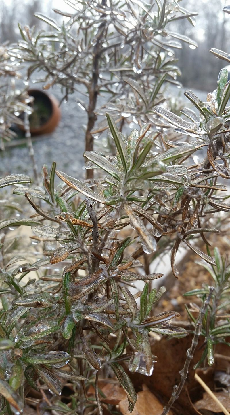
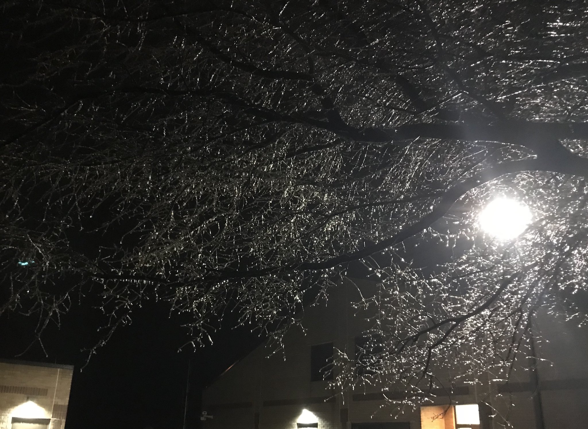
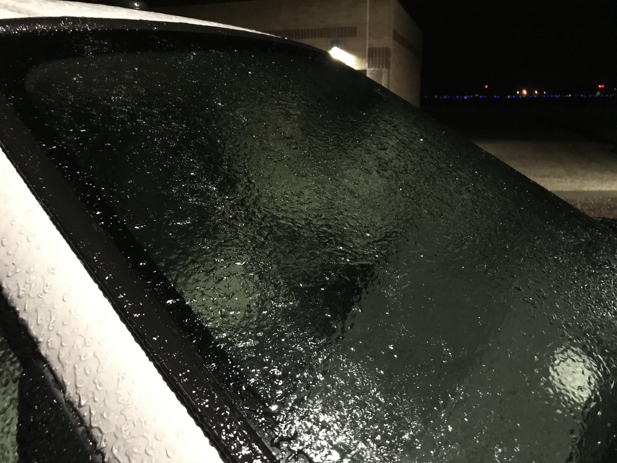
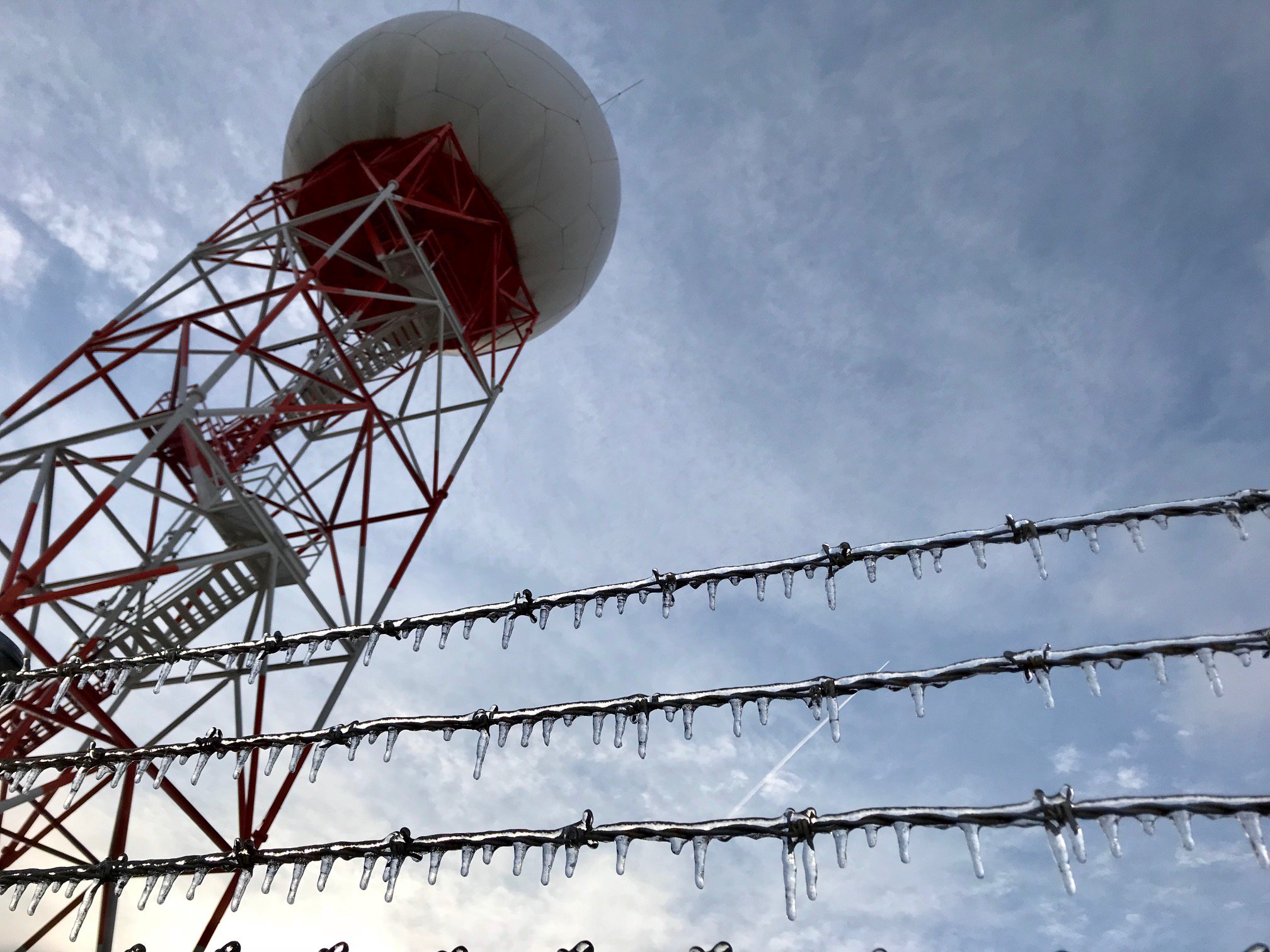
Photos:
 |
 |
 |
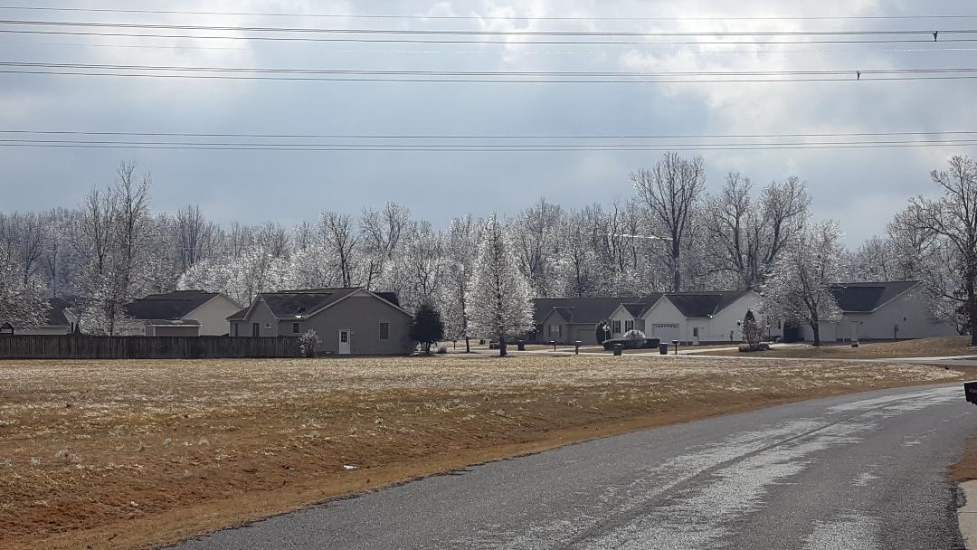 |
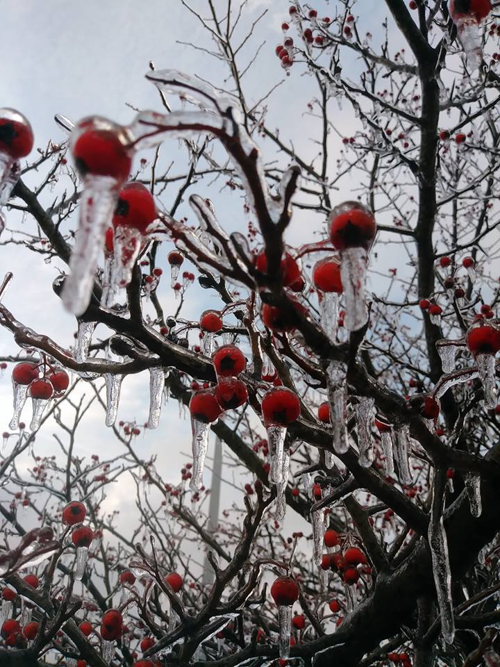
| Boaz, KY via Nancy C Turnbow | Dogwood, KY via Kim Cotham | Grand Chain, IL tree ice via Tammy Horn | Lone Oak, KY via NWS Employee |
 |
 |
 |
 |
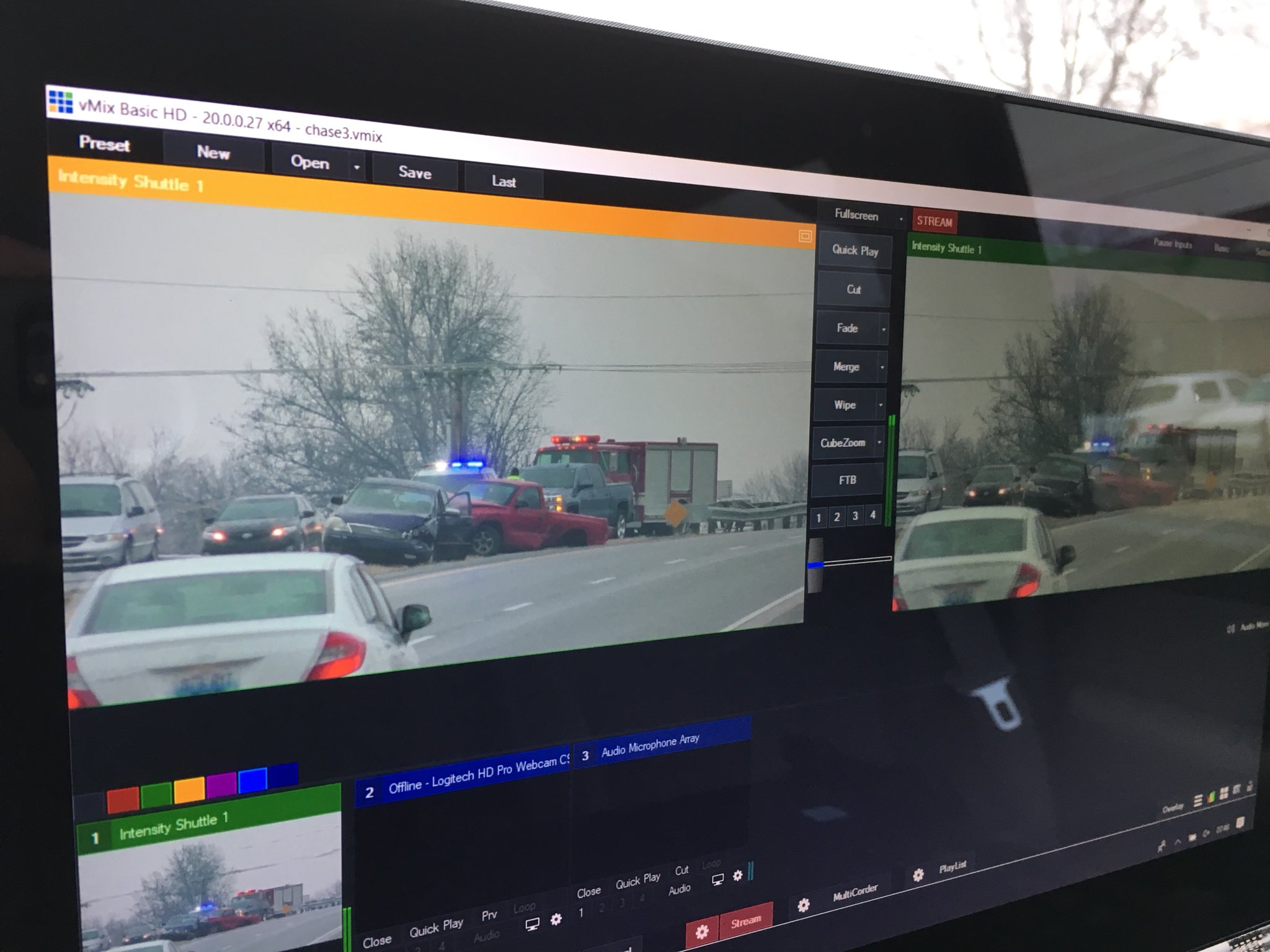
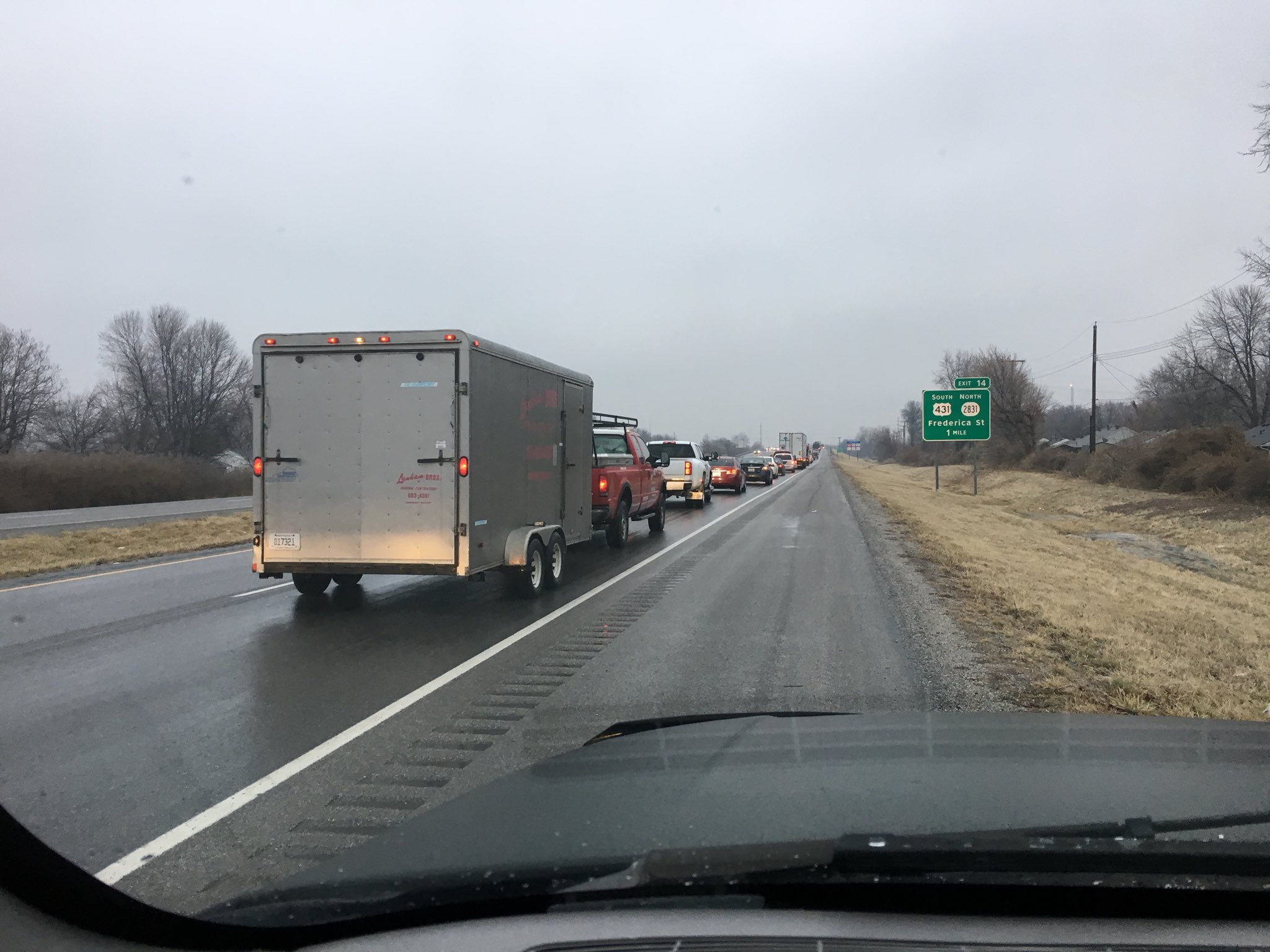
| Owensboro area accidents via Chris Conley | Owensboro Bypass at Hwy 431 backed up traffic due to accidents via Chris Conley | Paducah, KY via Angelica Silvio | Paducah, KY NWS Office evening of 6th by NWS employee |
 |
 |
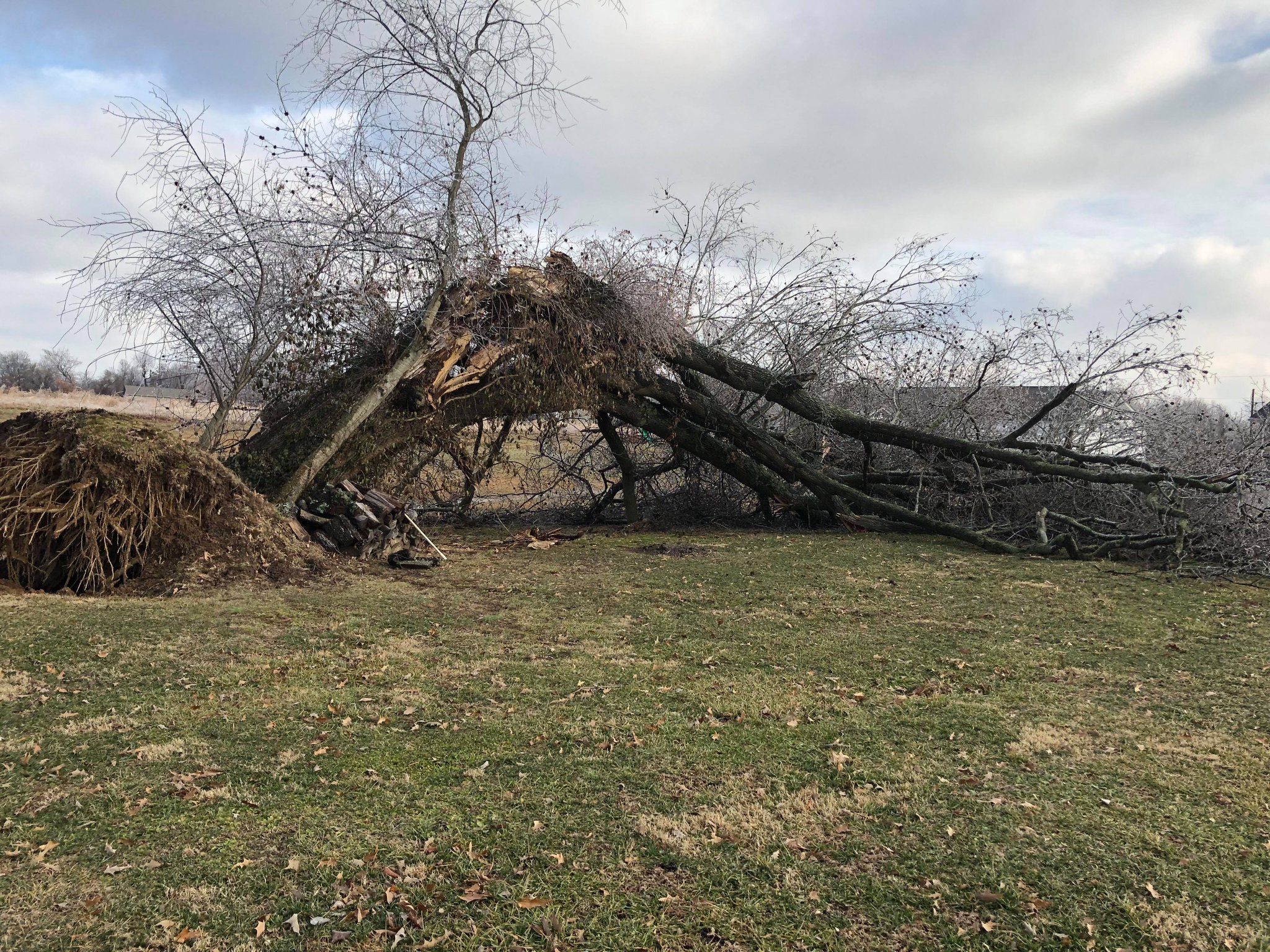 |
| Paducah, KY NWS Office showing glaze of ice on vehicles via NWS employee | Paducah, KY NWS Office shortly after sunrise Feb 7th | Tree uprooted due to ice in West Paducah, KY via Jennifer Cavitt |
Storm Reports
PRELIMINARY LOCAL STORM REPORT...SUMMARY
NATIONAL WEATHER SERVICE PADUCAH KY
230 PM CST WED FEB 07 2018

..TIME...   ...EVENT...      ...CITY LOCATION...     ...LAT.LON...
..DATE...   ....MAG....      ..COUNTY LOCATION..ST.. ...SOURCE....
            ..REMARKS..

0506 PM     FREEZING RAIN    POPLAR BLUFF            36.76N 90.41W
02/06/2018  E0.00 INCH       BUTLER             MO   BROADCAST MEDIA

            ICING REPORTED FORMING ON CARS.

0512 PM     FREEZING RAIN    3 E POPLAR BLUFF        36.76N 90.35W
02/06/2018  E0.00 INCH       BUTLER             MO   EMERGENCY MNGR

            ICING ON BACK DECK.

0512 PM     FREEZING RAIN    DEXTER                  36.79N 89.96W
02/06/2018  E0.00 INCH       STODDARD           MO   EMERGENCY MNGR

            ICING REPORTED ON VEHICLES.

0512 PM     FREEZING RAIN    FAIRDEALING             36.66N 90.62W
02/06/2018  E0.00 INCH       RIPLEY             MO   TRAINED SPOTTER

            LIGHT ICING REPORTED ON SIDEWALKS ALONG WITH LIGHTNING
            AND THUNDER.

0622 PM     FREEZING RAIN    PERRYVILLE              37.73N 89.87W
02/06/2018  E0.00 INCH       PERRY              MO   PUBLIC

            LIGHT ICING ACCUMULATING ON VEHICLES. RELAYED VIA
            TWITTER.

0623 PM     SLEET            BLOOMFIELD              36.89N 89.93W
02/06/2018  E0.00 INCH       STODDARD           MO   BROADCAST MEDIA

0623 PM     FREEZING RAIN    FRIEDHEIM               37.57N 89.82W
02/06/2018  E0.00 INCH       CAPE GIRARDEAU     MO   TRAINED SPOTTER

            ICING ON BACK DECK ALONG WITH LIGHTNING AND THUNDER.

0623 PM     FREEZING RAIN    9 S GREENVILLE          37.00N 90.45W
02/06/2018  E0.00 INCH       WAYNE              MO   LAW ENFORCEMENT

            LIGHT SLEET AND FREEZING RAIN ON STATE HIGHWAY F.

0627 PM     SLEET            BLOOMFIELD              36.89N 89.93W
02/06/2018  E0.00 INCH       STODDARD           MO   BROADCAST MEDIA

0634 PM     FREEZING RAIN    SCOTT CITY              37.22N 89.53W
02/06/2018  E0.00 INCH       SCOTT              MO   TRAINED SPOTTER

            ONSET OF FREEZING RAIN.

0653 PM     FREEZING RAIN    ANNA                    37.46N 89.24W
02/06/2018  E0.00 INCH       UNION              IL   BROADCAST MEDIA

            FREEZING RAIN MIXED WITH A FEW ICE PELLETS ALONG ILLINOIS
            HIGHWAQY 146. GLAZING ON ELEVATED SURFACES.

0653 PM     FREEZING RAIN    FAIRDEALING             36.66N 90.62W
02/06/2018  E0.00 INCH       RIPLEY             MO   TRAINED SPOTTER

            LIGHT GLAZE OF ICE ON MOST SURFACES.

0653 PM     FREEZING RAIN    ANNA                    37.46N 89.24W
02/06/2018  E0.00 INCH       UNION              IL   BROADCAST MEDIA

            FREEZING RAIN MIXED WITH SLEET ALONG ILLINOIS HIGHWAY 146
            JUST EAST OF ANNA. GLAZING ON ELEVATED SURFACES.

0653 PM     FREEZING RAIN    ANNA                    37.46N 89.24W
02/06/2018  E0.00 INCH       UNION              IL   BROADCAST MEDIA

            FREEZING RAIN MIXED WITH A FEW ICE PELLETS ALONG ILLINOIS
            HIGHWAY 146 JUST EAST OF ANNA. GLAZING ON ELEVATED
            SURFACES.

0700 PM     FREEZING RAIN    ENERGY                  37.78N 89.03W
02/06/2018  E0.00 INCH       WILLIAMSON         IL   TRAINED SPOTTER

            ONSET OF FREEZING RAIN.

0700 PM     FREEZING RAIN    GOREVILLE               37.56N 88.97W
02/06/2018  E0.00 INCH       JOHNSON            IL   PUBLIC

            ONSET OF FREEZING RAIN AND SLEET.

0717 PM     FREEZING RAIN    ROUND KNOB              37.22N 88.73W
02/06/2018  E0.00 INCH       MASSAC             IL   TRAINED SPOTTER

            ONSET OF FREEZING RAIN WITH SPOTTY GLAZING.

0720 PM     SLEET            PADUCAH                 37.07N 88.64W
02/06/2018  E0.00 INCH       MCCRACKEN          KY   PUBLIC

            MIXED SLEET AND RAIN ON IN THE WEST END OF PADUCAH.
            RELAYED VIA TWITTER.

0729 PM     FREEZING RAIN    LA CENTER               37.07N 88.97W
02/06/2018  E0.00 INCH       BALLARD            KY   TRAINED SPOTTER

            LIGHT FREEZING RAIN WITH GLAZING ON CARS.

0738 PM     SLEET            POPLAR BLUFF            36.76N 90.41W
02/06/2018  E0.00 INCH       BUTLER             MO   EMERGENCY MNGR

            SLEET CURRENTLY FALLING WITH ROADS IN POPLAR BLUFF
            BECOMING SLICK. RELAYED FROM MISSOURI HIGHWAY PATROL.

0741 PM     FREEZING RAIN    DEXTER                  36.79N 89.96W
02/06/2018  E0.00 INCH       STODDARD           MO   EMERGENCY MNGR

            STEADY FREEZING RAIN WITH FALLING IN DEXTER WITH LIGHT
            ACCUMULATION ON TREE LIMBS AND CITY STREETS. THUNDER
            REPORTED WITH THE FREEZING RAIN.

0742 PM     FREEZING RAIN    FANCY FARM              36.76N 88.79W
02/06/2018  E0.00 INCH       GRAVES             KY   BROADCAST MEDIA

            LIGHT ICING ON HANDRAILS AND VEHICLES.

0756 PM     FREEZING RAIN    PADUCAH                 37.07N 88.64W
02/06/2018  E0.00 INCH       MCCRACKEN          KY   BROADCAST MEDIA

            FREEZING RAIN WITH GLAZING ON CARS.

0813 PM     FREEZING RAIN    5 NW POCAHONTAS         37.55N 89.70W
02/06/2018  E0.00 INCH       CAPE GIRARDEAU     MO   TRAINED SPOTTER

            I-55 IN MISSOURI AROUND THE 115 MILE MARKER AND SOUTH IS
            ICY.

0816 PM     FREEZING RAIN    GREENVILLE              37.13N 90.45W
02/06/2018  E0.00 INCH       WAYNE              MO   EMERGENCY MNGR

            THIN ICE ACCUMULATION ON DECK.

0816 PM     FREEZING RAIN    ROUND KNOB              37.22N 88.73W
02/06/2018  E0.00 INCH       MASSAC             IL   TRAINED SPOTTER

            THIN GLAZING ON TREES POWER LINES AND OTHER ELEVATED
            SURFACES.

0824 PM     SLEET            NEWBURGH                37.95N 87.40W
02/06/2018  E0.00 INCH       WARRICK            IN   BROADCAST MEDIA

            SLEET RAIN MIX CURRENTLY FALLING.

0838 PM     FREEZING RAIN    EVANSVILLE              37.98N 87.54W
02/06/2018  E0.00 INCH       VANDERBURGH        IN   BROADCAST MEDIA

            MODERATE TO HEAVY FREEZING RAIN FALLING. GLAZING ON CARS,
            SIGNS, AND POWER LINES.

0850 PM     FREEZING RAIN    PADUCAH                 37.07N 88.64W
02/06/2018  E0.00 INCH       MCCRACKEN          KY   LAW ENFORCEMENT

            THE BROOKPORT BRIDGE WAS ICED OVER AND WILL PROBABLY BE
            CLOSED SOON. THE BRIDGE HAS A METAL GRATE FOR ROADWAY AND
            IT FREEZES OVER RAPIDLY.

0850 PM     FREEZING RAIN    EVANSVILLE              37.98N 87.54W
02/06/2018  M0.00 INCH       VANDERBURGH        IN   TRAINED SPOTTER

            FREEZING RAIN GLAZE ON SIDEWALKS AND PARKING LOTS AS WELL
            AS TREES AND POWER LINES.

0900 PM     FREEZING RAIN    SMITHLAND               37.14N 88.40W
02/06/2018  E0.00 INCH       LIVINGSTON         KY   PUBLIC

            ICING ON TREES AND POWERLINES.

0905 PM     FREEZING RAIN    EAST PRAIRIE            36.78N 89.38W
02/06/2018  M0.13 INCH       MISSISSIPPI        MO   TRAINED SPOTTER

            MEASURED ONE-EIGHT INCH OF ICE ACCUMULATION. GLAZING ON
            TREES, VEHICLES, AND OTHER ELEVATED SURFACES.

0907 PM     FREEZING RAIN    CAPE GIRARDEAU          37.31N 89.55W
02/06/2018  E0.13 INCH       CAPE GIRARDEAU     MO   BROADCAST MEDIA

            ESTIMATED ONE-EIGHTH OF AN INCH OF ACCUMULATION.
            SIDEWALKS,TREES, POWER LINES AND UNTREATED SURFACED
            GLAZED AND SLICK.

0908 PM     FREEZING RAIN    EAST PRAIRIE            36.78N 89.38W
02/06/2018  M0.13 INCH       MISSISSIPPI        MO   TRAINED SPOTTER

            MEASURED ONE-EIGHTH OF AN INCH OF ICE ACCUMULATION.
            GLAZING ON TREES AND ELEVATED SURFACES.

0917 PM     FREEZING RAIN    FAIRDEALING             36.66N 90.62W
02/06/2018  M0.10 INCH       RIPLEY             MO   TRAINED SPOTTER

            MEASURED 0.10 INCH OF ACCUMULATION. SIDEWALKS, CARS, AND
            OTHER ELEVATED SURFACES GLAZED.

0921 PM     FREEZING RAIN    OWENSVILLE              38.27N 87.69W
02/06/2018  E0.10 INCH       GIBSON             IN   TRAINED SPOTTER

            GLAZING ON TREES AND POWERLINES. ROADS BECOMING ICY.

0927 PM     FREEZING RAIN    POPLAR BLUFF            36.76N 90.41W
02/06/2018  M0.10 INCH       BUTLER             MO   EMERGENCY MNGR

            GLAZING ON POWERLINES, TREES, AND SIDEWALKS.

0943 PM     FREEZING RAIN    2 SSE LA CENTER         37.05N 88.96W
02/06/2018  E0.13 INCH       BALLARD            KY   TRAINED SPOTTER

            ICE HAS ACCUMULATED ON POWERLINES, TREES, AND CARS.

0944 PM     FREEZING RAIN    MINER                   36.89N 89.53W
02/06/2018  E0.10 INCH       SCOTT              MO   PUBLIC

            ICE ON SIDEWALKS AND ROADS.

0952 PM     FREEZING RAIN    1 E FANCY FARM          36.76N 88.77W
02/06/2018  E0.00 INCH       GRAVES             KY   TRAINED SPOTTER

            LIGHT ICING ON DRIVEWAY AND SIDEWALKS.

0952 PM     FREEZING RAIN    MOUNT CARMEL            38.42N 87.77W
02/06/2018  E0.00 INCH       WABASH             IL   PUBLIC

            LIGHT GLAZING ON CARS. RELAYED VIA TWITTER.

0955 PM     FREEZING RAIN    PRINCETON               37.11N 87.88W
02/06/2018  E0.00 INCH       CALDWELL           KY   BROADCAST MEDIA

            LIGHT ICING ON VEHICLES.

1015 PM     FREEZING RAIN    KEVIL                   37.08N 88.89W
02/06/2018  E0.00 INCH       BALLARD            KY   BROADCAST MEDIA

            LIGHT ICING ON ELEVATED SURFACES.

1018 PM     FREEZING RAIN    DUDLEY                  36.79N 90.09W
02/06/2018  E0.00 INCH       STODDARD           MO   TRAINED SPOTTER

            LIGHT GLAZE ON ELEVATED SURFACES.

1024 PM     FREEZING RAIN    BUCKSKIN                38.23N 87.41W
02/06/2018  E0.00 INCH       GIBSON             IN   PUBLIC

            LIGHT GLAZING. SECONDARY ROADS ARE ICY.

1104 PM     FREEZING RAIN    HENDERSON               37.84N 87.58W
02/06/2018  E0.00 INCH       HENDERSON          KY   BROADCAST MEDIA

            RAIN HAS TRANSITIONED TO FREEZING RAIN IN HENDERSON.

1201 AM     FREEZING RAIN    WEST PADUCAH            37.08N 88.74W
02/07/2018  M0.15 INCH       MCCRACKEN          KY   OFFICIAL NWS OBS

            MIDNIGHT OBSERVATION TAKEN AT THE NWS FORECAST OFFICE IN
            WEST PADUCAH.

1234 AM     FREEZING RAIN    EVANSVILLE              37.98N 87.54W
02/07/2018  E0.00 INCH       VANDERBURGH        IN   TRAINED SPOTTER

            LIGHT GLAZING ON ELEVATED SURFACES NEAR THE ANGEL MOUNDS
            AREA. FREEZING RAIN STILL FALLING.

1239 AM     FREEZING RAIN    PADUCAH                 37.07N 88.64W
02/07/2018  E0.00 INCH       MCCRACKEN          KY   PUBLIC

            SMALL TREE LIMBS DOWNED BY ICING. PICTURE RELAYED VIA
            TWITTER.

1257 AM     FREEZING RAIN    BENTON                  38.01N 88.92W
02/07/2018  E0.00 INCH       FRANKLIN           IL   EMERGENCY MNGR

            EMERGENCY MANAGEMENT REPORTS SLICK ROADS AND MOTOR
            VEHICLE ACCIDENTS ACROSS FRANKLIN COUNTY. RELAYED VIA
            TWITTER.

0102 AM     FREEZING RAIN    HERRIN                  37.80N 89.03W
02/07/2018  E0.00 INCH       WILLIAMSON         IL   PUBLIC

            PUBLIC REPORTS UNTREATED ROADS ARE VERY ICY BETWEEN
            HERRIN AND CARTERVILLE IN WILLIAMSON COUNTY. RELAYED VIA
            TWITTER.

0600 AM     FREEZING RAIN    CAPE GIRARDEAU          37.31N 89.55W
02/07/2018  M0.13 INCH       CAPE GIRARDEAU     MO   ASOS

            STORM TOTAL MEASURED BY AUTOMATED SENSOR

0600 AM     FREEZING RAIN    CARBONDALE              37.72N 89.22W
02/07/2018  M0.11 INCH       JACKSON            IL   ASOS

            STORM TOTAL MEASURED BY AUTOMATED SENSOR

0600 AM     FREEZING RAIN    POPLAR BLUFF            36.76N 90.41W
02/07/2018  M0.08 INCH       BUTLER             MO   ASOS

            STORM TOTAL MEASURED BY AUTOMATED SENSOR

0600 AM     FREEZING RAIN    PADUCAH                 37.07N 88.64W
02/07/2018  M0.23 INCH       MCCRACKEN          KY   ASOS

            STORM TOTAL MEASURED BY AUTOMATED SENSOR

0600 AM     FREEZING RAIN    EVANSVILLE              37.98N 87.54W
02/07/2018  M0.18 INCH       VANDERBURGH        IN   ASOS

            STORM TOTAL REPORTED BY AUTOMATED SENSOR

0946 AM     FREEZING RAIN    DIEHLSTADT              36.96N 89.43W
02/07/2018  E0.15 INCH       SCOTT              MO   TRAINED SPOTTER
1000 AM     FREEZING RAIN    2 WNW JACKSON           37.39N 89.69W
02/07/2018  E0.10 INCH       CAPE GIRARDEAU     MO   PUBLIC

            EVENT TOTAL ICE ACCUMULATION.
0700 AM     FREEZING RAIN    EDDYVILLE               37.08N 88.08W
02/07/2018  M0.13 INCH       LYON               KY   TRAINED SPOTTER

            RELAYED VIA TWITTER.
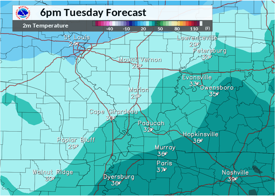
Observed Temperatures every 3 hours from 6PM Feb 6th - 6AM Feb 7th
 |
 |
Media use of NWS Web News Stories is encouraged! Please acknowledge the NWS as the source of any news information accessed from this site. |
|

