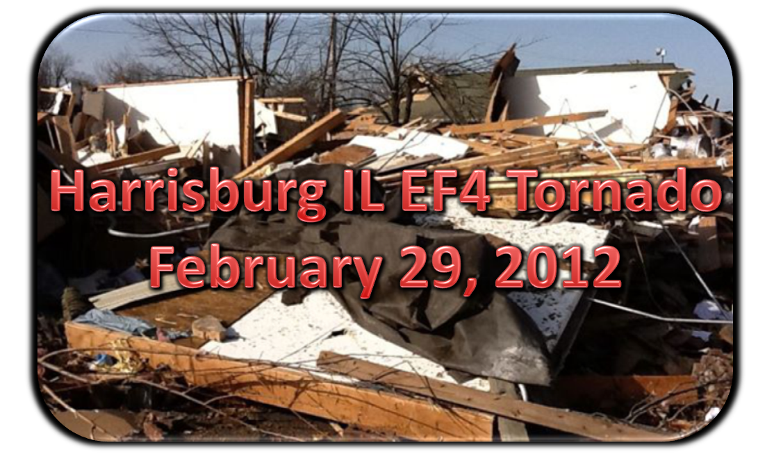
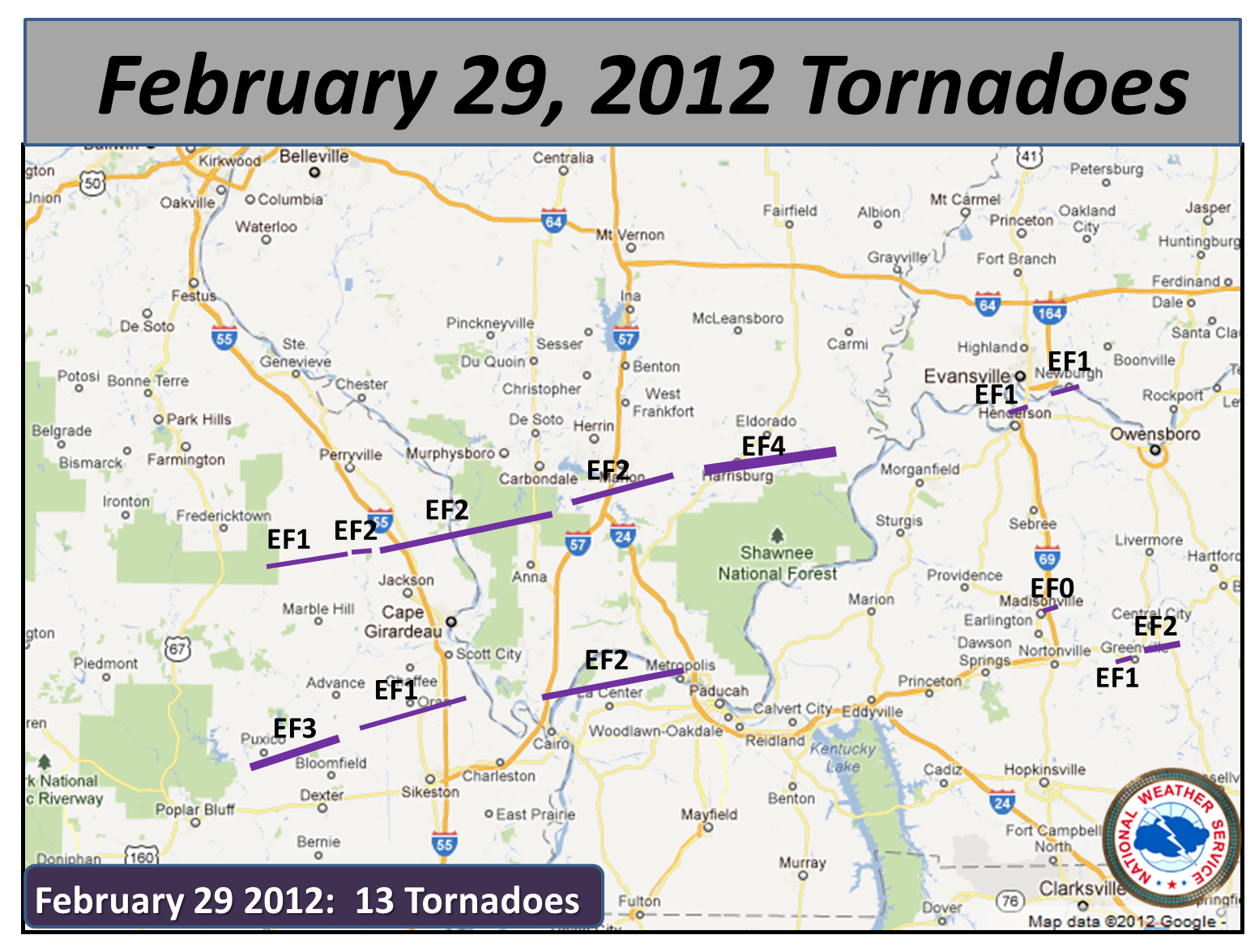
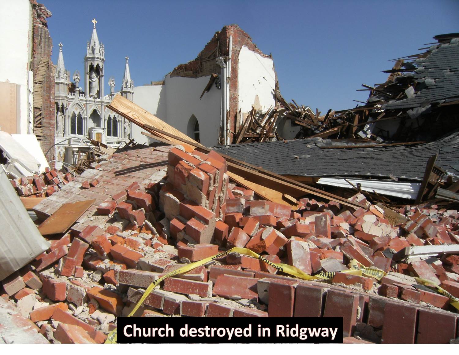
A squall line with embedded sustained supercells crossed into portions of southeast Missouri and southern Illinois during the early morning hours on February 29, 2012. The embedded supercells raced east-northeast at 60 to 70 mph, while the line moved southeast at a slower rate. The storms strengthened as they encountered richer low-level moisture, with surface dew points around 60 degrees spreading rapidly north-northeastward up the Mississippi Valley. Intense low to mid-level wind fields maintained the intensity of tornadic storms despite weak instability due to lack of solar heating. A south-southwesterly low level jet from 60 to 70 knots veered to west-southwest around 75 knots at 500 mb. Out of the 13 tornadoes that occurred that day, the most intense tornado was an EF4, which produced substantial damage to parts of Harrisburg and Ridgway Illinois.

BEFORE THE TORNADO: SETTING THE STAGE
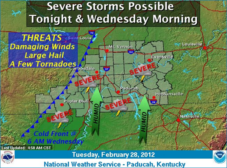
A few days before this tornado occurred, NWS Paducah and the Storm Prediction Center forecasters were already becoming concerned about the possibility of severe weather and tornadoes. Forecast discussions from NWS Paducah on the morning of February 27th highlighted the threat for severe weather and isolated tornadoes for the early morning hours on the 29th, due to the high degree of wind shear that was forecast. This threat for severe weather continued to be advertised with subsequent forecast discussions leading up to the event. In fact, almost 24 hours before the Harrisburg tornado occurred, forecasters at the NWS in Paducah issued this graphic:
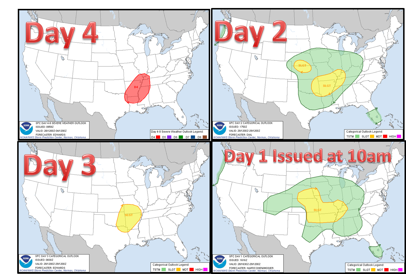
Let's take a look at some SPC (Storm Prediction Center) graphics leading up to this event:
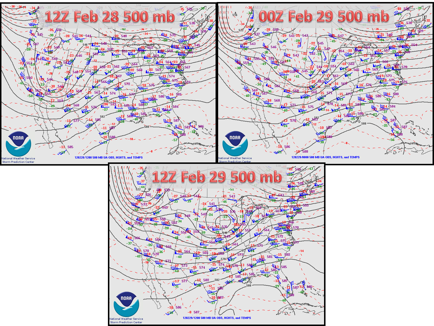
Looking at the upper air charts (500 mb) from 12Z Feb 28 through 12Z Feb 29 (Morning of the 28th through the morning of the 29th), shows the evolution of the upper trough. It starts out in the four corners region and then migrates northeast, strengthens, and becomes negatively titled and a closed low develops over northwest IA:
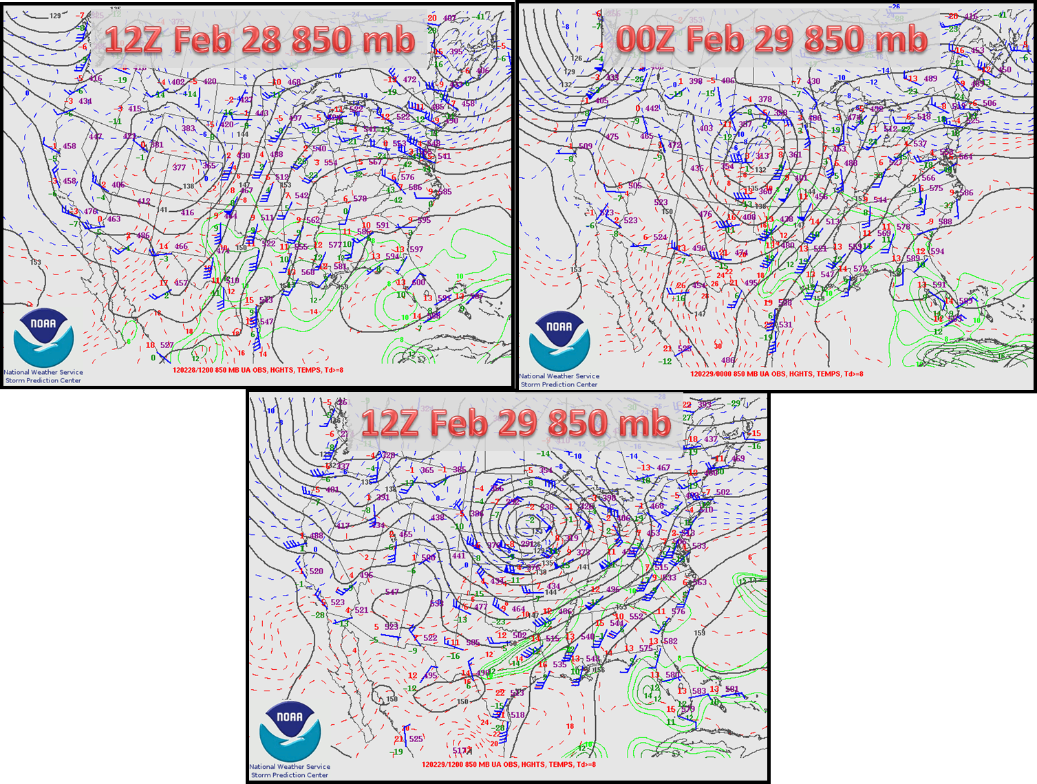
At 850mb, low pressure rapidly intensifies as it moves northeast, which allowed winds to strengthen and push warmer air and moisture up into our region:
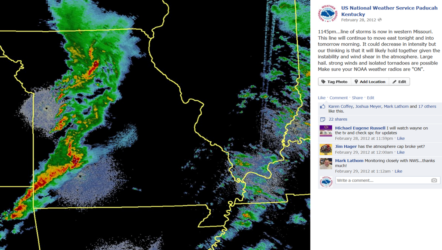
Roughly twenty four hours before the Harrisburg tornado, on the morning of February 28th, 2012, folks woke up to a rather chilly morning with temperatures in the 30s. The atmosphere was also very dry with dewpoints only in the 20s. Moisture would steadily increase throughout that day and high temperatures actually reached into the 60s to around 70 degrees with southeasterly winds. During the late evening hours on the 28th, winds shifted around to the south and increased dramatically and became very gusty. This allowed even more moisture to advect into the region. Shortly after midnight, dewpoints rose into the lower 60s across a good part of the area, which is a good deal of moisture for this time of year. While there were some scattered showers and thunderstorms around during the evening, the main line of severe storms was still off to the west at around midnight. Below is the Facebook post we submitted about that time:
THE EVENT: OVERNIGHT TORNADOES:
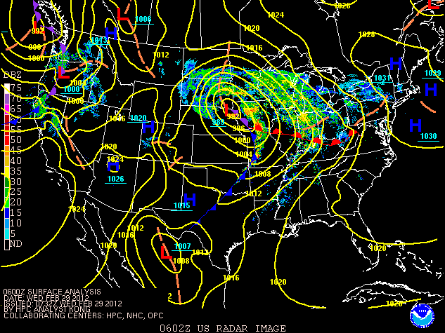
The graphic below shows the placement of the cold front at around midnight:
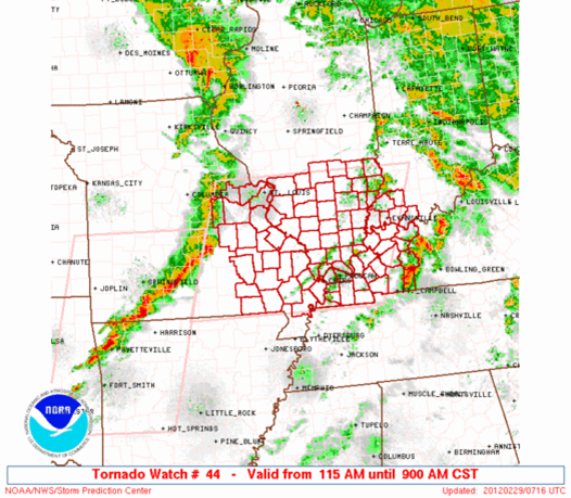
At 115 am, the Storm Prediction Center issued the Tornado Watch, which covered the entire region:
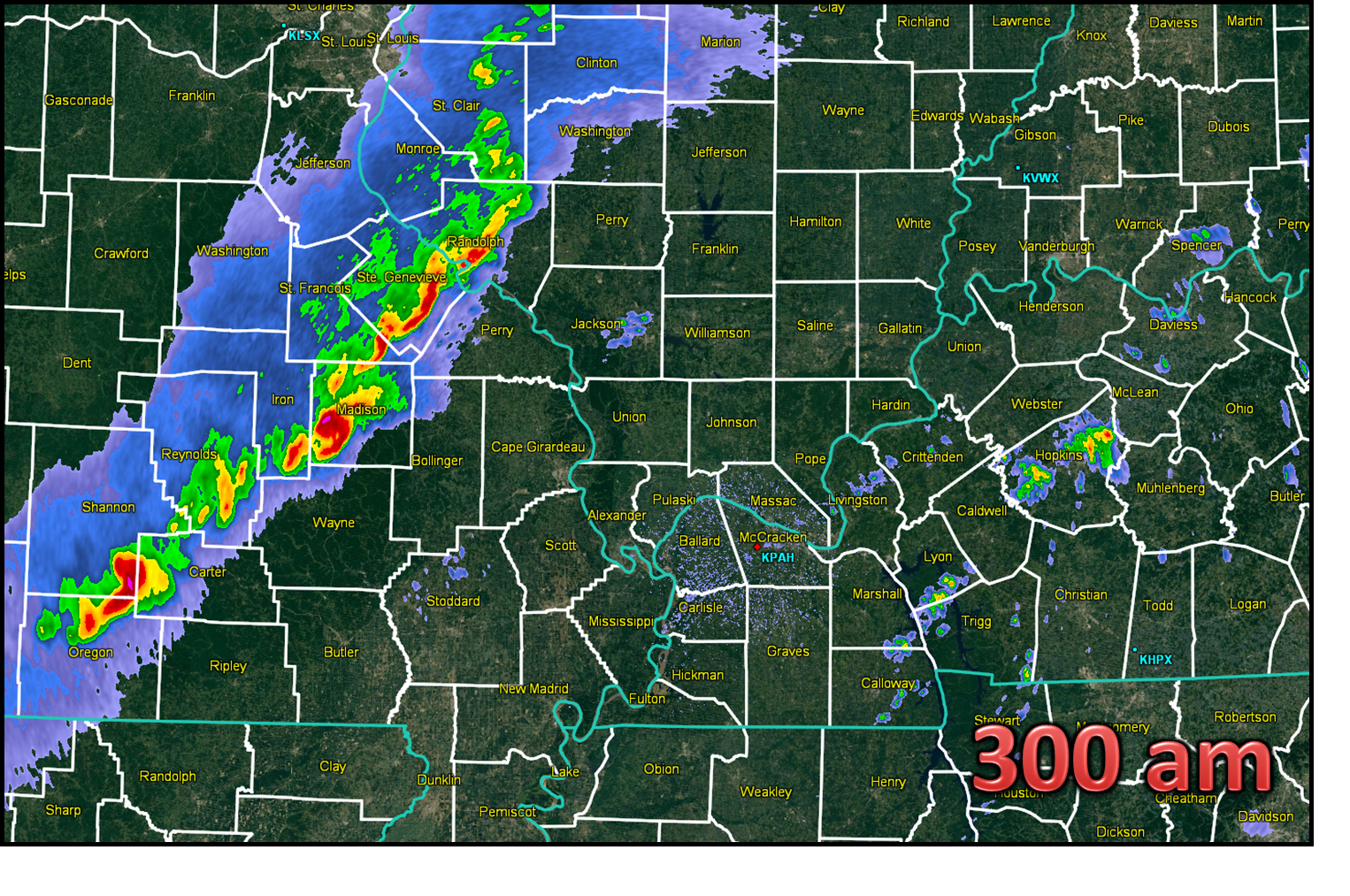
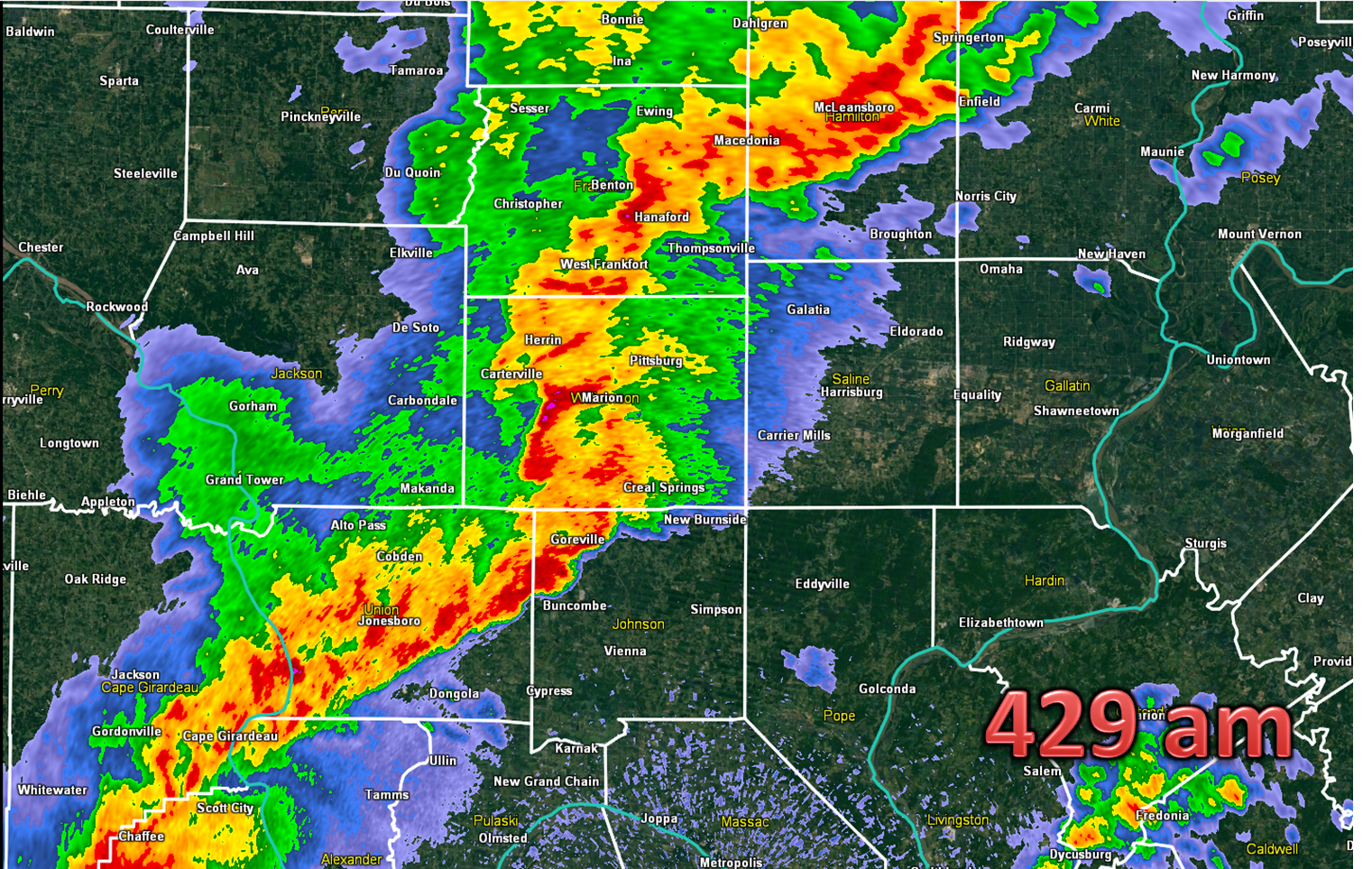
It would take another 3 hours or so before that line of storms would reach our area. Here is a look at the radar at 3am:
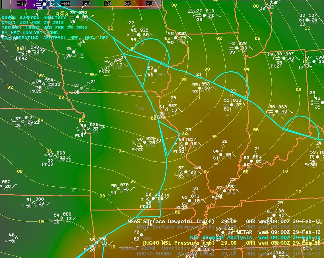
Here is a look at the synoptic set up around 3am (09Z). The surface low pressure system was positioned over northwest Iowa with the cold front extending down across central Iowa into eastern Missouri and northwestern Arkansas. Our area was clearly in what we call the "warm sector" ahead of the cold front. Dewpoints were in the lower 60s and very strong southwest winds were gusting 25 to 35 mph.
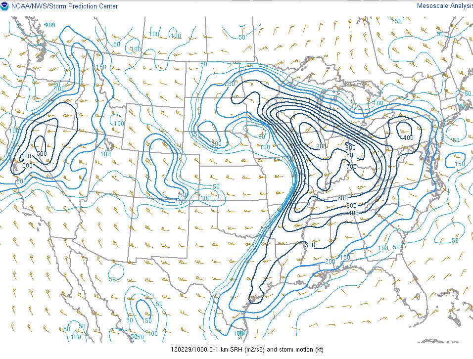
Therefore, we had plenty of moisture to work and at least some instability in the atmosphere. However, it was the degree of wind shear in the environment that turned some of these storms into supercells. Wind shear is simply the change in wind speed and/or direction with height. One of the ways meteorologists can decipher the degree of wind shear is called Storm Relative Helicity (SRH). SRH is a measure of the potential for a storm to acquire a rotating updraft. Even though there is no clear threshold value, larger values of SRH suggest an increased threat for tornadoes (greater than 250 m2/s2). Below is the graphic for 4am Feb 29 showing SRH values of 600-700 m2/s2 over much of our area:
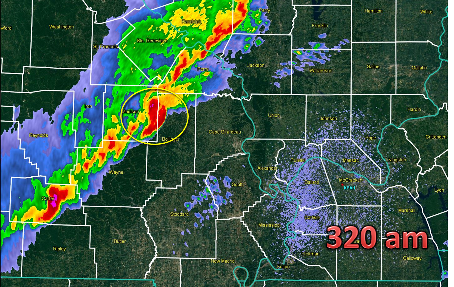
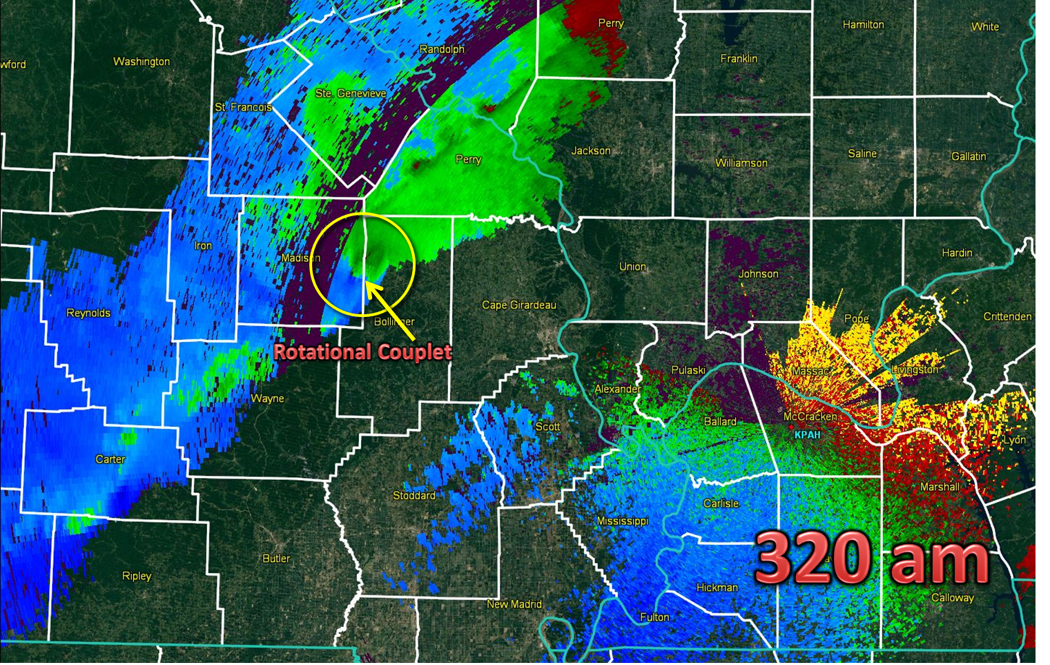
The supercell storm which produced the Harrisburg IL tornado actually produced a total of 6 different tornadoes (cyclic supercell). The first tornado was spawned in Madison county MO at 255am. The next tornado developed in our region and occurred in Bollinger county MO at 320am. A total of three different tornadoes ended up forming across Bollinger and Cape Girardeau counties in MO. The third tornado crossed the river into IL. NWS Paducah issues several tornado warnings for this dangerous storm as it crossed from Bollinger/Cape Girardeau counties into southern Illinois.
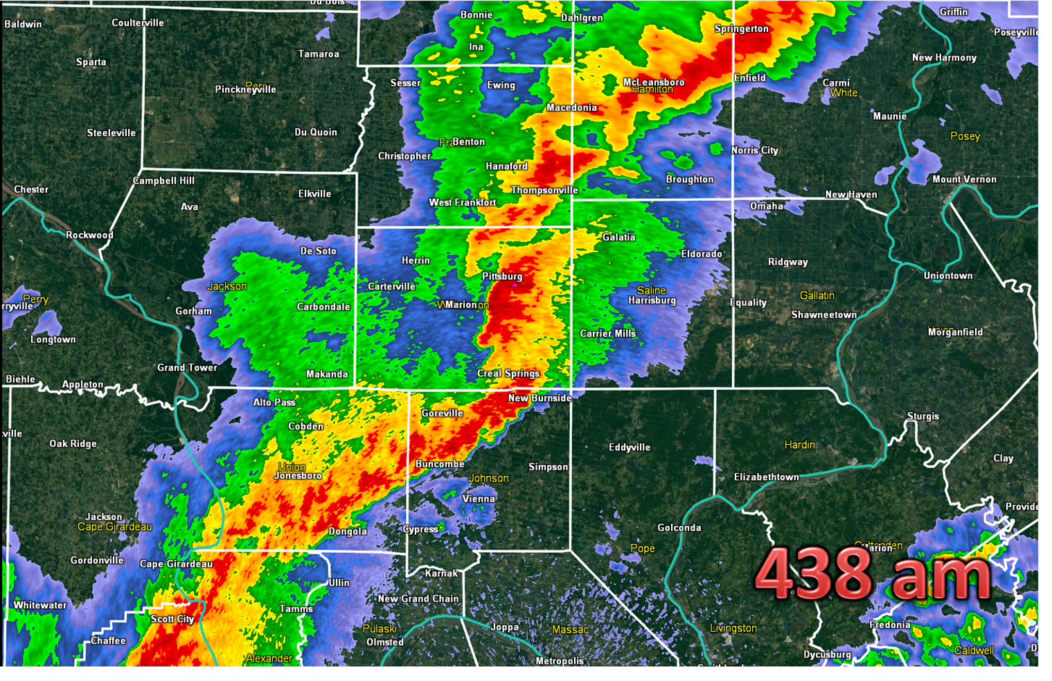
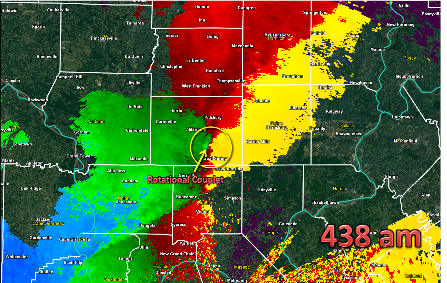
Another tornado formed in Williamson county in southern IL at 426am, which ended up becoming an EF2 in intensity as it moved across a good part of southern Williamson County IL:

At 437am, a trained spotter, who was south of Herrin IL, reported power flashes to their south. By that time, the tornado was just southeast of Marion. The tornado lifted shortly afterwards.
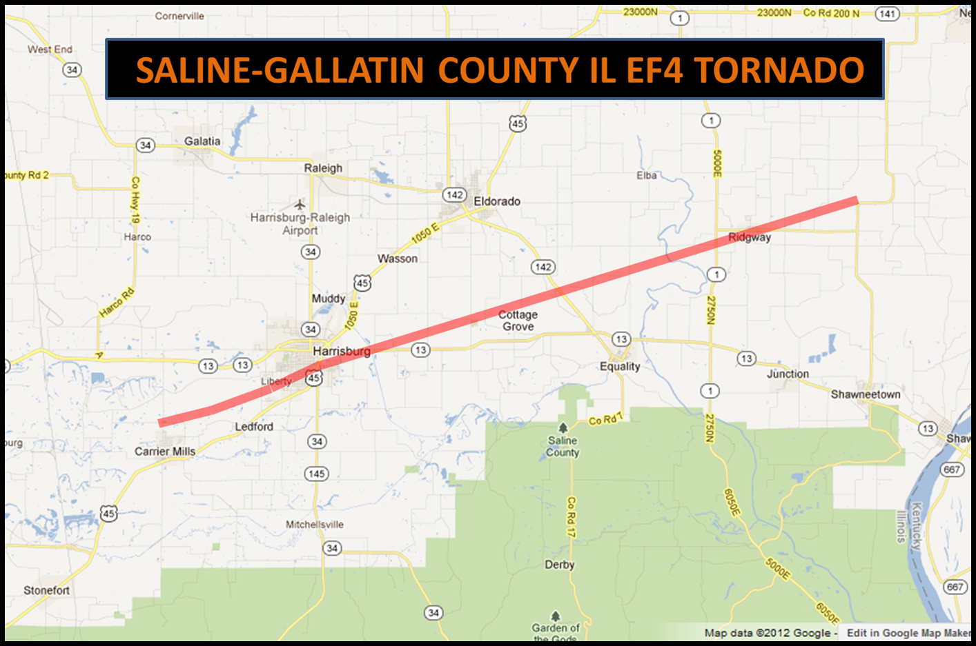
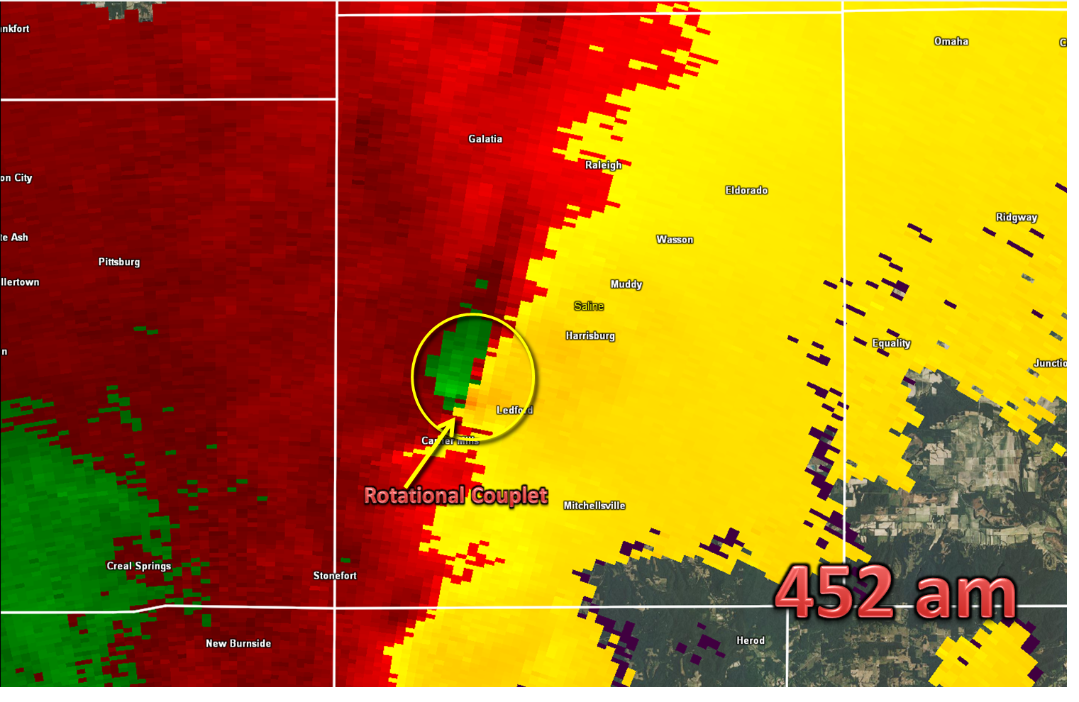
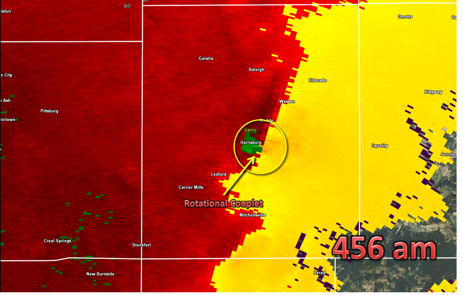
At 443am, NWS Paducah issues a tornado warning, which included the Harrisburg area. At 451am, the tornado touched down about one mile northwest of Carrier Mills, IL and then traveled east northeast into Harrisburg. Here are zoomed in radar images about a minute after touchdown and then as it was moving through the south side of Harrisburg. The tornado would continue in Gallatin county and lifted about 4 miles east northeast of Ridgway at 513am.
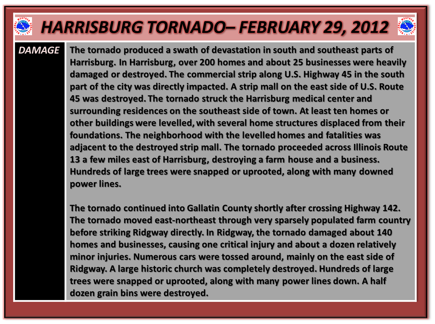
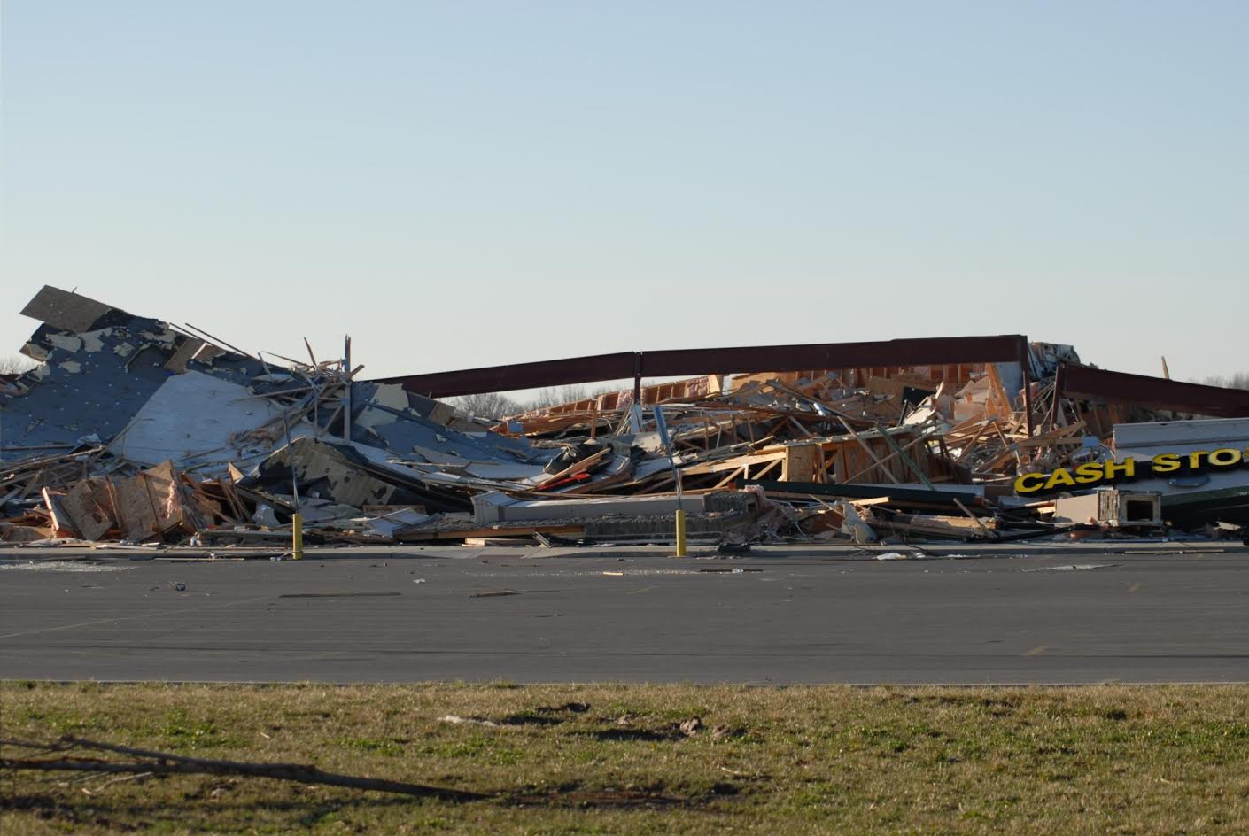
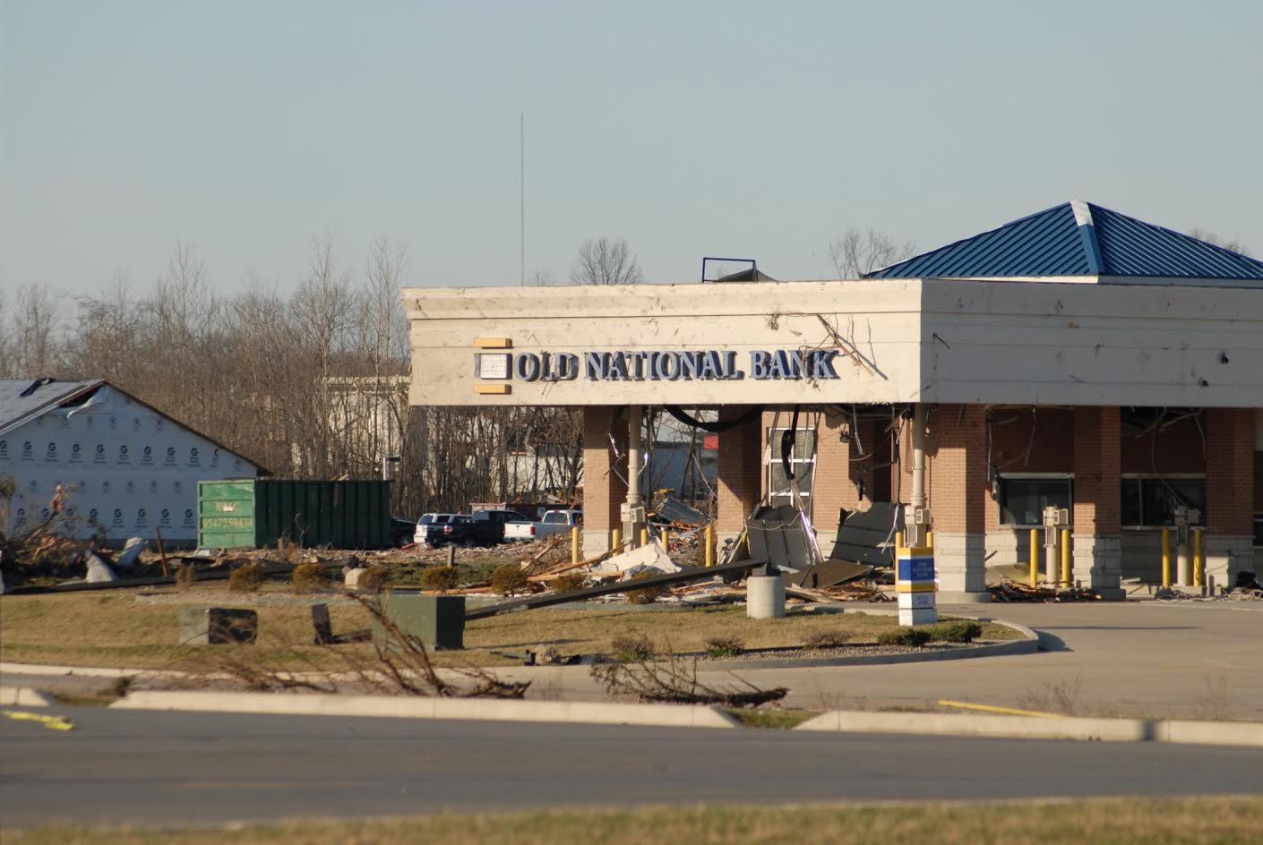
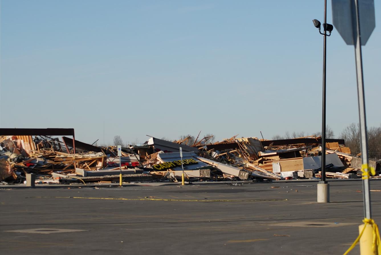
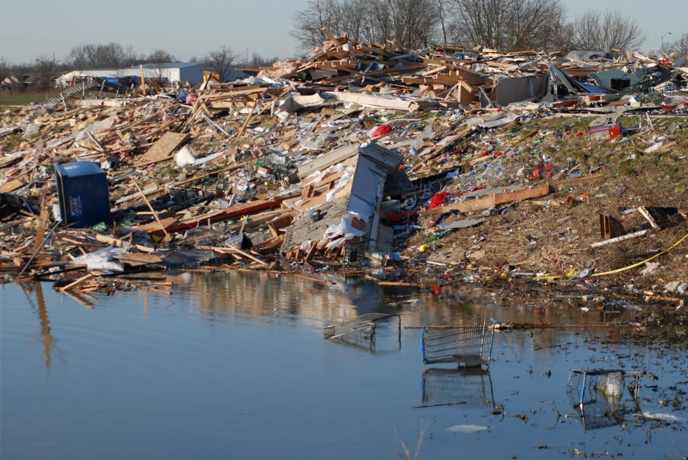
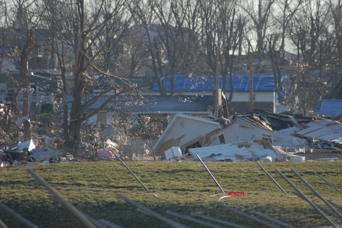
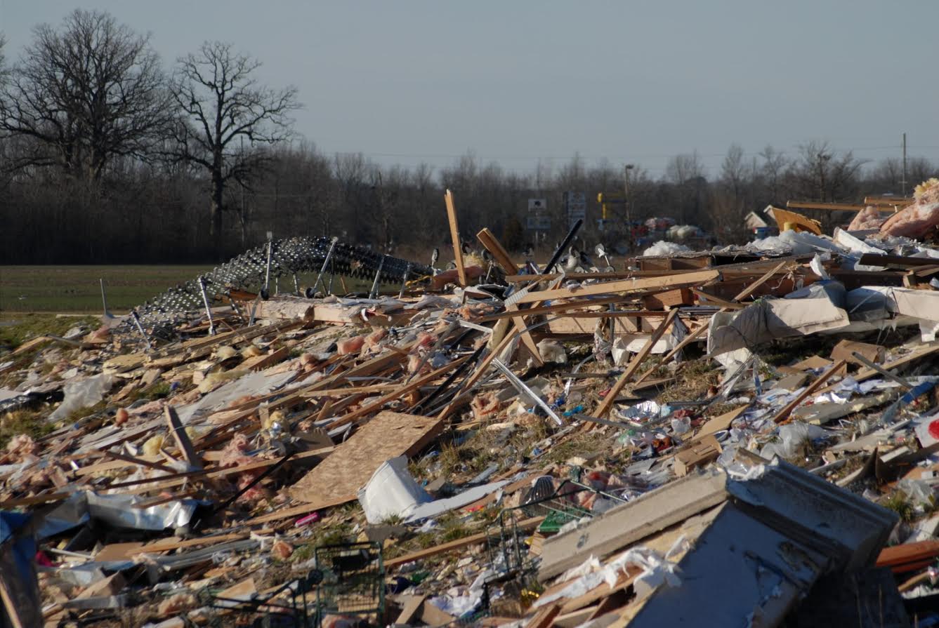
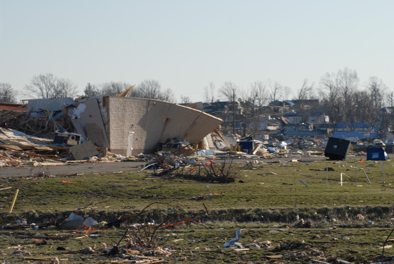
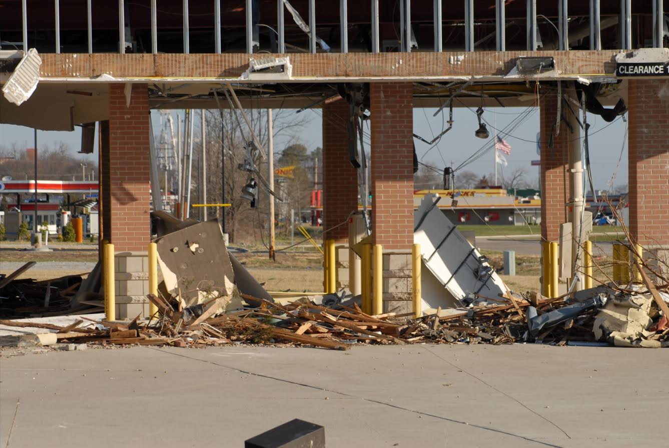
AFTER THE TORNADO: DAMAGE PHOTOS
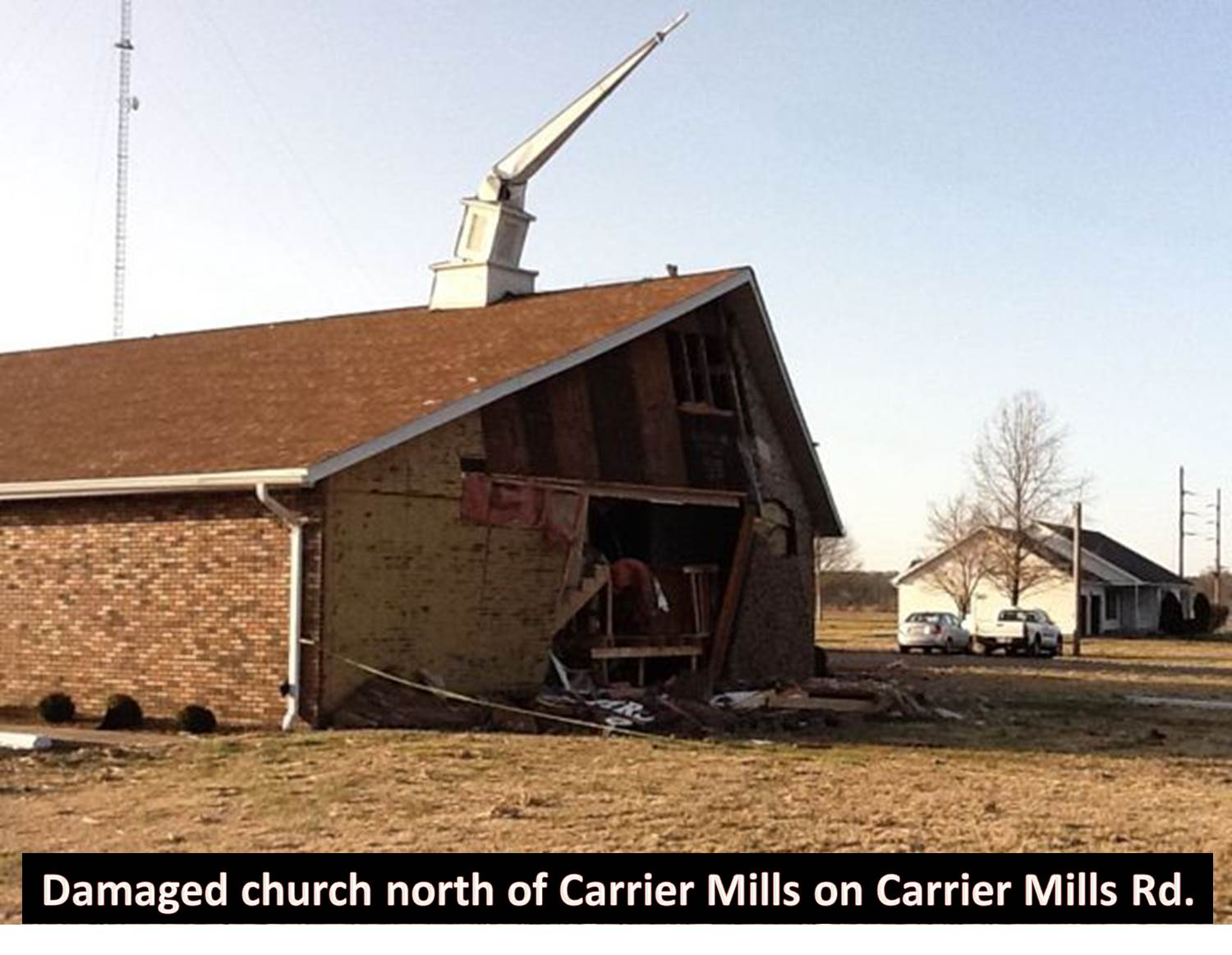
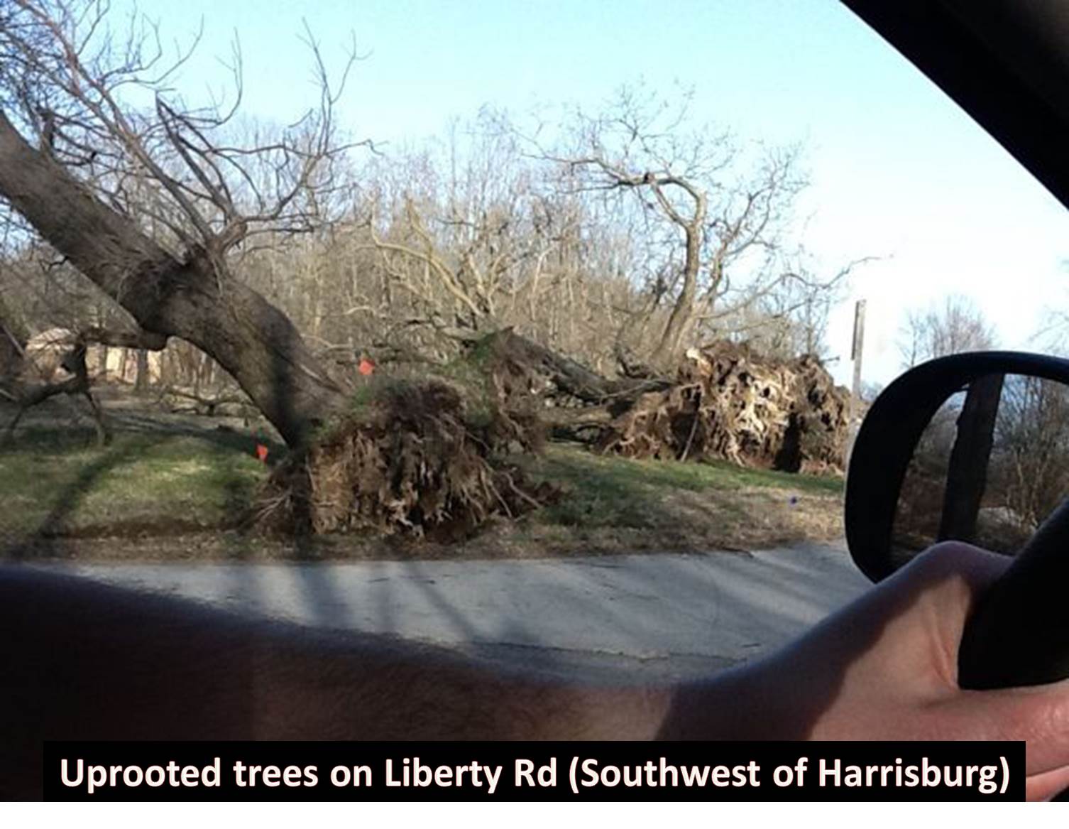
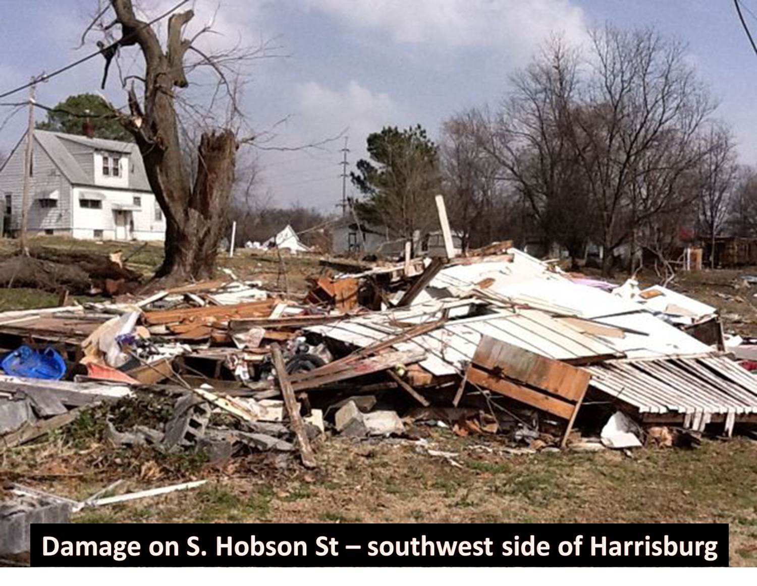
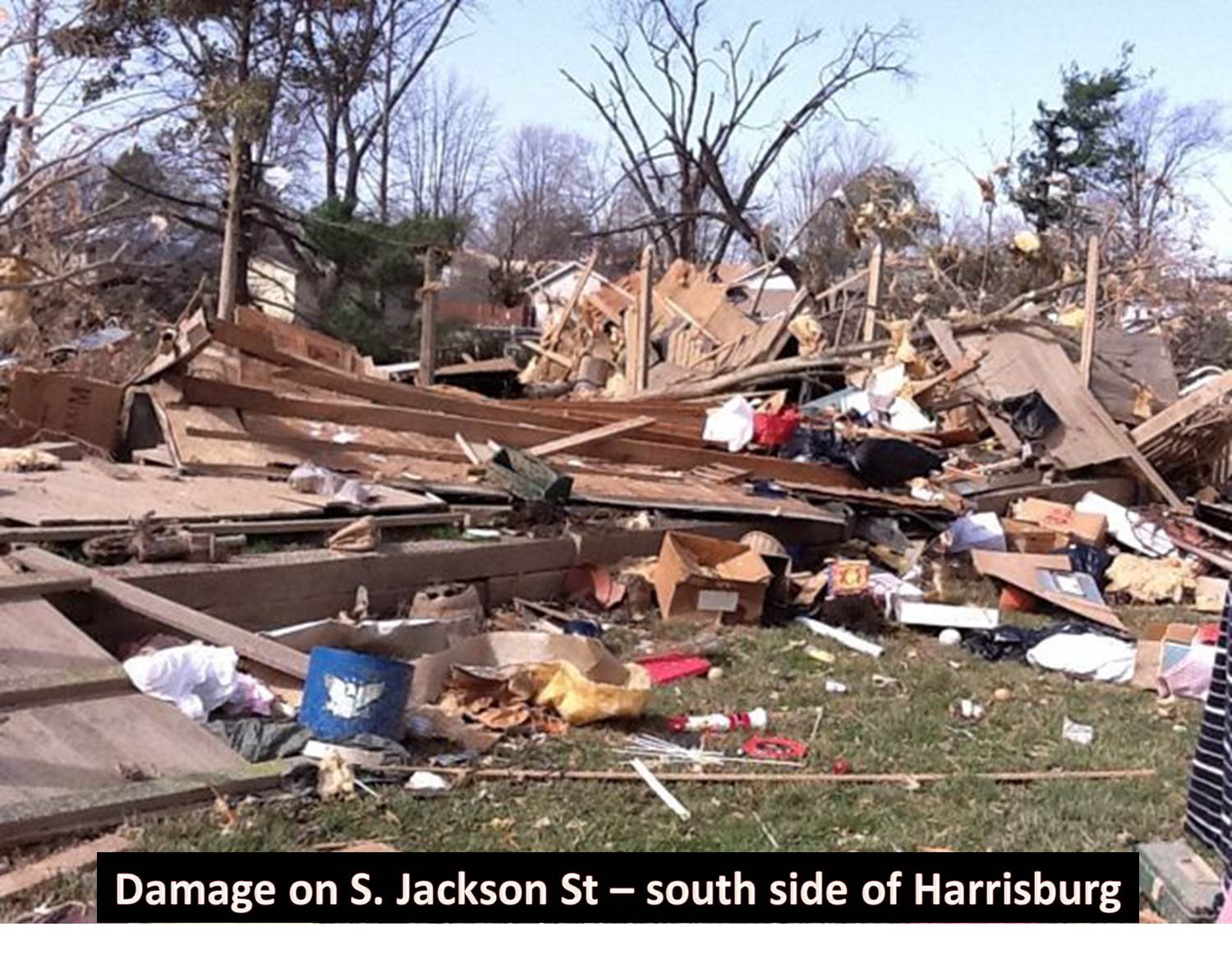
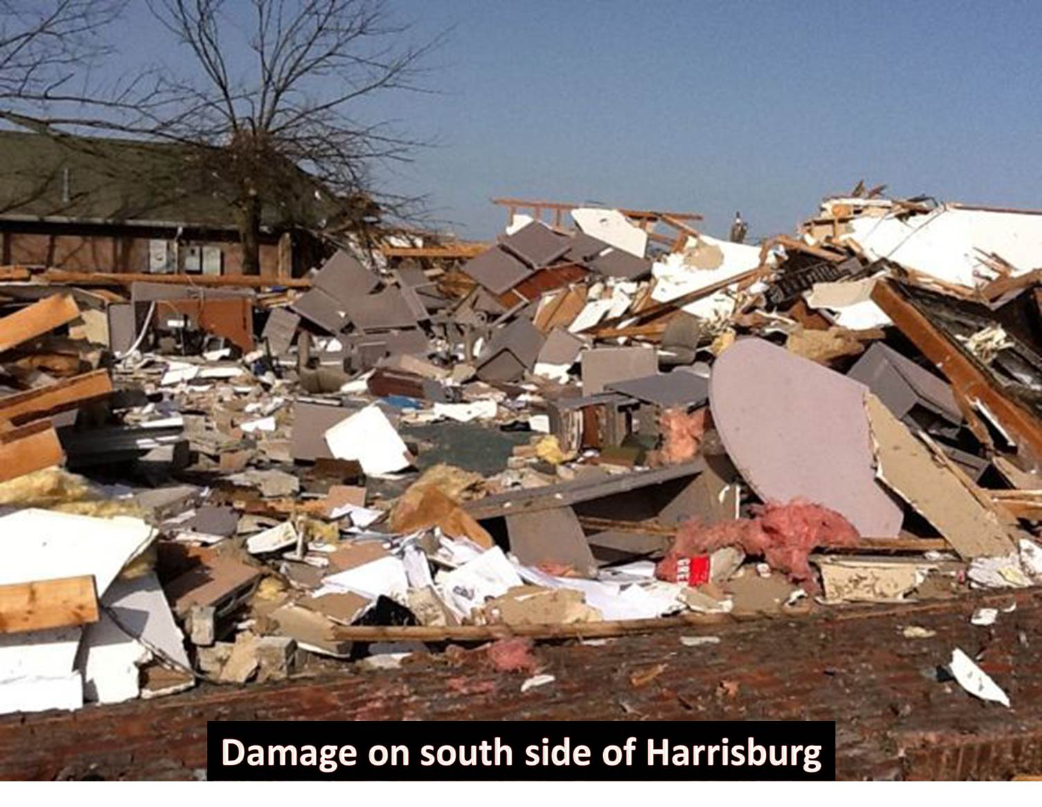
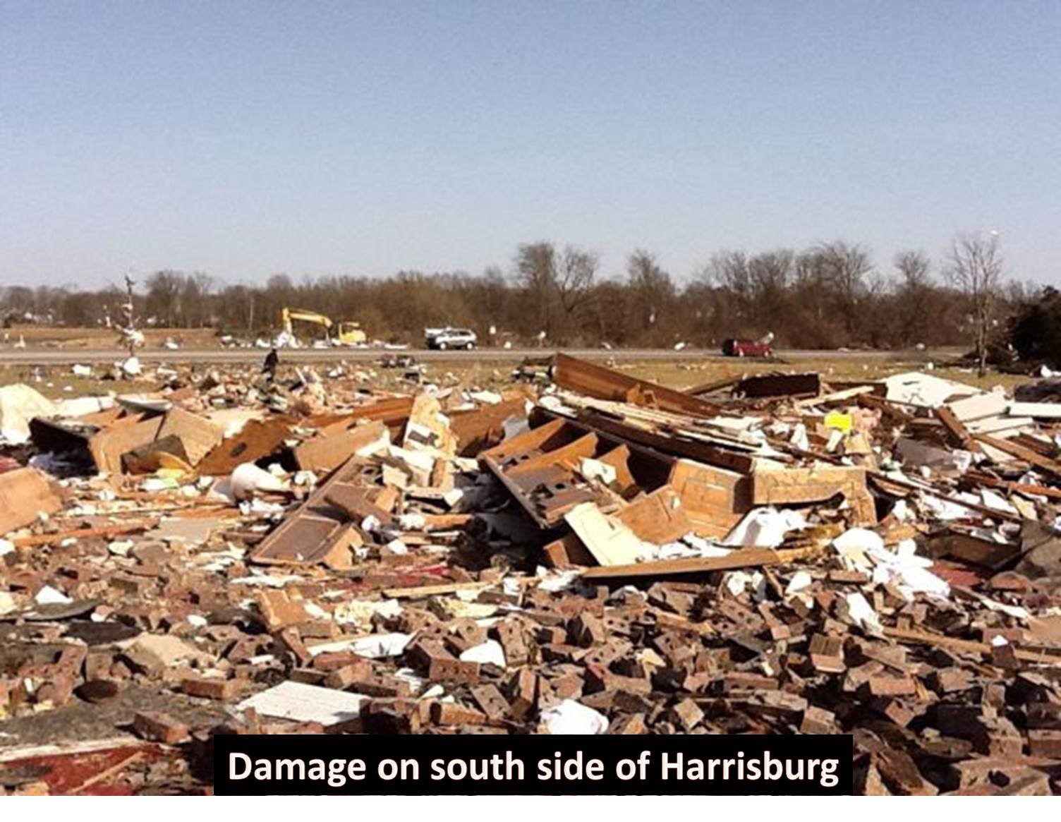
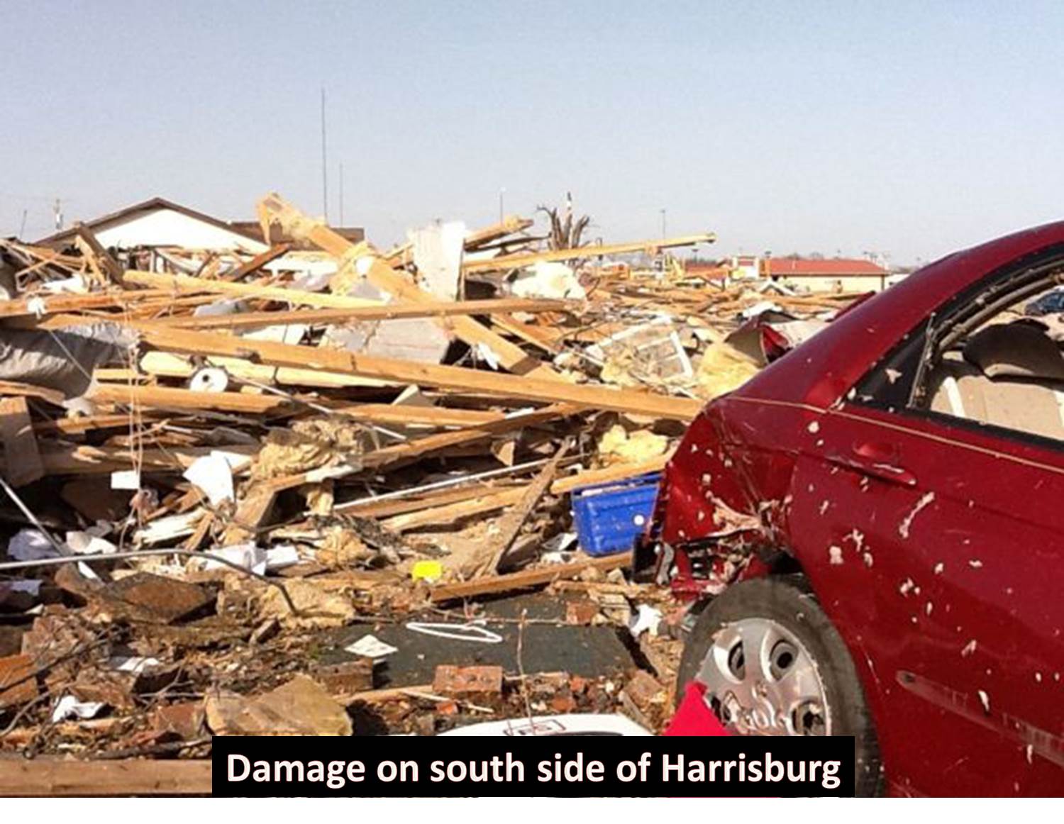
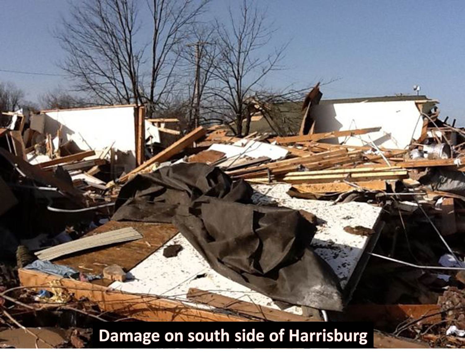

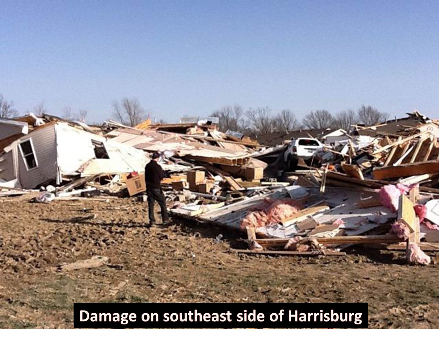
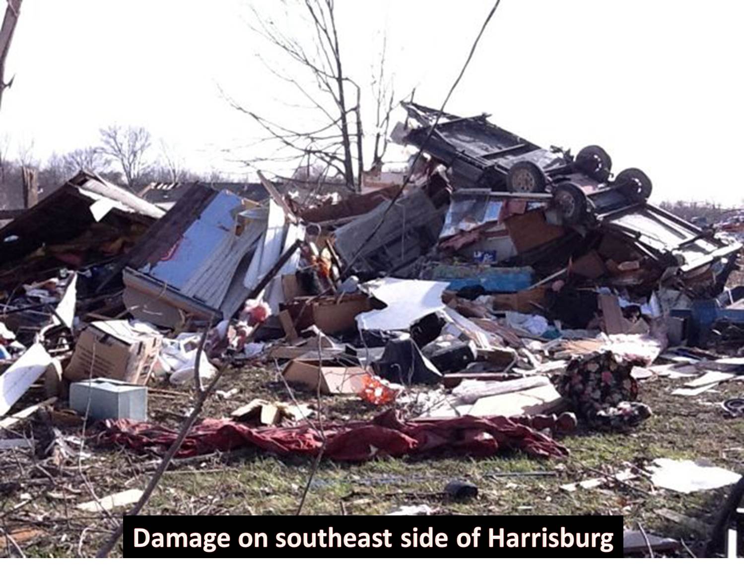
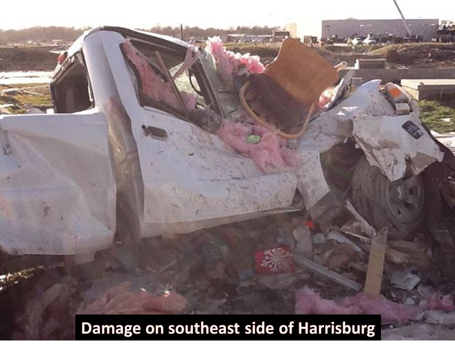
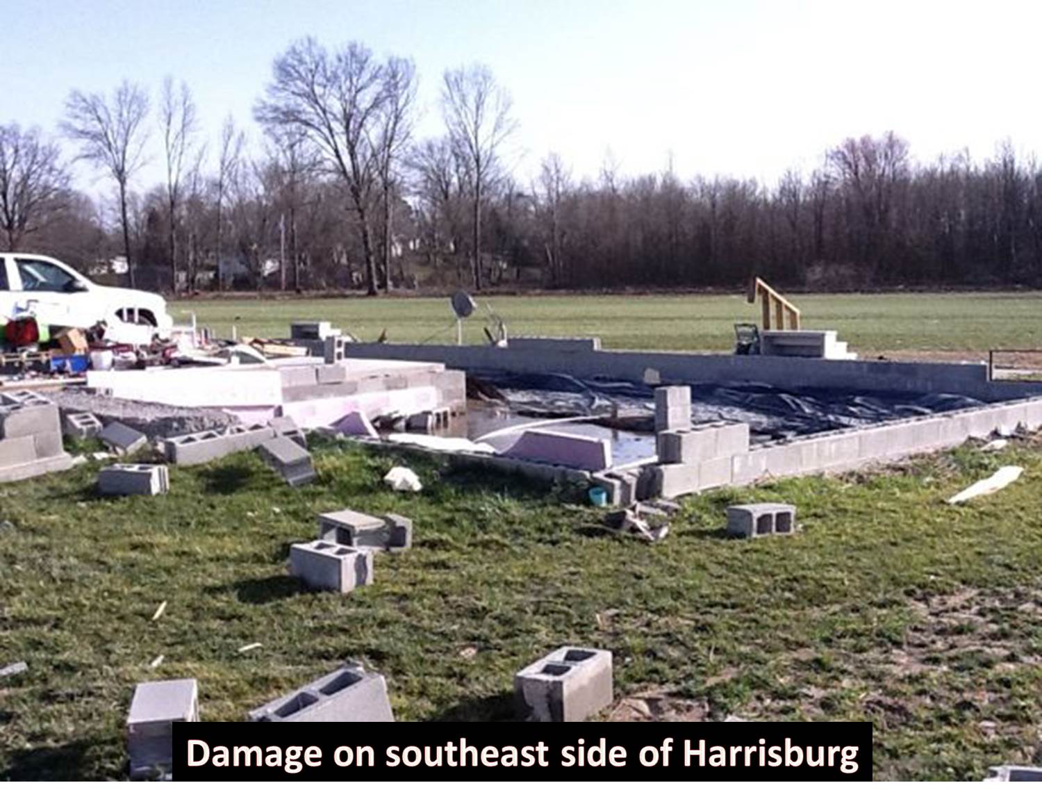
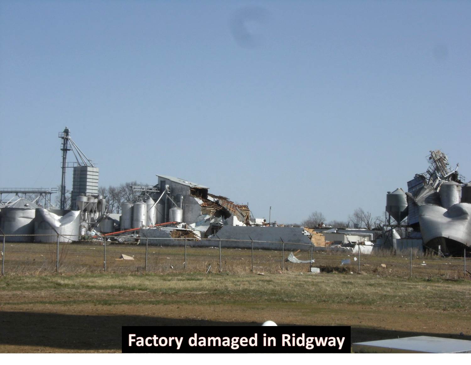
The following pictures are courtesy of Mr. Gary Rann. All of the photos were taken in the vicinity of the Walmart shopping center, where Route 45 meets Route 145 on the southeast side of town:
lf you have any photos you would like to share with us for this event, please email them to Christine.Wielgos@noaa.gov

