Paducah, KY
Weather Forecast Office
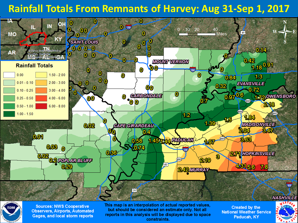
Overview
The remnants of Hurricane Harvey moved northeast from Texas into the lower Ohio Valley on August 31st with rain entering our southern counties during the late afternoon hours. Heavy rain spread across the southeast half of the area through the evening and overnight hours, continuing into the next day. The most concentrated rainfall remained over western Kentucky, where totals ranged from 1 to 4+ inches. The hardest hit area was Todd County Kentucky where localized amounts approached 8 inches. Lighter amounts occurred from southeast Missouri into southern Illinois and southwest Indiana, where some locations didn't receive any measurable rain from Harvey.
 |
Media use of NWS Web News Stories is encouraged! Please acknowledge the NWS as the source of any news information accessed from this site. |
|
FORECASTS
Forecast Discussion
User Defined Area Forecast
Hourly Forecasts
Fire Weather
Activity Planner
LOCAL INFORMATION
Aviation Weather
Our Office
SKYWARN
Items of Interest
Hazardous Weather Support
Local Observations
Weather History
NWS Paducah KY Weekly Partner Briefing
US Dept of Commerce
National Oceanic and Atmospheric Administration
National Weather Service
Paducah, KY
8250 Kentucky Highway 3520
West Paducah, KY 42086-9762
270-744-6440
Comments? Questions? Please Contact Us.